
North America Weekly Snow Roundup #319
Weekly Snow News for North America, updated 18 June 2026: Timberline and Beartooth still open with Banff's Sunshine ready to reopen for summer skiing this weekend.

Next 3 days weather summary:Mostly dry. Warm (max 29°C on Sat afternoon, min 19°C on Thu morning). Wind will be generally light. | Days 4-6 weather summary:Light rain (total 9.0mm), mostly falling on Sun night. Warm (max 29°C on Sun afternoon, min 18°C on Tue night). Winds increasing (calm on Sun morning, fresh winds from the NNW by Mon night). | |||||||||||||||||
Thursday 18 | Friday 19 | Saturday 20 | Sunday 21 | Monday 22 | Tuesday 23 | |||||||||||||
AM | PM | night | AM | PM | night | AM | PM | night | AM | PM | night | AM | PM | night | AM | PM | night | |
clear | cloudy | clear | clear | clear | clear | clear | some clouds | some clouds | clear | t-storm risk | rain shwrs | clear | clear | light rain | rain shwrs | clear | clear | |
km/h | ||||||||||||||||||
Snow map |  |  | 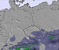 | 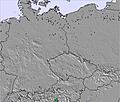 | 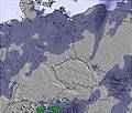 | 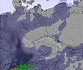 | ||||||||||||
— | — | — | — | — | — | — | — | — | — | — | — | — | — | — | — | — | — | |
mm | — | — | — | — | — | — | — | — | — | — | 1 | 3 | — | — | 4 | 1 | — | — |
max °C | 22 | 24 | 23 | 24 | 27 | 26 | 26 | 29 | 27 | 27 | 29 | 24 | 26 | 29 | 22 | 22 | 28 | 25 |
min °C | 19 | 23 | 20 | 22 | 27 | 22 | 23 | 28 | 22 | 24 | 25 | 19 | 22 | 28 | 19 | 20 | 27 | 18 |
chill °C | 19 | 23 | 20 | 22 | 27 | 22 | 23 | 28 | 22 | 24 | 25 | 19 | 22 | 28 | 19 | 20 | 27 | 18 |
Humid % | 62 | 54 | 65 | 57 | 48 | 60 | 50 | 41 | 64 | 50 | 61 | 76 | 52 | 40 | 81 | 68 | 36 | 59 |
Freeze m | 3700 | 3950 | 3950 | 4150 | 4250 | 4300 | 4250 | 4200 | 4200 | 4100 | 4100 | 4200 | 4250 | 4200 | 3950 | 3850 | 4000 | 4000 |
4:50 | — | — | 4:50 | — | — | 4:52 | — | — | 4:52 | — | — | 4:52 | — | — | 4:52 | — | — | |
— | — | 8:45 | — | — | 8:46 | — | — | 8:46 | — | — | 8:46 | — | — | 8:47 | — | — | 8:47 | |
Go pro and carve into:
Latest snow reports near Eplény Síaréna:
| Top snow depth: | — |
|---|---|
| Bottom snow depth: | — |
| Fresh snowfall depth: | — |
| Last snowfall: | 20 Feb 2026 |
| Snow Alerts | Create Alert |
0.0 | Bluebird Powder days Fresh snow, mostly sunny, light wind. |
|---|---|
0.0 | Powder days Fresh snow, limited sun, any wind. |
0.0 | Bluebird days Average snow, mostly sunny, light wind. |

The above table gives the weather forecast for Eplény Síaréna at the specific elevation of 515 m. Our sophisticated weather models allow us to provide snow forecasts for the top, middle and bottom ski stations of Eplény Síaréna. To access the weather forecasts for the other elevations, use the tab navigation above the table. For a wider view of the weather, check out the Weather Map of Hungary.
Click here to read further information on freezing levels and how we forecast our temperatures.
Resort name is also written as Epleny Siarena.
Overall 4.0 Based on 1 vote and 1 review
Fantastic! Friendly staff, great chairlift to top. Good value and no queues.
anita lewis from United Kingdom writes:
Fantastic! Friendly staff, great chairlift to top. Good value and no queues.


 Nearest