


View forecast
Drouzin Le Mont at 1400 m altitude
Issued by Snow-Forecast.com at: 1 am (local time) / 26 Apr 2024
Now
Friday 26 | Saturday 27 | Sunday 28 | Monday 29 | Tuesday 30 | Wednesday 1 | Thursday 2 | |||||||||||||||
AM | PM | night | AM | PM | night | AM | PM | night | AM | PM | night | AM | PM | night | AM | PM | night | AM | PM | night | |
light rain | light rain | rain shwrs | some clouds | cloudy | cloudy | cloudy | light rain | light rain | some clouds | cloudy | cloudy | some clouds | rain shwrs | rain shwrs | some clouds | risk thun- der | rain shwrs | cloudy | risk thun- der | heavy rain | |
km/h | |||||||||||||||||||||
Snow map |  |  |  |  |  |  |  | ||||||||||||||
— | — | — | — | — | — | — | — | — | — | — | — | — | — | — | — | — | — | — | — | — | |
1.0 | 3 | 2.0 | — | — | — | — | 2.0 | 1.0 | — | — | — | — | 1.0 | 1.0 | — | 1.0 | 4 | — | 4 | 20 | |
max°C | 3 | 5 | 3 | 6 | 9 | 7 | 7 | 8 | 6 | 7 | 10 | 10 | 11 | 12 | 10 | 10 | 13 | 11 | 9 | 11 | 9 |
min°C | 2 | 4 | 3 | 3 | 9 | 6 | 5 | 8 | 5 | 5 | 10 | 8 | 8 | 12 | 8 | 8 | 12 | 8 | 8 | 10 | 6 |
-1 | 2 | 1 | 1 | 8 | 4 | 3 | 8 | 4 | 4 | 10 | 7 | 8 | 12 | 7 | 7 | 12 | 6 | 7 | 10 | 4 | |
66 | 85 | 68 | 54 | 48 | 55 | 68 | 79 | 88 | 72 | 68 | 72 | 60 | 64 | 82 | 63 | 65 | 67 | 69 | 81 | 86 | |
1800 | 1950 | 1900 | 2400 | 2650 | 2650 | 2650 | 2550 | 2500 | 2700 | 2850 | 2950 | 3050 | 3000 | 3100 | 3100 | 3000 | 2900 | 2750 | 2800 | 2500 | |
6:26 | — | — | 6:24 | — | — | 6:22 | — | — | 6:22 | — | — | 6:20 | — | — | 6:18 | — | — | 6:16 | — | — | |
— | — | 8:36 | — | — | 8:37 | — | — | 8:37 | — | — | 8:39 | — | — | 8:40 | — | — | 8:42 | — | — | 8:43 | |
Next 0-3 days weather summary:
Light rain (total 9.0mm), mostly falling on Fri afternoon. Mild temperatures (max 9°C on Sat afternoon, min 2°C on Fri morning). Wind will be generally light.
Next 4-6 days weather summary:
Light rain (total 7.0mm), mostly falling on Wed night. Very mild (max 13°C on Wed afternoon, min 5°C on Mon morning). Wind will be generally light.
Popular Drouzin Le Mont Pages
Snow Radar
Submit a reportLatest snow reports near Drouzin Le Mont:
46 km away from Drouzin Le Mont
22 hours ago
Resort closed for the season. See you this summer! from La Giettaz en Aravis
Drouzin Le Mont Snow Conditions
| Top snow depth: | — |
|---|---|
| Bottom snow depth: | — |
| Fresh snowfall depth: | 1 cm |
| Last snowfall: | 24 Apr 2024 |
| Snow Alerts | Create Alert |
Other resorts in France are reporting: powder (2) / good piste (1)
Snow-Forecast Partner Offers
Show your business here
Snow History
Week 4 of April has on average:
0.2 | Bluebird Powder days Fresh snow, mostly sunny, light wind. |
|---|---|
0.4 | Powder days Fresh snow, limited sun, any wind. |
0.0 | Bluebird days Average snow, mostly sunny, light wind. |

Drouzin Le Mont Forecast Snowfall


Photos of Drouzin Le Mont
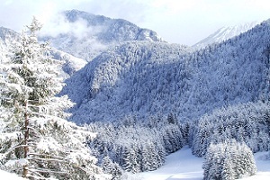
Fresh Snow in Drouzin Le Mont by paul
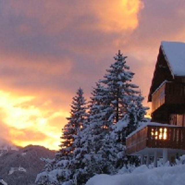
Red Sky @ Night - Skiers Delight by paul
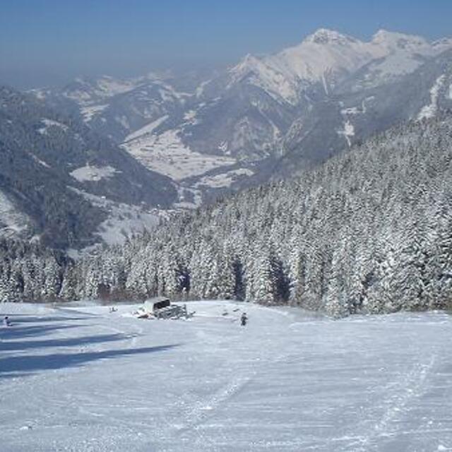
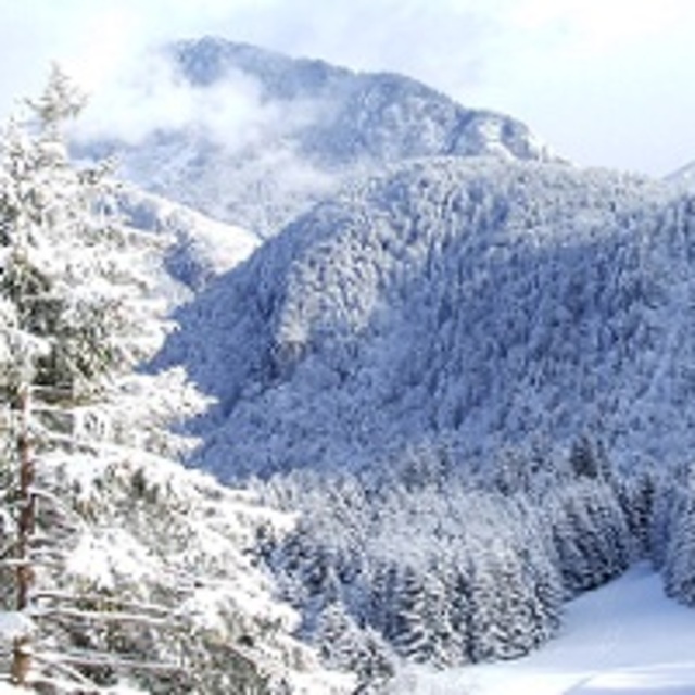
Upper Ski Fields by Paul Davis
Other resorts in France are reporting: powder (2) / good piste (1)
The above table gives the weather forecast for Drouzin Le Mont at the specific elevation of 1400 m. Our sophisticated weather models allow us to provide snow forecasts for the top, middle and bottom ski stations of Drouzin Le Mont. To access the weather forecasts for the other elevations, use the tab navigation above the table. For a wider view of the weather, check out the Weather Map of France.
Click here to read further information on freezing levels and how we forecast our temperatures.
Visitor Reviews of Drouzin Le Mont
Overall 2.5 Based on 3 votes and 1 review
- Snowsure
- Variety of pistes
- Vote
- paul from France writes:
Drouzin le Mont, situated at the top of the beautiful Col du Corbier is a charming family friendly ski resort. Ideal for beginners and intermediate skiers and snowboarders, it offers wide open blues, steep black, challenging reds, and tree lined green runs through the forest. All of the accommodation faces the pistes, so the less active may observe their more active colleagues, and parents can watch their children taking their first steps on snow from the comfort of their balcony.
Visitor Reviews of Drouzin Le Mont
paul from France writes:
Drouzin le Mont, situated at the top of the beautiful Col du Corbier is a charming family friendly ski resort. Ideal for beginners and intermediate skiers and snowboarders, it offers wide open blues, steep black, challenging reds, and tree lined green runs through the forest. All of the accommodation faces the pistes, so the less active may observe their more active colleagues, and parents can watch their children taking their first steps on snow from the comfort of their balcony.
Free Snow-Forecast.com weather widget for your website
The Drouzin Le Mont skiing weather widget is available to embed on external websites free of charge. It provides a daily summary of our Drouzin Le Mont snow forecast and current weather conditions. Simply go to the feed configuration page and follow the 3 simple steps to grab the custom html code snippet and paste it into your own site. You can choose the snow forecast elevation (summit, mid-mountain or bottom lift) and metric/imperial units for the snow forecast feed to suit your own website…. Click here to get the code.
View detailed snow forecast for Drouzin Le Mont at:
snow-forecast.com

 Nearest