


View forecast
Davos at 2202 m altitude
Issued by Snow-Forecast.com at: 7 pm (local time) / 19 Apr 2024
Now
Saturday 20 | Sunday 21 | Monday 22 | Tuesday 23 | Wednesday 24 | Thursday 25 | ||||||||||||||
night | AM | PM | night | AM | PM | night | AM | PM | night | AM | PM | night | AM | PM | night | AM | PM | night | |
heavy snow | light snow | light snow | light snow | snow shwrs | light snow | light snow | light snow | light snow | light snow | light snow | light snow | light snow | light snow | light snow | snow shwrs | cloudy | light snow | light snow | |
km/h | |||||||||||||||||||
Snow map |  |  |  |  |  |  |  | ||||||||||||
19 | 3 | 3 | 3 | — | 2.0 | 2.0 | — | 1.0 | 1.0 | — | 1.0 | 1.0 | 1.0 | — | — | — | 1.0 | 1.0 | |
— | — | — | — | — | — | — | — | — | — | — | — | — | — | — | — | — | — | — | |
max°C | -5 | -8 | -8 | -9 | -8 | -8 | -8 | -8 | -7 | -8 | -9 | -7 | -8 | -8 | -6 | -6 | -3 | -1 | -2 |
min°C | -8 | -9 | -8 | -11 | -10 | -8 | -10 | -9 | -7 | -10 | -10 | -7 | -9 | -9 | -6 | -7 | -5 | -2 | -4 |
-14 | -15 | -14 | -11 | -10 | -13 | -13 | -9 | -10 | -10 | -14 | -11 | -13 | -14 | -9 | -11 | -9 | -6 | -7 | |
96 | 88 | 89 | 96 | 87 | 88 | 92 | 89 | 92 | 92 | 91 | 88 | 92 | 90 | 84 | 66 | 82 | 85 | 94 | |
1350 | 1100 | 1200 | 500 | 1100 | 1200 | 550 | 1150 | 1300 | 550 | 1050 | 1300 | 600 | 1200 | 1500 | 1000 | 1800 | 2050 | 1600 | |
— | 6:22 | — | — | 6:20 | — | — | 6:20 | — | — | 6:18 | — | — | 6:16 | — | — | 6:13 | — | — | |
— | — | — | 8:15 | — | — | 8:16 | — | — | 8:17 | — | — | 8:20 | — | — | 8:21 | — | — | 8:22 | |
Next 0-3 days weather summary:
A heavy fall of snow, heaviest during Fri night. Temperatures will be below freezing (max -5°C on Fri night, min -11°C on Sat night). Wind will be generally light.
Next 4-6 days weather summary:
A light covering of new snow, mostly falling on Tue afternoon. Temperatures will be below freezing (max -1°C on Thu afternoon, min -10°C on Mon night). Wind will be generally light.
Popular Davos Pages
Snow Radar
Submit a reportLatest snow reports near Davos:
42 km away from Davos
2 hours ago
Continuous moderate rain reported from Vaduz at 598 metres elevation one km N of Steg but it is forecast cold enough for snow at the ski area from Steg
32 km away from Davos
3 hours agoLight snow reported from Samedan at 1710 metres elevation one km NE of Celerina/Engadin Ski Resort from Celerina/Engadin
32 km away from Davos
10 hours agoRain reported from Galtür at 1577 metres elevation SSW of Galtur-Silvapark but it is forecast cold enough for snow at the ski area from Galtur-Silvapark
Davos Snow Conditions
| Top snow depth: | 0 cm |
|---|---|
| Bottom snow depth: | 0 cm |
| Fresh snowfall depth: | — |
| Last snowfall: | 18 Apr 2024 |
| Snow Alerts | Create Alert |
Other resorts in Switzerland are reporting: powder (11) / good piste (10)
Snow-Forecast Partner Offers
Snow History
Week 3 of April has on average:
0.7 | Bluebird Powder days Fresh snow, mostly sunny, light wind. |
|---|---|
1.2 | Powder days Fresh snow, limited sun, any wind. |
0.4 | Bluebird days Average snow, mostly sunny, light wind. |


Davos Forecast Snowfall


Snow-Forecast Partner Offers

Photos of Davos
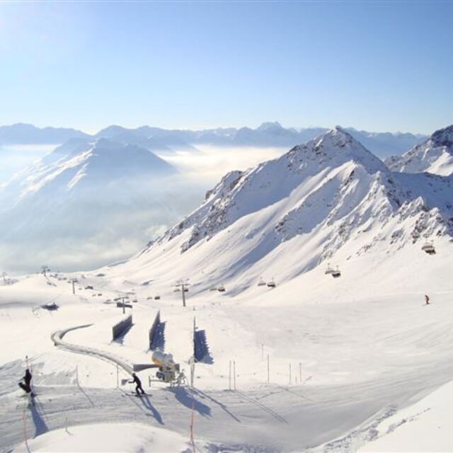
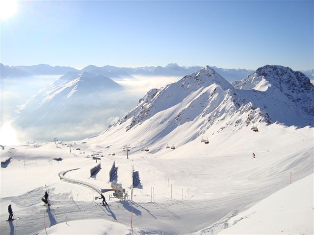
The easterm face of the Weissflujoch by Tony Galeano
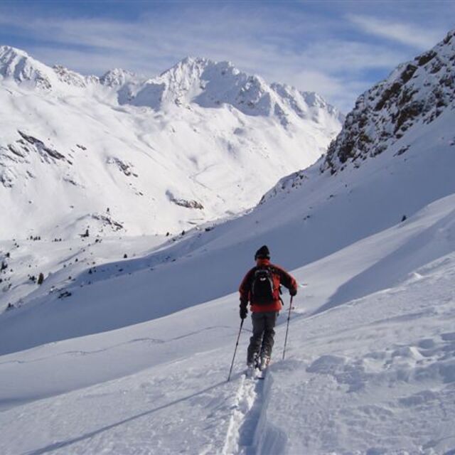
The view to Fluela Weisshorn from Sentishorn by Tony Galeano
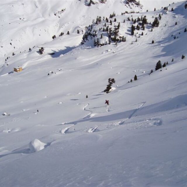
Almost down to the Fluela Strasse by Tony Galeano
Other resorts in Switzerland are reporting: powder (11) / good piste (10)
The above table gives the weather forecast for Davos at the specific elevation of 2202 m. Our sophisticated weather models allow us to provide snow forecasts for the top, middle and bottom ski stations of Davos. To access the weather forecasts for the other elevations, use the tab navigation above the table. For a wider view of the weather, check out the Weather Map of Switzerland.
Click here to read further information on freezing levels and how we forecast our temperatures.
Visitor Reviews of Davos
Overall 4.5 Based on 23 votes and 13 reviews
- Snowsure
- Variety of pistes
- Vote
- Ranger dad from Germany writes:
Yes, it’s a bit dated but this one is like a vintage car that gets better with age. The skiing is epic, long rolling piste. Some steep stuff around Klosters. Lots of off-piste and of course, it’s in the best snow location. It’s a must go.
Visitor Reviews of Davos
Ranger dad from Germany writes:
Yes, it’s a bit dated but this one is like a vintage car that gets better with age. The skiing is epic, long rolling piste. Some steep stuff around Klosters. Lots of off-piste and of course, it’s in the best snow location. It’s a must go.
Free Snow-Forecast.com weather widget for your website
The Davos skiing weather widget is available to embed on external websites free of charge. It provides a daily summary of our Davos snow forecast and current weather conditions. Simply go to the feed configuration page and follow the 3 simple steps to grab the custom html code snippet and paste it into your own site. You can choose the snow forecast elevation (summit, mid-mountain or bottom lift) and metric/imperial units for the snow forecast feed to suit your own website…. Click here to get the code.
View detailed snow forecast for Davos at:
snow-forecast.com

 Nearest