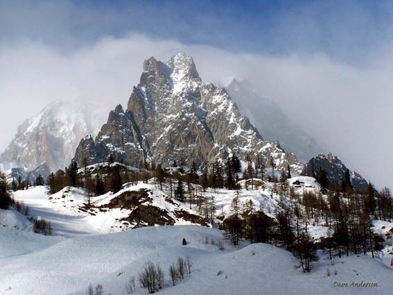


Portillo Storm Snowfall Total Passes 5m / 17 Feet
A snow storm that has now continued for nine days has taken Chilean ski resort Portillo to a snowfall total of 5.2 metres (17 feet) so far, with more snow forecast.

Next 3 days weather summary:Light rain (total 4.0mm), mostly falling on Tue night. Warm (max 28°C on Tue afternoon, min 13°C on Mon night). Wind will be generally light. | Days 4-6 weather summary:Light rain (total 9.0mm), mostly falling on Fri night. Warm (max 30°C on Thu afternoon, min 17°C on Fri night). Wind will be generally light. | ||||||||||||||||
Mon 27 | Tuesday 28 | Wednesday 29 | Thursday 30 | Friday 31 | Saturday 1 | ||||||||||||
PM | night | AM | PM | night | AM | PM | night | AM | PM | night | AM | PM | night | AM | PM | night | |
clear | clear | clear | clear | rain shwrs | clear | clear | clear | clear | clear | rain shwrs | some clouds | some clouds | rain shwrs | some clouds | some clouds | rain shwrs | |
km/h | |||||||||||||||||
Snow map |  |  |  |  |  |  | |||||||||||
— | — | — | — | — | — | — | — | — | — | — | — | — | — | — | — | — | |
mm | — | — | — | — | 4 | — | — | — | — | — | 1 | — | — | 3 | — | — | 3 |
max °C | 24 | 21 | 23 | 28 | 23 | 25 | 28 | 24 | 27 | 30 | 26 | 28 | 30 | 24 | 27 | 28 | 24 |
min °C | 22 | 13 | 16 | 27 | 15 | 18 | 27 | 17 | 21 | 30 | 18 | 20 | 29 | 17 | 21 | 27 | 17 |
chill °C | 22 | 13 | 16 | 27 | 15 | 18 | 27 | 17 | 21 | 30 | 18 | 20 | 29 | 17 | 21 | 27 | 17 |
Humid % | 47 | 74 | 52 | 39 | 88 | 55 | 33 | 49 | 28 | 23 | 65 | 35 | 31 | 52 | 36 | 38 | 64 |
Freeze m | 4400 | 4750 | 4650 | 4750 | 4500 | 4400 | 4750 | 4700 | 4650 | 4900 | 4800 | 4800 | 4800 | 4650 | 4600 | 4800 | 4650 |
— | — | 6:09 | — | — | 6:09 | — | — | 6:11 | — | — | 6:13 | — | — | 6:13 | — | — | |
— | 9:07 | — | — | 9:06 | — | — | 9:05 | — | — | 9:04 | — | — | 9:02 | — | — | 9:00 | |
Go pro and carve into:
Avalanche information: European Avalanche Warning Services (EAWS)
Latest snow reports near Courmayeur:
No information received. Another glorious day. from La Giettaz en Aravis
| Top snow depth: | 0 cm |
|---|---|
| Bottom snow depth: | 0 cm |
| Fresh snowfall depth: | — |
| Last snowfall: | 16 May 2026 |
| Snow Alerts | Create Alert |
0.0 | Bluebird Powder days Fresh snow, mostly sunny, light wind. |
|---|---|
0.0 | Powder days Fresh snow, limited sun, any wind. |
0.0 | Bluebird days Average snow, mostly sunny, light wind. |

The above table gives the weather forecast for Courmayeur at the specific elevation of 1210 m. Our sophisticated weather models allow us to provide snow forecasts for the top, middle and bottom ski stations of Courmayeur. To access the weather forecasts for the other elevations, use the tab navigation above the table. For a wider view of the weather, check out the Weather Map of Italy.
Click here to read further information on freezing levels and how we forecast our temperatures.
Overall 4.0 Based on 28 votes and 22 reviews
Spent a day in Courmayeur after Chamonix. What a difference! Friendly people everywhere, truly exceptional mountain restaurants, great scenery and a wonderful car-free main road. Many places with atmosphere-bars, restaurants etc. Our hotel was perfect: elderly Royal et Golf. Brilliant, location, rooms, service and staff. As for the skiing, it's not for the real top skiers (but they are actually a minority). For beginners and intermediates it is fun in the sun on interesting well laid out slopes which are impeccably groomed. A nice variety with great lifts, minimal lines and a real sense of fun. Lovely resort. Highly recommend it.
walter from Switzerland writes:
Spent a day in Courmayeur after Chamonix. What a difference! Friendly people everywhere, truly exceptional mountain restaurants, great scenery and a wonderful car-free main road. Many places with atmosphere-bars, restaurants etc. Our hotel was perfect: elderly Royal et Golf. Brilliant, location, rooms, service and staff.
As for the skiing, it's not for the real top skiers (but they are actually a minority). For beginners and intermediates it is fun in the sun on interesting well laid out slopes which are impeccably groomed. A nice variety with great lifts, minimal lines and a real sense of fun.
Lovely resort. Highly recommend it.


 Nearest