


America’s Next Indoor Snow Centre Takes Shape
Construction of a new indoor snow centre for skiers, boarders and tubers appears to be making good progress at Heritage Farm in Wayne County, West Virginia.

Next 4 days weather summary:Mostly dry. Warm (max 24°C on Fri afternoon, min 11°C on Tue night). Wind will be generally light. | Days 5-7 weather summary:Light rain (total 4.0mm), mostly falling on Sat night. Warm (max 32°C on Sun afternoon, min 17°C on Fri night). Wind will be generally light. | |||||||||||||||
Wednesday 22 | Thursday 23 | Friday 24 | Saturday 25 | Sunday 26 | ||||||||||||
night | AM | PM | night | AM | PM | night | AM | PM | night | AM | PM | night | AM | PM | night | |
some clouds | clear | some clouds | clear | clear | some clouds | some clouds | clear | clear | some clouds | cloudy | cloudy | t-storm risk | some clouds | cloudy | rain shwrs | |
km/h | ||||||||||||||||
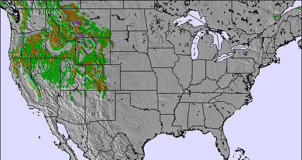
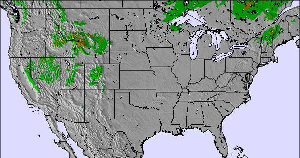
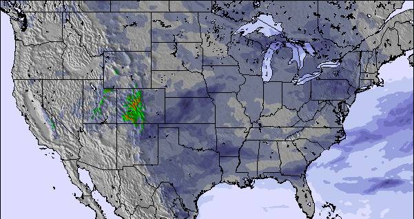
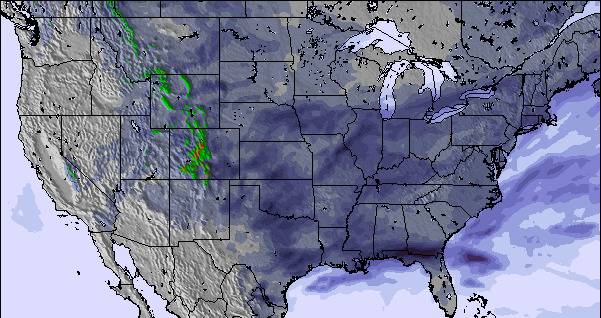
Snow map | 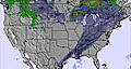 | 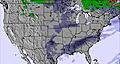 | 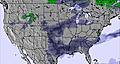 | 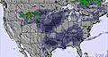 | 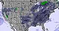 | 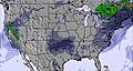 | ||||||||||
— | — | — | — | — | — | — | — | — | — | — | — | — | — | — | — | |
mm | — | — | — | — | — | — | — | — | — | — | — | — | 2 | — | — | 2 |
max °C | 18 | 18 | 20 | 16 | 21 | 21 | 18 | 22 | 24 | 18 | 24 | 28 | 27 | 30 | 32 | 26 |
min °C | 11 | 16 | 19 | 14 | 18 | 21 | 16 | 20 | 22 | 17 | 20 | 27 | 26 | 26 | 29 | 25 |
chill °C | 10 | 16 | 19 | 14 | 18 | 21 | 16 | 20 | 22 | 17 | 20 | 27 | 26 | 26 | 29 | 25 |
Humid % | 76 | 62 | 53 | 66 | 62 | 54 | 72 | 70 | 59 | 95 | 94 | 78 | 87 | 70 | 56 | 74 |
Freeze m | 4400 | 4050 | 4150 | 4400 | 4300 | 4500 | 4450 | 4400 | 4600 | 4800 | 5000 | 5100 | 5050 | 5050 | 5050 | 5200 |
— | 5:43 | — | — | 5:43 | — | — | 5:45 | — | — | 5:46 | — | — | 5:47 | — | — | |
— | — | 8:30 | — | — | 8:30 | — | — | 8:29 | — | — | 8:28 | — | — | 8:27 | — | |
Go pro and carve into:
Avalanche information: National Avalanche Center
Latest snow reports near Chestnut Mountain:
| Top snow depth: | — |
|---|---|
| Bottom snow depth: | — |
| Fresh snowfall depth: | — |
| Last snowfall: | 17 Mar 2026 |
| Snow Alerts | Create Alert |
0.0 | Bluebird Powder days Fresh snow, mostly sunny, light wind. |
|---|---|
0.0 | Powder days Fresh snow, limited sun, any wind. |
0.0 | Bluebird days Average snow, mostly sunny, light wind. |
The above table gives the weather forecast for Chestnut Mountain at the specific elevation of 317 m. Our sophisticated weather models allow us to provide snow forecasts for the top, middle and bottom ski stations of Chestnut Mountain. To access the weather forecasts for the other elevations, use the tab navigation above the table. For a wider view of the weather, check out the Weather Map of United States.
Click here to read further information on freezing levels and how we forecast our temperatures.
I was at Chestnut Mountain just once. It was the only resort I had close enough from work (Lena, IL). I ski there last Dec. 2nd 2008, and got the early season special "the date is the price" so I ski for $2 (cheapest I ever had). First thing I can say is that the views of the Mississipi river are just amazing. With a nice ski rental service and good lifts you can enjoy of the resort with no complain. The runs are short but, in some of the cases, real black ones. So even though it is a little resort, the well prepared runs have 100% snow making and lights. I could say it is a nice place to stop by if you are in the area, you'll get surprised.
Juan from Spain writes:
I was at Chestnut Mountain just once. It was the only resort I had close enough from work (Lena, IL). I ski there last Dec. 2nd 2008, and got the early season special "the date is the price" so I ski for $2 (cheapest I ever had).
First thing I can say is that the views of the Mississipi river are just amazing.
With a nice ski rental service and good lifts you can enjoy of the resort with no complain. The runs are short but, in some of the cases, real black ones. So even though it is a little resort, the well prepared runs have 100% snow making and lights. I could say it is a nice place to stop by if you are in the area, you'll get surprised.

 Nearest