
Pre-2025-Season Snowfall in Southern Hemisphere
Ski areas on three continents across the southern hemisphere have been reporting fresh snowfall ahead of the 2025 season, which is now only a month away.
Please sign in with your Snow-Forecast account details below.

Champoussin Weather (Next 3 days): The snow forecast for Champoussin is: Moderate rain (total 14.0mm), heaviest on Wed night. Very mild (max 16°C on Fri afternoon, min 8°C on Wed morning). Wind will be generally light.
Champoussin Weather (Days 4-6): Heavy rain (total 44.0mm), heaviest during Sun night. Freeze-thaw conditions (max 14°C on Sat afternoon, min 0°C on Mon night). Wind will be generally light.
| Resort | Snow Depth | Temp. (°C) | Wind (km/h) | Weather | ||
|---|---|---|---|---|---|---|
| Top Lift: | 6 | |||||
| Middle Lift: | 9 | |||||
| Bottom Lift: | 8 |
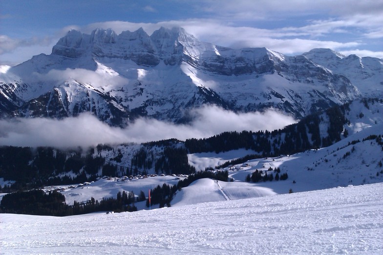
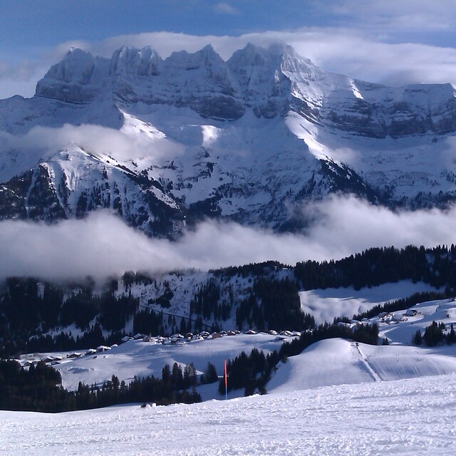
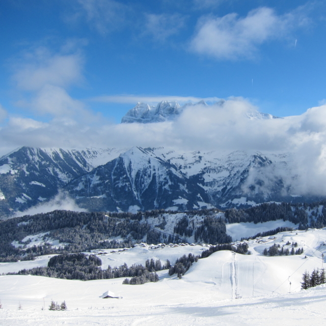
Latest snow reports near Champoussin:

Wednesday 30 | Thursday 1 | Friday 2 | Saturday 3 | Sunday 4 | Monday 5 | Tuesday 6 | |||||||||||||||
AM | PM | night | AM | PM | night | AM | PM | night | AM | PM | night | AM | PM | night | AM | PM | night | AM | PM | night | |
clear | risk thun- der | rain shwrs | clear | risk thun- der | rain shwrs | clear | some clouds | light rain | light rain | risk thun- der | rain shwrs | light rain | mod. rain | heavy rain | mod. rain | light snow | snow shwrs | clear | some clouds | clear | |
km/h | |||||||||||||||||||||
Snow map |  |  |  |  |  |  |  | ||||||||||||||
— | — | — | — | — | — | — | — | — | — | — | — | — | — | — | — | — | — | — | — | — | |
— | 3 | 4 | — | 1.0 | 1.0 | — | — | 5 | 1.0 | 3 | 3 | 4 | 6 | 19 | 7 | 1.0 | — | — | — | — | |
max°C | 10 | 11 | 11 | 11 | 14 | 13 | 14 | 16 | 14 | 13 | 14 | 10 | 9 | 12 | 8 | 4 | 2 | 1 | 3 | 6 | 4 |
min°C | 8 | 11 | 9 | 9 | 13 | 10 | 11 | 16 | 11 | 12 | 12 | 9 | 8 | 10 | 4 | 3 | 1 | 0 | 1 | 5 | 1 |
8 | 11 | 9 | 9 | 13 | 10 | 11 | 16 | 10 | 11 | 11 | 7 | 6 | 9 | 3 | 0 | -1 | -2 | 1 | 4 | 1 | |
61 | 64 | 67 | 58 | 62 | 64 | 50 | 51 | 66 | 64 | 67 | 60 | 78 | 84 | 97 | 99 | 90 | 71 | 56 | 56 | 71 | |
3050 | 3150 | 3250 | 3350 | 3400 | 3550 | 3600 | 3750 | 3350 | 3400 | 3400 | 3450 | 3150 | 3150 | 2500 | 2250 | 2050 | 1850 | 2500 | 2500 | 2050 | |
6:20 | — | — | 6:20 | — | — | 6:18 | — | — | 6:16 | — | — | 6:15 | — | — | 6:13 | — | — | 6:11 | — | — | |
— | — | 8:38 | — | — | 8:39 | — | — | 8:40 | — | — | 8:43 | — | — | 8:44 | — | — | 8:45 | — | — | 8:46 | |
Moderate rain (total 14.0mm), heaviest on Wed night. Very mild (max 16°C on Fri afternoon, min 8°C on Wed morning). Wind will be generally light.
Heavy rain (total 44.0mm), heaviest during Sun night. Freeze-thaw conditions (max 14°C on Sat afternoon, min 0°C on Mon night). Wind will be generally light.
Latest snow reports near Champoussin:
| Top snow depth: | — |
|---|---|
| Bottom snow depth: | — |
| Fresh snowfall depth: | — |
| Last snowfall: | 23 Apr 2025 |
| Snow Alerts | Create Alert |
0.1 | Bluebird Powder days Fresh snow, mostly sunny, light wind. |
|---|---|
0.6 | Powder days Fresh snow, limited sun, any wind. |
0.1 | Bluebird days Average snow, mostly sunny, light wind. |
The above table gives the weather forecast for Champoussin at the specific elevation of 1730 m. Our sophisticated weather models allow us to provide snow forecasts for the top, middle and bottom ski stations of Champoussin. To access the weather forecasts for the other elevations, use the tab navigation above the table. For a wider view of the weather, check out the Weather Map of Switzerland.
Click here to read further information on freezing levels and how we forecast our temperatures.
Overall 4.1 Based on 6 votes and 7 reviews
A gem of peace and great skiing with access to the full Porte du Soleil. As of winter 2017/18 the Morgins and Champoussin ski areas are now under new management and over the next few years the lifts and snow making facilities will all be hugely improved which will no doubt bring the crowds so go now whilst it's still relatively undiscovered. Slopes are quiet and a mix for all levels. For apres-ski and lunch/dinner the fabulous Italian "Amici" is the top pick (great food and location) followed by Le Poussin. The views are stunning and it's a great choice for families with quiet sunny nursery slopes and a great ski school next to the Amici Restaurant.
Gareth Lewis from United Kingdom writes:
A gem of peace and great skiing with access to the full Porte du Soleil. As of winter 2017/18 the Morgins and Champoussin ski areas are now under new management and over the next few years the lifts and snow making facilities will all be hugely improved which will no doubt bring the crowds so go now whilst it's still relatively undiscovered. Slopes are quiet and a mix for all levels. For apres-ski and lunch/dinner the fabulous Italian "Amici" is the top pick (great food and location) followed by Le Poussin. The views are stunning and it's a great choice for families with quiet sunny nursery slopes and a great ski school next to the Amici Restaurant.
The Champoussin skiing weather widget is available to embed on external websites free of charge. It provides a daily summary of our Champoussin snow forecast and current weather conditions. Simply go to the feed configuration page and follow the 3 simple steps to grab the custom html code snippet and paste it into your own site. You can choose the snow forecast elevation (summit, mid-mountain or bottom lift) and metric/imperial units for the snow forecast feed to suit your own website…. Click here to get the code.
View detailed snow forecast for Champoussin at:
snow-forecast.com


 Nearest