


View forecast
Champex-Lac at 2186 m altitude
Issued by Snow-Forecast.com at: 1 pm (local time) / 05 May 2024
Now
Sun 5 | Monday 6 | Tuesday 7 | Wednesday 8 | Thursday 9 | Friday 10 | Saturday 11 | ||||||||||||||
PM | night | AM | PM | night | AM | PM | night | AM | PM | night | AM | PM | night | AM | PM | night | AM | PM | night | |
risk thun- der | light rain | light rain | mod. snow | light snow | light snow | light snow | light snow | cloudy | snow shwrs | snow shwrs | clear | clear | some clouds | some clouds | some clouds | light rain | cloudy | some clouds | light rain | |
km/h | ||||||||||||||||||||
Snow map |  |  |  |  |  |  |  | |||||||||||||
— | — | — | 7 | 2.0 | 4 | 3 | 1.0 | — | — | — | — | — | — | — | — | — | — | — | — | |
3 | 2.0 | 3 | — | — | — | — | — | — | — | — | — | — | — | — | — | 1.0 | — | — | 4 | |
max°C | 7 | 6 | 3 | 2 | 1 | 0 | -1 | 0 | 1 | 2 | 2 | 3 | 6 | 5 | 6 | 8 | 7 | 7 | 9 | 7 |
min°C | 5 | 4 | 3 | 1 | 0 | -1 | -1 | -1 | 0 | 1 | 0 | 1 | 5 | 3 | 5 | 8 | 5 | 6 | 9 | 6 |
3 | 1 | 0 | -1 | 0 | -4 | -4 | -4 | -4 | -2 | -2 | -1 | 5 | 3 | 5 | 8 | 5 | 6 | 8 | 6 | |
77 | 85 | 97 | 98 | 99 | 98 | 99 | 98 | 82 | 93 | 79 | 57 | 68 | 68 | 56 | 72 | 83 | 59 | 67 | 86 | |
3000 | 3050 | 2700 | 2450 | 2250 | 2050 | 2100 | 2100 | 2350 | 2400 | 2300 | 2700 | 2900 | 3050 | 3100 | 3200 | 3150 | 3100 | 3350 | 3150 | |
— | — | 6:09 | — | — | 6:09 | — | — | 6:07 | — | — | 6:05 | — | — | 6:05 | — | — | 6:03 | — | — | |
— | 8:45 | — | — | 8:45 | — | — | 8:46 | — | — | 8:49 | — | — | 8:50 | — | — | 8:51 | — | — | 8:52 | |
Next 0-3 days weather summary:
Mild at first with light rain (total 8.0mm) on Sun afternoon followed by colder weather and light fall of snow, heaviest on Mon afternoon. Freeze-thaw conditions (max 7°C on Sun afternoon, min -1°C on Tue morning). Wind will be generally light.
Next 4-6 days weather summary:
Some drizzle, heaviest during Fri night. Freeze-thaw conditions (max 8°C on Fri afternoon, min 0°C on Wed night). Wind will be generally light.
Popular Champex-Lac Pages
Snow Radar
Submit a reportLatest snow reports near Champex-Lac:
25 km away from Champex-Lac
12 hours ago
Light rain reported from Sion at 339 metres elevation only 2 kms NW of Veysonnaz-Printse but it is forecast cold enough for snow at higher elevations in the ski area from Veysonnaz-Printse
41 km away from Champex-Lac
13 hours agoLight rain reported from Aosta Airport at 546 metres elevation 5 kms NE of Pila but it is forecast cold enough for snow at higher elevations in the ski area from Pila
Champex-Lac Snow Conditions
| Top snow depth: | — |
|---|---|
| Bottom snow depth: | — |
| Fresh snowfall depth: | 15 cm |
| Last snowfall: | 3 May 2024 |
| Snow Alerts | Create Alert |
Other resorts in Switzerland are reporting: powder (2) / good piste (3)
Snow-Forecast Partner Offers
Show your business here
Snow History
Week 1 of May has on average:
0.4 | Bluebird Powder days Fresh snow, mostly sunny, light wind. |
|---|---|
0.9 | Powder days Fresh snow, limited sun, any wind. |
0.1 | Bluebird days Average snow, mostly sunny, light wind. |

Champex-Lac Forecast Snowfall


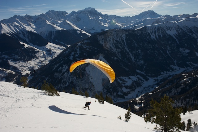
Photos of Champex-Lac
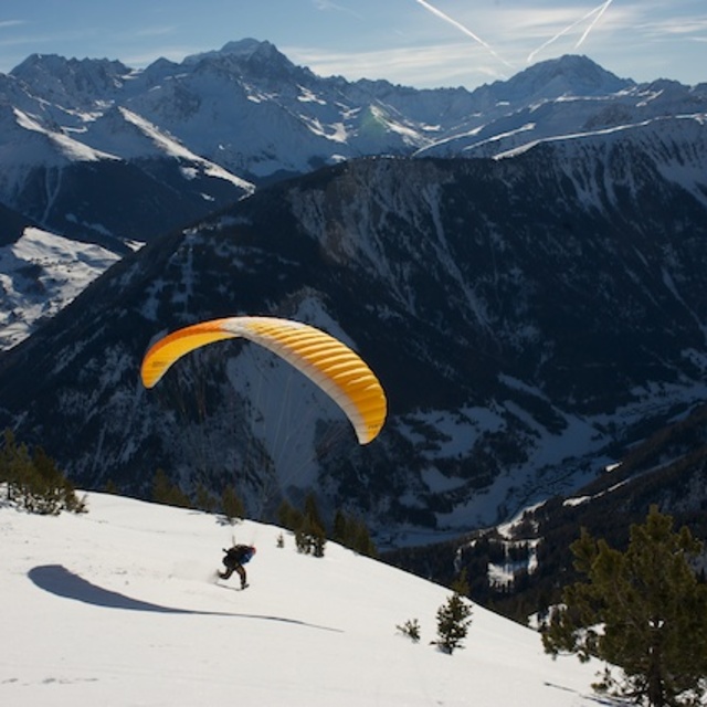
Take off by Chris Patient
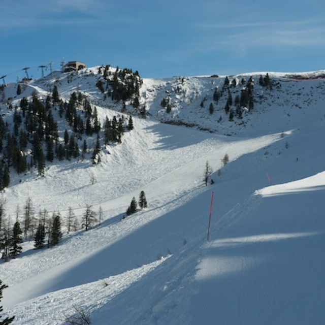
La Breya by Chris Patient
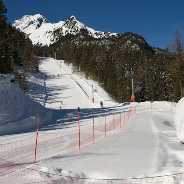
Petite Breya by Chris Patient
Other resorts in Switzerland are reporting: powder (2) / good piste (3)
The above table gives the weather forecast for Champex-Lac at the specific elevation of 2186 m. Our sophisticated weather models allow us to provide snow forecasts for the top, middle and bottom ski stations of Champex-Lac. To access the weather forecasts for the other elevations, use the tab navigation above the table. For a wider view of the weather, check out the Weather Map of Switzerland.
Click here to read further information on freezing levels and how we forecast our temperatures.
Visitor Reviews of Champex-Lac
Overall 3.8 Based on 3 votes and 5 reviews
- Snowsure
- Variety of pistes
- Vote
- Tom from Australia writes:
Champex-Lac is now overrun with guys with fat skis and no avalanche awareness. Having a beeper and backpack does not mean you have avalanche awareness. Be careful if going off-piste. Champex-Lac is not a very big place and most of the 'get outs' require you to point it and not dilly dally around, unfortunately lots of newbie's trash the place before lunch. Unless your an honest expert who knows the routes at Champex-Lac I'd suggest stay back in Verbier. There are some easy runs but do not drop in unless you know the proper safe way through - following tracks could be suicidal but I see it all the time.
Visitor Reviews of Champex-Lac
Tom from Australia writes:
Champex-Lac is now overrun with guys with fat skis and no avalanche awareness. Having a beeper and backpack does not mean you have avalanche awareness. Be careful if going off-piste. Champex-Lac is not a very big place and most of the 'get outs' require you to point it and not dilly dally around, unfortunately lots of newbie's trash the place before lunch. Unless your an honest expert who knows the routes at Champex-Lac I'd suggest stay back in Verbier. There are some easy runs but do not drop in unless you know the proper safe way through - following tracks could be suicidal but I see it all the time.
Free Snow-Forecast.com weather widget for your website
The Champex-Lac skiing weather widget is available to embed on external websites free of charge. It provides a daily summary of our Champex-Lac snow forecast and current weather conditions. Simply go to the feed configuration page and follow the 3 simple steps to grab the custom html code snippet and paste it into your own site. You can choose the snow forecast elevation (summit, mid-mountain or bottom lift) and metric/imperial units for the snow forecast feed to suit your own website…. Click here to get the code.
View detailed snow forecast for Champex-Lac at:
snow-forecast.com

 Nearest