

Global Weekly Snow Roundup #318
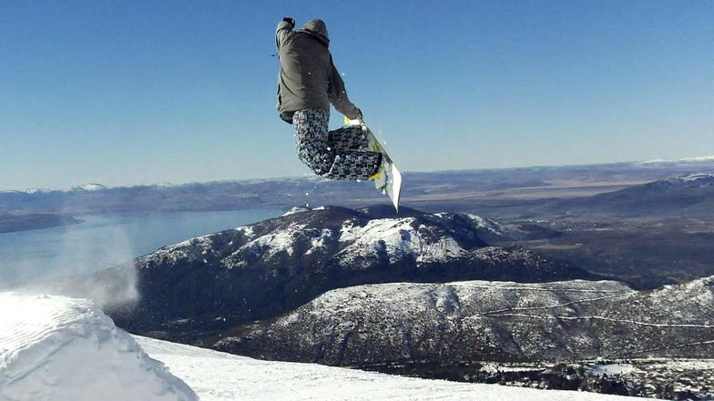
Weekly Snow News for the world, updated 11 June 2026: Australia's season begins, Val d’Isère reopens and major snowfall is forecast for the Andes.

Next 3 days weather summary:Mostly dry. Freeze-thaw conditions (max 1°C on Sat night, min -7°C on Fri night). Winds decreasing (strong winds from the W on Fri afternoon, calm by Sat morning). | Days 4-6 weather summary:Mostly dry. Freeze-thaw conditions (max 7°C on Tue night, min 0°C on Mon night). Winds increasing (calm on Tue afternoon, fresh winds from the W by Wed afternoon). | ||||||||||||||||
Fri 12 | Saturday 13 | Sunday 14 | Monday 15 | Tuesday 16 | Wednesday 17 | ||||||||||||
PM | night | AM | PM | night | AM | PM | night | AM | PM | night | AM | PM | night | AM | PM | night | |
snow shwrs | some clouds | clear | clear | clear | clear | clear | clear | clear | clear | clear | clear | clear | clear | clear | clear | some clouds | |
km/h | |||||||||||||||||
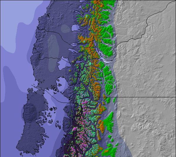
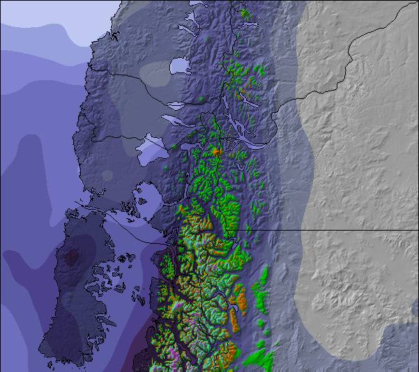
Snow map | 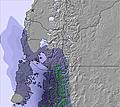 | 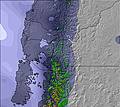 | 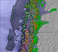 | 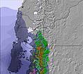 | 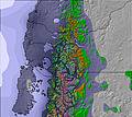 | 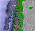 | |||||||||||
— | — | — | — | — | — | — | — | — | — | — | — | — | — | — | — | — | |
— | — | — | — | — | — | — | — | — | — | — | — | — | — | — | — | — | |
max °C | -5 | -6 | -5 | -3 | 1 | 1 | 1 | 0 | 1 | 1 | 4 | 5 | 6 | 7 | 4 | 3 | 2 |
min °C | -6 | -7 | -5 | -4 | -1 | 1 | 0 | 0 | 1 | 1 | 0 | 5 | 6 | 4 | 4 | 2 | 2 |
-15 | -14 | -10 | -8 | -6 | -4 | -4 | -4 | -4 | -3 | -4 | 2 | 6 | 0 | -1 | -4 | -4 | |
44 | 50 | 36 | 47 | 22 | 30 | 54 | 55 | 48 | 61 | 45 | 11 | 8 | 10 | 22 | 34 | 32 | |
1200 | 700 | 0 | 1200 | 2200 | 2850 | 3000 | 1150 | 3300 | 3300 | 3100 | 3300 | 3350 | 3400 | 3100 | 3000 | 2600 | |
— | — | 9:08 | — | — | 9:08 | — | — | 9:08 | — | — | 9:10 | — | — | 9:10 | — | — | |
6:22 | — | — | 6:22 | — | — | 6:22 | — | — | 6:22 | — | — | 6:22 | — | — | 6:22 | — | |
Go pro and carve into:
Avalanche information: Centro de Información de Avalanchas CIAV
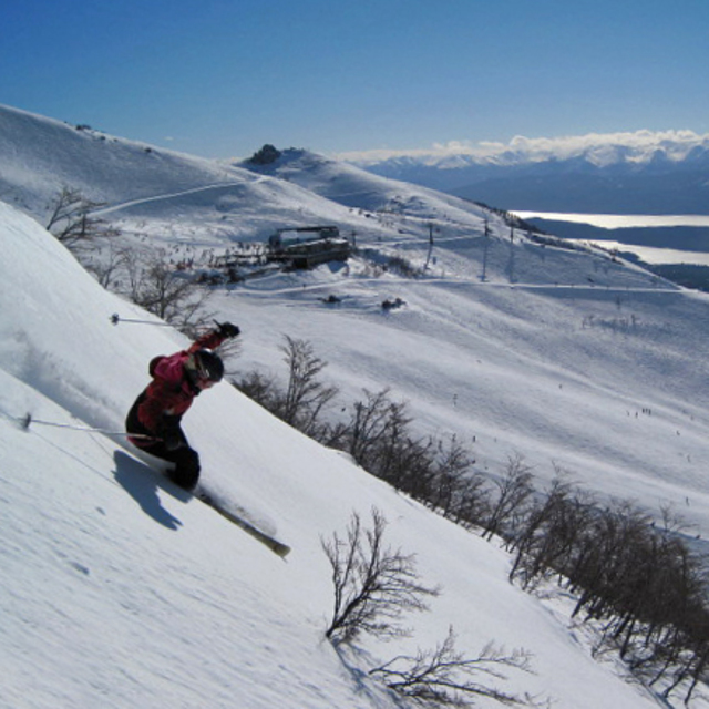
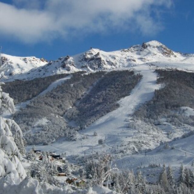
Latest snow reports near Cerro Catedral:
It is snowing steadily in Cerro Catedral. from Cerro Catedral
Resort not yet open. Snow has started to fall. from Cerro Catedral
It is snowing heavily in Cerro Catedral. from Cerro Catedral
Snowing heavily in Cerro Catedral. from Cerro Catedral
Snow falling at Cerro Bayo. from Cerro Bayo
| Top snow depth: | 0 cm |
|---|---|
| Bottom snow depth: | 0 cm |
| Fresh snowfall depth: | 40 cm |
| Last snowfall: | 11 Jun 2026 |
| Snow Alerts | Create Alert |
0.4 | Bluebird Powder days Fresh snow, mostly sunny, light wind. |
|---|---|
2.6 | Powder days Fresh snow, limited sun, any wind. |
1.3 | Bluebird days Average snow, mostly sunny, light wind. |
The above table gives the weather forecast for Cerro Catedral at the specific elevation of 2179 m. Our sophisticated weather models allow us to provide snow forecasts for the top, middle and bottom ski stations of Cerro Catedral. To access the weather forecasts for the other elevations, use the tab navigation above the table. For a wider view of the weather, check out the Weather Map of Argentina.
Click here to read further information on freezing levels and how we forecast our temperatures.
Overall 3.5 Based on 199 votes and 265 reviews
Séjour d'une semaine en septembre 2018 ce qui correspond à Mars Avril en Europe. Peu ou pas de neige en station mais enneigement naturel correct plus en hauteur. J'en garderai un très bon souvenir même si le domaine n'était pas totalement ouvert. Les points à retenir : à part le billet d'avion le séjour sur place ne coûte rien. La viande et le vin sont excellents en Argentine. Toutes commodités en station (boutiques de sport, superette, restos, bars, souvenirs). Paysages à couper le souffle. Un peu d'exotisme qui fait vraiment du bien en fin d'été quand on a hate de retrouver l'hiver.
Florent from France writes:
Séjour d'une semaine en septembre 2018 ce qui correspond à Mars Avril en Europe. Peu ou pas de neige en station mais enneigement naturel correct plus en hauteur.
J'en garderai un très bon souvenir même si le domaine n'était pas totalement ouvert.
Les points à retenir : à part le billet d'avion le séjour sur place ne coûte rien. La viande et le vin sont excellents en Argentine. Toutes commodités en station (boutiques de sport, superette, restos, bars, souvenirs). Paysages à couper le souffle. Un peu d'exotisme qui fait vraiment du bien en fin d'été quand on a hate de retrouver l'hiver.

 Nearest