


View forecast
Buttermilk at 3018 m altitude
Issued by Snow-Forecast.com at: 5 pm (local time) / 26 Apr 2024
Now
Fri 26 | Saturday 27 | Sunday 28 | Monday 29 | Tuesday 30 | Wednesday 1 | Thursday 2 | ||||||||||||||
PM | night | AM | PM | night | AM | PM | night | AM | PM | night | AM | PM | night | AM | PM | night | AM | PM | night | |
light snow | snow shwrs | light snow | mod. snow | light snow | light snow | light snow | snow shwrs | rain shwrs | light rain | some clouds | clear | some clouds | clear | clear | some clouds | snow shwrs | light snow | light snow | light snow | |
km/h | ||||||||||||||||||||
Snow map |  |  |  | 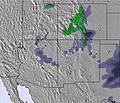 | 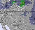 |  |  | |||||||||||||
1.0 | 1.0 | 2.0 | 6 | 2.0 | 1.0 | 1.0 | — | — | — | — | — | — | — | — | — | 2.0 | 2.0 | 2.0 | 2.0 | |
2.0 | — | — | — | — | — | — | — | 1.0 | 2.0 | — | — | — | — | — | — | 1.0 | — | — | — | |
max°C | 4 | -1 | -1 | -1 | -3 | 0 | 2 | -2 | 3 | 5 | 3 | 6 | 8 | 4 | 8 | 10 | 3 | -4 | -3 | -6 |
min°C | 2 | -2 | -1 | -1 | -4 | -2 | 2 | -3 | 1 | 4 | -3 | 1 | 7 | 1 | 5 | 8 | -3 | -5 | -4 | -8 |
0 | -4 | -1 | -3 | -6 | -5 | -1 | -3 | 0 | 0 | -3 | -1 | 3 | -2 | 2 | 4 | -6 | -9 | -9 | -8 | |
55 | 89 | 85 | 98 | 97 | 92 | 69 | 87 | 68 | 52 | 54 | 67 | 39 | 44 | 40 | 29 | 84 | 81 | 61 | 96 | |
3500 | 2700 | 2850 | 2950 | 2500 | 2650 | 3200 | 2500 | 3150 | 3800 | 3400 | 3250 | 3950 | 3650 | 3800 | 4200 | 3150 | 2250 | 2550 | 1950 | |
— | — | 6:11 | — | — | 6:11 | — | — | 6:09 | — | — | 6:09 | — | — | 6:07 | — | — | 6:05 | — | — | |
7:55 | — | — | 7:57 | — | — | 7:58 | — | — | 7:59 | — | — | 8:00 | — | — | 8:00 | — | — | 8:00 | — | |
Next 0-3 days weather summary:
Mild at first with light rain (total 3.0mm) on Fri afternoon followed by colder weather and light fall of snow, heaviest on Sat afternoon. Freeze-thaw conditions (max 4°C on Fri afternoon, min -4°C on Sat night). Wind will be generally light.
Next 4-6 days weather summary:
Light rain (total 3.0mm) at first, then becoming colder with a dusting of snow on Thu morning. Freeze-thaw conditions (max 10°C on Wed afternoon, min -5°C on Thu morning). Winds increasing (calm on Mon night, fresh winds from the WSW by Wed afternoon).
Popular Buttermilk Pages
Snow Radar
Submit a reportLatest snow reports near Buttermilk:
9 km away from Buttermilk
16 hours ago
Light rain reported from Aspen Airport at 7644 feet only 3 miles NE of Snowmass but it is forecast cold enough for snow at the ski area from Snowmass
Buttermilk Snow Conditions
| Top snow depth: | 0 cm |
|---|---|
| Bottom snow depth: | 0 cm |
| Fresh snowfall depth: | 1 cm |
| Last snowfall: | 25 Apr 2024 |
| Snow Alerts | Create Alert |
Other resorts in USA - Colorado are reporting: powder (0) / good piste (1)
Snow-Forecast Partner Offers
Show your business here
Snow History
Week 4 of April has on average:
0.4 | Bluebird Powder days Fresh snow, mostly sunny, light wind. |
|---|---|
1.6 | Powder days Fresh snow, limited sun, any wind. |
0.2 | Bluebird days Average snow, mostly sunny, light wind. |

Buttermilk Forecast Snowfall


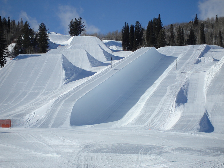
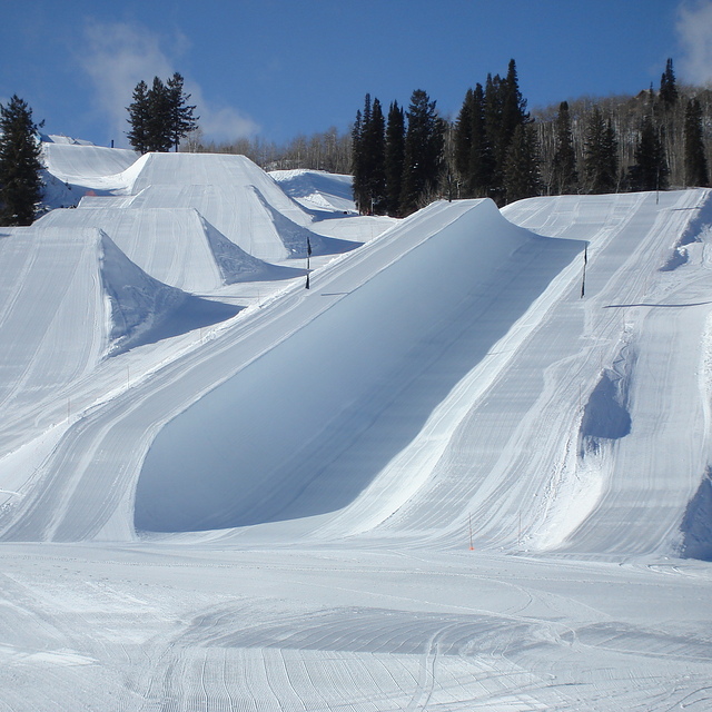
Photos of Buttermilk
Other resorts in USA - Colorado are reporting: powder (0) / good piste (1)
The above table gives the weather forecast for Buttermilk at the specific elevation of 3018 m. Our sophisticated weather models allow us to provide snow forecasts for the top, middle and bottom ski stations of Buttermilk. To access the weather forecasts for the other elevations, use the tab navigation above the table. For a wider view of the weather, check out the Weather Map of United States.
Click here to read further information on freezing levels and how we forecast our temperatures.
Visitor Reviews of Buttermilk
Overall 4.3 Based on 2 votes and 2 reviews
- Snowsure
- Variety of pistes
- Vote
- federico danza from Argentina writes:
Buttermilk is THE place to learn how to do everything. There is a great environment seen from the lifts and slopes. After a storm powder is great and it has very good secret spots. Very good for kids and grown ups, the only matter is the free style skiers and snowborders that don't care about the other riders. Hope you enjoy it.
Visitor Reviews of Buttermilk
federico danza from Argentina writes:
Buttermilk is THE place to learn how to do everything. There is a great environment seen from the lifts and slopes. After a storm powder is great and it has very good secret spots. Very good for kids and grown ups, the only matter is the free style skiers and snowborders that don't care about the other riders. Hope you enjoy it.
Free Snow-Forecast.com weather widget for your website
The Buttermilk skiing weather widget is available to embed on external websites free of charge. It provides a daily summary of our Buttermilk snow forecast and current weather conditions. Simply go to the feed configuration page and follow the 3 simple steps to grab the custom html code snippet and paste it into your own site. You can choose the snow forecast elevation (summit, mid-mountain or bottom lift) and metric/imperial units for the snow forecast feed to suit your own website…. Click here to get the code.
View detailed snow forecast for Buttermilk at:
snow-forecast.com

 Nearest