


Global Weekly Snow Roundup #314
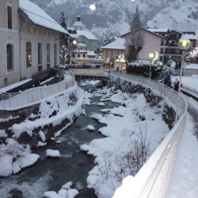
Weekly Global Snow News, updated 14 May 2026: Fresh snowfall in Argentina, Australia and Lesotho signals winter’s approach, while Japan maintains the world’s deepest snowpack.

Next 3 days weather summary:A light covering of new snow, mostly falling on Mon afternoon. Temperatures will be below freezing (max -3°C on Sun afternoon, min -11°C on Sat morning). Wind will be generally light. | Days 4-6 weather summary:Mostly dry. Freeze-thaw conditions (max 7°C on Thu night, min -2°C on Tue morning). Wind will be generally light. | |||||||||||||||||
Saturday 16 | Sunday 17 | Monday 18 | Tuesday 19 | Wednesday 20 | Thursday 21 | |||||||||||||
AM | PM | night | AM | PM | night | AM | PM | night | AM | PM | night | AM | PM | night | AM | PM | night | |
clear | light snow | snow shwrs | cloudy | snow shwrs | light snow | light snow | light snow | light snow | cloudy | light snow | snow shwrs | clear | some clouds | some clouds | clear | clear | clear | |
km/h | ||||||||||||||||||
Snow map |  |  |  |  |  |  | ||||||||||||
— | 1 | — | — | — | — | 1 | 3 | 3 | — | — | — | — | — | — | — | — | — | |
— | — | — | — | — | — | — | — | — | — | — | — | — | — | — | — | — | — | |
max °C | -10 | -8 | -5 | -4 | -3 | -4 | -4 | -4 | -4 | -2 | -1 | 0 | 1 | 2 | 4 | 5 | 6 | 7 |
min °C | -11 | -9 | -8 | -4 | -4 | -5 | -5 | -5 | -4 | -2 | -2 | -2 | 0 | 2 | 3 | 4 | 6 | 6 |
-18 | -14 | -13 | -7 | -4 | -8 | -8 | -9 | -7 | -4 | -5 | -5 | -3 | 0 | 0 | 2 | 5 | 5 | |
87 | 89 | 39 | 37 | 95 | 92 | 89 | 90 | 98 | 85 | 96 | 63 | 56 | 78 | 32 | 14 | 29 | 14 | |
1650 | 1900 | 1500 | 2350 | 2500 | 2250 | 2350 | 2400 | 2150 | 2550 | 2700 | 2850 | 3050 | 3200 | 3650 | 3750 | 3800 | 4100 | |
6:01 | — | — | 6:01 | — | — | 6:00 | — | — | 5:58 | — | — | 5:58 | — | — | 5:56 | — | — | |
— | — | 8:57 | — | — | 8:59 | — | — | 9:00 | — | — | 9:00 | — | — | 9:01 | — | — | 9:02 | |
Latest snow reports near Brides Les Bains:
| Top snow depth: | — |
|---|---|
| Bottom snow depth: | — |
| Fresh snowfall depth: | 11 cm |
| Last snowfall: | 15 May 2026 |
| Snow Alerts | Create Alert |
0.4 | Bluebird Powder days Fresh snow, mostly sunny, light wind. |
|---|---|
1.0 | Powder days Fresh snow, limited sun, any wind. |
1.2 | Bluebird days Average snow, mostly sunny, light wind. |
The above table gives the weather forecast for Brides Les Bains at the specific elevation of 2950 m. Our sophisticated weather models allow us to provide snow forecasts for the top, middle and bottom ski stations of Brides Les Bains. To access the weather forecasts for the other elevations, use the tab navigation above the table. For a wider view of the weather, check out the Weather Map of France.
Click here to read further information on freezing levels and how we forecast our temperatures.
Overall 3.9 Based on 3 votes and 17 reviews
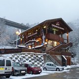
I have just come back from Brides Les Bains with Directski, a very good company which offered a remarkably good deal for a week's skiing. I agree with the reviewers who say it is a cheap way to experience the Three Valleys ski area. We had a self-catering apartment but ate out a few times in the town. There was not a lot of choice in restaurants but the best for a bit of buzz, friendly staff and half-decent food at a reasonable price is La Petite Auberge. We were VERY disappointed with our set menu dinner in Les Cerisiers, which you will pass as you walk down to the village from the lift station. The bar next door is comfortable and welcoming and you can sit out on the terrace and have a drink apres-ski but I would warn people about eating in the restaurant. We complained to the manager and although he apologised, the meal was so poor, we deserved a refund.
david hickie from Ireland writes:
I have just come back from Brides Les Bains with Directski, a very good company which offered a remarkably good deal for a week's skiing. I agree with the reviewers who say it is a cheap way to experience the Three Valleys ski area.
We had a self-catering apartment but ate out a few times in the town. There was not a lot of choice in restaurants but the best for a bit of buzz, friendly staff and half-decent food at a reasonable price is La Petite Auberge.
We were VERY disappointed with our set menu dinner in Les Cerisiers, which you will pass as you walk down to the village from the lift station. The bar next door is comfortable and welcoming and you can sit out on the terrace and have a drink apres-ski but I would warn people about eating in the restaurant. We complained to the manager and although he apologised, the meal was so poor, we deserved a refund.


 Nearest