


View forecast
Blue Knob at 967 m altitude
Issued by Snow-Forecast.com at: 1 am (local time) / 05 May 2024
Now
Sunday 5 | Monday 6 | Tuesday 7 | Wednesday 8 | Thursday 9 | Friday 10 | Saturday 11 | |||||||||||||||
AM | PM | night | AM | PM | night | AM | PM | night | AM | PM | night | AM | PM | night | AM | PM | night | AM | PM | night | |
light rain | rain shwrs | rain shwrs | some clouds | rain shwrs | light rain | rain shwrs | risk thun- der | risk thun- der | clear | clear | some clouds | light rain | heavy rain | heavy rain | light rain | light rain | heavy rain | heavy rain | light rain | light rain | |
km/h | |||||||||||||||||||||
Snow map |  |  |  |  | 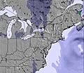 | 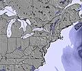 | 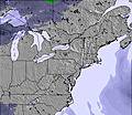 | ||||||||||||||
— | — | — | — | — | — | — | — | — | — | — | — | — | — | — | — | — | — | — | — | — | |
1.0 | 1.0 | 1.0 | — | 1.0 | 2.0 | 1.0 | 4 | 4 | — | — | — | 5 | 11 | 12 | 1.0 | 2.0 | 24 | 13 | 1.0 | 2.0 | |
max°C | 12 | 14 | 14 | 15 | 16 | 15 | 15 | 17 | 17 | 15 | 17 | 15 | 11 | 10 | 9 | 9 | 10 | 9 | 4 | 4 | 4 |
min°C | 11 | 14 | 14 | 14 | 16 | 14 | 14 | 16 | 15 | 15 | 17 | 13 | 10 | 9 | 8 | 8 | 9 | 5 | 4 | 4 | 3 |
8 | 12 | 13 | 13 | 16 | 14 | 13 | 16 | 12 | 12 | 15 | 11 | 6 | 6 | 5 | 4 | 6 | 1 | 0 | -2 | -3 | |
94 | 95 | 89 | 95 | 81 | 91 | 90 | 89 | 72 | 75 | 63 | 62 | 99 | 99 | 99 | 100 | 99 | 99 | 95 | 95 | 95 | |
3500 | 3700 | 3600 | 3650 | 3700 | 3400 | 3550 | 3750 | 3750 | 3400 | 3450 | 3650 | 3500 | 3450 | 3100 | 2700 | 2650 | 2350 | 1750 | 1800 | 1550 | |
6:07 | — | — | 6:05 | — | — | 6:05 | — | — | 6:03 | — | — | 6:03 | — | — | 6:01 | — | — | 6:01 | — | — | |
— | — | 8:13 | — | — | 8:14 | — | — | 8:15 | — | — | 8:15 | — | — | 8:16 | — | — | 8:17 | — | — | 8:19 | |
Next 0-3 days weather summary:
Moderate rain (total 15.0mm), heaviest on Tue afternoon. Very mild (max 17°C on Tue afternoon, min 11°C on Sun morning). Winds increasing (calm on Mon night, strong winds from the W by Tue night).
Next 4-6 days weather summary:
Heavy rain (total 55.0mm), heaviest during Fri night. Very mild (max 17°C on Wed afternoon, min 5°C on Fri night). Winds decreasing (strong winds from the W on Wed morning, calm by Fri night).
Popular Blue Knob Pages
Snow Radar
Latest snow reports near Blue Knob:
Blue Knob Snow Conditions
| Top snow depth: | — |
|---|---|
| Bottom snow depth: | — |
| Fresh snowfall depth: | — |
| Last snowfall: | 5 Apr 2024 |
| Snow Alerts | Create Alert |
Other resorts in USA - Pennsylvania are reporting: powder (0) / good piste (0)
Snow-Forecast Partner Offers
Show your business here
Snow History
Week 1 of May has on average:
0.1 | Bluebird Powder days Fresh snow, mostly sunny, light wind. |
|---|---|
0.0 | Powder days Fresh snow, limited sun, any wind. |
0.1 | Bluebird days Average snow, mostly sunny, light wind. |

Blue Knob Forecast Snowfall


Other resorts in USA - Pennsylvania are reporting: powder (0) / good piste (0)
The above table gives the weather forecast for Blue Knob at the specific elevation of 967 m. Our sophisticated weather models allow us to provide snow forecasts for the top, middle and bottom ski stations of Blue Knob. To access the weather forecasts for the other elevations, use the tab navigation above the table. For a wider view of the weather, check out the Weather Map of United States.
Click here to read further information on freezing levels and how we forecast our temperatures.
Visitor Reviews of Blue Knob
- docreight from United States writes:
Blue Knob is amazing as far as Pennsylvania can take it. Unlike other local resorts you can actually get some burn in your calves here. The Knob has some awesome glades and steeps (they had 2 small avalanches on some of the expert terrain, the last time I was there, since when do we get avalanches in PA?) and when it storms this place takes the cake. To my knowledge this place has the best and most varied terrain in PA. Blue Knob does not have much of a terrain park but the natural terrain will make up for that. Beware, this is PA and our weather usually sucks so this place is only really good when the weather is.
Visitor Reviews of Blue Knob
docreight from United States writes:
Blue Knob is amazing as far as Pennsylvania can take it. Unlike other local resorts you can actually get some burn in your calves here. The Knob has some awesome glades and steeps (they had 2 small avalanches on some of the expert terrain, the last time I was there, since when do we get avalanches in PA?) and when it storms this place takes the cake. To my knowledge this place has the best and most varied terrain in PA. Blue Knob does not have much of a terrain park but the natural terrain will make up for that. Beware, this is PA and our weather usually sucks so this place is only really good when the weather is.
Free Snow-Forecast.com weather widget for your website
The Blue Knob skiing weather widget is available to embed on external websites free of charge. It provides a daily summary of our Blue Knob snow forecast and current weather conditions. Simply go to the feed configuration page and follow the 3 simple steps to grab the custom html code snippet and paste it into your own site. You can choose the snow forecast elevation (summit, mid-mountain or bottom lift) and metric/imperial units for the snow forecast feed to suit your own website…. Click here to get the code.
View detailed snow forecast for Blue Knob at:
snow-forecast.com

 Nearest