

Global Weekly Snow Roundup #314
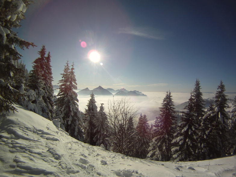
Weekly Global Snow News, updated 14 May 2026: Fresh snowfall in Argentina, Australia and Lesotho signals winter’s approach, while Japan maintains the world’s deepest snowpack.

Next 3 days weather summary:Moderate rain (total 14.0mm), heaviest on Mon afternoon. Freeze-thaw conditions (max 7°C on Sun afternoon, min -1°C on Sat morning). Wind will be generally light. | Days 4-6 weather summary:Light rain (total 5.0mm), mostly falling on Tue afternoon. Very mild (max 14°C on Thu afternoon, min 4°C on Tue morning). Wind will be generally light. | |||||||||||||||||
Saturday 16 | Sunday 17 | Monday 18 | Tuesday 19 | Wednesday 20 | Thursday 21 | |||||||||||||
AM | PM | night | AM | PM | night | AM | PM | night | AM | PM | night | AM | PM | night | AM | PM | night | |
light snow | snow shwrs | rain shwrs | some clouds | cloudy | some clouds | light rain | rain shwrs | mod. rain | cloudy | light rain | rain shwrs | clear | some clouds | some clouds | some clouds | some clouds | clear | |
km/h | ||||||||||||||||||
Snow map |  |  |  |  |  |  | ||||||||||||
— | — | — | — | — | — | — | — | — | — | — | — | — | — | — | — | — | — | |
— | 1 | 1 | — | — | — | 2 | 4 | 6 | — | 3 | 2 | — | — | — | — | — | — | |
max °C | 0 | 3 | 3 | 4 | 7 | 7 | 4 | 6 | 7 | 5 | 6 | 7 | 9 | 12 | 11 | 11 | 14 | 14 |
min °C | -1 | 1 | 1 | 2 | 6 | 5 | 4 | 6 | 4 | 4 | 5 | 6 | 7 | 11 | 9 | 9 | 13 | 12 |
-1 | -1 | 1 | 2 | 5 | 2 | 1 | 4 | 2 | 2 | 2 | 3 | 7 | 10 | 9 | 8 | 13 | 12 | |
92 | 62 | 81 | 65 | 55 | 61 | 86 | 76 | 96 | 81 | 88 | 86 | 78 | 63 | 77 | 67 | 48 | 53 | |
1450 | 1850 | 1750 | 2150 | 2400 | 2250 | 2100 | 2250 | 2100 | 2400 | 2650 | 2650 | 2850 | 3100 | 3400 | 3600 | 3750 | 4000 | |
5:58 | — | — | 5:58 | — | — | 5:56 | — | — | 5:56 | — | — | 5:54 | — | — | 5:54 | — | — | |
— | — | 9:00 | — | — | 9:00 | — | — | 9:01 | — | — | 9:04 | — | — | 9:05 | — | — | 9:06 | |
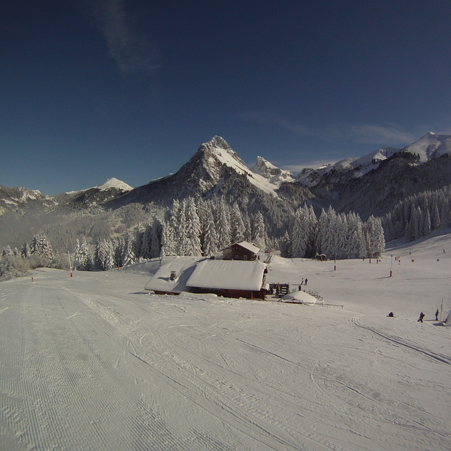
Latest snow reports near Bernex:
| Top snow depth: | — |
|---|---|
| Bottom snow depth: | — |
| Fresh snowfall depth: | 15 cm |
| Last snowfall: | 15 May 2026 |
| Snow Alerts | Create Alert |
0.0 | Bluebird Powder days Fresh snow, mostly sunny, light wind. |
|---|---|
0.1 | Powder days Fresh snow, limited sun, any wind. |
0.0 | Bluebird days Average snow, mostly sunny, light wind. |
The above table gives the weather forecast for Bernex at the specific elevation of 1456 m. Our sophisticated weather models allow us to provide snow forecasts for the top, middle and bottom ski stations of Bernex. To access the weather forecasts for the other elevations, use the tab navigation above the table. For a wider view of the weather, check out the Weather Map of France.
Click here to read further information on freezing levels and how we forecast our temperatures.
Overall 3.7 Based on 16 votes and 9 reviews
Nous partons a bernex faire du ski pour la période du nouvel an et après avoir lu tous les commentaires je trouve cela hallucinant de voir comment un commentaire peut être détourné aussi facilement par un autre en y marquant totalement tout le contraire! et dans toutes les remarques c'est la même chose.. Soit on lit c'est nase, c'est pas propre et 2 lignes en dessous on a tout le contraire! pour les gosses c'est pareil, rien pour garder les bébé et en dessous tout le contraire!! alors faudrait tous vous mettre d'accord, est ce que vous êtes sur au moins d'avoir passé vos vacances au même endroit??? car c'est à se demander tout de même.
alexia from France writes:
Nous partons a bernex faire du ski pour la période du nouvel an et après avoir lu tous les commentaires je trouve cela hallucinant de voir comment un commentaire peut être détourné aussi facilement par un autre en y marquant totalement tout le contraire! et dans toutes les remarques c'est la même chose.. Soit on lit c'est nase, c'est pas propre et 2 lignes en dessous on a tout le contraire! pour les gosses c'est pareil, rien pour garder les bébé et en dessous tout le contraire!! alors faudrait tous vous mettre d'accord, est ce que vous êtes sur au moins d'avoir passé vos vacances au même endroit??? car c'est à se demander tout de même.


 Nearest