


View forecast
Banff Mt Norquay at 1539 m altitude
Issued by Snow-Forecast.com at: 5 am (local time) / 28 Apr 2024
Now
Sunday 28 | Monday 29 | Tuesday 30 | Wednesday 1 | Thursday 2 | Friday 3 | Saturday 4 | |||||||||||||||
AM | PM | night | AM | PM | night | AM | PM | night | AM | PM | night | AM | PM | night | AM | PM | night | AM | PM | night | |
some clouds | light rain | light snow | light snow | light snow | heavy snow | mod. snow | light snow | light snow | some clouds | light rain | snow shwrs | cloudy | light rain | mod. snow | light snow | light rain | some clouds | clear | rain shwrs | rain shwrs | |
km/h | |||||||||||||||||||||
Snow map | 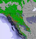 | 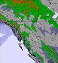 | 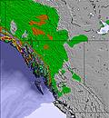 | 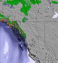 | 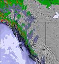 | 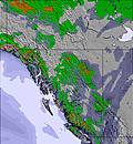 | 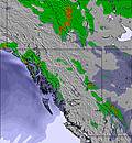 | ||||||||||||||
— | — | — | 2.0 | 2.0 | 11 | 8 | 2.0 | — | — | — | — | — | — | 8 | — | — | — | — | — | — | |
— | 1.0 | 1.0 | — | — | — | — | — | — | — | 1.0 | — | — | 3 | 3 | 1.0 | 2.0 | — | — | 2.0 | 1.0 | |
max°C | 6 | 7 | 1 | 2 | 3 | 0 | 0 | 1 | -3 | 2 | 4 | 0 | 3 | 5 | 1 | 3 | 4 | 1 | 5 | 6 | 1 |
min°C | 3 | 7 | -2 | 2 | 2 | -1 | -1 | 1 | -8 | -1 | 3 | -4 | 1 | 4 | 0 | 2 | 3 | -8 | 1 | 6 | -3 |
0 | 5 | -5 | 2 | 0 | -3 | -4 | -1 | -11 | -1 | 3 | -4 | -1 | 4 | 0 | 0 | 2 | -8 | 1 | 6 | -3 | |
70 | 50 | 93 | 86 | 79 | 97 | 94 | 89 | 91 | 78 | 79 | 97 | 85 | 85 | 97 | 84 | 88 | 91 | 80 | 73 | 89 | |
1900 | 2250 | 1450 | 1700 | 1700 | 1500 | 1450 | 1550 | 1050 | 1450 | 2000 | 1150 | 1750 | 2100 | 1700 | 1750 | 2000 | 1100 | 1800 | 2300 | 1650 | |
6:18 | — | — | 6:16 | — | — | 6:15 | — | — | 6:13 | — | — | 6:11 | — | — | 6:09 | — | — | 6:07 | — | — | |
— | — | 9:00 | — | — | 9:01 | — | — | 9:04 | — | — | 9:05 | — | — | 9:07 | — | — | 9:07 | — | — | 9:09 | |
Next 0-3 days weather summary:
Light rain (total 2.0mm) on Sun afternoon. Becoming colder with heavy fall of snow, heaviest during Mon night. Freeze-thaw conditions (max 7°C on Sun afternoon, min -8°C on Tue night). Wind will be generally light.
Next 4-6 days weather summary:
Mild with moderate rain (total 10.0mm) on Thu night, Becoming colder with a light covering of snow, mostly falling on Thu night. Freeze-thaw conditions (max 5°C on Thu afternoon, min -8°C on Fri night). Wind will be generally light.
Popular Banff Mt Norquay Pages
Snow Radar
Latest snow reports near Banff Mt Norquay:
Banff Mt Norquay Snow Conditions
| Top snow depth: | 0 cm |
|---|---|
| Bottom snow depth: | 0 cm |
| Fresh snowfall depth: | 6 cm |
| Last snowfall: | 26 Apr 2024 |
| Snow Alerts | Create Alert |
Other resorts in Canada - Alberta are reporting: powder (1) / good piste (2)
Snow-Forecast Partner Offers
Banff Paintings from The Ski Guru
Snow History
Week 4 of April has on average:
0.1 | Bluebird Powder days Fresh snow, mostly sunny, light wind. |
|---|---|
0.9 | Powder days Fresh snow, limited sun, any wind. |
0.1 | Bluebird days Average snow, mostly sunny, light wind. |

Banff Mt Norquay Forecast Snowfall


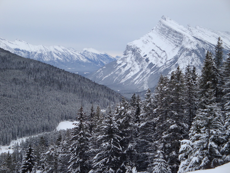
Photos of Banff Mt Norquay
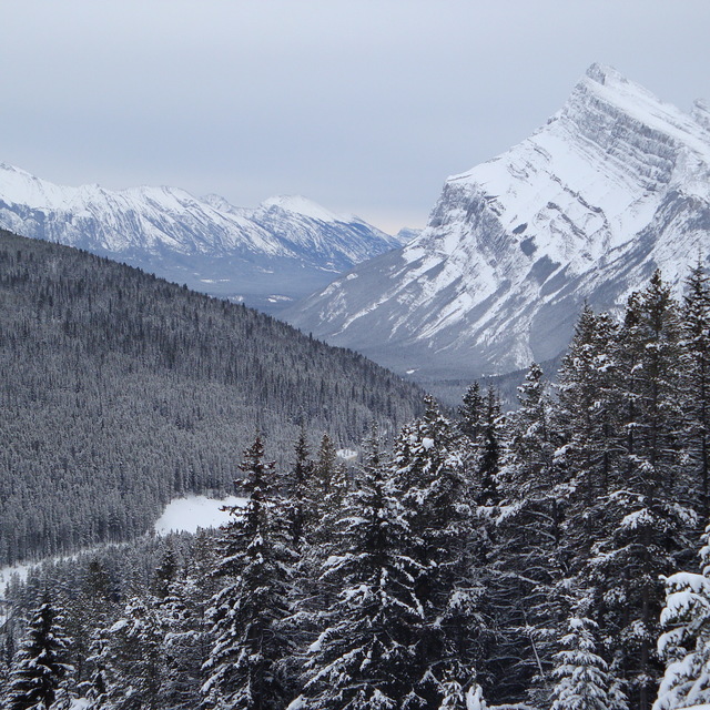
Love this view! by martin paine
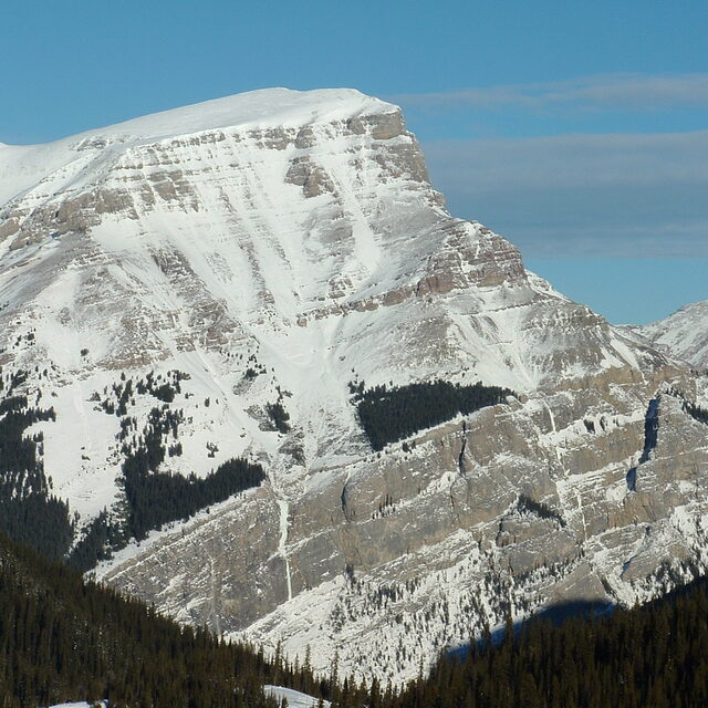
rockies! by andywells
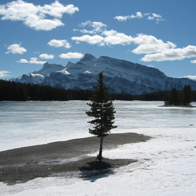
Frozen Lakeside in Banff by BeRo
Other resorts in Canada - Alberta are reporting: powder (1) / good piste (2)
The above table gives the weather forecast for Banff Mt Norquay at the specific elevation of 1539 m. Our sophisticated weather models allow us to provide snow forecasts for the top, middle and bottom ski stations of Banff Mt Norquay. To access the weather forecasts for the other elevations, use the tab navigation above the table. For a wider view of the weather, check out the Weather Map of Canada.
Click here to read further information on freezing levels and how we forecast our temperatures.
Resort name is also written as Banff Mount Norquay.
Visitor Reviews of Banff Mt Norquay
Overall 3.4 Based on 10 votes and 14 reviews
- Snowsure
- Variety of pistes
- Vote
- Diego from Canada writes:
I love Mt. Norquay. It's close to Calgary, the views are stunning. On the way up you often see all kinds of animals, bears, mountain goats, deer, elk, its awesome. We got married there this summer and the staff were awesome, everything ran smooth and they were super accommodating. In the winter we always come to ski the north American chair and other parts, off-piste at times that are incredible. Small and homie like. No annoying folks, only real ski lovers. snow is often really good and the powder days have been just amazing!
Visitor Reviews of Banff Mt Norquay
Diego from Canada writes:
I love Mt. Norquay. It's close to Calgary, the views are stunning. On the way up you often see all kinds of animals, bears, mountain goats, deer, elk, its awesome. We got married there this summer and the staff were awesome, everything ran smooth and they were super accommodating. In the winter we always come to ski the north American chair and other parts, off-piste at times that are incredible. Small and homie like. No annoying folks, only real ski lovers. snow is often really good and the powder days have been just amazing!
Free Snow-Forecast.com weather widget for your website
The Banff Mt Norquay skiing weather widget is available to embed on external websites free of charge. It provides a daily summary of our Banff Mt Norquay snow forecast and current weather conditions. Simply go to the feed configuration page and follow the 3 simple steps to grab the custom html code snippet and paste it into your own site. You can choose the snow forecast elevation (summit, mid-mountain or bottom lift) and metric/imperial units for the snow forecast feed to suit your own website…. Click here to get the code.
View detailed snow forecast for Banff Mt Norquay at:
snow-forecast.com

 Nearest