

Global Weekly Snow Roundup #314
Weekly Global Snow News, updated 14 May 2026: Fresh snowfall in Argentina, Australia and Lesotho signals winter’s approach, while Japan maintains the world’s deepest snowpack.

Next 3 days weather summary:Light rain (total 2.0mm), mostly falling on Sat night. Very mild (max 17°C on Sat morning, min 5°C on Sun night). Winds increasing (calm on Sun morning, fresh winds from the WSW by Mon afternoon). | Days 4-6 weather summary:Light rain (total 3.0mm), mostly falling on Tue morning. Very mild (max 14°C on Thu morning, min 5°C on Tue night). Wind will be generally light. | |||||||||||||||||
Saturday 16 | Sunday 17 | Monday 18 | Tuesday 19 | Wednesday 20 | Thursday 21 | |||||||||||||
AM | PM | night | AM | PM | night | AM | PM | night | AM | PM | night | AM | PM | night | AM | PM | night | |
some clouds | some clouds | rain shwrs | clear | some clouds | some clouds | some clouds | some clouds | light rain | light rain | light rain | some clouds | clear | some clouds | clear | clear | clear | some clouds | |
km/h | ||||||||||||||||||
Snow map | 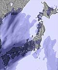 | 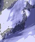 | 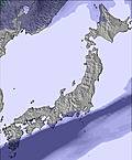 | 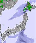 | 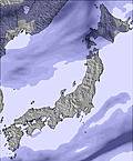 |  | ||||||||||||
— | — | — | — | — | — | — | — | — | — | — | — | — | — | — | — | — | — | |
— | — | 1 | — | — | — | — | — | 1 | 1 | 2 | — | — | — | — | — | — | — | |
max °C | 17 | 15 | 8 | 10 | 11 | 7 | 14 | 14 | 9 | 8 | 7 | 7 | 12 | 12 | 9 | 14 | 14 | 10 |
min °C | 17 | 11 | 6 | 7 | 9 | 5 | 11 | 10 | 7 | 8 | 7 | 5 | 10 | 9 | 6 | 12 | 11 | 8 |
16 | 9 | 5 | 7 | 7 | 2 | 8 | 7 | 4 | 5 | 4 | 3 | 9 | 8 | 4 | 12 | 11 | 8 | |
52 | 73 | 99 | 92 | 77 | 88 | 73 | 62 | 94 | 99 | 93 | 65 | 56 | 49 | 76 | 52 | 53 | 67 | |
3600 | 3450 | 3150 | 3600 | 3800 | 3600 | 3150 | 3250 | 3000 | 2750 | 2450 | 2300 | 2300 | 2450 | 2600 | 2650 | 2700 | 2750 | |
4:03 | — | — | 4:01 | — | — | 4:01 | — | — | 4:00 | — | — | 3:59 | — | — | 3:58 | — | — | |
— | 6:46 | — | — | 6:47 | — | — | 6:49 | — | — | 6:50 | — | — | 6:51 | — | — | 6:52 | — | |
Latest snow reports near Asahidake:
| Top snow depth: | — |
|---|---|
| Bottom snow depth: | — |
| Fresh snowfall depth: | — |
| Last snowfall: | 9 May 2026 |
| Snow Alerts | Create Alert |
0.1 | Bluebird Powder days Fresh snow, mostly sunny, light wind. |
|---|---|
0.4 | Powder days Fresh snow, limited sun, any wind. |
0.1 | Bluebird days Average snow, mostly sunny, light wind. |
The above table gives the weather forecast for Asahidake at the specific elevation of 1100 m. Our sophisticated weather models allow us to provide snow forecasts for the top, middle and bottom ski stations of Asahidake. To access the weather forecasts for the other elevations, use the tab navigation above the table. For a wider view of the weather, check out the Weather Map of Japan.
Click here to read further information on freezing levels and how we forecast our temperatures.
Overall 2.6 Based on 4 votes and 14 reviews
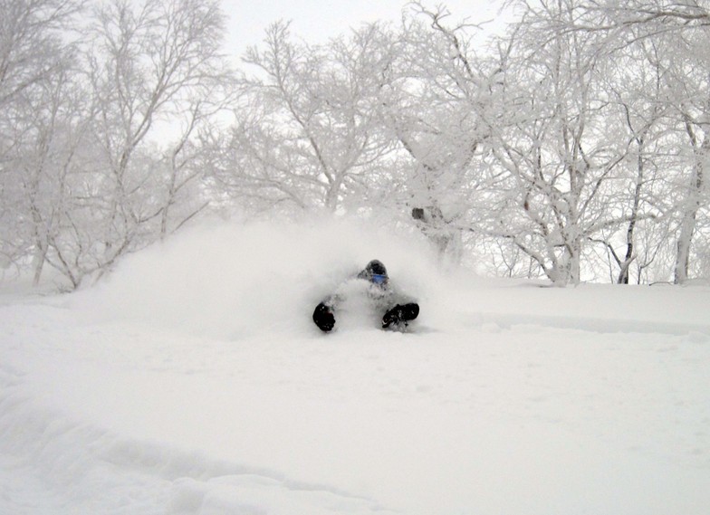
I've been to Asahidake for several seasons. It used to be my little secret, no lift lines, endless lift assisted pow runs. Those times are gone! This year brought unbelievable waits at the lift lines during weekdays, weekends, all days. Lift lines with no rules, with people cutting in line constantly. Many of these people are beginners or don't know the mountain, and I would routinely see them walking the cat track, or stuck in the snow, barely able to climb out. If you are a beginner, or even an intermediate, this mountain is not for you. There are no ropes showing boundaries, there is no ski patrol, and it's entirely possible to die here. Almost every year someone dies on the mountain. More annoying than the beginner skiers are the hikers. What do they want to do on windy, cloudy, snowy day with zero visibility? Why some people want to bring up their kids to the top of a mountain during a blizzard to walk around is beyond me. You can't see anything! I used to love Asahidake. Those days are unfortunately behind. Behind a lift line that goes all the way down the stairs, out the door, and wraps around the building. Sayanara Asahidake!
Crowded from Thailand writes:
I've been to Asahidake for several seasons. It used to be my little secret, no lift lines, endless lift assisted pow runs. Those times are gone!
This year brought unbelievable waits at the lift lines during weekdays, weekends, all days. Lift lines with no rules, with people cutting in line constantly.
Many of these people are beginners or don't know the mountain, and I would routinely see them walking the cat track, or stuck in the snow, barely able to climb out.
If you are a beginner, or even an intermediate, this mountain is not for you. There are no ropes showing boundaries, there is no ski patrol, and it's entirely possible to die here. Almost every year someone dies on the mountain.
More annoying than the beginner skiers are the hikers. What do they want to do on windy, cloudy, snowy day with zero visibility? Why some people want to bring up their kids to the top of a mountain during a blizzard to walk around is beyond me. You can't see anything!
I used to love Asahidake. Those days are unfortunately behind.
Behind a lift line that goes all the way down the stairs, out the door, and wraps around the building.
Sayanara Asahidake!


 Nearest