

Global Weekly Snow Roundup #314
Weekly Global Snow News, updated 14 May 2026: Fresh snowfall in Argentina, Australia and Lesotho signals winter’s approach, while Japan maintains the world’s deepest snowpack.

Next 3 days weather summary:Moderate rain (total 15.0mm), heaviest on Sat afternoon. Freeze-thaw conditions (max 13°C on Sun afternoon, min 0°C on Sat night). Wind will be generally light. | Days 4-6 weather summary:Light rain (total 4.0mm), mostly falling on Tue afternoon. Very mild (max 19°C on Thu afternoon, min 6°C on Tue night). Wind will be generally light. | ||||||||||||||||
Sat 16 | Sunday 17 | Monday 18 | Tuesday 19 | Wednesday 20 | Thursday 21 | ||||||||||||
PM | night | AM | PM | night | AM | PM | night | AM | PM | night | AM | PM | night | AM | PM | night | |
light rain | rain shwrs | some clouds | some clouds | some clouds | light rain | light rain | light rain | light rain | light rain | some clouds | some clouds | some clouds | rain shwrs | some clouds | some clouds | clear | |
km/h | |||||||||||||||||
Snow map |  |  |  |  |  |  | |||||||||||
— | — | — | — | — | — | — | — | — | — | — | — | — | — | — | — | — | |
3 | 1 | — | — | — | 1 | 4 | 4 | 2 | 3 | — | — | — | 1 | — | — | — | |
max °C | 7 | 6 | 9 | 13 | 10 | 9 | 10 | 8 | 7 | 8 | 9 | 14 | 17 | 13 | 16 | 19 | 16 |
min °C | 6 | 0 | 4 | 12 | 5 | 8 | 9 | 6 | 7 | 8 | 6 | 9 | 15 | 8 | 11 | 19 | 10 |
5 | -2 | 4 | 12 | 5 | 8 | 9 | 6 | 7 | 8 | 6 | 9 | 15 | 8 | 11 | 19 | 10 | |
74 | 85 | 60 | 48 | 78 | 84 | 76 | 96 | 95 | 95 | 86 | 71 | 66 | 82 | 52 | 51 | 69 | |
1900 | 1550 | 2300 | 2500 | 2200 | 2250 | 2300 | 2150 | 2400 | 2650 | 2650 | 3100 | 3050 | 3450 | 3750 | 3650 | 3850 | |
— | — | 6:01 | — | — | 6:00 | — | — | 5:58 | — | — | 5:56 | — | — | 5:56 | — | — | |
— | 8:58 | — | — | 8:59 | — | — | 9:00 | — | — | 9:01 | — | — | 9:02 | — | — | 9:04 | |
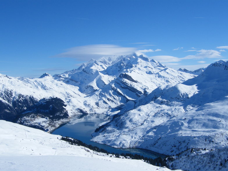
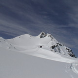
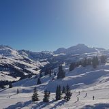
Latest snow reports near Arêches-Beaufort:
Moderate rain reported from Haute-Savoie Mont Blanc Airport/Aéroport Annecy/Meythet at 711 metres elevation only 3 kms WNW of Annecy-LeSemnoz but it is forecast cold enough for snow at the ski area from Annecy-LeSemnoz
| Top snow depth: | — |
|---|---|
| Bottom snow depth: | — |
| Fresh snowfall depth: | 14 cm |
| Last snowfall: | 15 May 2026 |
| Snow Alerts | Create Alert |
0.0 | Bluebird Powder days Fresh snow, mostly sunny, light wind. |
|---|---|
0.0 | Powder days Fresh snow, limited sun, any wind. |
0.0 | Bluebird days Average snow, mostly sunny, light wind. |
The above table gives the weather forecast for Arêches-Beaufort at the specific elevation of 1050 m. Our sophisticated weather models allow us to provide snow forecasts for the top, middle and bottom ski stations of Arêches-Beaufort. To access the weather forecasts for the other elevations, use the tab navigation above the table. For a wider view of the weather, check out the Weather Map of France.
Click here to read further information on freezing levels and how we forecast our temperatures.
Resort name is also written as Areches Beaufort.
Overall 4.2 Based on 8 votes and 3 reviews
Beaufort is certainly one of the best places to find traditional French skiing. Set with few foreigners, few Parisians and a lot of fresh snow. Restaurants are typically alpine style. Cheap, good. Folk are kind. Try the famous "Beaufort" cheese. Delicious whith a red savoyard wine like "Mondeuse". Beaufort is a very snowy and cold village where Frison Roche, the famous French alpine writer, used to live. Huge forest where you're skiing down hard slopes. Hotels and flats are cheap. From Albertville the famous '92 Olympic games city, you drive 25 KM, then you find the bottom of the world! You can ski from end of November to end of April, snow is deep every time!
eric Bastié from France writes:
Beaufort is certainly one of the best places to find traditional French skiing. Set with few foreigners, few Parisians and a lot of fresh snow. Restaurants are typically alpine style. Cheap, good. Folk are kind.
Try the famous "Beaufort" cheese. Delicious whith a red savoyard wine like "Mondeuse".
Beaufort is a very snowy and cold village where Frison Roche, the famous French alpine writer, used to live.
Huge forest where you're skiing down hard slopes.
Hotels and flats are cheap.
From Albertville the famous '92 Olympic games city, you drive 25 KM, then you find the bottom of the world!
You can ski from end of November to end of April, snow is deep every time!


 Nearest