WORLD SNOW ROUNDUP #283

Issued: 22nd March 2023
By Patrick “Snowhunter” Thorne
World Overview
After the huge snowfalls last week on ski slopes in both western North America (once again) and western Europe (more unusually this winter), the past seven days have been a lot drier and sunnier on both sides of the Atlantic.
That’s not to say there’s been no snowfall. Most areas in Europe and North America have seen more snowfall, with the Rockies, New England and Scandinavia posting the most in the last week.
Spring is definitely here though and it’s getting warmer, with freeze-thaw conditions the norm almost everywhere. More low-lying ski centres are also calling it a day on their 22-23 ski seasons, most notably in more southerly locations like the Pyrenees in Europe and southeast and Midwest in the US.
Europe
EUROPE INTRO
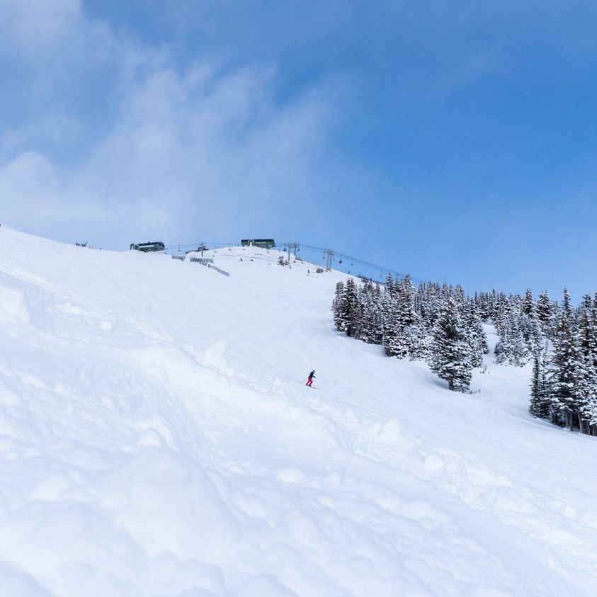
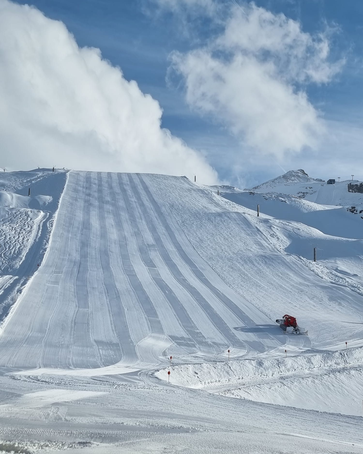
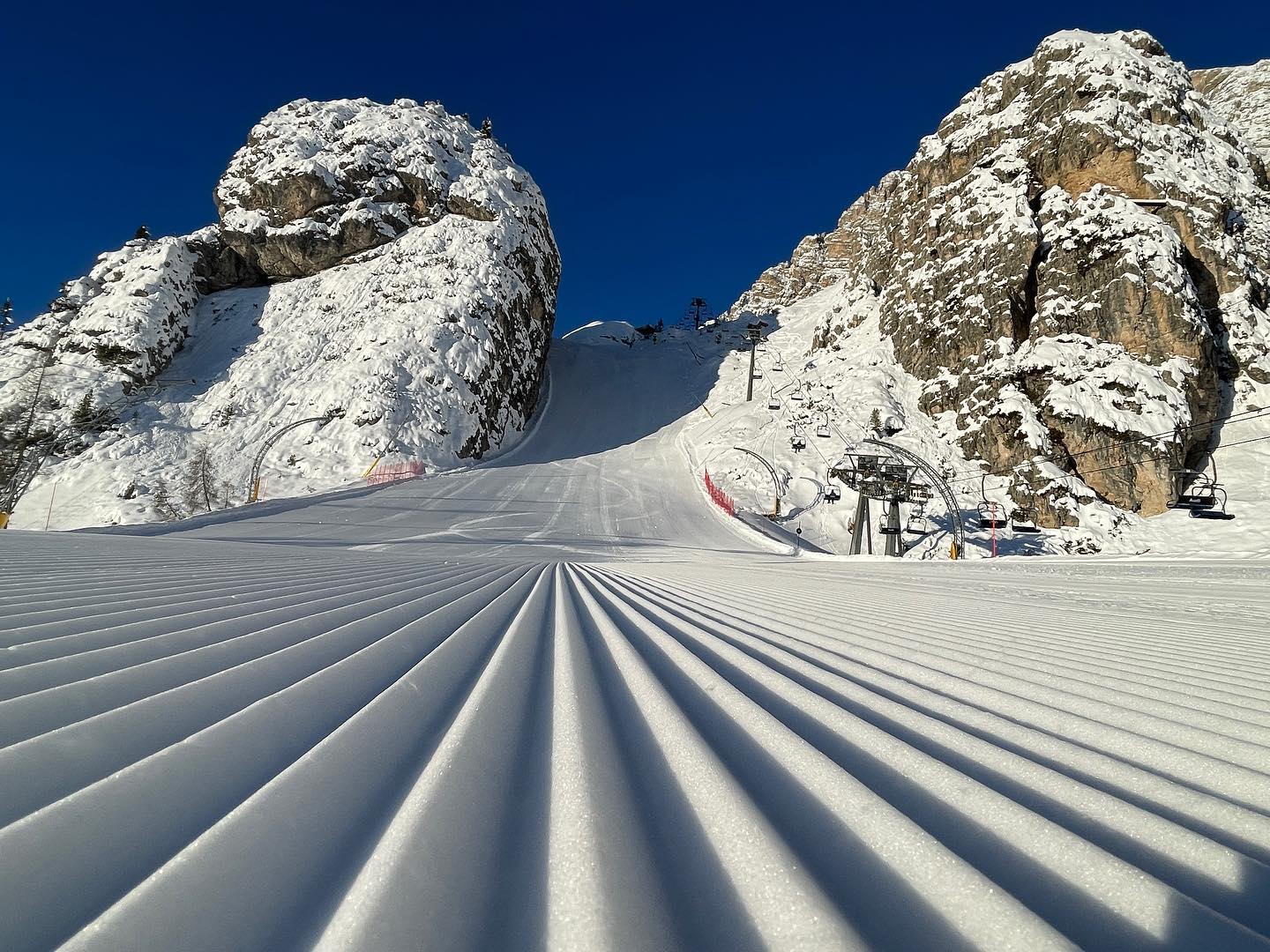
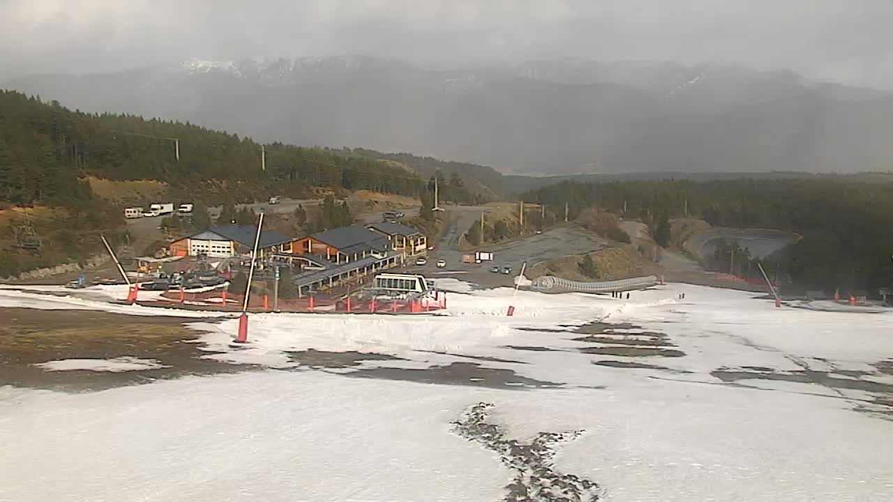
As we enter springtime by the astronomical as well as the meteorological measure of the seasons, by which spring started three weeks ago, snow depths on upper slopes in the Alps are about twice as good as they were in mid-winter. The heavy snowfall of just over a week ago has been consolidated by some smaller falls in the past week, along with a lot of sunny weather. In fact, the biggest accumulations of the last seven days have been posted up in Scandinavia once more. Springtime, however, means the start of the thaw and that’s well underway on lower slopes, with temperatures getting to +10C at 1,500m and +15C or higher in valleys below 1,000m altitude in the afternoons. So any remaining ski runs down low are very much white ribbons on the green valley sides. That’s especially the case down in the Pyrenees, which have had a very warm week. The fluctuating temperatures have kept avalanche danger levels quite high, generally in the 2-4 level on the scale to 5, typically highest in the western Alps.
AUSTRIA REPORT
A mixed week of weather across Austria with most areas seeing some snowfall a week ago. But, for most, not the big totals that were seen further west in the Alps. There were some exceptions though, most notably in the Arlberg where St Anton (96/310cm / 38/124”) posted more than a metre of fresh snowfall up high by Wednesday morning, with snow depths on the expert-only slopes at the top of Valluga, the first in Austria to report a 3m (10 feet) plus base this season. The base is also much deeper at Solden (80/250cm / 32/100”) with a number of Austria’s other glacier areas posting fairly good numbers up high ahead of the late spring ski season. Since all the snowfall, although there have been some light snow flurries, the weather has been predominantly dry across Austria and getting very mild again, above 15C in resort, some afternoons, in fact.
AUSTRIA FORECAST
The next few days look set to be sunny again but more changeable conditions are expected in the latter half of the week with precipitation possibly rain or snow depending on altitudes and the time of day.
SWITZERLAND REPORT
Swiss centres have seen a big jump in base depths following last week’s storms. Glacier 3000 near Gstaad was closed for almost a week by the snowfall there, which was eventually measured as a 1.6m (64”) storm total. The snow was heaviest in the west but ski areas like St Moritz (30/90cm / 12/36”), in the southeast that have had very little fresh snowfall all winter, eventually saw snow at resort level and the upper slope base depths doubling. Since then though it was a dry and warm end to last week and weekend across the country. The amount of terrain open in the country is gradually dropping, although there’s still plenty open, with the 4 Vallées (40/144cm / 16/57”) reporting about 75% of its terrain open, down from 90% over the last few months.
SWITZERLAND FORECAST
Quite a lot of cloud and slightly cooler than it has been but still reaching +15C at 1000m. Overnight lows below freezing above about 1700m, staying above freezing on lower slopes 24-67. Some light showers are expected, heavier towards the end of the week, falling as snow up high.
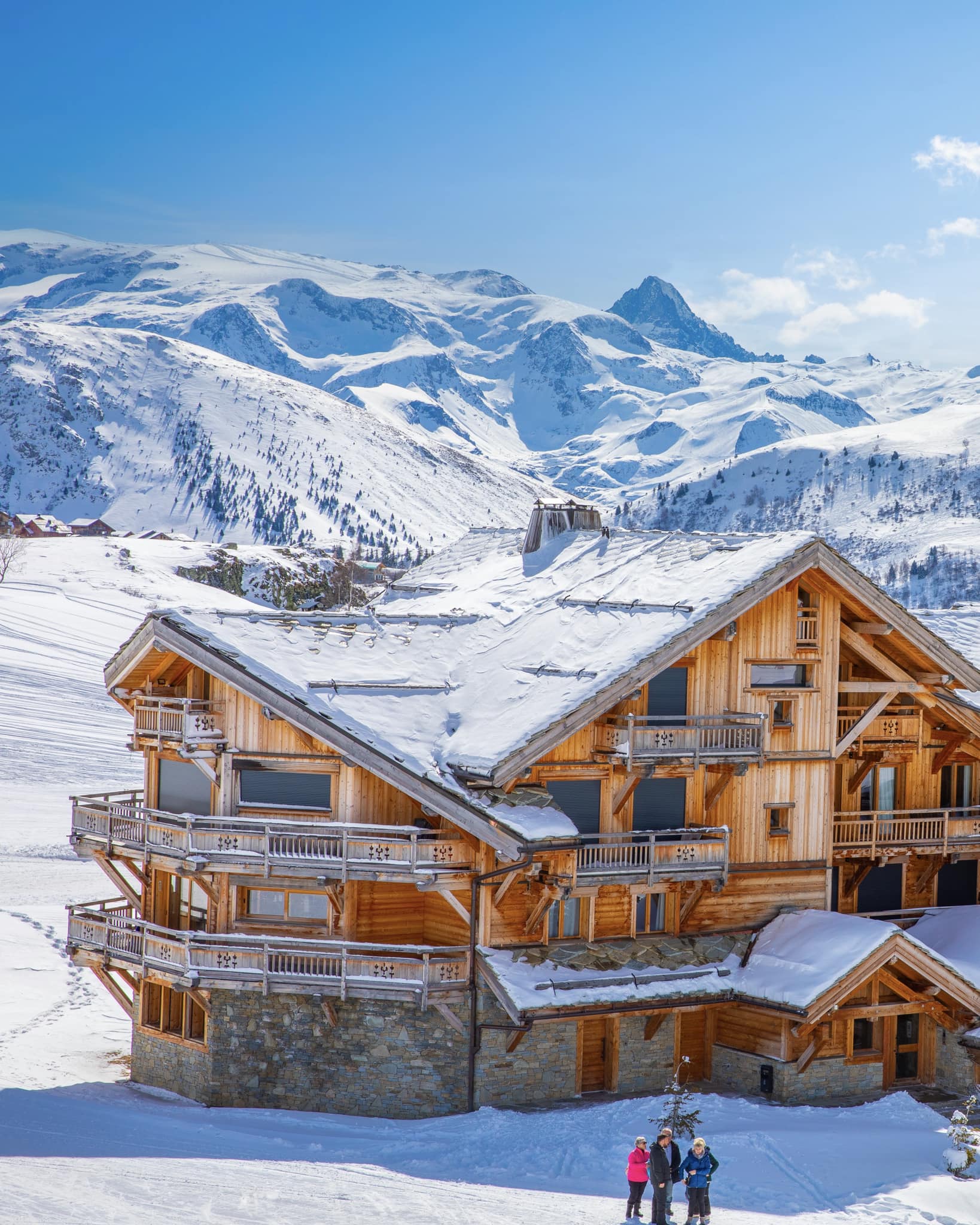
FRANCE REPORT
French resorts are in the best shape they’ve been all season, at least on higher slopes, with four of the five deepest reported snow depths in Europe, all in France. Tignes (136/390. cm / 54/156”) tops the table for all of Europe, its base depth jumping four feet (1.2m) up on the glacier last week after staying stationary at 2.7m (9 feet) for months. La Plagne (15/310cm / 6/124″) in second place illustrates the big chasm between the snow depths up high and the ribbons of thin white snow down in valleys keeping descents complete. Flaine, in Le Grand Massif, (5/300cm / 2/120″) has similar issues but with its base up at 1850m, La Rosiere (80/280cm / 32/112”) has plenty of snow at all levels.
FRANCE FORECAST
After a sunny period midweek it is looking increasingly wintery for the last few days of the week with another 30cm (foot) or so of snowfall expected for Thursday/Friday above 2000m altitude, which could pop Tignes over the 4m (160”) base mark, potentially.
ITALY REPORT
Italy has had a largely dry week although after a lot of sunshine before the weekend it has turned increasingly cloudy and the country’s highest slopes saw 5-15cm (2-6″) of snowfall on Saturday/Sunday. Bases were bolstered with more substantial snowfall, particularly in the north and west, just over a week ago. Elsewhere, and on lower slopes everywhere, the thaw has set in with the freezing point typically moving between 1500 and 2500m altitude through the 24-hour cycle, but tends to remain above 2000m. La Thuile (80/280cm / 32/112”), on the Italian border, is posting the deepest snow in the country right now and the Via Lattea or Milky Way (230/110cm / 12/44”), including Sestriere and Sauze d’Oulx, has the most terrain open (about 60% of the 400km possible when fully open there).
ITALY FORECAST
Similar conditions to the past few days, periods of sunshine and cloud, the freezing point mostly up around 2000m, continuing through the coming week. Light snow showers are possible up high but could fall as rain at lower elevations.
GERMANY REPORT
Another often warm, dry and sunny week in German mountains has killed off still more of the country’s smaller ski areas for the season, leaving less than 10% (a few dozen of the larger areas) still open. Some did see snowfall in the middle of last week but for many, that was rain, and subsequent plus temperatures into double-digits at low elevations (and above freezing up high at times too) has been the death knell for the 2022-23 seasons in more German areas. The Zugspitze Glacier (171/177cm / 68/76″), with Germany’s highest slope and longest season through to the start of May, has the country’s deepest snow, and about 16km (10 miles) of slopes open.
GERMANY FORECAST
It’s currently looking warm and sunny for the remainder of this week, which appears to be bad news for the remaining German snowpack.
SCANDINAVIA FORECAST
There’s more snow forecast in many areas for the remainder of this week, with light to moderate accumulations continuing daily, and temperatures in the -10C to +3C range.
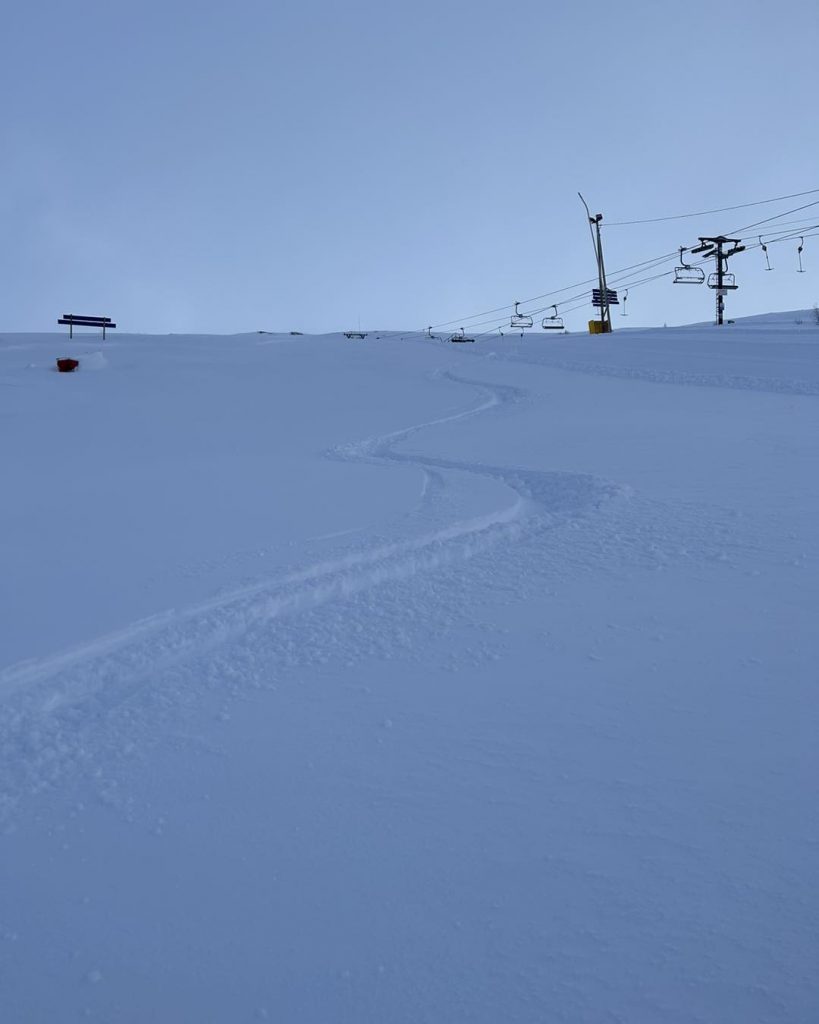
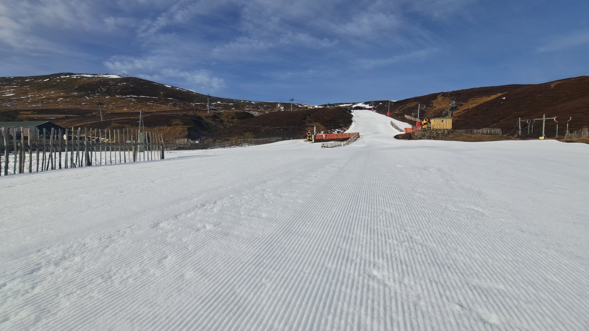
SCOTLAND REPORT
Scottish ski centres remain tantalisingly close to re-opening main runs following weeks of cold overnight temperatures. But it’s still not really enough for the big change. Cairngorm (20/450cm / 8/20”) continues to have the most terrain open, a dozen or so runs and about half its maximum total. Glenshee and The Lecht each have a handful of runs available. Over in the west, Glencoe had hoped to be able to reopen some terrain at the weekend but, in the end, announced cover was not quite enough to do so.
SCOTLAND FORECAST
The usual ups and downs of cold spells, rain and snow showers and warm weather in the afternoons continues to be forecast. There now seems little hope though of consistent cold to allow much to reopen. But experienced Scottish skiers know to never say never.
SPAIN / ANDORRA REPORT
The Pyrenees have seen some very warm temperatures over the past week, which has spelt the end of the season for some smaller and lower ski centres in France and Spain, a few weeks sooner than they had thought. Formigueres, in France, said it just wasn’t worth the effort and cost of trying to patch up holes in the snow appearing on lower pistes. There was a weak front move though at the weekend bringing a few light snow showers overnight up high but it’s been back to sunny from the start of the week. Grandvalira (20/70cm / 8/28”), in Andorra & the region’s largest resort, was hosting the FIS Alpine Skiing World Cup Finals in Soldeu up to Sunday. It illustrated the issue with white ribbons of race slopes and slushy snow for competitors, although there were snow showers at times on the upper half of the runs. It’s down to about 60% of its slopes still open.
SPAIN / ANDORRA FORECAST
Sunny weather is forecast to continue through the coming week, with freeze-thaw conditions. Daytime highs in valleys above +10C, more in the -5 to +5C range through the 24-hour cycle at 2,000m.
BULGARIA / ROMANIA REPORT
Plenty of sunshine across Bulgaria and Romania over the last week, with occasional light snow showers and freeze-thaw conditions above 2000m. Bases are slowly thawing although the region’s largest resort, Bansko (5/70cm / 2/32″), continues to maintain its long run back from the base of the slopes to the resort and says 75% of its slopes remain open.
BULGARIA / ROMANIA FORECAST
A little midweek snowfall is expected, perhaps 5-10cm (2-4”) on higher slopes on Wednesday-Thursday, before a return to sunny weather for the rest of the week.
CZECH REPUBLIC / SLOVAKIA REPORT
Cloudier and perhaps slightly cooler conditions than further south but still getting to +10C in valleys and +5C on higher slopes in the region. So the spring thaw continues and the few bits of precipitation there have been tended to be rain rather than snow. The region’s bigger ski areas are in a strong position to see out the rest of the season though after snowfall in mid-March. The largest, Slovakia’s Jasná (50/180cm / 20/72”) has the region’s deepest snowpack and, like another of the region’s bigger centres, Tatranská Lomnica (55/80cm / 20/32”), remains fully open. Jasna’s biggest issue in the latter half of last week was very strong winds closing lifts.
CZECH REPUBLIC / SLOVAKIA FORECAST
A mostly sunny picture with occasional clouds. Temperatures getting to +10C in valleys by the afternoons but still dipping below freezing overnight for freeze-thaw conditions. Daytime highs will be closer to +5C on higher slopes.
NORTH AMERICA INTRO
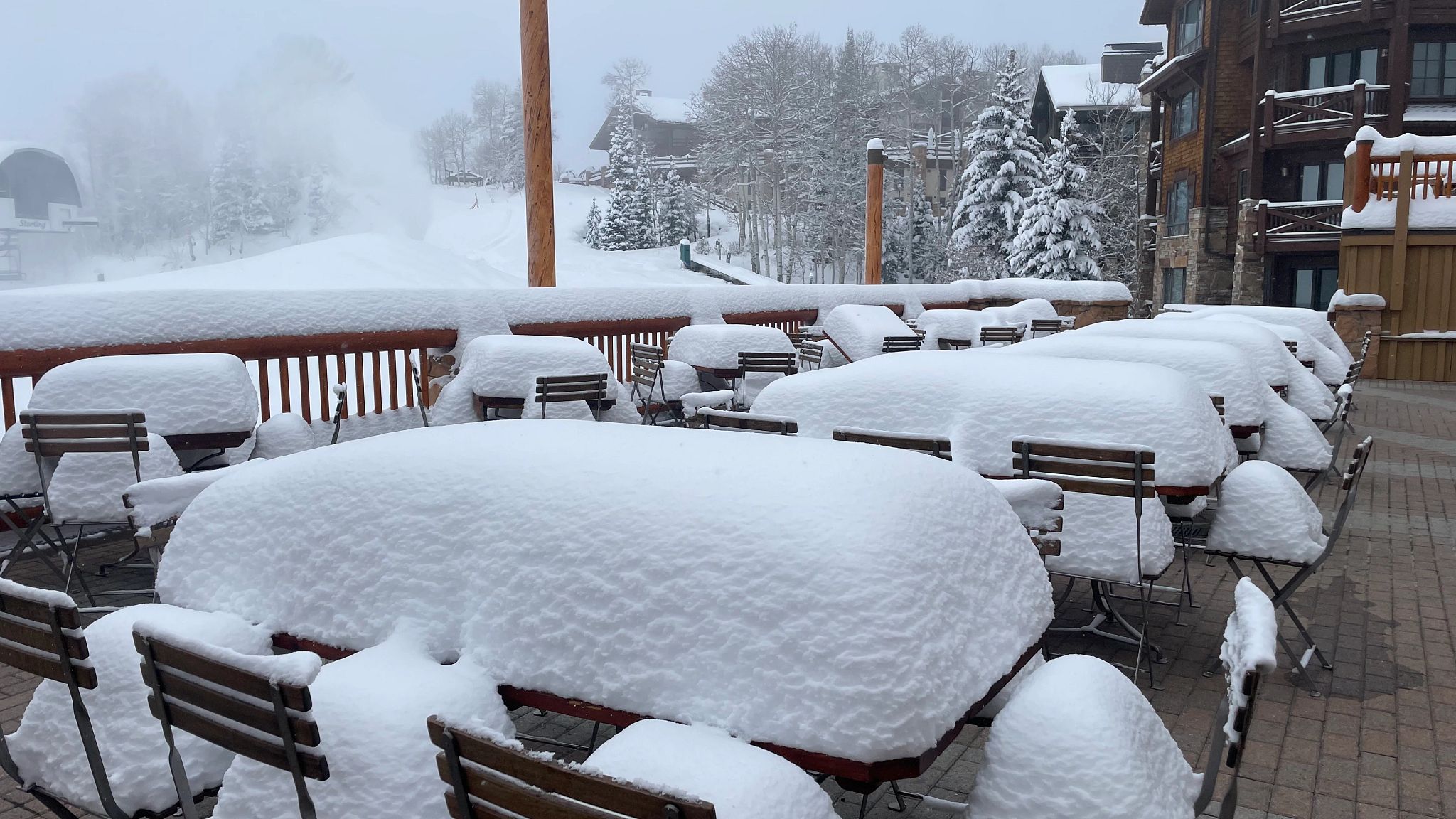
Have the stream of huge snow storms off the Pacific (the ‘atmospheric river’) finally eased? The jury is out and it is snowing again in the west as we publish this week’s report. But after the latest huge dig-out was completed in time for a sunny weekend there last Friday/Saturday, the current storm feels more ‘normal’ without the vast excesses of snowfall that each of the dozens on previous storms over the past three months has brought. It is still snowing though and this week the east has, unusually this winter, seen almost as much fresh snow as the west with a ‘Nor’easter’ hitting the continent on the other side, this time off the Atlantic. At the same time spring is starting to take hold and more smaller, lower ski areas, particularly in the Midwest, and more southerly locations on the East Coast, have decided to call it day on winter 22-23.
ROCKIES REPORT
Conditions remain good across the Rockies with more snow falling. More southerly areas have posted some of the biggest falls in recent days with Taos Ski Valley (80/93″ / 200/235cm) in New Mexico posting 20” in 72 hours and Wolf Creek (142/159″ / 355/398cm), in Southern Colorado, posting 18” (45cm). Both report all runs open and powder conditions. From anecdotal social media evidence, the good conditions have brought high skier numbers and some long lift lines. America’s largest ski area of Park City (243/328cm / 97/131”), in Utah, remains fully open and Alta (52/183” / 130cm/457cm), also in Utah, is posting the deepest snowpack in the region.
ROCKIES FORECAST
Temperatures are starting to creep warmer, into the low 40s at resort bases in the daytime, though still getting well below freezing overnight and with more snow falling. Now mostly light showers this week though.
USA WEST REPORT
There was a brief respite in the series of super storms hitting the western US from the Pacific at the weekend. Quite a few Californian resorts had been closed for a period last week to dig out lifts, most re-opening for the weekend and finding themselves under blue skies. Snow clouds returned on Sunday/Monday but so far it is a more manageable snowfall, rather than the multi-feet-in-24-hours that have been the norm in the region all winter. Mammoth (256/310″ / 640/775cm) continues to post the deepest base in the world. Further north Alyeska (35/83” / 87/208cm), up in Alaska, has posted one of the biggest accumulations this week with three feet (90cm) of snowfall in 72 hours over the weekend.
USA WEST FORECAST
Temperatures remain fairly cool and rain and snow showers are in the forecast, more snow about 6000 feet, but not the huge falls of recent weeks and months and with occasional sunny spells. Temperatures between the high-teens and mid-30s Fahrenheit.
MIDWEST REPORT
Times are changing in the Midwest. It’s still cold and there’s been more snowfall in many areas, but at the same time, a growing number of ski areas are shutting down for the season, mostly due to a lack of demand as locals switch to spring activities mode, and away from snow sports. Little Switzerland, in Wisconsin, is one of those that have closed down for the season. Others have reduced to weekend-only operations. Bigger centres are still in business for skiing and boarding though. Minnesota’s Lutsen Mountains (30/50″ / 90/150cm) are posting the deepest snow in the region, have 60 of 62 trails open and reported 6″ (15cm) of fresh snow in the last few days.
MIDWEST FORECAST
It’s looking warmer for the week ahead with rain more likely than snowfall in some areas. But, for most, it will be cloud rather than snow. Temperatures will get into the low 50s.
USA EAST REPORT
The snow conditions in the Eastern US continue to be about the best they’ve been all season with further fronts (‘Nor’easters’) moving in off the Atlantic and bringing seven day snow totals of up to three feet (90cm) now, for most resorts in the region the biggest falls of what has been a fairly lack lustre season until the past month or so. So there have been some good pow days, bases are building rather than shrinking and most centres in the north of the region are fully open. Even some at more southerly latitudes have seen the action. Several areas that ended their seasons a month ago after record-warm temperatures for February, are looking better and planning to stay open longer. Killington, in Vermont (14/23″ / 35/58cm), is fully open with the most terrain in the region. Sunday River (36/50” / 91/127cm), up in Maine, is reporting the deepest snowpack.
USA EAST FORECAST
The end of the week is looking more problematic with rising temperatures combined with precipitation, potentially meaning rain rather than snow, unfortunately. It should get cooler by the weekend, however, with the storm ending with snow.
CANADA WEST REPORT
It’s been a typical March week of gradually climbing temperatures, sunny spells and light snow showers across Western Canada. Coastal resorts in BC have seen daytime highs climb up to 5 or 6C, but at altitude and inland, temperatures have stayed below freezing. Whistler Blackcomb (20/235cm / 8/89”) has seen its base depths drop a little on a week ago, despite fresh snowfall up high, but reports North America’s largest ski area remains 100% open. Mount Seymour (285/430cm / 114/172”) is posting Canada’s deepest snowpack.
CANADA WEST FORECAST
Staying in the temperature range of +5C at bases in afternoons to -15C up high overnight with more light snow showers bringing 2-10cm (1-4 inches) every 24 hours or so on higher slopes. The ongoing mix of sunshine and cloud continues too.
CANADA EAST REPORT
It’s been a mostly good week in Eastern Canada with more snowfall reported. Against that, though a ‘warm weather event’ at the end of last week coupled with strong winds did impact snow cover in some areas at the weekend. Tremblant (54/140cm / 21/54”) still has the most terrain open in the region, although it’s down a little from the 100% of the past month or so.
CANADA EAST FORECAST
Staying in the -5 to +5C range over the coming week with occasional light snow showers and currently signs of a bigger fall likely at the weekend, although still some way off for full forecast precision.
Asia
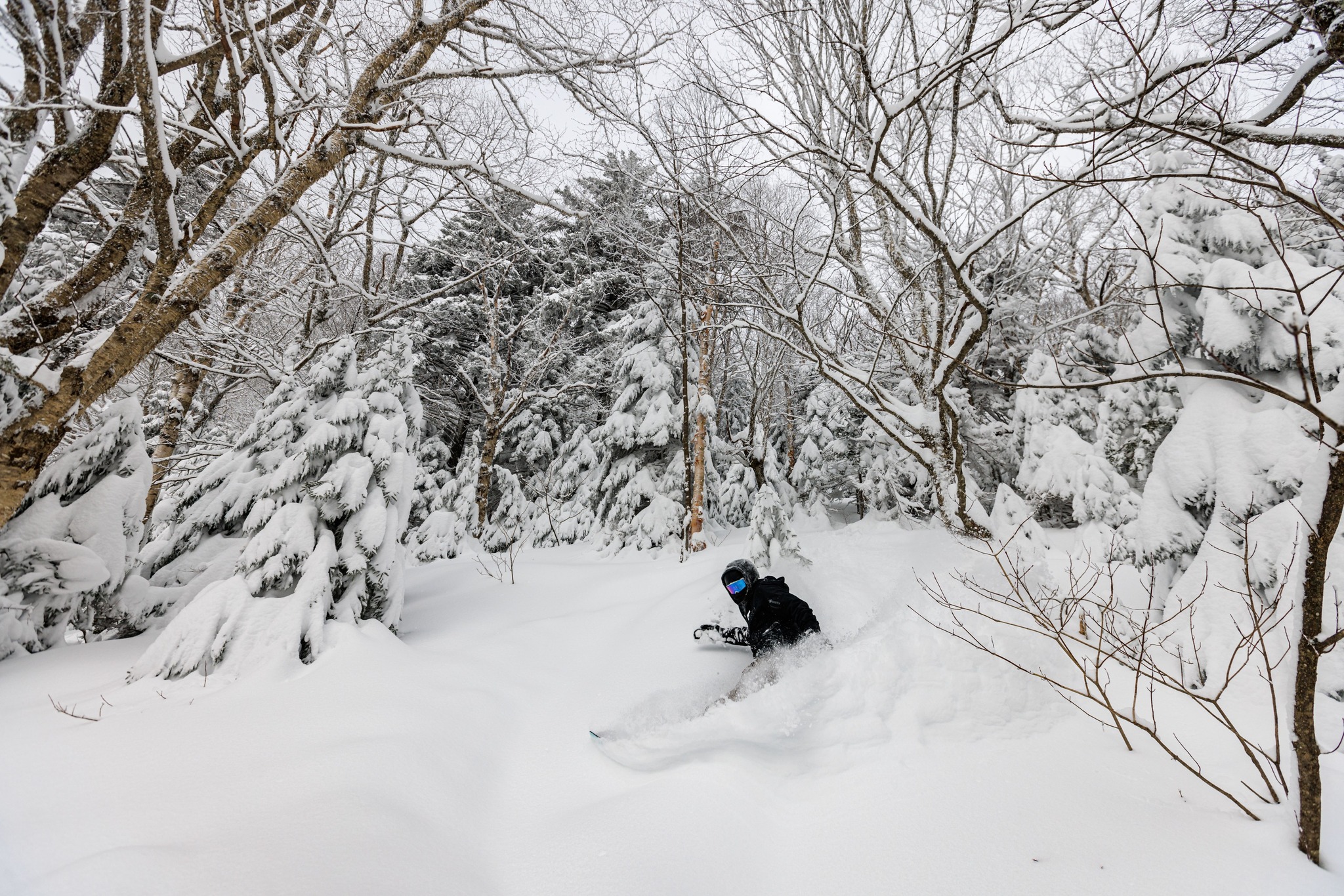
JAPAN REPORT
We continue to see the switch to spring conditions in Japan, with some light snow showers and sub-zero temperatures reported in the mountains still at times, but temperatures creeping up and more sunshine than snowfall is the norm. All the time the winter snowpack is slowly melting, but most big-name Japanese ski centres will still be staying open into May. Niseko (100/340cm / 40/136″) sums up the situation with -5C reported and 5cm (2″) of fresh snowfall before the weekend, then plenty of sunshine and temperatures climbing above freezing since.
JAPAN FORECAST
The current mix of sunshine, occasional snow or rain showers and temperatures fluctuating a few degrees on either side of freezing will continue into the first week of astronomical springtime this week.


