WORLD SNOW ROUNDUP #279

Issued: 15th February 2023
By Patrick “Snowhunter” Thorne
World Overview
After the very cold temperatures in north eastern North America just over a week ago, temperatures have warmed up to just below freezing in the region. Most of the rest of the continent’s ski areas have reported some fresh snowfall in the last week, if nothing spectacular, and sunny spells with generally cold temperatures. So, essentially, almost everywhere is open, most with good snow cover and many fresh cover. The Rockies and the west coast mountains continue to post many of the world’s deepest snowpacks. In Europe, the snowfall in the eastern Alps seems to have stalled for now and it has joined the rest of the region in offering a sunny week to skiers there, with the previously high avalanche danger easing off a little in many areas. Temperatures across the Alps have also risen back above freezing for most resorts after weeks of sub-zero temperatures. Elsewhere in Europe, there’s been plenty of snowfall reported in Scandinavia, particularly western Norway and up in Finnish Lapland, where the fresh powder is this week. It has also stayed cold down in the Balkans and the Pyrenees have had a little snowfall, but otherwise have similar conditions to the Alps. Scotland continues to battle warm weather fronts moving across the Highlands. In the wider world, the past week has seen plenty of snowfall for Japan and the Indian Himalayas too.
Europe
EUROPE INTRO
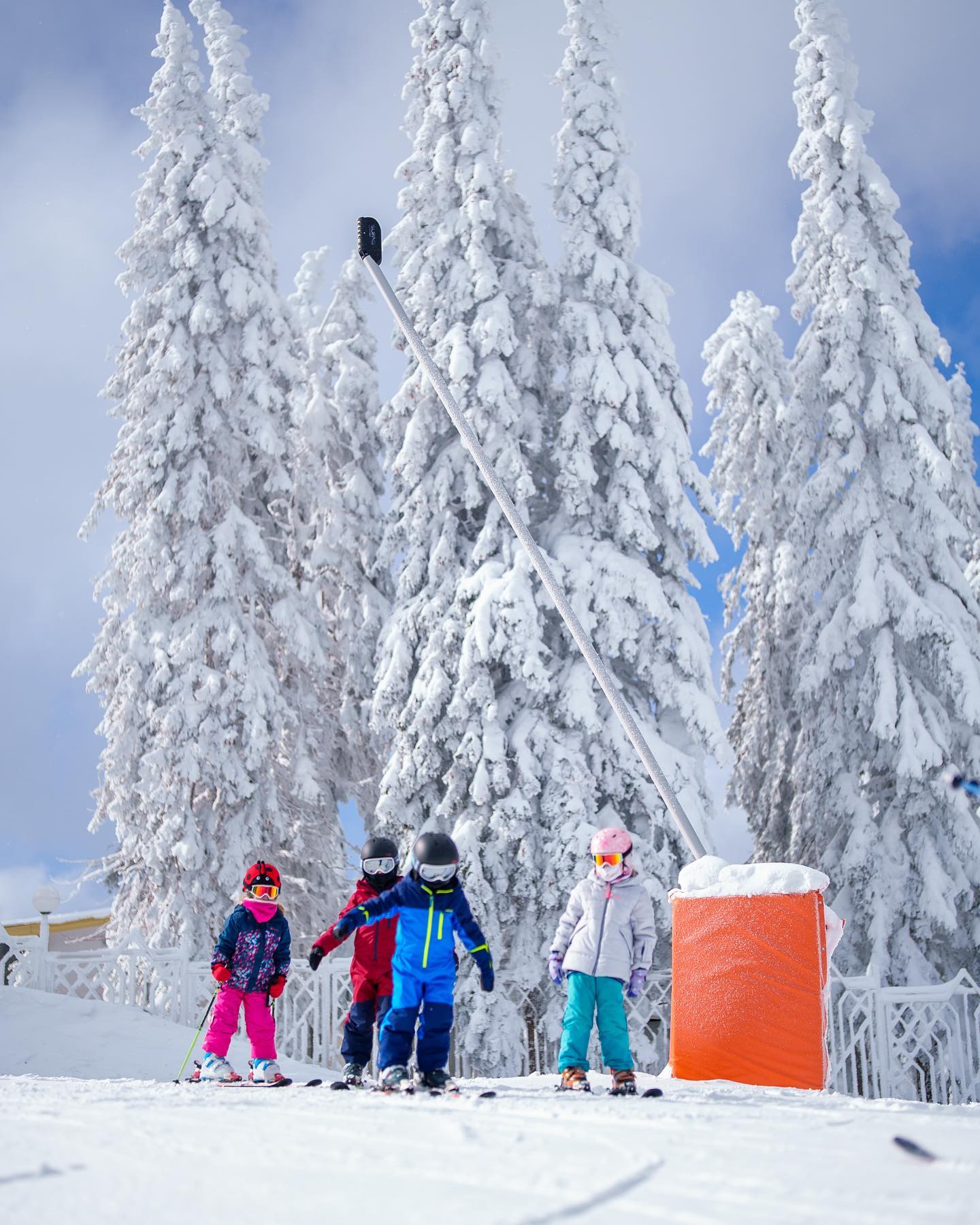
Sun, sun, sun has been the order of the day for the last week across much of western Europe. The main change is that temperatures have warmed by about 10 degrees on the mostly sub-zero numbers that have dominated for the last month. So feeling a little springlike at resort level, particularly the traditional villages (if not so much the purpose-built altitude resorts), but with overnight lows still below freezing and staying cold at altitude even in the daytime. There’s not been much impact on the snowpack. That said, pretty much everywhere is open for the first of the busy February school holiday weeks. The snow is getting old in the western Alps with some areas not having any significant fresh for nearly a month now, better in the east where it has only been a week. Outside the Alps, it’s a similar sunny, warming story for the Dolomites and Pyrenees. But it has stayed colder down in the Balkans and up in Scandinavia where snow showers continue.
AUSTRIA REPORT
It has been nearly non-stop sunshine on Austrian slopes following the big snowfalls here, 10+ days ago. The good news is that the avalanche danger has dropped somewhat, increasing the amount of terrain where there’s still fresh snow lying, but the danger levels are low. It’s been getting a little warmer this last week, impacting snow cover a little low down, but not yet significantly. There have also been a few fresh, light, snow flurries in the east of the country. Temperatures are climbing and are now in the high single-plus figures at resort bases in the afternoons, though colder of course up on the slopes. The Arlberg region (St. Anton, St. Christoph, Lech, Zürs, Warth and Schröcken)(85/170cm / 34/68”) is reporting the most terrain open in the country, about 90% of the 302km of slopes there and 85 of 89 lifts running.
AUSTRIA FORECAST
The sunny weather and warm temperatures in valleys will continue for the next few days. But more unsettled conditions are expected later in the week with a cloud-bearing front moving in on Thursday/Friday and the potential for 10-25cm (4-10”) of snowfall by the weekend.
SWITZERLAND REPORT
Swiss ski areas have had the same sunshine week as the rest of the Alps after its position on the east/west dividing line between sunny and snowy conditions the week before last came to an end. As with other alpine nations, temperatures rose about 10 degrees at the weekend from the previous mostly sub-zero norms to more of a -5 to +5 range, the higher temps at resort bases in the warmest part of the day of course, the coldest at night up high. Again, as with the rest of the Alps, conditions are fairly good almost everywhere, with most slopes open. The 4 Valleys around Verbier (45/90cm / 18/36”) have 90% of their terrain open. Zermatt-Cervinia (10/75cm / 4/30”), which has unusually missed out on many of this winter’s snow storms so far, has just under 80% of its slopes open. Bases are down on the usual average at this point of the season across Switzerland (and Europe) with Lötschental (25/192cm / 10/77”) posting the deepest in the country at present.
SWITZERLAND FORECAST
Still more sunshine forecast with, if anything, temperatures creeping a little higher as the week goes on and we await a change.
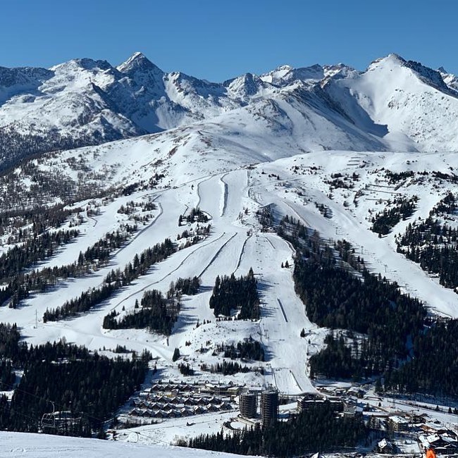
FRANCE REPORT
There were a few more light snowfalls in the southeast French Alps at the end of last week, but for most areas, it has been a third or even fourth week of dry, sunny weather. The main difference to the previous month was rather warmer temperatures starting to creep in, if not enough to impact the snowpack much, which remains just about deepest in the Alps here, thanks to the falls in mid-January. Tignes and Val d’Isere (85/270cm / 34/108″) continue to post the deepest snowpack in France and the entire Alps and most of the big ski regions are 90% open or more, the biggest, the 3 Valleys, reports about 97% of its runs open for what is one of the busiest weeks of the season, the French half term holidays.
FRANCE FORECAST
The sunny weather is expected to continue at least to the weekend, with temperatures mostly remaining below freezing above about 2,000m, but hitting afternoon highs of 10C down at low-lying resorts around the 1,000m altitude mark.
ITALY REPORT
Italian ski slopes have probably seen more fresh snowfall than most over the past few weeks with ski areas in the northwest of the country over by the French and Swiss border receiving snow a fortnight ago and then in the east, ski areas in the Dolomites and along the Austrian border got snowfall just over a week ago. Since then though it has been sun, sun, sun and some of the warmest weather in the Alps, getting up to double positive figures Celsius in valleys in the afternoons this week, staying closer to freezing up high. After all that snowfall in the east, the country’s deepest reported snow depth is in the far east, on the Slovenian border, at Sella Nevea (55/230cm / 22/92″). On-piste conditions remain fairly good across Italy despite the rising temperatures with almost all slopes open.
ITALY FORECAST
There’s not much change in the non-stop sun forecast for the rest of this week. If anything temperatures will rise further to as high as +15C at resort bases below around 1,000m altitude in the afternoons.
GERMANY REPORT
Germany’s main ski focus this last week has been the Biathlon World Championships in Oberhof, quite a low-lying resort where it is usually white ribbons of cross-country tracks on a green background. But thanks to all the snow just over a week ago, it has been pleasantly white off the tracks too this year. It’s been sunny here as well this week with warming temperatures. But, still, the gains from the start of the month after the warm dry start of the season are holding and all the newly opened terrain remains open. Reit im Winkl (10/130cm / 4/52”) continues to post the most runs open (40km / 25 miles / 95% of its terrain). Its snow depth is actually slightly greater than that reported at the country’s highest slopes on the Zugspitze (121/121cm / 48/48”).
GERMANY FORECAST
Sunny weather ahead, temperatures largely in the -5C to 9C range.
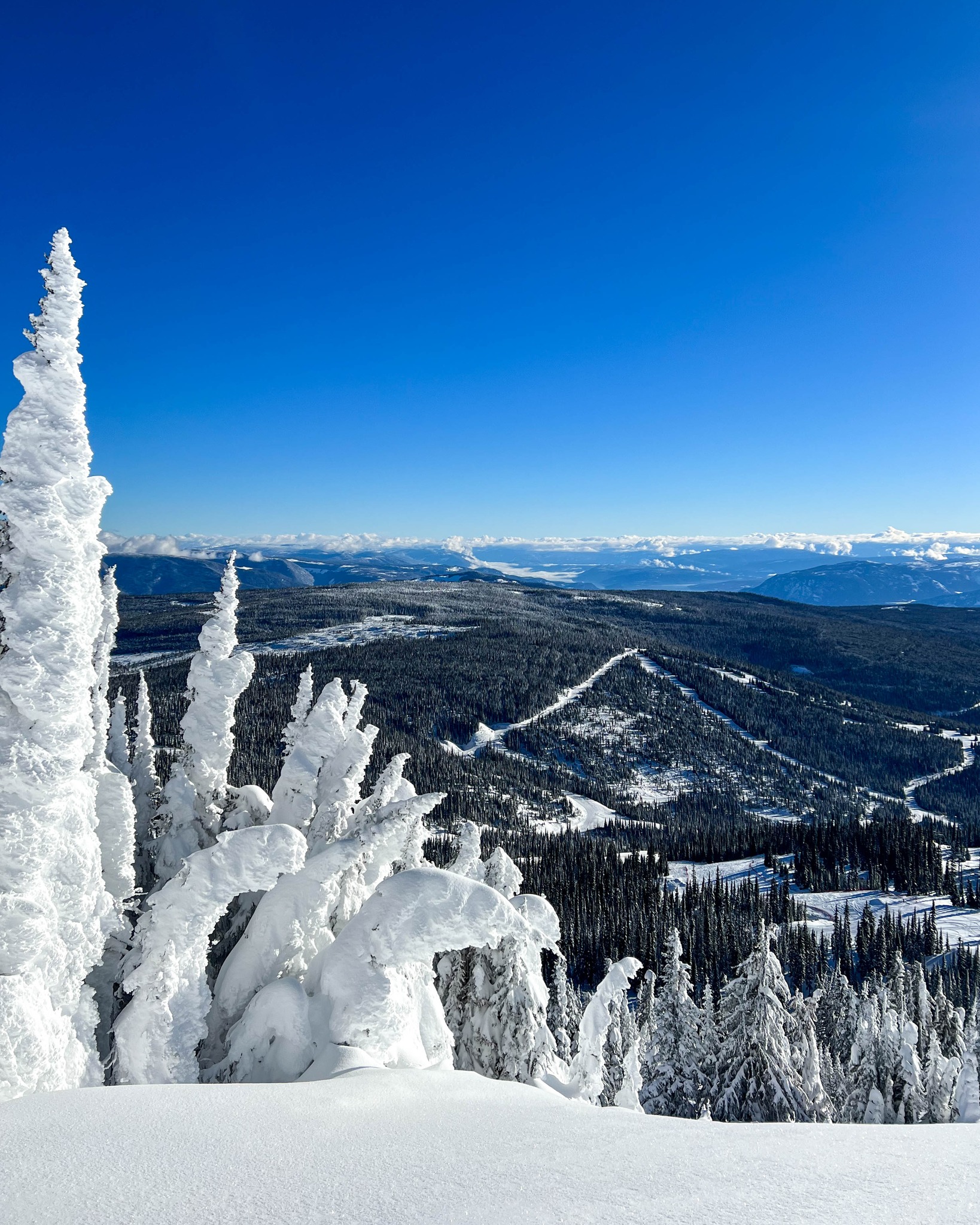
SCANDINAVIA FORECAST
A continuing mix of clouds, snow showers and occasional sunny spells, getting longer as the days lengthen. Temperatures in the range of freezing down to -20C. Western Norway potentially going to post the greatest snow depths in Europe by this time next week assuming the western Alps stay dry.
SCOTLAND REPORT
Scottish ski centres continue to see rapidly changing conditions with heavy snowfall one day then +10C the next, a familiar picture from the past few months. Strong winds have also played their usual part, sometimes closing lifts even when they can open some runs. It’s a fast-changing picture but, currently, Glencoe has half a dozen runs open on its upper mountain for good skiers, Cairngorm, Glenshee and The Lecht each have a few runs open, a mix of all-weather snow-making machine-made snow and surviving natural cover from the snowfalls. Nevis Range is closed for snowsports.
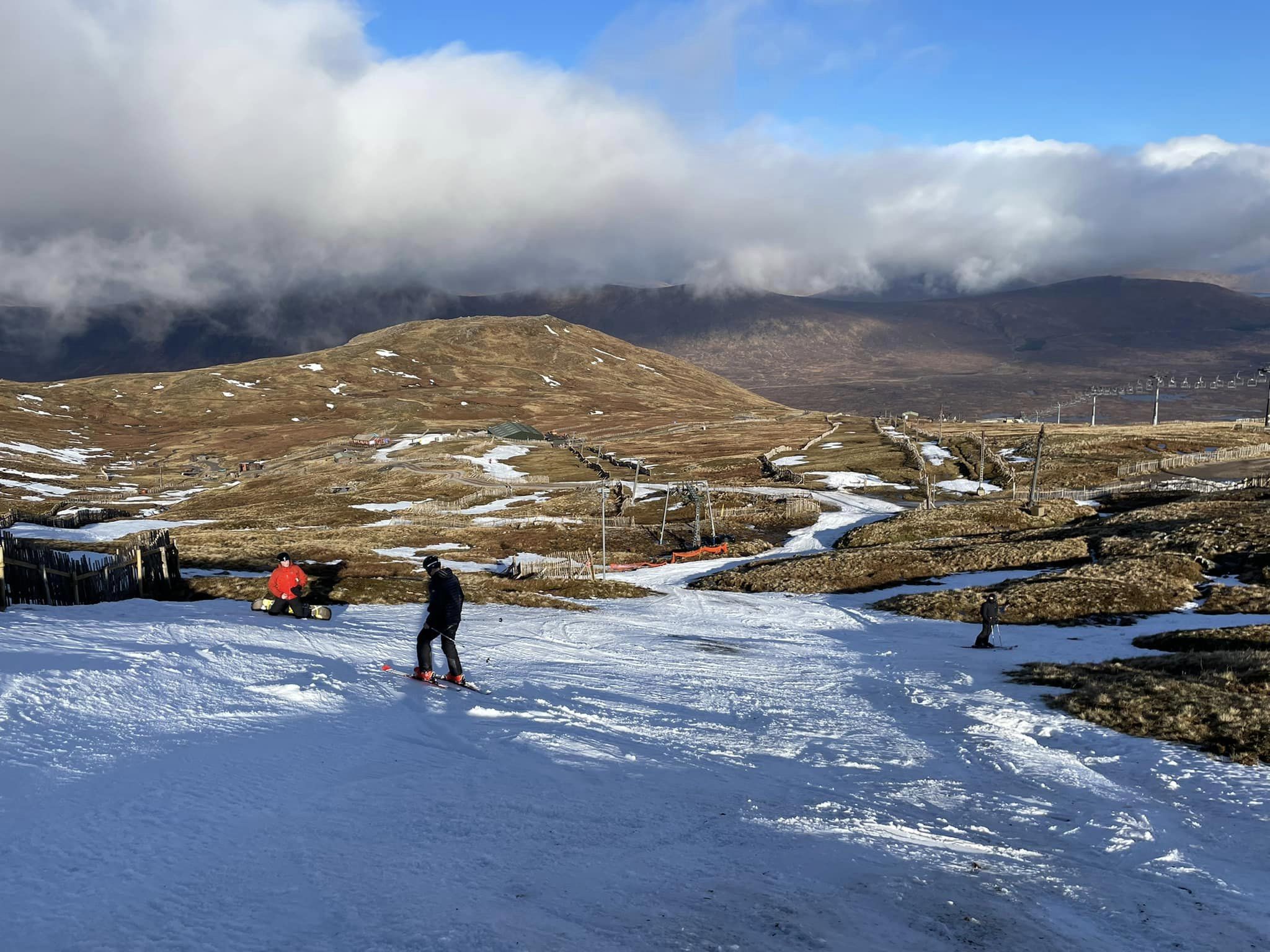
SCOTLAND FORECAST
Conditions will be a little cooler than they have been for the latter half of this week, but still warmer than we’d like. Currently, precipitation is forecast but it is on the snow/rain cusp for lower slopes, hopefully, snow up top. But not yet a return to real winter over a prolonged period that the Scottish centres need.
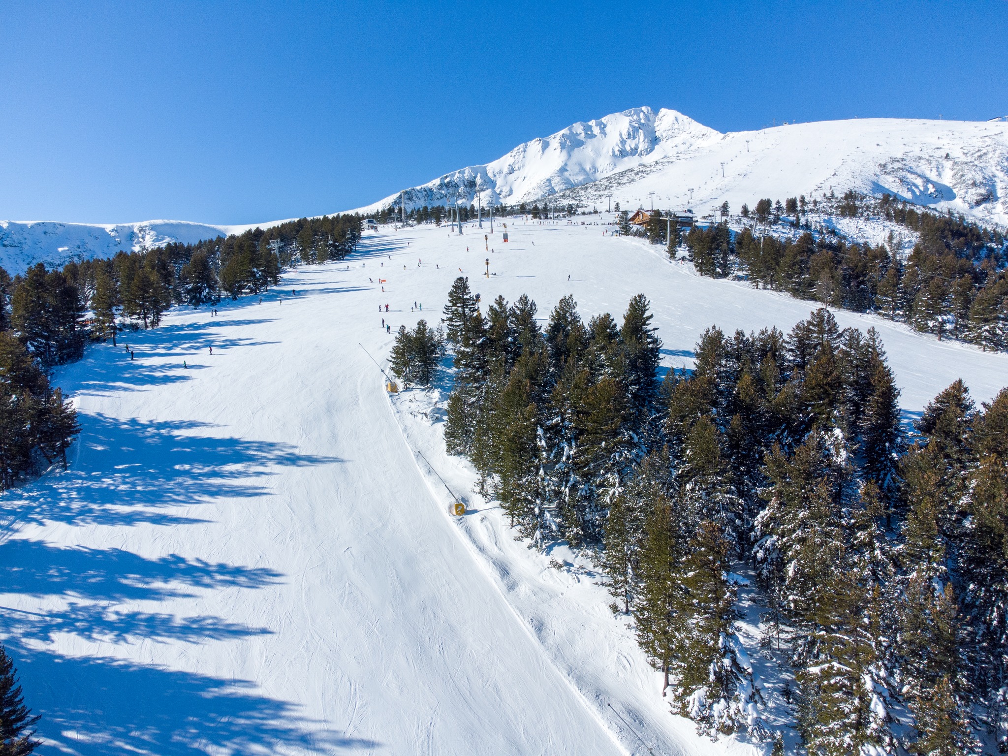
SPAIN / ANDORRA REPORT
Full sun for The Pyrenees as for the Alps with quite a range in temperatures from -10C in the mountains overnight to +5 or 6 down at resort level in the afternoon. So, other than the snowpack getting a little more hardpacked than it was a week ago, there has been little change. The amount of terrain open has perhaps dropped slightly, the largest area in the region Aundorra’s Grandvalira (Pas de la Casa, Grau Roig, Soldeu – El Tarter, Canillo, Encamp) (25/80cm / 10/32”) down to about 80% of its terrain open from a high of about 90% over the last few weeks.
SPAIN / ANDORRA FORECAST
A mostly sunny picture for the rest of this week, temperatures in the range of -2 to +9C at resort level, -9 to +2C at the top of the slope, possible some cloud building up ad snow showers resulting. But no serious snowfall expected at present.
BULGARIA / ROMANIA REPORT
It’s a constantly improving picture in the Balkans although the end of last week did see some wild weather with gales cutting off power supplies in some areas and briefly shutting lifts. But, otherwise, the low temperatures and snow showers have allowed more resorts to open more terrain. The region’s largest resort Bansko (5/70cm / 2/28”) now has about 80% of its terrain open, pretty impressive considering a month ago it had almost nothing open.
BULGARIA / ROMANIA FORECAST
After snowfall to start the week it is mostly sunny and looks set to continue so through to the weekend. Temperatures remain colder than in the Alps, with highs around +2 or +3C, well below freezing in the mountains.
CZECH REPUBLIC / SLOVAKIA REPORT
The warmer and sunny weather now dominating in the Alps has not quite made it up into Europe’s northeast. True, there’s not so much snowfall as a week ago, but there’s plenty of clouds and snow showers and temperatures are sticking closer to freezing at resort level, -10 or lower in the mountains. After all the snowfall earlier this month, Jasná (50/180cm / 20/72”) is posting both the deepest snowpack in the region and the most terrain open with 45km -100% of its terrain.
CZECH REPUBLIC / SLOVAKIA FORECAST
The current mix of sunshine, cloud and snow showers is set to carry on through the remainder of this week. Temperatures perhaps warming a few degrees but still staying close to freezing in valleys and well below zero on ski slopes.
NORTH AMERICA INTRO
A largely good week across North America with the very cold weather in the northeast just over a week ago now moving into memory. But temperatures are staying low at almost all ski areas across North America with most reporting all, or nearly all, of their slopes open and some fresh snowfall in the past week. The most was probably in the Rockies, where some areas in Colorado and Utah posted another two feet (60cm) or so in total over the last seven days.
ROCKIES REPORT
The great conditions in the Rockies continue with deep-lying snow and plenty more fresh snowfall over the last seven days. Most resorts remain fully open with Utah resorts, in particular, posting some of the deepest snowpacks in the world. At the weekend Crested Butte (57/57” / 143/143cm) announced they were 100% open for only the third time ever, with its TEO 2 terrain open for only the third time. Utah is posting the biggest numbers with America’s largest ski area at Park City (70/92” / 175/231cm) fully open and the three deepest snowpacks in the region all in the state too, topped by Alta (52/143” / 130/358cm).
ROCKIES FORECAST
Temperatures staying in the low teens to high 20s, but little or no snow is forecast for the remainder of this week. Some sunny, some cloudy days.
USA WEST REPORT
It has been quite a sunny week on the US west coast although several weak fronts have moved through, each one depositing a few inches of snow on slopes but giving way to returning sunshine within about 24 hours. Temperatures have largely stayed well below freezing. California’s Mammoth Mountain (406/622cm / 162/249”)continues to post the region’s and the world’s deepest snowpack, even if it has dropped a few inches on a week ago. The Palisades Tahoe (64/134” / 160/335cm) has 95% of its terrain open, the most in the west.
USA WEST FORECAST
A mostly dry and sunny end to the week, with some cloudy spells but no real snowfall forecast. Temperatures remain a little below freezing in most areas, getting about 15 degrees below overnight up high.
MIDWEST REPORT
The Midwest has had a good week when it comes to cold weather and snowfall, with a weekend front bringing 6-12” (15-30cm) of fresh cover across the region’s ski areas. Chestnut Mountain Resort (38/56” / 95/140cm), in Illinois, was one of those reporting six inches (15cm) of snowfall just in time for the weekend to the delight of Chicago-based skiers and boarders. The deepest reported snow depth though, just, continues to be in Michigan where Boyne Mountain Resort (57/57” / 142/142cm) reported a few inches of fresh snowfall on its 100% open, 60 trails.
MIDWEST FORECAST
Conditions look like they’ll turn a bit wild and wintery again in the latter half of this week with another front moving through potentially delivering 6-9” (15-23cm) of fresh snowfall to the midwest’s ski slopes.
USA EAST REPORT
After the very cold weather just over a week ago, there was fresh snowfall and then clear skies with temperatures remaining cold, but no longer that cold. So, really good conditions, the best this season in fact. Ski areas across the northeast were also able to make more snow and have the most terrain open they’ve had all winter. Whiteface (20/41” / 51/102cm), at Lake Placid, is reporting the deepest snowpack in the region.
USA EAST FORECAST
The cold, sunny weather is just ending as we post this report and the latter half of this week should see precipitation, hopefully snowfall, and lots of it. But there are also signs temperatures will get well into the 40sF and possibly the low 50s so there’s a danger of rain, particularly at lower elevations and southerly latitudes. Base depths still aren’t spectacular but the region’s largest ski area, Vermont’s Killington (16/22” / 40/54cm) now has 95% of its slopes open.
CANADA WEST REPORT
A fairly snowy week in western Canada with North America’s largest resort Whistler Blackcomb (40/206cm / 16/83”) reporting a good dump of snow for the weekend. It also remains 100% open. It’s a little behind its Pacific coast neighbours Mount Seymour (197/334cm / 79/134”), Grouse Mountain (211/292cm / 84/117”) and Cypress Mountain (120/290cm / 48/116”) on snow depth, however, with Seymour posting the deepest in Canada. The weather has been a mix of sunshine and snow showers across western Canada over the last week, with temperatures inland in the freezing to -20C range but getting up to +5C at bases at the Pacific coast resorts.
CANADA WEST FORECAST
More sunshine and cloud with occasional snow showers for the remainder of this week. Temperatures are typically -5 to -15C inland but creeping up towards positive numbers at bases by the weekend.
CANADA EAST REPORT
Temperatures ranging between freezing and -10C have seemed quite balmy in eastern Canada after the -40s reported at the start of the month. In fact, conditions are the best they’ve been with snowfall at the end of last week giving way to a sunny weekend, then clouds at the start of this week. The base depth at Mont Tremblant (54/220cm / 22/88″), which recently announced it has its terrain fully open for the first time this season, is looking very healthy indeed.
CANADA EAST FORECAST
It is due to stay cold with a mixture of sunshine and cloud for the next few days with no real snow in the forecast. Temperatures may climb into single figures above freezing at bases by the weekend.
Asia
JAPAN REPORT
It has been a very snowy week in Japan, with the kind of snowfall on Friday/Saturday that led to flight cancellations and bullet train line closures. After that, though things have calmed down with high pressure dominating and less snowfall over the past few days. Niseko (150/350cm / 60/140″) finally saw clear skies after nearly a month of daily snowfall.
JAPAN FORECAST
After the brief weekend respite we are back on track with daily snowfall for most Japanese centres, and temperatures in the freezing to -10C range.


