WORLD SNOW ROUNDUP #278
Issued: 8th February 2023
By Patrick “Snowhunter” Thorne
World Overview
There have been some interesting and isolated winter weather impacts around the world over the past week. The northeastern Alps, particularly Austria, saw a week of localised heavy snowfall, although this also brought strong winds and high avalanche danger, while the rest of the Alps stayed largely sunny and dry. Then across the Atlantic northeastern North America saw some of the coldest weather in years, with many areas reaching -40C and some claiming almost -60C with wind chill, leading to resorts being forced to close here too, for a day or two.
Elsewhere there was less weather drama to report. The Pyrenees stayed dry while southeastern Europe remained very cold with snow showers improving conditions there further from the snowless first month of the season. Scandinavia saw more snowfall, the heaviest in western Norway. In North America, outside the very cold area, plenty of sunshine but also frequent snow showers across the continent, keeping things fresh there.
In the wider world, it keeps dumping in Japan, and there was some unusual midsummer snowfall in Australia.
Europe
EUROPE INTRO
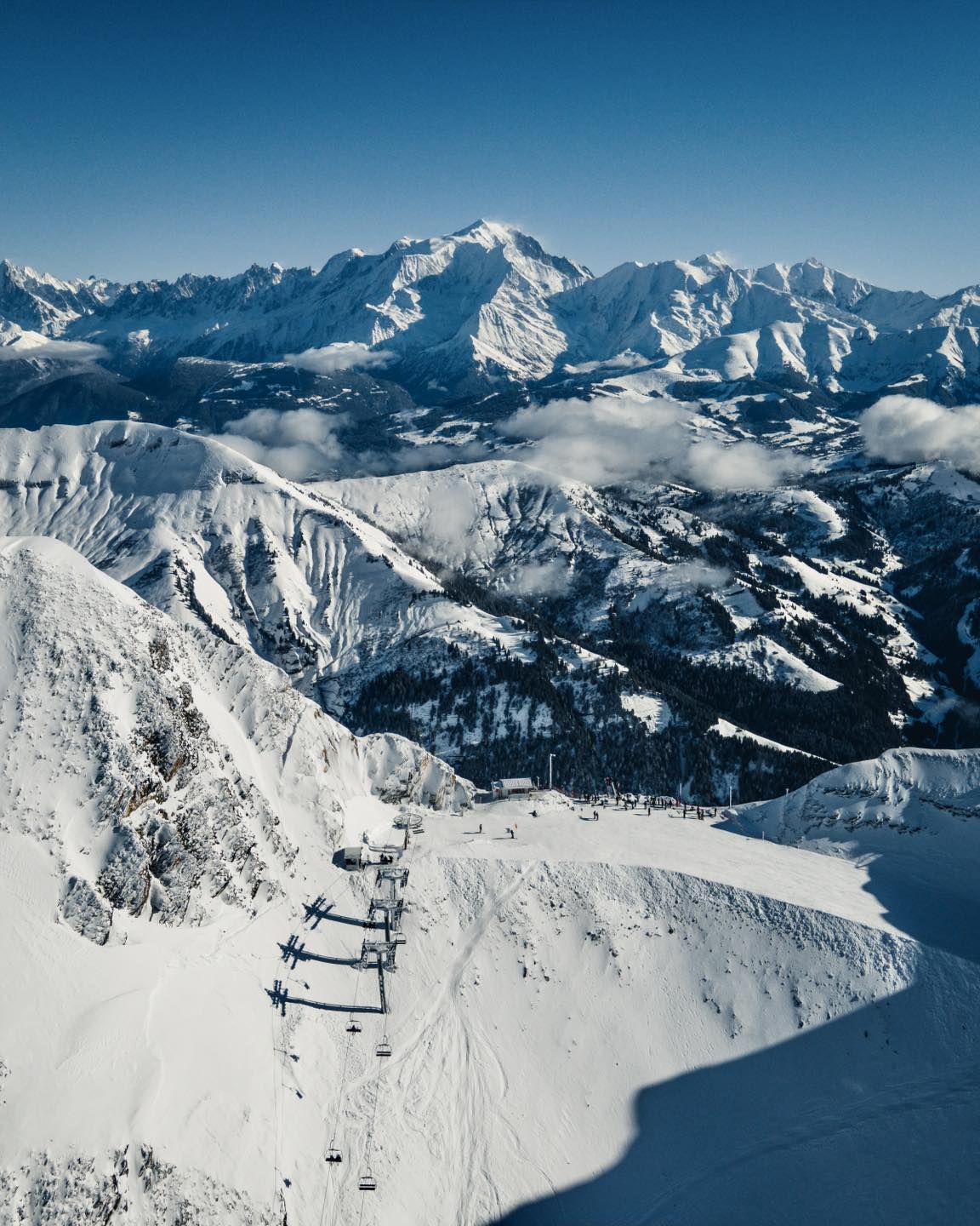
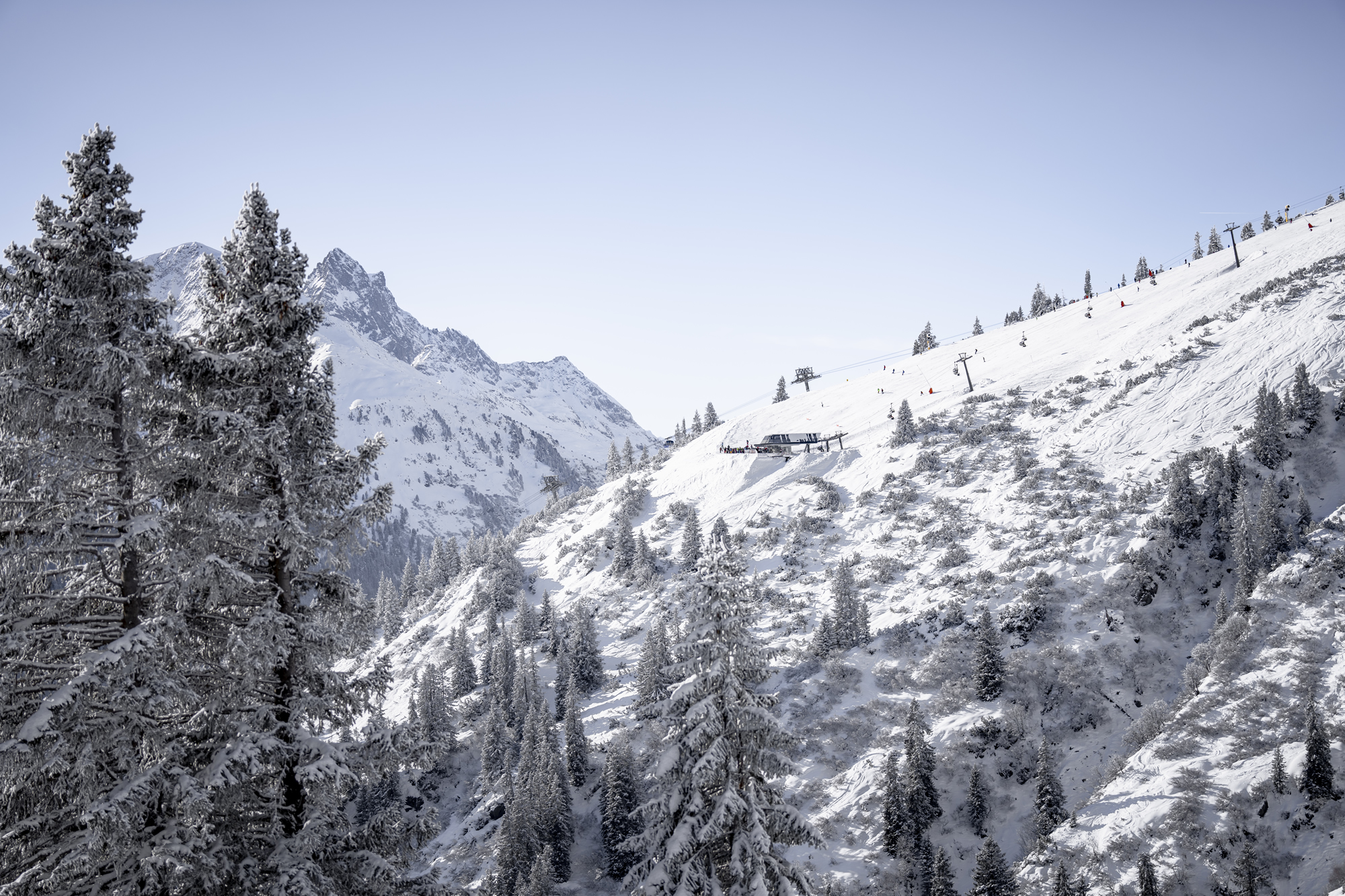
Europe remains a continent divided with cold and snow in the east and cold and sun in the west. Well, that was the case until the weekend at least, it’s currently cold and sunny almost everywhere. The difference actually turned out fairly dramatic with Austria and countries to the north like Germany, Czechia and Slovakia posting up to a metre of snowfall, while Western Italy, Switzerland, France and the Pyrenees saw almost nothing. The snowfall in Austria, Eastern Switzerland and north-eastern Italy did come accompanied by very strong gales and this destabilised the snowpack creating a high avalanche danger and unfortunately fatal consequences for some of those who decided to chance it. Elsewhere in Europe, there’s been more heavy snowfall in western Scandinavia giving ever deeper bases to ski areas in Norway, while Scottish resorts have their usual battle with warm fronts and windy weather. In Europe’s southeast, there’s been more cold and snowy weather meaning ski resorts in Bulgaria and Romania have the most terrain open of the season so far.
AUSTRIA REPORT
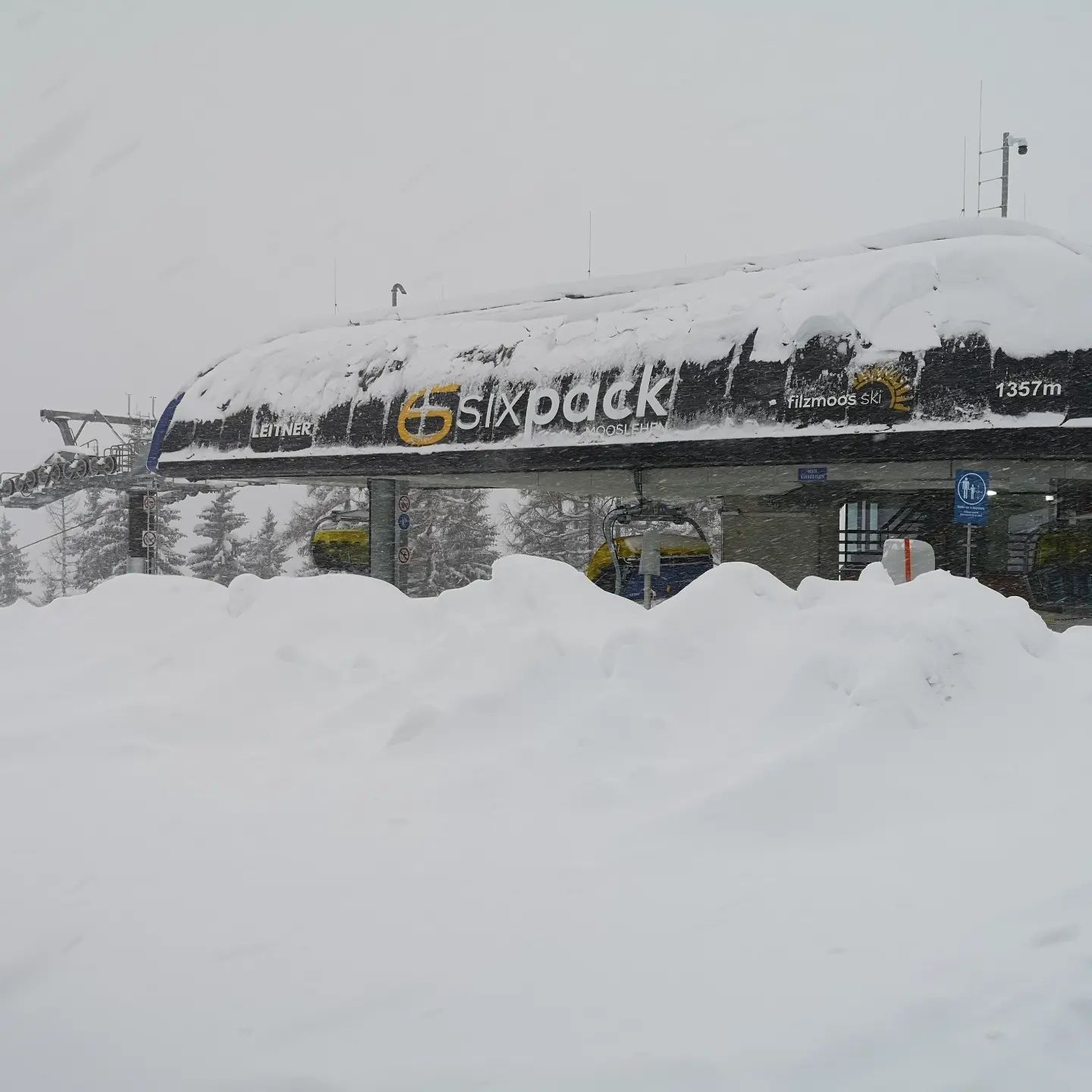
Unlike the rest of the Alps, it has been a very snowy week in Austria with a number of areas reporting more than a metre of snowfall in the six days up to Sunday. But it wasn’t just snowfall, some low-lying areas saw rain for periods at resort level and almost everywhere saw very strong winds, often gusting to more than 120hph (75 mph) and resulting in many Austrian areas closing for periods. The upside of all the snow is great on-piste conditions now the sun is back out, and the downside is high avalanche danger with more than 30 avalanches and a high number of off-piste deaths reported, sadly, at the weekend. Snow depths have jumped in Austria following the snowfall with the Zillertal Arena (65/240cm / 26/96”) and Sölden (72/239cm / 32/96”) topping the current snow depth chart.
AUSTRIA FORECAST
Sunshine should continue for the week ahead with temperatures well below freezing above 2,000m, but creeping into positive numbers in the afternoons in lower valleys.
SWITZERLAND REPORT
Switzerland lay on the moving border between the two big Alpineweasther fronts over the last week, with ski areas in the west staying dry and sunny, in the east getting a good amount of snowfall if not so much as in Austria. The avalanche danger has been fairly low (on a scale of 5) in the west where there’s been little fresh snowfall for nearly three weeks now, and much higher in the east, 3 or touching 4 with the snowfall and wind. With the fresh snowfall a number of ski areas have moved above Saas Fee (10/170cm / 4/68”), which had held the ”deepest snow in Switzerland” title for six months. That’s Lötschental (25/192cm / 10/77”) followed by Glacier 3000 (20/180cm / 8/72”) with Saas-Fee dropping to third.
SWITZERLAND FORECAST
It has been mostly sunny across Switzerland, with some light snow showers since the weekend and there’s no real sign of that changing. Temperatures are still very cold in the mountains, climbing to a degree or two above freezing at bases and looks set to get a little warmer through to the weekend, but not a lot.
FRANCE REPORT
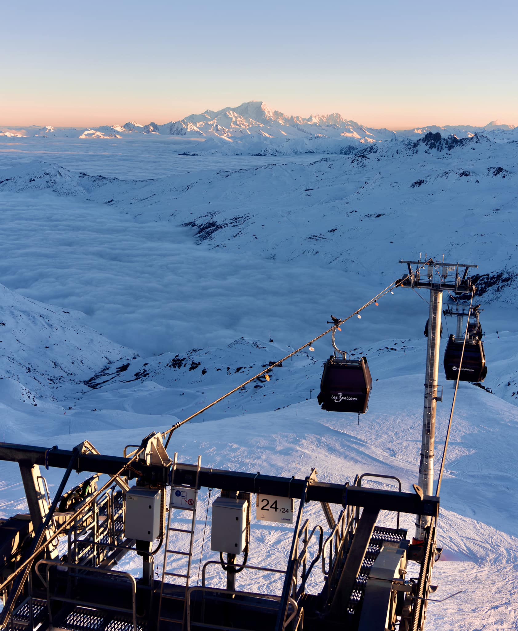
French ski areas stayed mostly dry as the snow fell in Austria, with plenty of sunshine and just the odd light snow flurry, but this means ski areas in the southern French Alps have not had any real snowfall for a fortnight and those in the north not for nearly three weeks now. So we’re talking hard-packed snow and very hard-to-find powder pockets remaining for those prepared to hike. Base depths have dropped a little too from settling more than thawing as it remained pretty cold, but most centres remain fully open. Tignes and Val d’Isere (87/270cm / 35/108”) are still posting Europe’s deepest snowpack but ski areas in Austria and Scandinavia are closing in now after the fresh snowfall there.

FRANCE FORECAST
The forecast continues to be sun, sun, sun for France with little else in the forecast. Temperatures may climb up towards freezing and a few degrees above at bases by the weekend, according to the wide range of the forecasting models, but then as the days draw nearer that reality remains to be seen.
ITALY REPORT
Italian ski areas have had a mostly dry week, but the wild and snowy weather over Austria did penetrate into the north and east of the country at the end of last week. Bormio (20/50cm / 8/20”)was one resort that had to close temporarily due to gales before re-opening 24 hours later with powder on the pistes. But mostly it has been sun, sun, sun, especially since the weekend. Sella Nevea (55/230cm / 22/92”) over on the Slovenian border, famous for its spring skiing after winter snowpack build-up has leapt to the Italian snow depth table top, overtaking La Thuile over in the west (60/180cm / 24/72”).
ITALY FORECAST
A sunny week is forecast with just occasional light to moderate snow showers. Temperatures remain well below freezing above 1500m, climbing a degree or two into positive numbers at the resort level in the afternoons.
GERMANY REPORT
Many German areas were beneficiaries of the cold and snowy weather in northeastern Europe. Although it’s still only a little over half of the country’s ski areas open this winter, those that are are reporting big jumps in their open terrain and much deeper snowpacks than was the case a week ago. Reit im Winkl (13/130cm / 5/52”) continues to post the most terrain open, now 95% of its runs, and has seen a jump of more than half-a-metre on its upper slope base depth on seven days ago.
GERMANY FORECAST
Sunny weather now dominates across much of Germany with temperatures tending to creep a little warmer as we head towards the weekend with the possibility of (just) above-freezing temperatures from top to bottom of low-lying ski areas by Saturday, but only by a degree or two up high and remaining below freezing at still higher southern Bavarian alpine areas.
SCANDINAVIA FORECAST
A mixture of sunshine, snow showers and cloud across Scandinavia. Temperatures up close to freezing at lower resorts, -10 to -20C at altitude. Norway’s Björkliden opens for its 2023 season this weekend and it is just over a fortnight now until nearby Riksgransen is expected to open for the season on February 24th.
SCOTLAND REPORT
It’s been another week of mixed fortunes for Scottish ski areas. Unfortunately, warm and windy weather has been dominant which has further eroded the snowpack and most of the country’s centres are down to just a few runs left made from the all-weather machine snow. That said, there has been some colder weather and fresh snow at high levels which has redressed the balance a little. Glencoe and Cairngorm posting the most terrain open on their upper mountain slopes.
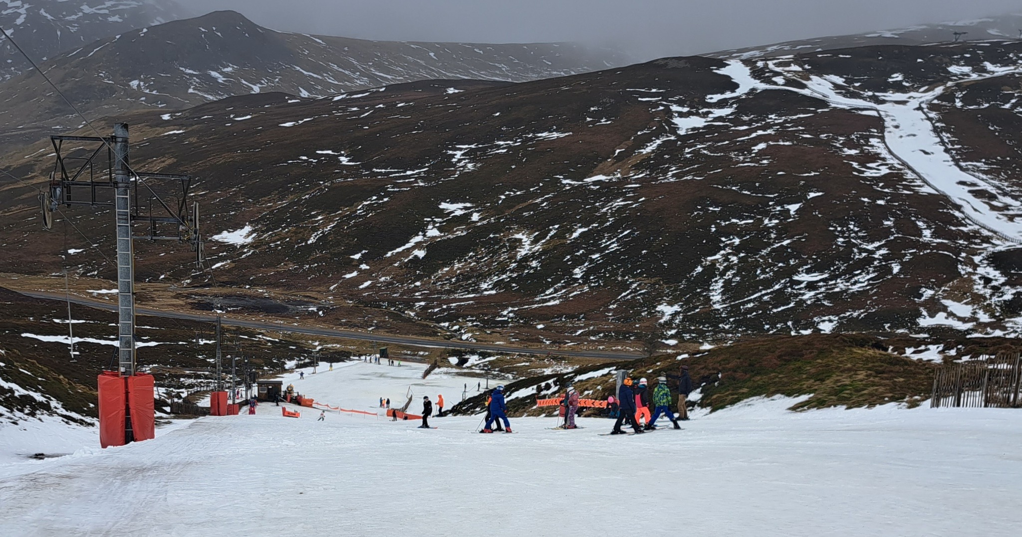
SCOTLAND FORECAST
The forecast continues to be mixed for Scottish areas, but snowfall is forecast over the latter half of the week, along with more strong winds.
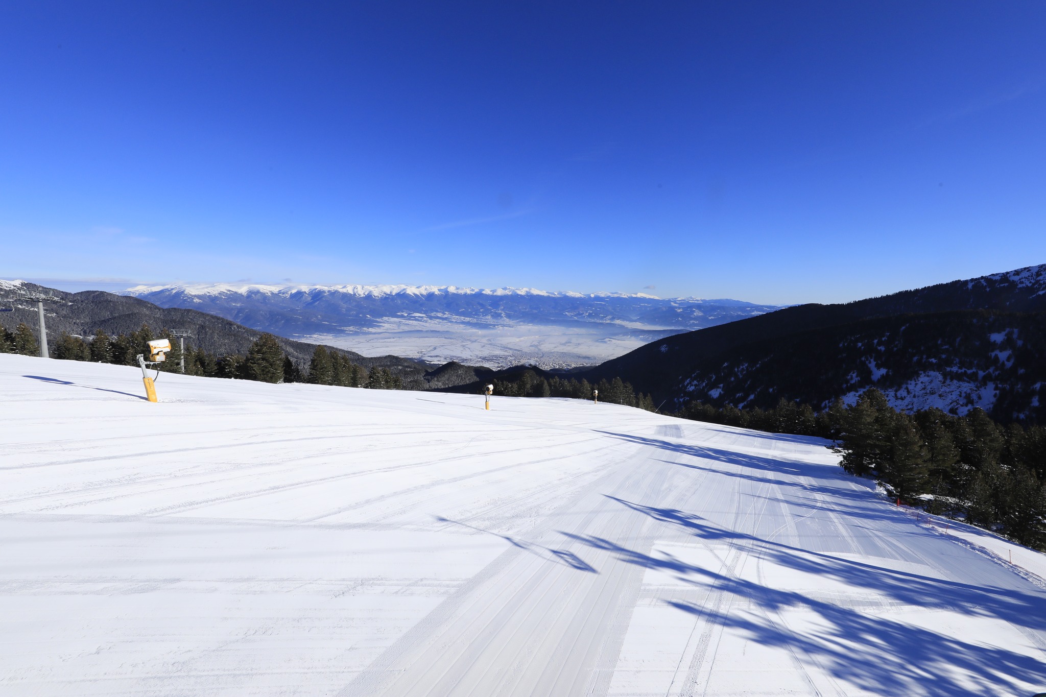
SPAIN / ANDORRA REPORT
We have been back to dry and sunny weather in the Pyrenees after the cold and snowy season reset at the end of January. That has left most ski areas in the region back up from about 50% open in mid-Jan to nearer 80-90% open now. Some ski areas have seen some light snowfall in the past few days, however. Bases at the big resorts in the Pyrenees remain fairly thin, 30-60cm (1-2 feet) typical. The snow is deepest at Spain’s Aragon Huesca region where Candanchú (100/240cm / 40/90cm) and Formigal (60/190cm / 24/76″) are posting the deepest snowpacks in the region (and all of Europe) and have their slopes 95-100% open.
SPAIN / ANDORRA FORECAST
It is back to sunshine for the rest of this week, with temperatures getting warmer and well above freezing (+4 to +8C) even at high elevations, which will impact the snowpack to some extent. How much, remains to be seen with overnight lows still getting well below zero, so freeze-thaw conditions dominating.
BULGARIA / ROMANIA REPORT
Conditions have continued to improve across south-eastern Europe ski areas and it is hard to believe now that almost nothing was open a month ago. We’ve had another week of predominantly sub-zero temperatures allowing Bansko (5/70cm / 2/28”) to reach 80% of its slopes open including, for the first time this season, the long home run to the base of the mountain. After weekend snowfalls, conditions have been mostly sunny giving great on-piste skiing.
BULGARIA / ROMANIA FORECAST
The cold and sunny weather is expected to continue for the coming week. There’s the odd light snow shower expected but nothing very significant. Temperature ranges from freezing in the resort in the afternoon to -20C on high slopes overnight.
CZECH REPUBLIC / SLOVAKIA REPORT
A good week for the Czech and Slovak Republic too, as well as neighbouring Poland, all seeing similar cold and snowy weather to Austria. This brought the same problems with gales and high avalanche danger, but once this cleared it meant deeper bases and more groomed terrain open. The region’s largest resort Jasna (30/100cm / 12/40”) has hit the metre mark for snow depth and has 100% of its runs open for the first time this season as a result.
CZECH REPUBLIC / SLOVAKIA FORECAST
Mostly sunny and dry now, but staying cold. There are signs of a return of snowfall later in the week with light snowfall forecast for Saturday, and heavier on Sunday, Although that’s a bit of a distant forecast for precision at this stage.
NORTH AMERICA INTRO
The biggest weather story of the past week in North America was the super-cold weather that descended on the continents North-east and parts of the Midwest from the Arctic last Thursday to Sunday, leading to many areas in the region shutting down from 1-4 days for safety reasons.
Elsewhere, the news continues to be generally good with cold but not that cold windy at times but not too relentlessly, often sunny but not too warm and plenty more snow showers in the Rockies and further west. As we’re now at around the midpoint of the season, it’s all looking good.
ROCKIES REPORT
The snow keeps falling in The Rockies and bases get deeper but most resorts are currently fully open, unless on weather hold. Utah is posting some of the deepest snowpacks in North America with two resorts there reporting the snow now more than ten feet (3 metres) deep up top. Alta (52/144” / 130/361cm) and Snowbird (58/127” / 145/318cm), but it’s looking good almost everywhere. The deep snow has allowed more resorts to open more of their steepest terrain, now it had adequate cover.
ROCKIES FORECAST
Mostly sunny conditions over the coming week, with temperatures ranging from the low 30s down to the teens. Some clouds and light snowfall but sunshine will be the dominant weather factor.
USA WEST REPORT
The weather has settled a little in the West after the endless series of storms from late November to late January that left Mammoth Mountain (168/254” / 421/635cm) with the world’s deepest snowpack. There’s been much more sunshine and temperatures have been climbing 5 or 10 degrees above freezing at mountain bases, but the snow remains very deep and storms do keep moving through, bringing more snowfall, just not the huge dumps of earlier this winter.
USA WEST FORECAST
Continuing mostly sunny with temperatures ranging from the mid-40s at resort bases later this week, to the mid-teens up high. Snowfall is forecast again for the weekend but much lighter than before, just 2-6 inches for most areas.
MIDWEST REPORT
It’s been cold and snowy in the Midwest with some decent snowfall over the past few days. One of the biggest 24-hour totals came at Jackson Creek (25/25” / 63/63cm), in Michigan, reporting 9″ (22cm) of fresh snowfall in that period. Fellow Michigan Ski area Ski Brule (64/64” / 160/160cm) is posting the deepest base in the region and like most Midwest ski areas, has everything open.
MIDWEST FORECAST
Conditions remain cold, if not so cold as it has been this last week, with snow showers and sunny spells.
USA EAST REPORT
The main weather event in the US Northeast over the last seven days was exceptionally low temperatures, down to the -30s and even -40s Fahrenheit at the end of last week, which led many areas in Maine, Vermont, New York state and the wider region to decide to close some or all of their slopes and lifts while the coldest weather passed through. The cold weather did allow resorts to keep snowmaking though and big players Killington (16/22” / 40/54cm) and Sunday River (16/22” / 40/55cm) now have about 95% of their terrain open, the most this season so far, but still not very deep bases.
USA EAST FORECAST
It’s quite a mixed picture for the week ahead. Much warmer but still mostly below freezing, with frequent snow showers bringing anything from an inch or two (2-5cm) to perhaps 8” (20cm) of fresh every 24 hours.
CANADA WEST REPORT
A real mix of weather across western Canada with sunny spells various intensities of snow showers and cloudy but dry days all following one after another. The most constant factor has been temperatures, typically -10 to -20C at altitude, closer to freezing at bases and getting a few degrees above at low-lying coastal bases like Whistler’s (0/203cm / 0/81”). It’s still got every run open and every lift operating for the biggest ski area in North America.
CANADA WEST FORECAST
Conditions won’t change much for the next few days, an ongoing mix of snow showers, clouds and sun with temperatures continuing to dip down to -20C overnight up high, nearer freezing at resort level in the daytime.
CANADA EAST REPORT
The big weather issue of Eastern Canada, much as the northeastern US to the south, was the extreme cold that arrived Thursday and lasted through to Sunday, bringing temperatures down to the -30s and in some cases -40s Celsius with wind chill bringing temperatures lower still. Most ski areas were closed for 2-4 days as a result. From Sunday though temperatures warmed and fresh snowfall arrived giving great conditions.
CANADA EAST FORECAST
After a brief sunny spell, midweek, fresh snowfall is expected to arrive on Thursday and continue for the next few days through to the weekend, further improving conditions. Temperatures warmer, but remaining in the -5 to -15C range.
Asia
JAPAN REPORT
An up and down week in Japan with heavy snowfall going into last weekend followed by lighter snowfall and a settling snowpack. This has led to a high avalanche danger and unfortunately, several more reported fatalities among skiers arriving from abroad. Yudonosan (300/540cm / 120/216”) in Yamagata prefecture continues to post the deepest base in the country and is only the second resort in the world (after California’s Mammoth Mountain) to post a 5m+ base. Niseko (170/370cm / 68/128″) has had a very snowy week, recording about a metre more, in total, over the last 7 days.
JAPAN FORECAST
Light winds and more snowfall are forecast for the next few days with skies remaining cloudy but with less snowfall going into the weekend.


