WORLD SNOW ROUNDUP #276
Issued: 25th January 2023
By Patrick “Snowhunter” Thorne
World Overview
It’s the most positive picture of the season so far in many of the world’s main ski regions.
In Europe, the most commonly used phrase is “winter is finally here” as following heavy snowfall last week temperatures have become consistently sub-zero Celsius keeping it cold. The snow has transformed the state of lower slopes, greatly improving conditions in the Alps, Pyrenees and south-eastern Europe in countries like Bosnia, Bulgaria and Greece. These all remain well below average for snow cover and terrain open in late January but are still in much better shape than they were up to last week.
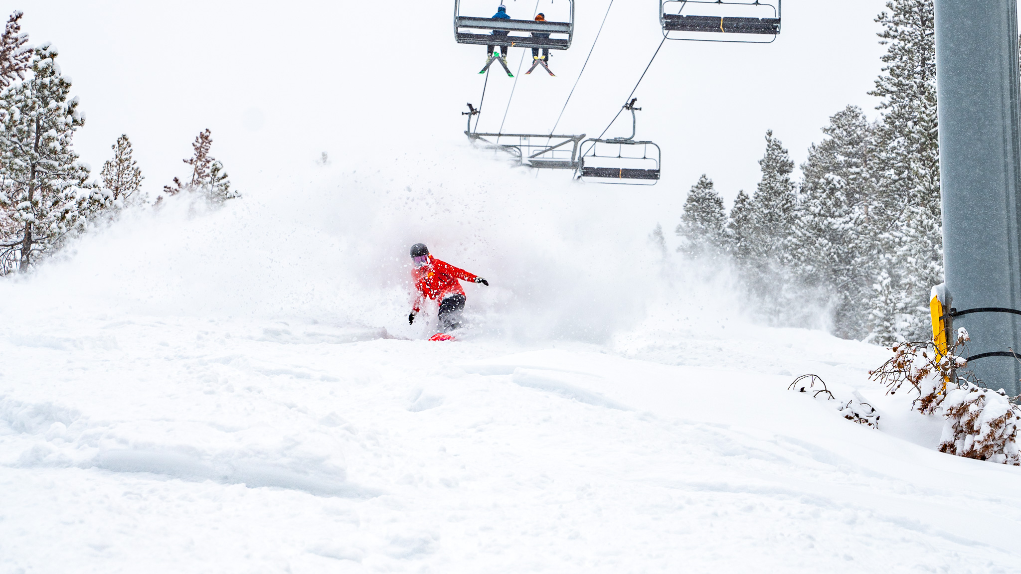
In North America, there are also improvements. The western side of the continent has been seeing by far the best of the world’s snowfall over the first two months of the ski season, but they’ve also had a seemingly endless succession of major storms which have meant difficulty accessing all the snow for practical and safety reasons. There has now been a window in the storm cycle allowing more reliable opening. In the east, there had been similar warmth and rain issues on the lower slopes, as in the Alps, over the past few months. But the area has also seen increasingly cold and snowy weather allowing more terrain to be opened.
Elsewhere in the world, heavy snowfall has been reported in the mountains of North Africa. There’s snow in the Middle East allowing ski areas in Israel and Lebanon to open for the first time this season. And in Japan, a major storm system is currently impacting particularly the north of the country bringing very low temperatures and very heavy snowfall.
Europe
EUROPE INTRO
The heavy snowfall in the Alps and many other mountain ranges, which were ongoing as we completed last week’s report, began to peter out on Wednesday/Thursday leaving up to a metre of snowfall up high and snow to low levels allowing resorts that had been partly or fully closed by the previous warm conditions to re-open. Apart from the snowfall, the crucial difference was consistently below-freezing temperatures, night and day to low elevations, allowing snow-making systems to fire up where available and needed. A week on most of the continent’s big ski regions have 80-95% of their slopes open and large numbers of low-lying areas in countries like Germany are open for the first time this season. The snowfall has largely eased in the western and northern Alps where sunshine is now dominating but continues in southeastern Europe and the Dolomites for now at least.
Elsewhere there’s snow and colder weather in the Pyrenees, which had been suffering rather warm, dry conditions over the last 4-6 weeks and the Balkans, where it has been too warm and dry for almost anything to open in countries like Bulgaria, have also now seen plenty of snowfall and low temps allowing most areas to open 30-50% of their slopes there now. Staying wintery in Scandinavia and Scotland had its most runs open of the season so far at the weekend although is now dealing with warmer weather.
AUSTRIA REPORT
A much quieter week this week compared to last with a mixture of cloudy and overcast skies, light snowfall and sunny spells, as witnessed at the annual Hahnenkamm races at the weekend. Temperatures have stayed low, rarely getting above freezing across the country and dropping as low as -20 in the mountains. That allowed snow-making systems to operate where needed. Snow depths are still not huge in most areas but most resorts are open and have 60-90% of slopes open, with around 200km each at the country’s largest like Ischgl/Samnaun (30/70cm / 12/28”), Ski Arlberg(65/155cm / 26/62”), The SkiWelt Wilder Kaiser-Brixental (30/ 73cm / 12/29”) and Saalbach Hinterglemm Leogang Fieberbrunn (aka The Skicircus)(40/60cm / 12/24”). The deepest snow remains at fully open Solden (74/185cm / 30/74”).
AUSTRIA FORECAST
It’s currently more of the same in the forecast, a mixture of cloud and sunshine with more light snow showers expected for some over the next few days. Eastern Austria is the most likely recipient, with temperatures staying largely below freezing.
SWITZERLAND REPORT
Great conditions for much of Switzerland too after last week’s snowfall, which carried on to the weekend in some areas to the east of the country. Here too it is between freezing and about -25C with mostly dry weather and lots of sunshine. Snow depths remain below average but are nearing the two metres mark at resorts like Saas Fee (45/195cm / 18/78”), Andermatt (18/170cm / 7/70”), Engelberg and Glacier 3000 (30/167cm / 12/67″) the usual Swiss contenders for best in snow. With cold, drier weather the snowpack is stabilising a little and the avalanche danger, while still considerable, is down slightly in most areas. Lower resorts like Gstaad (50/90cm / 20/36″) and Villars (40/127 / 16/49″), which made headlines earlier in the month for too little snow and closed slopes, are now in much better shape.
SWITZERLAND FORECAST
Predominantly dry and cold weather is expected to continue for the next few days across Switzerland. The drier, sunnier weather will be in the west with the chance of light snow showers from more overcast skies in eastern Switzerland.
FRANCE REPORT
The heavy snowfall ended in France last Wednesday or Thursday and conditions have remained largely unchanged since, other than an occasional light snow shower. But generally, it has been cold with the temperature down to minus 25 range from top to bottom of the mountain, and frequently sunny. With the cold keeping the snow in good shape this generally means pretty glorious conditions. With up to a metre of snow falling last week, down to low elevations, most resorts previously reported closed have been open to re-open most or all of their terrain. The biggest area, the 3 Valleys, reports more than 330 of their 350 runs open. The off-piste avalanche danger remains high, however.
FRANCE FORECAST
There’s not a lot of change in the forecast with temperatures staying below freezing to the valley floor, day and night and getting to the minus 20s on higher slopes. No snow forecast at present but plenty of sunshine.
ITALY REPORT
Italy started the week on the dividing line of weather systems in the Alps with ski areas along the country’s northern and western mountain borders largely in clear, sunny conditions, but further east and south in Trentino, overcast skies and snow showers, the heaviest, many in the Trentino province, currently ongoing and expecting to add up to half a metre (20”) of snow. Conditions are generally good across Italy with most slopes open, particularly in the Dolomites, and either fresh snowfall last week in the north and west still in good shape due to the low temperatures, or with fresh snowfall right now in the Dolomites.
ITALY FORECAST
The snowfall in the Dolomites is expected to ease from midweek. It will then join the rest of Italy in seeing largely dry conditions into the weekend with a return of sunshine but with temperatures staying low.
GERMANY REPORT
The colder, snowier weather has finally allowed more German ski areas to open after only about 10% of the country’s resorts had enough snow to operate up to mid-January. It’s now about half of the 500 or so German areas that have at least a few runs open. But conditions remain far from ideal, evidenced by the moving of the Garmisch World Cup Races to Cortina. Most German areas are now much colder with temperatures around freezing down to -10. The deepest snowpack is on the Zugspitze Glacier (125/125cm / 50/50″), finally passing the 1m mark.
GERMANY FORECAST
Staying cold and mostly dry across German ski areas, with just the odd snow shower. A mix of overcast skies and sunny spells.
SCANDINAVIA REPORT
Conditions continue to be pretty good across Scandinavia although there’s not been much fresh snowfall to report since the weekend and southerly and westerly areas saw a brief plus temperature spike on Monday, before dropping back down towards well below freezing. The deepest snow is currently in western Norway at resorts including Myrkdalen (90/180cm / 36/72”) near Voss and Hemsedal (80/150cm / 32/60”).
SCANDINAVIA FORECAST
Cold but mostly clear and often sunny weather for the next few days but with a front arriving at the weekend that currently looks like it has the potential to bring some heavy snowfall.
SCOTLAND REPORT
Alas, after a few cold and snowy weeks as part of a generally promising past few months for cold weather in the Scottish Highlands, this week has seen the return of the frequent curse of the region, mild winds from the southwest. This is having an inevitable impact after a great weekend and end to last week, particularly on lower slopes with softening and thawing. But, so far, resorts still have at least some terrain open. Glencoe (50/150 / 20/60”) is still posting about the most and by far the deepest snowpack although down from virtually all to about half of their slopes currently reported open.
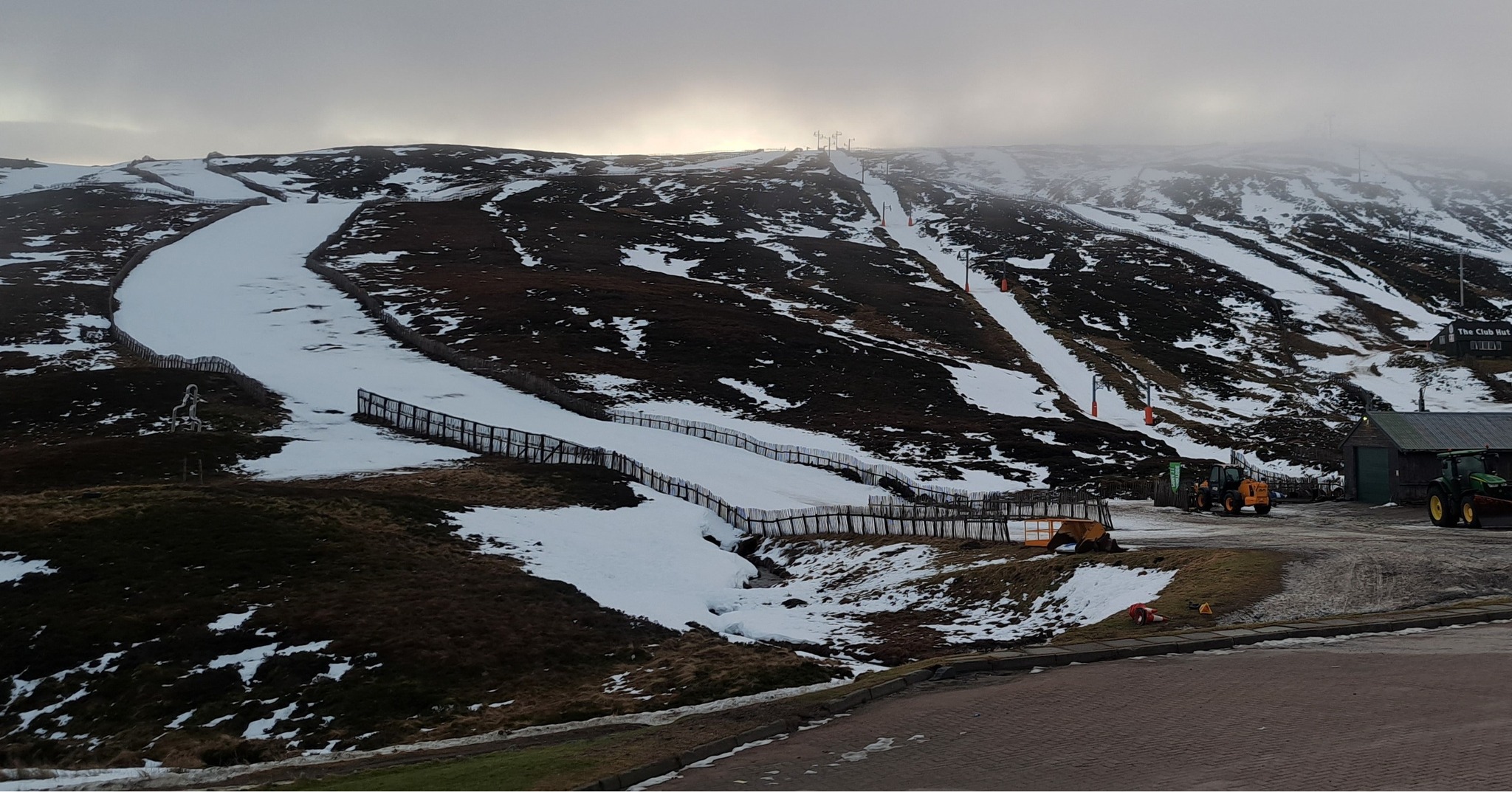
SCOTLAND FORECAST
Unfortunately, it continues to look a bit too mild and the forecast precipitation may fall as rain rather than snow on lower slopes. Although marginal there is hope. No real sign of a big temperature dip looking into next week.
SPAIN / ANDORRA REPORT
A much-improved picture on a week ago in much of the Pyrenees with powder skiing following fresh snow and low temperatures. The largest ski area, Andorra’s Grandvalira (Pas de la Casa, Soldeu- El Tarter et al) (25/70cm / 10/28″) reports about 75% of its terrain open, up from 50% last week. It’s a similar story over the border at Baqueira Beret (105/155cm / 42/62”), which reports 80% of its runs open and powder conditions ahead of hosting the Freeride World Cup.
SPAIN / ANDORRA FORECAST
We are now back to sunnier weather, which is expected to dominate for the coming week. But there is a crucial difference, rather than being mostly above freezing, as previously, temperatures are going to remain in the freezing to -15C range so no thawing and more snow-making. There’s the chance of light snow showers towards the weekend.
BULGARIA / ROMANIA REPORT
There have been big improvements to conditions in southeastern Europe with ski areas in Bulgaria, Croatia, Slovenia, Serbia, Romania, Greece and others reporting cold weather and heavy snowfall. Most had unseasonably warm, dry conditions up to now and had hardly been able to use snow-making systems as a result. Now though, Bansko (0/60cm / 0/24”) has been able to host World Cup competitions at the weekend and has about half of its 75km of slopes open. Borovets (40/55cm / 16/22”) has about a third of its terrain skiable.
BULGARIA / ROMANIA FORECAST
Remaining cold, temperatures typically in the +2 to -10C range, with frequent light to moderate snow showers through the remainder of the week and into the weekend. Early signs that skies may clear and the sunshine return early next week.
CZECH REPUBLIC / SLOVAKIA REPORT
A good week in Europe’s more northerly eastern ski areas with plenty of fresh snowfall and low temperatures on Czech and Slovak slopes allowing for more ski areas to open and those already open to add more terrain. Špindlerův Mlýn (30/50cm / 12/20″) continues to post the most open in the country but still only has half its slopes open. In Slovakia, it’s Jasna (309/100cm / 12/40”) as usual, which by contrast, now has 95% of its slopes open, the most this season so far.
CZECH REPUBLIC / SLOVAKIA FORECAST
Conditions will remain cold, staying below freezing night and day down to the valley floor and light to moderate snowfall is expected daily through the remainder of this week into the weekend.
NORTH AMERICA INTRO
After the endless stream of storms for around the past two months impacting the US West Coast, the weather appears to have finally calmed down since the weekend with now non-stop sunshine dominating and ski areas finally allowed to take stock and skiers enjoy all the snow now lying up to 20 feet (six metres) deep. It had been almost the reverse scenario on the East Coast with too little snowfall and too warm for snow-making at times. But there are more reliable conditions and more terrain open here this week with some good snowfalls and cold weather since the weekend.
ROCKIES REPORT
Conditions continue to be good in the Rockies with great snow conditions at most resorts in the region, almost all resorts fully open, and some of the world’s best snow depths. There’s also been less stormy weather in recent days allowing for some stability. Utah continues to stand out in particular on early season snow depth, but it’s good almost everywhere. Alta (60/143” / 150/358cm) is posting the deepest snow in the region and Snowbird (165/318cm / 66/127”) is not far behind and slightly deeper at its base. A third Utah area and largest in the US, Park City (208/239cm / 83/96”), is fully open.
ROCKIES FORECAST
Mostly cold and sunny weather in the Rockies for the coming week although with some midweek and weekend snow showers possible. Staying cold, typically highs around freezing point in the afternoons in valleys but as low as single figures Fahrenheit overnight up high.
USA WEST REPORT
After storm after super storm dumped and dumped on the US Pacific Coast over the last two months, constantly burying ski areas and causing repeat issues digging out and making slopes safe, we finally have a return to sunshine. Resorts are celebrating by opening more and more terrain. The Palisades (79/147” / 198/368cm), now claiming “largest in California” (gondola linking its two bases), finally have all 6,000 acres open. Mammoth (160/250″ / 420/625cm) continues to post the world’s deepest snowpack, the only one in the world over 200 inches/5 metres. There are cloudier skies further north in Oregon and Washington but here too it is largely dry.
USA WEST FORECAST
The California forecast is non-stop sun going into next week. Temperatures between the high 20s and high 30s. Similar temperatures further north and the potential of light snowfall to end the week, but not much.
MIDWEST REPORT
A fairly good week for Midwest ski areas with low temperatures and a front moving across from the coast bringing 6-10″ (15-20cm) of fresh snowfall to the region’s ski slopes. Ski Brule (64/64″ / 160/160cm), in Michigan, is posting the region’s deepest snow and is 100 per cent open. Wisconsin’s Cascade Mountain (48/48″ / 120/120cm) is in second place in the region on snow depth, with Crystal Mountain (44/44″ / 110/110cm) back in Michigan in third place. It’s cold, typically in the teens to single figures Fahrenheit.
MIDWEST FORECAST
Staying cold with temperatures in the low single figures to teens Fahrenheit. Largely overcast skies with a chance of snowfall towards the end of the week and into the weekend.
USA EAST REPORT
It’s probably been the best week of a rather lacklustre season so far in the Eastern US, with finally, plenty of fresh snowfall and, crucially, more reliably cold weather in most mountain areas. Previously warm temperatures have brought rain in the mix to many areas. There was good snowfall at the weekend and more is currently falling. Killington (16/20” / 40/51cm) has about 95% of its terrain open now, the most this season by some distance, and has reported over a foot (30cm) of snowfall, in the past 48 hours with more falling. The deepest reported snowpack in the region has also gone through the 40 inches (metre) mark for the first time but in the slightly more southerly state of West Virginia. Snowshoe Mountain (24”/43” / 60/107) is topping the eastern snow depth tables right now.
USA EAST FORECAST
The forecast continues to look promising for the US East Coast with cold weather and snowfalls expected daily and cumulative snowfall totals of up to 20” (50cm) expected by the weekend. It seems winter is finally here.
CANADA WEST REPORT
It’s been a mostly good week in western Canada with some fresh snowfall, low temperatures and more settled conditions. This has allowed Whistler Blackcomb (20/200cm / 8/80”) to open its full skiable vertical for the first time this season. In fact, since Monday, North America’s largest ski area says it is now fully open for the first time this season. Many of the region’s other larger ski areas like Sun Peaks (85/153cm / 34/61”) have been fully open for some time.
CANADA WEST FORECAST
Staying cold, typically between -5 and -30 Celcius and largely dry but with a front moving through Friday – Saturday, which should bring more snowfall to many areas. Typically 15-30cm (6-12”) totals.
CANADA EAST REPORT
An ever-improving picture in Quebec with consistently cold weather and lots of snowfall. The region’s largest area, Tremblant (70/130cm / 28/52″) has about 85% of its slopes open, while the second-biggest, Mont-Sainte-Anne (20/45cm / 8/18″) is not far behind with about 40km (25 miles) of slopes open, about two-thirds of its full area, following a slow start to the seasons there.
CANADA EAST FORECAST
It’s looking good for the week ahead in Quebec with more sub-zero temperatures and plenty more snowfall forecast. This should continue to improve the thin snow depths and allow resorts to open more terrain.
Asia
JAPAN REPORT
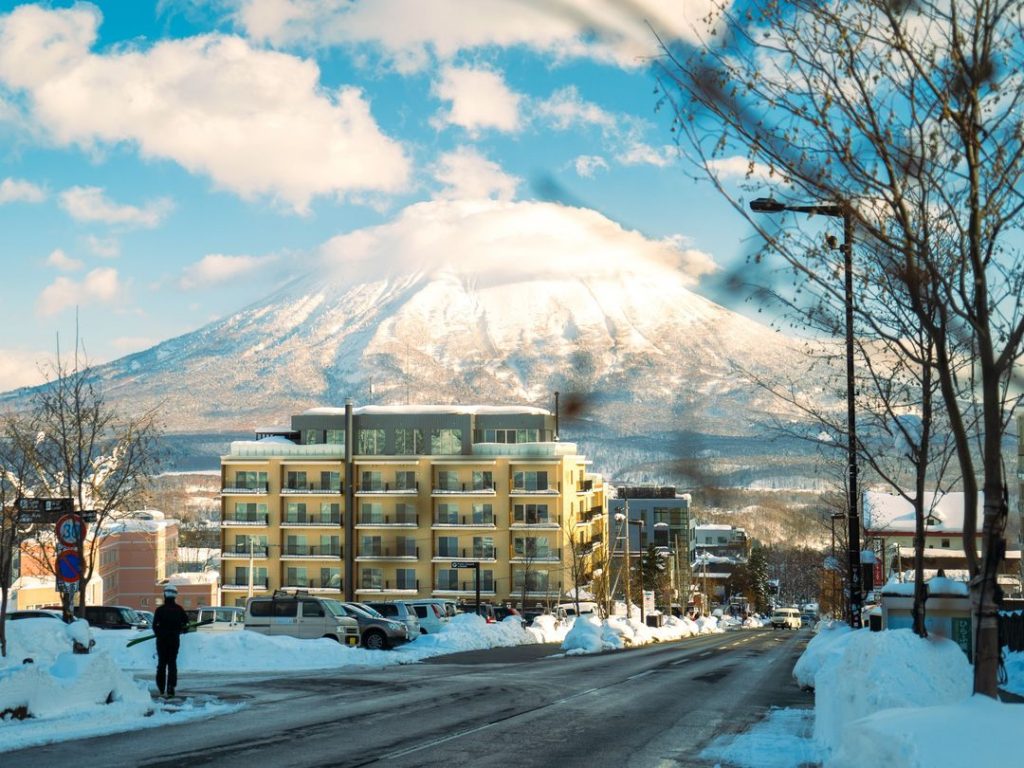
Japan is seeing a roller coaster of weather at present with record warm January temperatures for some areas earlier this month and now an extremely strong cold air flow bringing heavy snowfall from Tuesday through to Thursday in many parts of northern and western Japan. Niseko (110/305cm / 44/122″) is one of those expected to see very cold temperatures and heavy snowfall, but it’s the same for many ski areas across Japan. Currently, Yudonosan (100/420cm / 40/168”) in Yamagata prefecture is posting the country’s deepest snow and one of the deepest snowpacks in the world at this point of the season.
JAPAN FORECAST
Northern to western Japan, especially areas along the Sea of Japan coast, but also to a lesser extent the Pacific Coast, are currently getting heavy snowfall and stormy weather. That’s expected to continue at least through to Thursday.
You might also like...

A Guide to the Perfect Skiing Stance in All Conditions with Maison Sport

Huge Snowstorm Hitting Western North America

World Snow Roundup #231
