WORLD SNOW ROUNDUP #254

Issued: 24th August 2022
By Patrick “Snowhunter” Thorne
World Overview
A few landmark changes in the ski year over the past week, most notably the last area still operating from 2021 in North America, Timberline, ended its 21-22 season at the weekend. This means we’re down to ski lifts turning on only four continents from the next month or two, down from a high of six only a month ago. That’s if we don’t include indoor snow centres that are where you can still find machine-made snow on six continents.
Europe is down to just one area open with Scandinavia’s last glacier summer ski centre shutting to the public suddenly last Wednesday, although it and one other Norwegian resort is still keeping their slopes open to racers for training.
The good news though was a report of the first early pre-season snowfall on high peaks in Colorado last week.
While there may be little left to ski north of the Equator in the final weeks of summer though, the main ski season continues in the Southern Hemisphere. There is a week of winter left by the meteorological measure of the seasons or four weeks, if you go by the traditional astronomical measure.
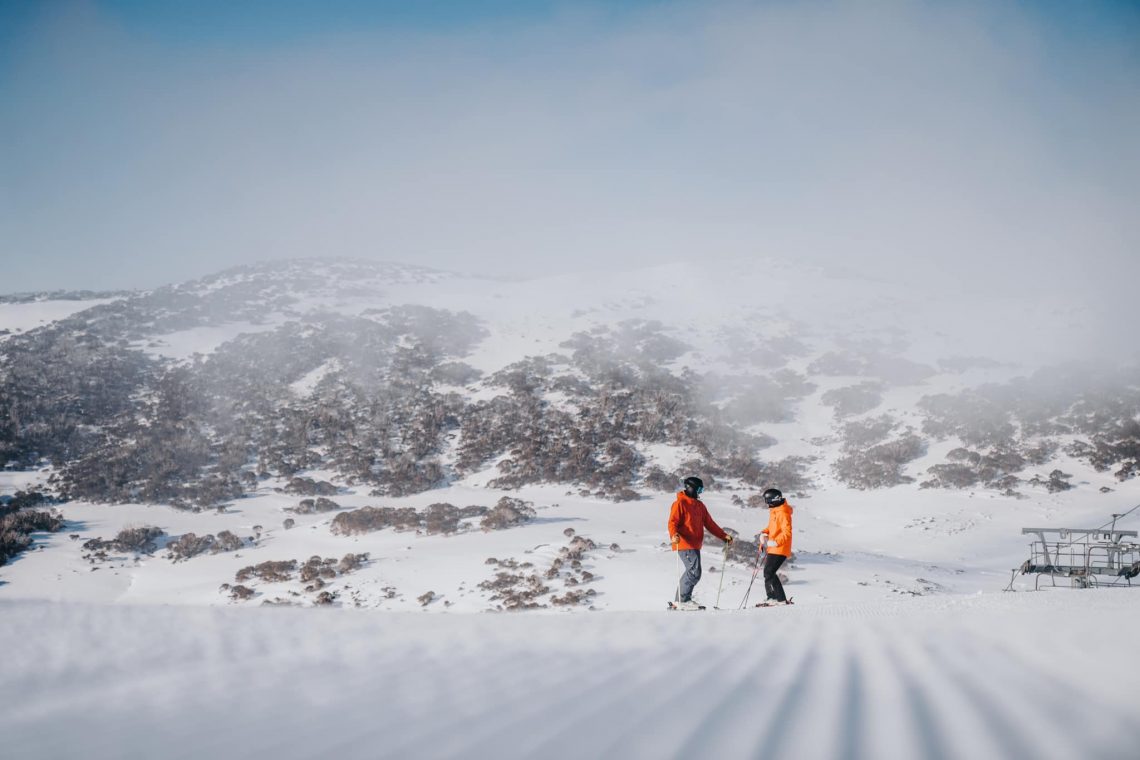
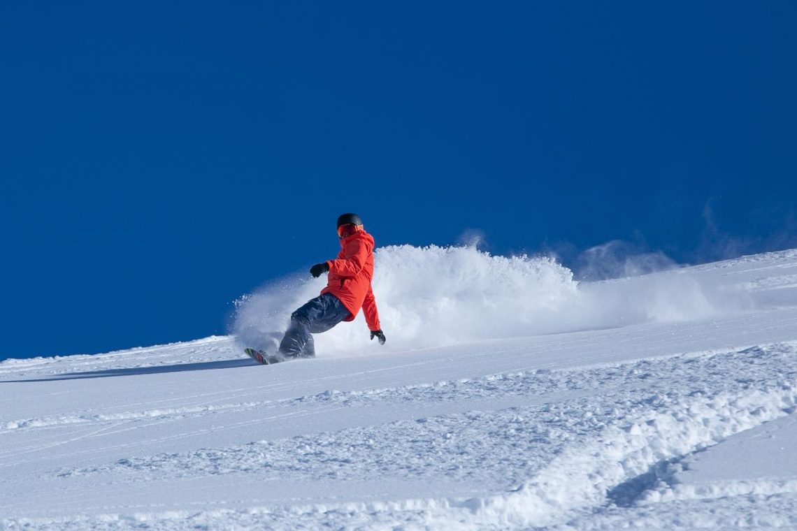
Australia and the Andes are both in good shape, with Australian centres reporting more fresh snowfall and ski areas in the Andes enjoying the sunshine after the snow there. Conditions in New Zealand have taken a dip, however, with a warm, wet storm at the end of last week severely impacting the snowpack and bringing springlike conditions, although some have had fresh snowfall since. In Southern Africa, it’s the last week of the season and although overnight lows still dipping below freezing, daytime highs are now double digits above.
Most ski areas in the Southern Hemisphere have reported fresh snowfall over the past week, but it’s a mixed picture. The Andes had a good snowfall last week and ski areas there have been reporting excellent conditions for enjoying it now the sunshine has returned. For Australia, most ski areas have had at least two snowstorms in the past seven days, so it has been a consistently snowy week with some areas getting about 50cm (20”) of new snow in total over the last seven days. New Zealand though has had a very problematic week with warm weather, strong winds and rain going into last weekend. This has impacted bases and some smaller centres are still closed. The commercial centres are operating and most have had fresh snow, but report ‘early springlike conditions.’ In southern Africa, there’s been some fresh snowfall up high ahead of the final week of winter 2022 there.
AUSTRALIA REPORT
Australia enjoyed a snowy end to last week and then after a clear weekend a snowy start to this after a second storm brought more powder on Monday and Tuesday. Perisher (90/146cm / 36/58”), the country’s biggest centre with 65km (41 miles) of slopes open, the second most in the world at present, posted 25cm (10”) of fresh snow lying on Friday morning after the latest storm hit, with more snow continuing to fall before skies cleared for the weekend. It then got another 15cm (6”) for Tuesday morning. Most other ski areas reported 5-15cm (2-6”) of fresh at the same time. As a result, all areas are fully open (or thereabouts). There are ongoing issues with demand outstripping supply, particularly at weekends, and most centres have pushed through the 1.5 metres (five feet) upper slope base mark, the deepest yet, as we enter the final month of operations for 2022. Skies cleared through the weekend but the new week has seen a return of more unsettled, snowy weather and there was much excitement on Tuesday with Aussie ski areas waking to find loads of fresh powder. Thredbo (85/146cm / 34/58”) reported the most fresh snowfall on Tuesday morning with 28cm (11”) of powder. Mt Baw Baw reported 25cm (10”) of fresh snowfall with the snow still falling. For Mt Buller (85/115cm / 34/46”) it was 15cm (6”) more snow reported and, as with everywhere in Australia, a great powder day on Tuesday.
AUSTRALIA FORECAST
The next few days should remain cold with temperatures rarely getting much above freezing and dipping down to low single figures below zero Celsius. There will be more light snowfalls. The end of the week will be drier and getting warmer though with lower parts of the mountains seeing double-digit positive temps in the afternoons by the weekend.
NEW ZEALAND REPORT
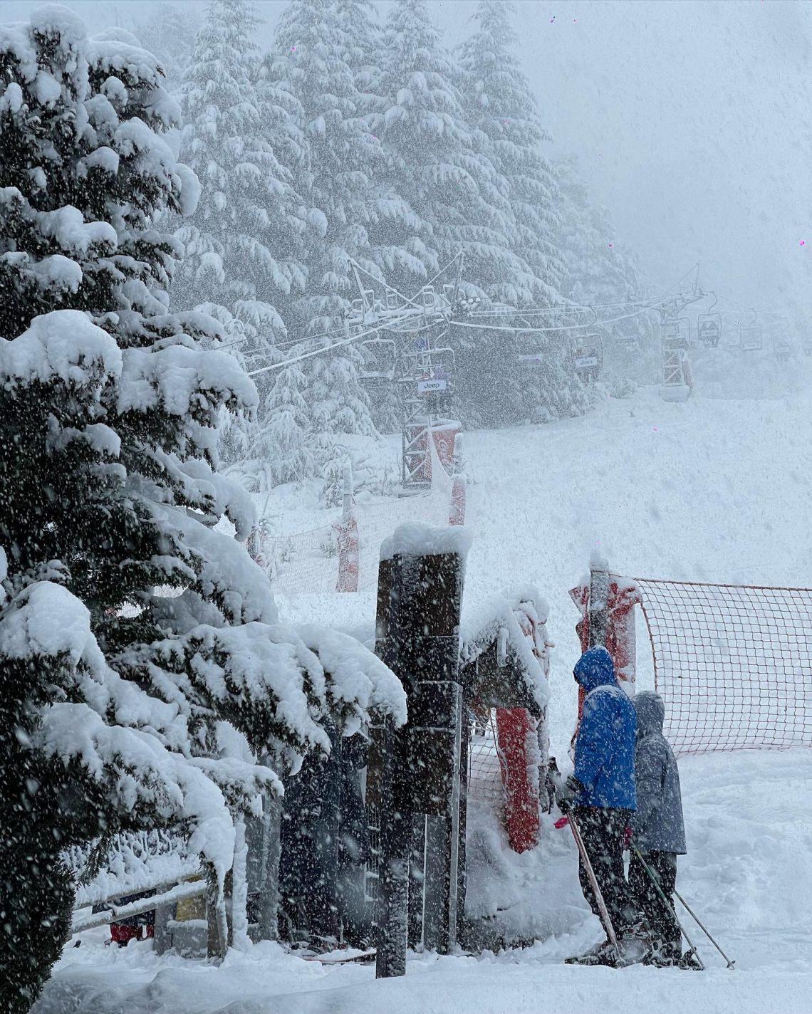
After the great week previously, New Zealand’s ski areas took a bit of a hit on Wednesday/Thursday last week when the forecast ‘warm storm’ blew through bringing strong winds and, unfortunately, a period of rain, which led to many of the country’s centres closing for the duration. As the storm passed on Friday it became clear it had a major impact on the snow cover and that the weather was still warm. Mt Hutt (105/150cm / 42/60”) put a positive spin on it, “Spring’s come early?? Good vibes and soft snow” but Mt Lyford was more candid, “Unfortunately this week of super warm winter weather and some wind has depleted our snowpack to the point we cannot operate safely. …We will not be able to re-open until the next snowstorm gives us a top-up. It is extremely frustrating to make this call because we had the most amazing snow up until the Northerlies kicked in.” About half of the country’s areas did re-open Friday although some with reduced terrain available, Mt Hutt again, for example, was 100% open before the storm but about 70% open immediately after it. Things did begin to improve at the weekend though with Cardrona (90/140cm / 36/116”) reporting 15cm (6”) of fresh snowfall waiting when it opened on Saturday morning and posted “what a difference a day makes.” It reopened its Willows terrain to celebrate.
Unfortunately, the Ruapehu ski areas of Whakapapa and Turoa continue to face problems with a lack of snowfall and having struggled to open terrain all season the storms last week have caused further problems. Turoa is closed as we publish this report with limited terrain open at Whakapapa. The unusually poor conditions over a prolonged period are now leading to New Zealand media reports that it’s now the worst season in decades. Usually, Ruapehu is last to close in the Southern Hemisphere in late October or November, but it is unclear if that can be the case this year unless there’s a big improvement in early spring.
NEW ZEALAND FORECAST
Temperatures should fall to some extent and there should be a fairly decent snowfall over the next few days with 20-40cm (68-16”) accumulations likely, further improving things after the damage done by the storm at the end of last week. The snow will arrive a little later on the North Island. Overnight lows will be back below freezing but daytime highs continue to be in the +5 to +10C range.
ARGENTINA REPORT
It has been a mostly sunny week across Argentinean ski areas after the heavy snowfalls last week. Caviahue (160/220cm / 64/88″) is posting the country’s deepest base but most centres have at least 1.5m (five feet) of snow lying and with the majority planning to close in 3-4 weeks that should see them through to the end of winter. Catedral (30/120cm / 12/48”) continues to post the most terrain open in the world at present with about 100km (63 miles) of slopes open.
ARGENTINA FORECAST
It’s a mostly sunny picture once more for the rest of the week for most of Argentina’s ski areas. Temperatures should continue to drop a few degrees below freezing overnight but as we approach the end of winter, daytime highs will get to 5-8 degrees above freezing (warmer still in low valleys). The exception to the sunshine is likely to be southern Cerro Castor where snowfall is expected for the next few days.
CHILE REPORT
After the big snowfalls in the Andes a week or so ago it’s been much more settled with plenty of sunshine over the past week, although some Chilean ski areas did get a little fresh snowfall on Tuesday. Nevados de Chillán (80/350cm / 36/140″) continues to post the deepest base in the world at present and is indeed the only centre anywhere with a base of about three metres/10 feet. El Colorado/Farellones (60/100cm / 24/40”) reports the most terrain open in the country with all 50km (31 miles) of slopes open and all two dozen lifts turning. Lagunillas (35/80cm / 14/32″) hinted the end-of-the-season was night there posting images of the thin cover and wet snow (an unusual tactic for a ski area) and saying that it was low season and that skiers should visit before it is too late. It currently has 10km (6 miles) of slopes open.
CHILE FORECAST
It’s a sunny picture across the country’s mountains and there’s a big range in temperatures with overnight lows still getting down to double-digits below freezing some nights. But, equally, daytime highs are double digits above Celsius too, so real freeze-thaw conditions. It looks like it should stay sunny through the remainder of this week and into the weekend.
AFRICA REPORT
It’s just coming up to the final week of the season at Afriski (20/50cm 8/20”) in Lesotho, southern Africa where the season is due to end a week on Thursday, September 1st. It’ll be the first ski area in the Southern Hemisphere to complete its season after being the first to open three months ago. There has been a celebratory mood in the resort all season with the most ‘normal’ season in terms of the pandemic and visitor access since 2019. This has ramped up a bit in the past few weeks with various festivals and spring-type events. But the weather itself has been quite wintery with mountain passes closed for periods.
AFRICA FORECAST
It should be sunny weather and gradually rising temperatures over the coming week. Overnight lows still dropping a few degrees below freezing for the next few days, but daytime highs into double digits Celsius.
We are down to just one ski area open to the public in Europe as climate change shuts down the glacier centres that would otherwise be open. We have lots of rather sad ‘firsts’ this week: the first week since the advent of summer skiing more than 50 years ago that only one ski area is open in Europe and the Northern Hemisphere, the first that more ski areas are open for private race teams training (3-4) than to the public, the first that more ski areas are on hold awaiting better conditions (four) to re-open than are able to open.
In Scandinavia, the Fonna glacier closed to the public earlier than expected, last week, but it and the Galdhopiggen glacier are still open to race teams booked for private training sessions.
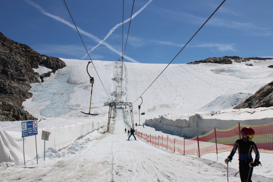
ALPS REPORT
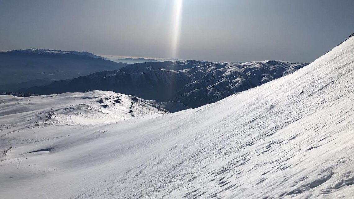
It is just the Hintertux glacier (0/25cm / 0/10”) open still with 6km (3.5 miles) of ‘very icy’ slopes and a thin base, thanks to snowmaking efforts on the glacier. Temperatures have been cooler and the past week has actually seen temporary closures of lifts at glaciers across the Alps (including those open but without snow sport at present) due to strong winds at times. We’re getting close to September when about half a dozen areas like Solden and the Pitztal glaciers, in Austria, and Val Senales, in Italy, usually open for their seasons. It remains to be seen how many will be able to until the weather changes to something more wintery up high. Zermatt and Italy’s Passo Stelvio, which would like to be open now, remain temporarily closed until there is that improvement.
ALPS FORECAST
The weather is remaining a little stubbornly warm and sunny for the final week of August. Temperatures on glaciers should remain close to freezing so we’re (hopefully) getting close to somewhere where we might see snowfall up high. The next chance looks to be the weekend when we’re on a borderline between rain and snow showers above 3,000m depending on how things play out.
SCANDINAVIA REPORT
Norway’s 2022 summer ski season had been due to end for the general skiing public last Sunday after the Fonna glacier announced it would close then. In the event though, things happened more quickly with the Fonna suddenly announcing last Wednesday 17th August that it was no longer safe to open terrain to the public due to fast thawing and that it would be closed immediately. That said, it and a second Norwegian area, Galdhopiggen, do remain open to pre-booked race teams for training. Galdhopiggen is, like several areas in the Alps, hoping to re-open to all when conditions improve and there’s more of a feel (and low temperatures) of autumn in the air. Its season is due to run to the start of November so there is time. Otherwise, the next centres due to open in Scandinavia are about six or seven weeks away when resorts like Ruka and Levi in Finland will open for their 22-23 seasons with snow saved from the previous spring in a snow farming effort.
SCANDINAVIA FORECAST
It’s a fairly changeable forecast for Scandinavia’s glacier areas, with temperatures generally in the freezing to plus 10 Celcius range, the weather a mix of sunshine and showers with some gusty winds too. The showers look most likely to be largely rainfall but there’s a chance of light snowfalls during the colder hours of the day.
NORTH AMERICA INTRO
There are no ski areas open in North America for the first time in 10 months. Timberline ski area, in Oregon, which had been the last area still operating in North America for its 21-22 season, closed its snowfield on Mt Hood on Sunday. It had been the only North American ski area still open for the past few months, Other than a private camp on a patch of snow above Copper Mountain in Colorado. Its closure means that the only snow skiing currently possible in North America is at the Big Snow indoor snow centre in the American Dream mall in New Jersey. But excitement for the start of the 22-23 season, potentially less than two months away, was fired up with news of the first snowfall dusting high points in Colorado late last week and again at the weekend. It was the earliest snow had been seen in the state for more than three years. The dusting on high peaks near Alma in the Mosquito Range was three days earlier than last year. It quickly melted but there was another dusting, this time at Pike’s Peak, on Sunday. More fronts are in the forecast to bring more snow and high centres in Colorado, aiming for an October season-start, are likely to start snowmaking towards the end of next month, assuming temperatures drop enough. Snowfall had already been reported in North America earlier this month on high peaks in Alaska. To extend the good news, the ski resort of Apex Mountain in BC, Canada, which was the latest ski area to be threatened by forest fires has had its evacuation order, issued earlier this month, rescinded. So residents can return home.
NORTH AMERICA FORECAST
Another largely sunny week with temperatures in the 60s-70s Fahrenheit in valleys, but up high in the Colorado Rockies overnight lows will not be more than a few degrees above freezing, which is moving in the right direction ahead of the hoped-for start to snowmaking in a little over a month. There’s also the chance of more dustings of snow up high over the next seven days.
You might also like...

A Guide to the Perfect Skiing Stance in All Conditions with Maison Sport

Huge Snowstorm Hitting Western North America

World Snow Roundup #231
