WORLD SNOW ROUNDUP #234
Issued: 06 April 2022
By Patrick “Snowhunter” Thorne
European Roundup
North American Roundup
Asia Roundup
WORLD OVERVIEW
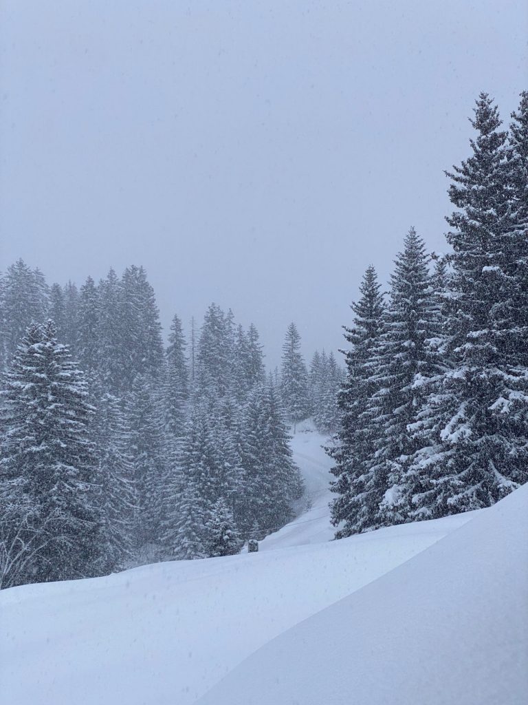
Europe has seen a major change in the weather since the end of last week with April beginning with cold and snowy weather across much of the continent’s ski slopes, quite a change after the unseasonably dry and often warm weather for much of March, now the continent has been belatedly plunged back into winter (not that it saw much of one), with some significant fresh snowfalls especially up high.
In North America, the deepest snowpack has passed the 200″ (5 metres) mark for the first time this season, up in Alaska, but against that the snowpack in California is reported to be at a ‘historic low, again’ for the time of year and some ski areas there have closed early. There have been more snow showers across the continent through the week though with 6 to 18 inch (15-45cm) 7-day totals reported.
In global snow news, North America has overtaken Asia for the world’s deepest snowpack. The numbers keep going up at Alyeska, in Alaska, which is now posting a base of over 5 metres (200”). While in Japan the deepest reported base is down to 4.5 metres (180”) from a high of 6m (20 feet) at the start of March.
Oukaïmeden ski area in Morocco, North Africa, also reported good snow conditions (if not so much as Alaska) and in the Southern Hemisphere, Afriski in Lesotho, opening for its 2022 season in two months time, got snow in its long range forecast.
In the Southern Hemisphere, we’re now only two months away from the start of the 2022 season, which, hopefully, will include the return of international skiers for the first time since 2019. Ski areas in South America and Australia have posted fresh early-autumn snowfalls this week.
EUROPE INTRODUCTION

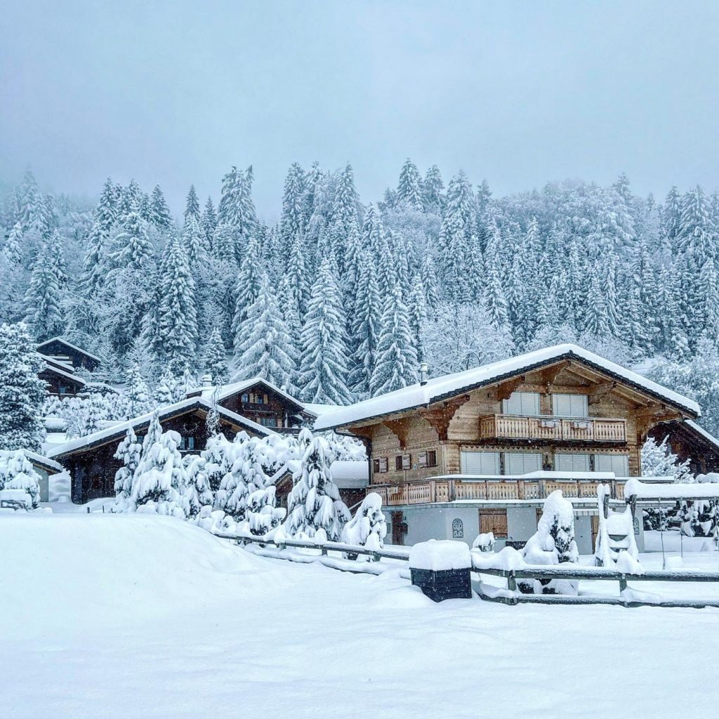
A major change in the weather after a warm March for much of mainland Europe. The last day of March and first of April at the end of last week saw the sunny, dry and warm weather that dominated much of the continent for much of last month give way to something much more like winter with temperatures plummeting back below freezing down to low levels, and frequent snow showers, eventually bringing as much as 75cm (30″) of snow to some higher slopes by the end of the weekend. Skies have cleared a little since then but it remains a much snowier start to April than the end of March. Against this of course more and more ski areas are closing as spring progresses.
AUSTRIA
AUSTRIA REPORT The 21-22 season in Austria is now in full wind down, with more areas closing at the weekend. A large part of one of the biggest areas, the SkiWelt is among the centres that have mostly or fully closed down. In its case, the Ellmau-Going sector is staying open for another fortnight up to the Easter weekend. About a quarter of Austrian ski areas remain open with Sölden (74/285cm / 30/115”) posting the deepest base in the country and open to May 1st. The Arlberg region (75/185cm / 30/75”) has the most terrain open still, about 75% of its 300+km of runs.
AUSTRIA FORECAST Getting drier and getting warmer with the sunshine returning too, albeit in sunny spells. That said there may be some snow showers at the weekend up high, down low though we’ll be well back into double figures above freezing by the weekend.
SWITZERLAND REPORT Swiss ski areas saw heavy snow showers at the weekend with several centres closing either partially or fully for a day or two while the heavy snowfall bringing low visibility passed through. Ski centres posted up to 60cm (two feet) of fresh snow on higher Swiss slopes by the end of the weekend. Verbier (10/100cm / 4/40”) was a major beneficiary posting just over 50cm (20”) of fresh snowfall by Saturday evening, just as it closed the first of its sectors for the season. Glacier 3000 (40/253cm / 16/101”) near Gstaad has the country’s deepest snowpack and plans to stay open to at least May 1st. After the cold and snow, there’s been sunshine and temperatures rising fast again to double digits above freezing down in the valleys. About half of Swiss centres are now closed for the season but most of the major resorts are at least partially open still.
SWITZERLAND FORECAST The current dry and sunny weather looks set to be short-lived with more snow forecast from around Thursday, although it looks more showery and less set-in than last weekend. Temperatures dipping back down below freezing.
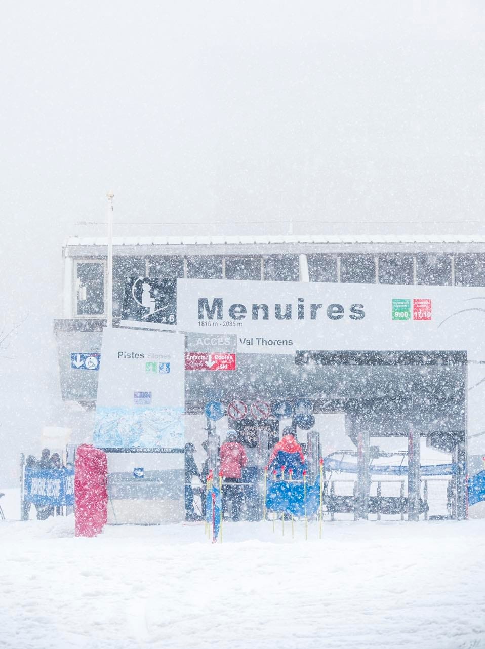
FRANCE REPORT France had lots of fresh snowfall from Thursday through to the start of the week with up to 50-cm (20”) of snowfall reported up above 2500m altitude. There were celebrations all round on Friday morning with resorts posting snowy images. Val d’Isere (74/120cm / 30/48”) opted to post an exceptionally snowy image from a February in a winter a few years again as an ‘Avril Poission’ or April Fool joke which backfired on them a little after tens of thousands of likes appeared from people who mostly hadn’t realised it was a joke and thought they had been conned. A glimpse at webcams showed a fresh snow covering down to the resort, but not the metres of deep snow shown. That said, conditions are definitely the best they’ve been for a month, although things are returning to more like spring seasonal norms with temperatures fast recovering to back above freezing and more sunny spells with lighter snow showers.
FRANCE FORECAST It has warmed up a lot midweek with dry and sunny weather once more, but another trough is moving in later this week which could bring colder temperatures once more and potentially more significant snowfalls. Especially for higher slopes.
ITALY REPORT One of the snowiest weekends of the season in Italy with Bormio (0/150cm / 0/75”) one of the big winners, reporting 70cm (28”) of new snow up at Bormio 3000 and around 40cm (16″) at mid-mountain. Livigno (23/113cm / 9/45”) posted a powder alarm on Saturday morning with 24cm (10”) falling in 24 hours on its higher slopes. There was snowfall for the Dolomites too. Italy has eased Covid restrictions for the start of April too, with a Covid passport no longer required to buy a lift pass or get on a lift.
ITALY FORECAST Drier, sunnier and getting warmer after last week’s snow. The weekend forecast is more unpredictable with temperatures potentially between -15C and +15C with the possibility of some light snow showers up high.
GERMANY REPORT Germany now has only a handful of ski areas still open, around 1% of the ski areas in the country. However, that’s the top 1% including the highest centres. Reit im Winkl (0/90cm / 0/36″), which had been one of a dozen or so areas that stayed open into April and had been posting the most terrain open in Germany for much of the year with 40km (25 miles) of runs, was one of those closing on Sunday. However, the Nebelhorn sector of Oberstdorf (0/100cm / 0/40”) aims to stay open another month to May 1st, as do the country’s highest slopes on the Zugspitze Glacier (200/250cm / 80/100”). Ironically, with everything closing, German mountains have seen their snowiest week for a month with temperatures dipping below freezing over the weekend and 20-540cm (8-16”) of snowfall recorded.
GERMANY FORECAST Mixed conditions over the coming week, with sunny spells and showers. The showers will be snow or rain depending on where you are on the mountain and in the country as temperatures will vary between -5 and+10 Celcius.
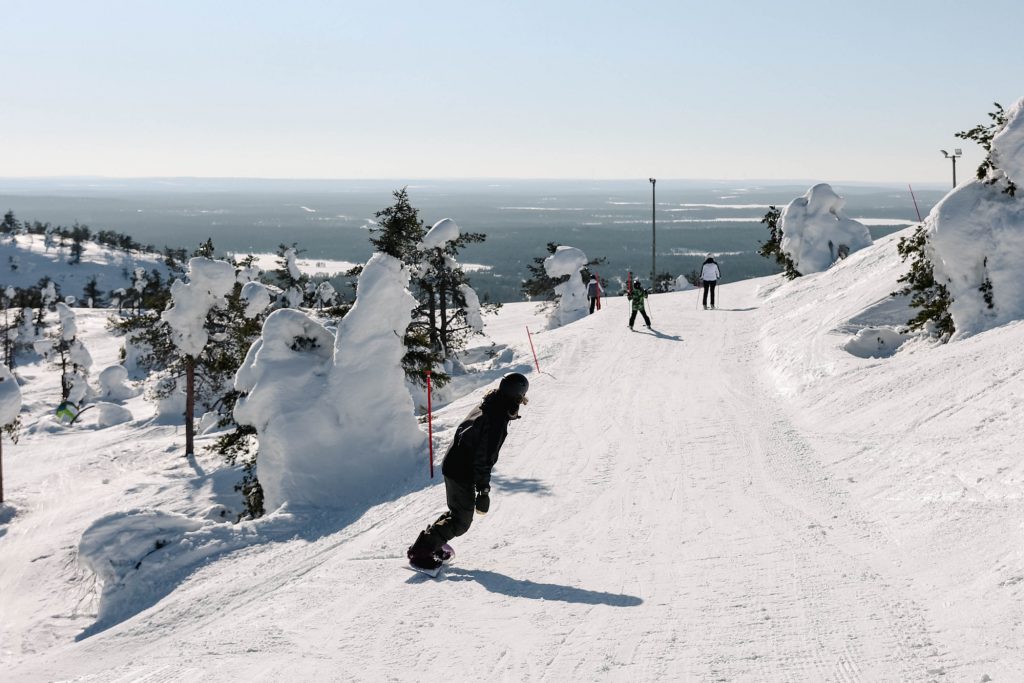
SCANDINAVIA REPORT Sunny spells, snow showers and cold still in the north sums up the changeable picture across Scandinavia over the last week. Unsurprisingly, the further north you go the lower the temperatures, in most cases at least, and they’re remaining close to or below freezing at most ski centres other than in the south and centre of the region. The lowest temperatures and the most snow showers are being reported up in the north, especially Lapland. Most ski areas in the region are open at least to Easter and a good number to the start of May. The largest, Sweden’s Åre (40/99cm / 16/40”) is one of those open for another month and remains 100% open.
SCANDINAVIA FORECAST Overcast and snowy conditions continuing in the north through the remainder of this week with temperatures remaining below freezing and 20-40cm (8-16″) more snow possible by next week. More sunshine further south but still close to or below freezing except in the south and a few more snow showers are likely.

SCOTLAND REPORT Scottish ski centres have had a bit of a late-season upturn with colder weather and fresh snowfall over the past week. The weather allowed The Lecht to re-open if only with beginner terrain thanks to its Snowfactory all-weather snowmaking system. Cairngorm re-opened on Friday after its slopes turned white again. It is still just the upper mountain terrain that’s open, with a hike up and down to the snowline and the reverse of The Lecht, no beginner terrain. More terrain is open in the west, although the snow at the Nevis Range is also down to the upper mountain. The weather took a turn for the worse on Tuesday/Wednesday with temperatures rising and rain to high levels so it remains to be seen what’s still open later this week.
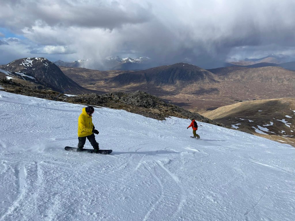
SCOTLAND FORECASTThe rest of the week looks colder again, with snow showers and sunny spells.
SPAIN / ANDORRA REPORT Temperatures dropped far below freezing in the Pyrenees over the weekend and there were regular snowfalls from Thursday through to Sunday bringing 20-40cm (8-16”) of fresh snow cover to ski areas in the region. That said, despite this early April bonus, a growing number of areas have now closed for the season and the amount of terrain still available at those still open is dropping. Grandvalira (50/115cm / 20/46”) still has about 85% of its runs open though, the largest area in the region. Spain’s Candanchú (70/235cm / 28/94”) has the deepest snowpack.
SPAIN / ANDORRA FORECAST After last weekend’s cold snap the coming week is looking much more in line with seasonal norms with temperatures climbing well above freezing and getting warm in the valleys and plenty of sunshine expected. That said, there is the chance of a light snowfall. More areas will close this weekend and most of the remainder at Easter.
BULGARIA / ROMANIA REPORT The wintery weather of March is over in southeastern Europe and there’s been plenty of sunshine in the past week, although a few light snow showers were recorded at the weekend. Overnight temperatures have dropped back below freezing but daytime highs are into double digits so the thaw is underway in the freeze-thaw cycle and most ski areas in the region are expected to close this weekend or next. Base depths remain good though for the time of year with Bansko (20/180cm / 8/72”) still having all its runs open. But, that said, the depth at the base has more than halved in the past seven days.
BULGARIA / ROMANIA FORECAST Mostly sunny weather for the week ahead with ever warmer daytime highs, but that said a cool front later in the week could bring a few centimetres of fresh snow up high. Bansko and Pamporovo are believed to be closing for the season this coming weekend on April 10th and Vitosha on April 15th but Borovets plans to remain open until the end of April.
CZECH REPUBLIC / SLOVAKIA REPORT Mostly cloudy skies over the past week with some light to moderate snowfalls on Czech and Slovak slopes. Temperatures were cooler at the weekend, with some resorts getting down to -10C, but at the other extreme, some +10C daytime highs were reported at bases too. About two-thirds of ski areas in the region have now closed for the season with just the larger, higher centres staying open, the latest probably to Easter weekend. Špindlerův Mlýn (20/60cm / 8/24”) is one but it has only about a third of its terrain still accessible.
CZECH REPUBLIC / SLOVAKIA FORECAST The forecast is for similar weather over the weekend. Cloudy skies with little sunshine expected, rain or snow showers, temperatures five to ten degrees either side of freezing.
NORTH AMERICA
NORTH AMERICA INTRO Spring continues to take hold across North America, with the usual mixture of rising temperatures and late-season snow showers alternating across most parts of the continent. More ski areas closed for the 21-22 season on Sunday although not many big names yet. However, next weekend will see a swathe of famous areas call it a day on the winter. The Northwest corner has reported the most snowfall in the past week (1-2 feet/30-60cm for some areas) and is the first ski area to post a 200 inch (5 metre) base on the continent this season. Actually, it’s the only ski area outside Japan to do so anywhere in the world. Some fresh too in California but the snowpack remains below average and there have been early closures. Snow in the Rockies and in the Midwest, where most ski areas are already closed. Some for the Northeast too.
ROCKIES REPORT The storm last week brought significant fresh cover for what is the last week or two of the season for many ski areas in the Rockies. Wolf Creek (99/116″ / 248/290cm), one of those closing soon, reported 11″ (27cm) of fresh cover then a return to spring conditions. For now, it’s continuing to post the deepest base in The Rockies though. Most areas in Colorado and Utah reported a few days of nice skiing on the fresh snow but we’re also seeing the first centres in the region close for the 21-22 season.
ROCKIES FORECAST Cold with possible snow showers over the next few days then a sunny weekend forecast. Getting very warm (the 50s but possibly low 60s) in the valleys, but staying below freezing overnight on the higher slopes.
USA WEST REPORT Snow depths in the western US have reached new highs in the past week with Alyeska (46/205″ / 114/513cm) the first ski area in North America, in fact outside of Japan, to post a 200″/5m+ base depth this season. It’s good it is staying open an extra three weekends to mid-May. Back over in the contiguous US’s Pacific Coast, Timberline (122/164″ / 305/410cm), in Oregon, is posting the continent’s second deepest base so things are looking good there for the next five months of North America’s longest ski season. Some more fresh snowfall was reported down in California and Nevada but not enough to save the season for some with Diamond Peak announcing it was closing earlier than expected for its 21-22 season last weekend.
USA WEST FORECAST Largely sunny and quite warm the next few days (into the 50s at mountain bases) but expected to get cooler at the weekend in the Northwest, although staying warm down in southern states like California. Little or no snowfall in the forecast.
MIDWEST REPORT We are down to less than a dozen Midwest resorts still open, but those that are have been reporting fresh snowfall still arriving over the past week. Terry Peak (12/28” / 20/70cm) in South Dakota had five inches (13cm) of fresh snow for its final weekend. Granite Peak Ski Area (18/36″ / 45/90cm) open to the 17th, has more than 50 runs open, topped only by Lutsen Mountains (36/48″ / 90/120cm) which has 60 runs still skiable and is one of two resorts in the region targeting a May 1st season end.
MIDWEST FORECAST Conditions will continue changeable with temperatures ranging from lows in the high-teens Fahrenheit, to highs in the still open areas in the low to mid-40s.
USA EAST REPORT April is the final month of the season for almost all ski areas in the northeastern US and centres have already begun closing here, as everywhere. But the past week has been fairly good with lots of sunshine and a few snow showers and standard freeze-thaw daily weather cycles. Killington (20/30” / 50/75cm), which normally has the region’s longest season staying open through May, currently has about 90% of its slopes still open. This is the biggest area in the region, and they say it has been using its snowmaking overnight for piling snow on its superstar trail ready to keep going through late spring.
USA EAST FORECAST There’s more or less everything in the forecast for the next few days in the northeast with snow, sun, rain and wind all expected to hit before the weekend. Temperatures continue to climb in the afternoons spelling the end of the season in a good many areas.
CANADA
CANADA WEST REPORT A nice spring mixture of weather in western Canada with temperatures varying between plus and minus ten degrees over the last week, and a mixture of sunshine and snow showers too. The snowfall has been quite significant at times with some areas posting 50cm (20″) accumulations over the past seven days. The season is in wind-down though with some centres in the region closing at the weekend and a swathe more expected to follow them on Sunday, although a dozen or so should power on through to Easter weekend and a handful into May. Whistler (20/250cm / 8/100″) still reports most of its terrain is open, the largest area in North America still. Kimberley (102/395cm / 41/158″) across on the other side of BC has the country’s deepest snowpack but is one of those closing on Sunday.
CANADA WEST FORECAST More sunshine and showers but temperatures continue to creep up with daytime highs likely to hit +15C later this week at Whistler.
CANADA EAST REPORT A spring feel to the weather in eastern Canada with mostly dry conditions since the weekend, temperatures ranging from a few degrees below freezing up to plus five or six. As with most parts of the Northern Hemisphere, some centres have closed and in the others, some switched to weekend operations only for their final weeks of 21-22 and many have reduced terrain available. A few though plan to stay open past Easter and even into May. Tremblant (30/305cm / 12/122”) still has more than three metres/10 feet of snow lying at the top of the mountain and has around 85% of slopes open. Its season will run to Easter weekend.
CANADA EAST FORECAST Alas, most areas in eastern Canada look set to see rain over the next few days. Skies clearing at the weekend but temperatures climbing into double figures.
ASIA
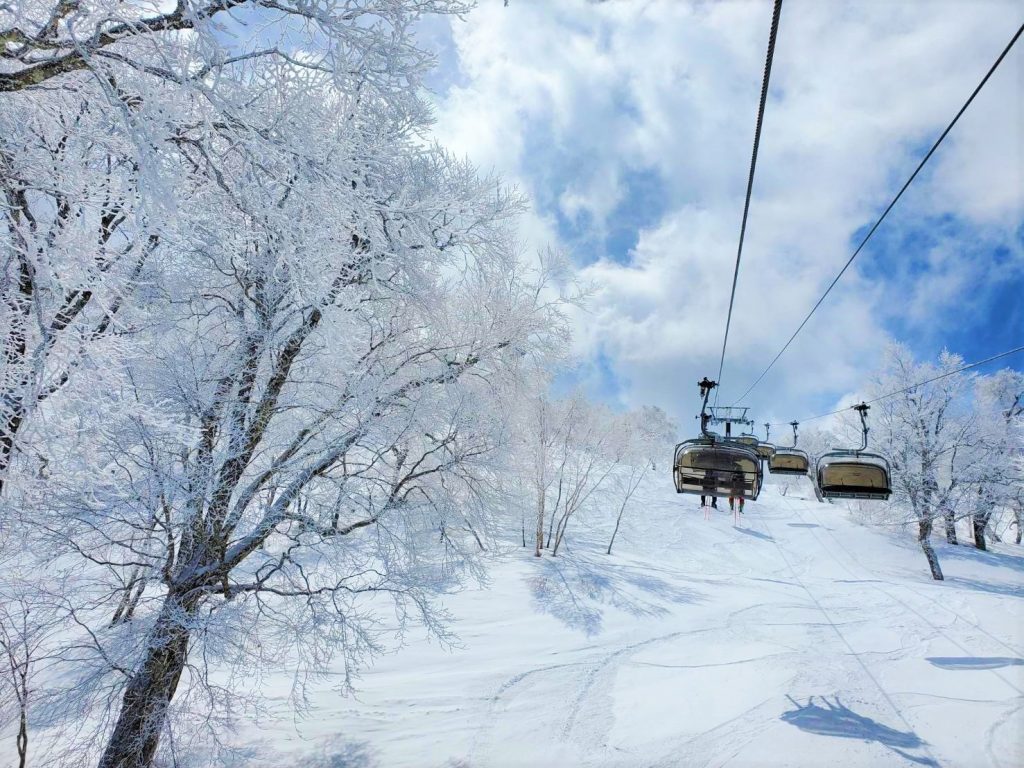
JAPAN REPORT As mentioned in our world overview, Japan no longer has the deepest snow in the world, with that stat down another 50cm (20”) on a week ago (and 1.5m/5 feet in the past three weeks) to 4.5 metres at Ishiuchi Maruyama (450/450cm / 180/180”), while a US ski area now says it has more than five metres lying. A swathe of Japanese ski areas have also now closed for the season although larger centres remain open and with temperatures fluctuating either side of freezing, have reported some fresh snowfalls- although also occasionally rain. Nozawa Onsen (300/300cm / 120/120”), one of those staying open into May, reported 5cm / 2” of snowfall at the weekend.
JAPAN FORECAST The spring weather is only going to keep creeping to slightly warmer temperatures, typically around freezing to plus five or six. There’s still the chance of the odd snow shower but equally, some may see rain. Summer ski area Gassan opens for its 2022 season this coming weekend.


