WORLD SNOW ROUNDUP #232
Issued: 10 March 2022
By Patrick “Snowhunter” Thorne
European Roundup
North American Roundup
Asia Roundup
WORLD OVERVIEW
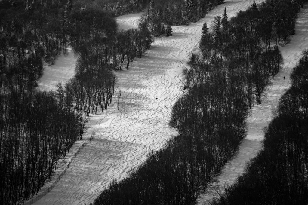
It was a second successive week of predominantly blue skies across many European ski regions, including the Alps. Temperatures turning into the usual spring pattern of overnight lows freezing the slopes then daytime highs above freezing, thawing things out. The continent’s southeast corner continued to see more snowfall with Bulgaria posting an avalanche danger level of three, unusually high for the region and about the highest in Europe at present. By contrast, it has been a very wintery picture for the first full week of spring across North America with two successive waves of storm systems moving from west to east bringing plenty of snow to ski slopes, although temperature spikes led to freezing rain and sleet at times for some areas. The overall picture was positive though with the result being multiple days of fresh tracks in many areas.
EUROPE INTRODUCTION
There has been a second week of glorious sunny skies across much of central and northern Europe including the Alps, Scotland and Scandinavia, for much of the past week giving great conditions on the groomers. More unsettled around the continent’s southern mountains with some light snowfall in the Pyrenees and, very unusually, some of the coldest temperatures and heaviest snowfall for a second week down in the Balkans around Bulgaria and Romania.
AUSTRIA
AUSTRIA REPORT It has been another week of predominantly sunny weather across Austria, putting pressure on snow cover at lower elevations, but then we are moving further into March and many of the country’s ski areas are scheduled to end their seasons in only 3-4 weeks now. Up on the glaciers and at the larger resorts with higher elevation slopes, snow depth remains good and operations to late spring and in some cases beyond remain in place for 2022. It has actually stayed below freezing up to about 1500m altitude and double-digits below at 3,000m and above. Most centres continue to have all their slopes open. Loser (60/340cm / 24/136”) has the deepest base in the country, but almost all of the glaciers including year-round Hintertux as well as the Kaunertal, Kitzsteinhorn, Pitztal and Solden glaciers, report at least 2.5m (100”) of snow cover.
AUSTRIA FORECAST The weather should remain dry and sunny through midweek but a fresh front is expected to bring in heavy cloud and light snowfall later in the week.
SWITZERLAND REPORT It has been predominantly sunny over the last seven days across Switzerland. Temperatures have been ranging from highs of +10C down at low lying resort bases in the afternoons (though more commonly freezing to +5C) to -10C lows on higher slopes. The country’s deepest snowpacks have thawed a little and are back on below 3 metres (10 feet), about half what they’d be at this point in the season in a good year. Engelberg is at (28/295cm / 11/118”). There is still plenty of snow to ski on though through the final weeks/months of the 21-22 Swiss season. The 4 Valleys still has about 360km (225 miles) of runs open, the most in the country and about 85% of their maximum area skiable.
SWITZERLAND FORECAST It’s expected to remain sunny across Switzerland for the remainder of this week, making it two straight weeks of sun. However, clouds are expected to start bubbling up from Friday with overcast skies at the weekend and some seeing light snowfall from Sunday.
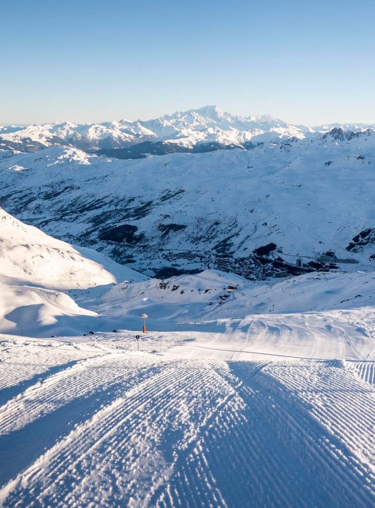
FRANCE REPORT It has been a mostly sunny week again in France, with just the odd light snow flurry for most areas. Temperatures have remained cold for early March, however, typically below freezing but with highs of only +5C in lower valleys. So there has not been much thawing and base depths continue to look good to see out the season. Les Arcs (80/260cm / 32/104”) is posting the deepest base in the country and, like most of the rest of France’s giant ski regions, its huge Paradiski area has more than 95% of its slopes open. It has been more unsettled down in the south with small to moderate snowfalls in the French Pyrenees bringing 5-20cm (2-8”) of fresh snowfall to the region over the past few days.
FRANCE FORECAST It looks increasingly unsettled in the French Alps over the week ahead with clouds due to roll in and then light to moderate snowfalls to end the week.
ITALY REPORT Yet another mostly sunny week for the majority of Italian ski areas. Base depths are generally holding out though as it has remained fairly cold, actually a few degrees colder than further north for many, with highs typically in the +4-8C range in valleys in the afternoons but more commonly staying below freezing. There have been few big snowfalls all season for many Italian areas and many have snow depths below 50cm (20”) on lower slopes and below a metre (40”) even at the top of the runs, but still most look set to see out the final 4-6 weeks of the season. The Milky Way (25/50cm / 10/20”) is one of those impacted and has never opened more than 70% of its terrain all season, the current 290km (179 miles) of its 400km (250 miles) of runs is the most all winter and still the largest area skiable (mostly) in Italy. The deepest reported base in the country at present is at Reinswald (70/270cm / 28/108”) in Trentino to the east.
ITALY FORECAST The sunny weather will continue through the week but there are signs of a change at the weekend with temperatures expected to dip and a front bringing moderate snowfall to most of Italy’s slopes at the weekend.
GERMANY REPORT Germany has shared the sunny, calm weather that has been common across northern Europe over the past week. The country’s ski areas have reported clear skies and little wind all week. The number of ski areas open in the country remains one of the lowest in the world with only about a third of the country’s leading 200 or so centres open. For those that are open most will close by the end of the month too. Most have thin cover and daytime highs in double digits above freezing haven’t helped maintain that. But up high the Zugspitze glacier (250/280cm 100/112”) is the exception for snow depth, and is open season for nearly two more months to the start of May. Reit im Winkl (40/165cm / 16/66”) has the second deepest snow and the most terrain open, 40km (25 miles) or 95% of its total.
GERMANY FORECAST As with other mainland northern European centres a sunny remainder of the week. Overcast at the weekend with some areas seeing snow showers from Sunday, others staying dry.
SCANDINAVIA REPORT Scandinavia has seen a fairly dry week with some glorious, sunny days after most of February was snowy, cloudy and windy for many areas. So with daylight hours stretching away, this felt like a good start to two months of spring skiing in the region, which benefits from ongoing low temperatures in most of March and April, thanks to the northerly latitude. The Men’s World Cup Alpine skiing tour returned to Norway at the weekend and experienced the great conditions of the past week there too. Myrkdalen (200/280cm / 80/112”) near Voss in Norway has the region’s thickest snowpack, while the largest ski area at Åre (80/120cm / 32/48”) is finally 100% open for the first time this season.

SCANDINAVIA FORECAST After a few more dry and sunny days for most areas the weather is looking much more changeable from Friday onwards. Light to moderate snowfalls are possible daily from Friday onwards and through the weekend.
SCOTLAND REPORT March continues to be the best month of the 21-22 season so far on Scottish slopes with more than half of the country’s ski runs open. The past week began with the usual challenges of strong winds at times, causing some rain and thawing on lower runs. But overnight lows have been sub-zero and there have been more fresh snowfalls too. Since the weekend though it has been beautifully still and sunny with perfect conditions. Most centres now have at least half of their terrain open with Glencoe (40/100cm / 16/40”) and The Lecht (20/60cm / 8/24”) reporting almost all of their runs accessible.
SCOTLAND FORECAST After the sunny start to the week more typical March weather looks set to impact Scottish hills over the coming week with cloudy skies, rising temperatures, moderate wind speeds and some precipitation. It is, unfortunately, looking more like rain than snow at present and it remains to be seen if there is more snow on higher slopes and how well the existing snowpack stands up to the coming weather.
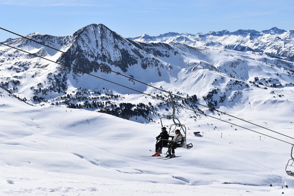
SPAIN / ANDORRA REPORT The weather has been more unsettled in the Pyrenees than up in the Alps with a mixture of sunny and cloudy periods and some light to moderate snow showers, most recently bringing fresh snow to start the week with 5-10cm (2-4”) reported on many slopes in the region on Tuesday morning. With snow depths continuing to diminish on the French side of the range, which had been posting the thickest snowpack the past three months, it’s now Spain’s Baqueira Beret (135/235cm / 54/94”) with the deepest snow and posting one of the largest areas open with nearly 160km (100 miles) of slopes skiable, about 98% of its total. Only Andorra’s Grandvalira (70/120cm / 28/48”) is posting more with just over 200km (125 miles) of slopes open.
SPAIN / ANDORRA FORECAST The week ahead is looking sunnier than the last with increasingly prolonged sunny spells and ever warmer temperatures (Up to +12C) in valleys, although staying below freezing on upper slopes. There’s no snowfall in the forecast for the remainder of the week.
BULGARIA / ROMANIA REPORT It was Bulgaria’s national day in the middle of last week, which led to lots of celebrations on the slopes. The big snowfalls of just over a week ago helped add to the upbeat mood. In Romania the snowfall led to several areas announcing they planned to stay open for an extra week or two, extending their planned ski seasons. Unlike the rest of Europe, base depths have been growing here. After those big snowfalls then recent top-ups Bansko (50/200 cm / 20/80”) has moved to have the deepest base in the region. Its lower slopes cover allows the long run back to the base village to remain open through the final weeks of the season. This is especially welcome.
BULGARIA / ROMANIA FORECAST The unusually cold weather will continue through to the weekend and more snow showers are expected
making the region the coldest and snowiest part of Europe at present, especially unusual in March.
CZECH REPUBLIC / SLOVAKIA REPORT A sunny and fairly cold week in the Czech and Slovak Republics over the last seven days with temperatures in the +5 to -5 Celcius range. Špindlerův Mlýn 45/70cm / 18/32”) continues to post the Czech Republic’s deepest base and the most terrain open with about 30km (19 miles) of runs, about 95% of its total. In Slovakia, Valča (50/110cm / 20/44”) has the deepest base with the region’s largest resort Jasná (40/90cm / 16/36”) not far behind and posting 90% of its terrain open.
CZECH REPUBLIC / SLOVAKIA FORECAST Largely sunny for the week ahead but a weak front is expected to bring some light snowfall to Slovakia on Wednesday before a return to sunshine to end the week and through the weekend. Slightly brighter weather
NORTH AMERICA
NORTH AMERICA INTRO Another stormy week across North America has brought multiple snowfalls to many areas with March looking a better month so far than February and especially January for snowfall. Temperatures have been fluctuating, however, meaning some areas have seen freezing rain or sleet at lower elevations at times. On the whole though a positive picture with many areas seeing 6-9 inches (15-22cm) of snow accumulations and the most fortunate 1-2 feet (30-60cm) over the last seven days making for a snowy start to spring.
ROCKIES REPORT A good seven days for snowfall in the Rockies with many areas seeing 6-12 (15-30cm) snowfalls at the end of last week and a second front bringing as much again to start this week. Large parts of the Rocky Mountains are receiving some much-needed snow Sunday with some areas picking up more than a foot through Monday. In Colorado, Aspen Snowmass (20/87” / 60/217cm) was typical posting 6″ (15cm) of fresh snowfall on Monday as part of a 19” (47cm) accumulation over the weekend. It described conditions as “powder” and reported 335 of its 336 runs open.
ROCKIES FORECAST The current snowfall is expected to continue through the middle of the week with further light to moderate accumulations likely. Sunny weather and warmer temperatures from the end of the week and through the weekend.
USA WEST REPORT The Western US has seen more fresh snowfall over the past week with ski areas in California posting 6-12” (15-30cm) accumulations and heavier falls (although at times also freezing rain and sleet due to borderline temperatures) further north. The three resorts posting the deepest bases in North America are all in the US West with Alyeska (44/168” / 110/420cm), up in Alaska, having the continent’s deepest base. Mk Baker (126/150″ / 315/375cm), in Washington state, is the only ski area in North America posting a lower slope base of more than 120″ (3m) although it remains some way off its usual world-beating huge annual average snow total. The third deepest snowpack is at Timberline (114/140″ / 284/350cm), in Oregon, which still has nearly six months of its ski season to go, all being well, with its spring and summer snowfield due to stay open to early September. Hopefully, the amount of snow lying there now will see it through the hotter months of the year ahead. Further south, Mammoth Mountain (68/130” / 170/325cm), in California, still has the continent’s fifth deepest base and also looks good to stay open at least to late spring, as usual.
USA WEST FORECAST More light to moderate snowfall is expected for the next few days with skies clearing and sunshine returning on Saturday. Temperatures climbing through the weekend and hitting afternoon highs 5 to 10 degrees above freezing in valleys.
MIDWEST REPORT Most ski areas in the Midwest are in good shape as the final weeks of the season for many get underway. The past few days have seen fresh snowfall and ski areas have reported that temperatures have remained cold so snow is sticking around longer into March than usual, and in better shape too. A number of resorts are posting five feet (1.5m) of snow now lying on their upper slopes and most are fully open. They include Minnesota’s Giants Ridge (35/60″ / 87/150cm) and Michigan’s Mont Ripley (54/60″ / 135/150cm).
MIDWEST FORECAST Staying well below freezing over the coming week with snow showers forecast for many states in the region from Friday through the weekend, Minnesota and Michigan looking particularly snowy.
USA EAST REPORT A snowy start to the week in the Northeast with most resorts reporting 6-12” (15-30cm) accumulations and powder conditions with the sun returning to most on Sunday. Killington (20/28” / 50/71cm) has the most terrain open in the region but it is not clear if it will do its usual and stay open another three months towards June as it is not sitting on a huge base. Fellow Vermont area Smugglers’ Notch (24/48” / 60/120cm) has the region’s deepest snowpack.
USA EAST FORECAST After a brief sunny spell, it will be overcast for the rest of the week with more precipitation forecast for the weekend. Temperatures will be rising then too so some areas may see freezing rain or sleet, others snow, at that point.
CANADA
CANADA WEST REPORT It has been a mixture of sunshine and snow showers across western Canada over the past week, bringing fresh snow cover to many areas. Typical accumulations of 15-30cm (6-12”) have been reported since the end of last week keeping snow cover in the region in good shape at most resorts. Kimberley (105/330cm / 42/132″), on BC’s Western edge, is reporting the deepest snowpack in Canada (and the fourth deepest in North America). A little further west Big White Ski Resort (150/200cm / 60/80”) said at the weekend that its ski patrol recorded that they had reached a 200cm (80”) snow base for the first time this season.
CANADA WEST FORECAST It’s set to stay cold and frequently snowy over the coming week with mostly overcast skies, however, there will be some sunny spells at times and accumulations are likely to be light to moderate. Temperatures will remain below freezing inland, even at low levels, maintaining snowflake integrity for longer.
CANADA EAST REPORT A cold and sometimes snowy week in eastern Canada where restrictions on slope access have been eased in Ontario with skiers and boarders no longer having to show proof that they are vaccinated, so allowing more to get on the slopes. Tremblant (30/305cm / 12/122″) continues to post the region’s deepest snow and the most terrain open. However, most centres have plenty of snow cover now and are fully open.
CANADA EAST FORECAST After a sunny start to the week, it is looking largely overcast and occasionally snowy over the next seven days. Temperatures remain below freezing from top to bottom of the slopes, as low as 20 below up high. Probably not much snowfall until the weekend when only light accumulations are expected so far.
ASIA
JAPAN REPORT Snow is still falling on Japanese ski slopes with two months of the season still remaining for the country’s larger resorts. However, most have seen less (about 30-50cm/12-20″) in the first week of March than the metre (40″) or so in the last week of February. Temperatures have also been climbing up closer to freezing and the past few days have seen strong winds in many areas. But snow depths remain the world’s deepest this season, even though they’re down a few centimetres/inches for many compared to a week ago. Niseko (215/415cm / 86/166”) has had a foot (30cm) more snowfall in the last week and reports seasonal snowfall past the 10m mark. Seki Onsen ski area, by Myoko, is the first in the world to report a six-metre (20 feet) base this year.
JAPAN FORECAST The forecast for the week ahead remains little changed with clear days interspersed with more light to moderate snowfall days. Temperatures remain a little below freezing and some strong winds are expected on higher slopes at times.


