WORLD SNOW ROUNDUP #232
Issued: 23 March 2022
By Patrick “Snowhunter” Thorne
European Roundup
North American Roundup
Asia Roundup
WORLD OVERVIEW
Spring is now here by the astronomical as well as the meteorological measure of the seasons with the equinox behind us. That’s the Northern Hemisphere, of course, in the Southern it’s autumn/fall and excitement for the coming 2022 season, hopefully largely pandemic-rules free for the first time since 2019.
It certainly feels very springlike in much of Europe with the northern half of the continent seeing predominantly sunny, warm weather. Unusually March has seen colder, snowier weather in the south, both in the Pyrenees and the wider Iberian peninsula, but especially the south-east around Bulgaria and Turkey.
In North America, winter seems to be attempting a rear-guard action after failing to make much of an effort when it actually was winter for much of the past four months. The past week though has seen snowfall across the continent, including some quite significant falls of up to 20 inches in the northwest.
EUROPE INTRODUCTION
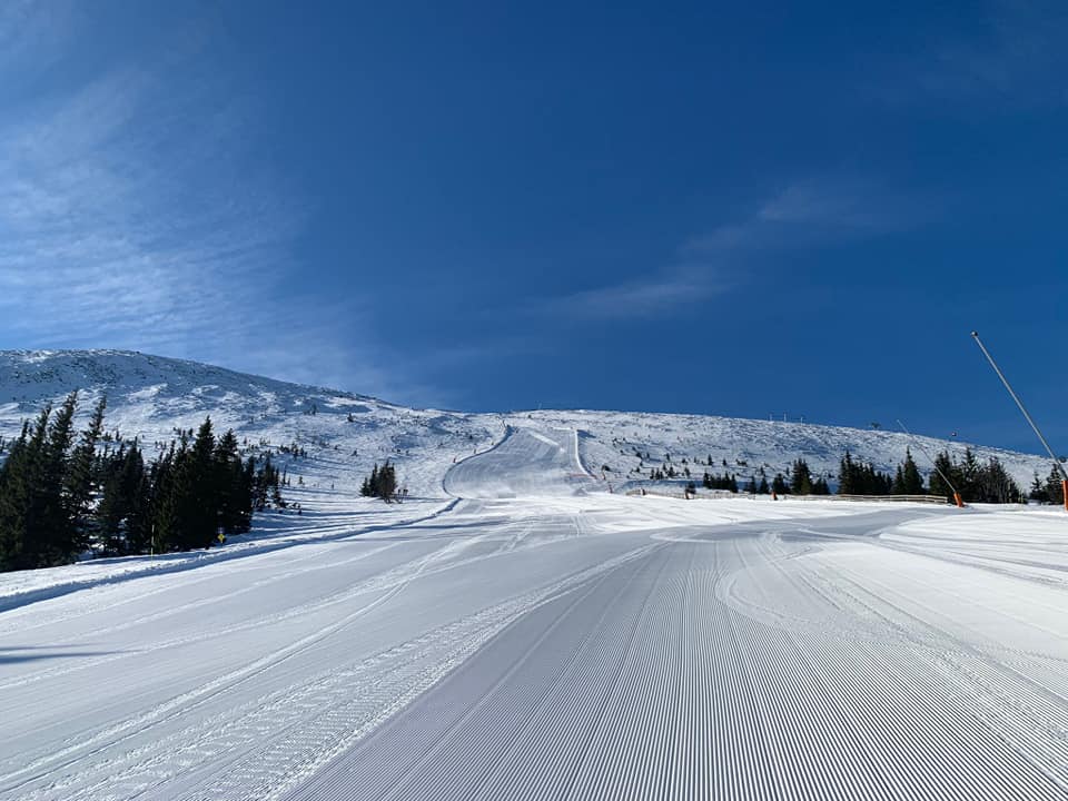
The most noticeable thing for much of Europe over the past week was sunshine, lots of it, and warm weather in the Alps too making for very late-season conditions. The second big weather factor was dust, sand from the Sahara in fact which covered much of the continent in an orangey hue, settling on the snow and floating in the air in the latter half of last week, creating a surreal effect. Not everywhere was warm and orange though. Unusually the colder, snowier weather was in the south, with more snowfall for the Pyrenees and countries like Bulgaria and Turkey in the southeast.
AUSTRIA
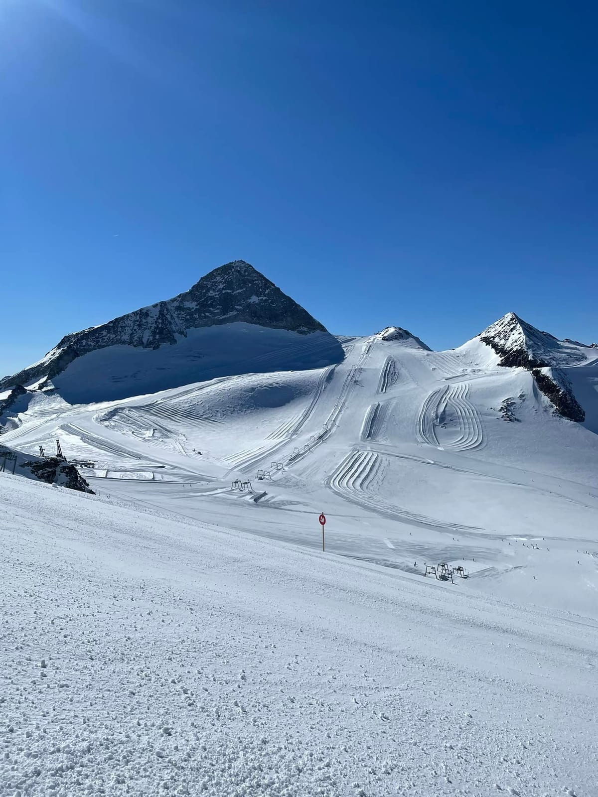
AUSTRIA REPORT Full-scale spring is perhaps the best way to describe the weather in Austria with very warm temperatures now both in the valleys and upon the slopes and more unbroken sunshine. Temperatures have been hitting as high as +20C down in some resorts (though more commonly +10-+15C) and even as high as +10C at 2000m up on the slopes (though again more commonly +3-6C), clearly not good news for snow cover and quality. Built-up depths mean most areas should see it through to the season end, now only a few weeks away for most. In fact, about a quarter of Austrian areas, mostly smaller, lower centres, have ended their seasons already. Although the picture has been generally warm and sunny there was a weak front at the weekend that pushed through bringing a brief temperature drop and some light snow (or rain) for some. Of the higher resorts looking to stay open for a month or more, it is a much more promising picture with temperatures still sub-zero up above about 2500m. The year-round Hintertux Glacier (35/275 cm / 14/160”) has one of the country’s deepest bases.
AUSTRIA FORECAST There’s not much change in the Austrian forecasts with more sunshine and warm temperatures forecast for the rest of the week.
SWITZERLAND REPORT A little snowfall in the east and south of Switzerland at the weekend but, as with much of central and northern Europe, an otherwise predominantly dry and sunny week once more for Swiss ski areas. Temperatures did drop at the end of last week, allowing for the snow, but have been climbing since, back above freezing at most levels and into double digits in the afternoon even at quite high-altitude resorts. But everywhere remains fully open, even if snow conditions are definitely “springlike.” The 4 Vallées (35/80cm / 14/32”) continue to offer the most open terrain, about 85% of their 400km+of slopes, the deepest snow reported is up on the glacier at Laax (55/280cm / 22/112”) which is 100% open.
SWITZERLAND FORECAST More sunshine to see out the week with temperatures reaching +20C in the lowest valleys at around 600m, altitude, +15C at 1000m, + 5C up on the slope at 1500m, and staying around freezing or below once up above 2,000m, so a full freeze-thaw spring skiing daily cycle.
FRANCE REPORT Other than a decent snowfall just over a week ago it has been a largely sunny March in the French Alps and social media ski forums have seen skiers complaining about sticky snow on lower slopes and in the afternoons, so that’s spring fully underway. Unusually, it has been colder further south with some fresh snowfall in the Pyrenees, the front just about stretching up to the Southern Alps with Serre Chevalier (10/130cm / 4/52″) reporting light snowfall to start the week. But, overall, it has been sun, sun, sun, with temperatures above 2,000m generally remaining close to freezing, but getting to +10C down in the valleys. However, most big resorts have enough snow to last out the season, pushing some down the slopes from higher altitudes if necessary. La Clusaz (25/250cm / 10/100”) has the country’s deepest upper slopes depth.
FRANCE FORECAST More sunshine forecast and warmer temperatures still as we move into the final week of March. Highs in valleys are now up to +15C.
ITALY REPORT Temperatures dipped a little at the end of last week and there was some snowfall in some parts of Italy, most notably Trentino, but by the end of the weekend the spring sunshine was back and temperatures were rising once again, getting well into positive numbers in the daytime even high on the slopes and hitting double digits by the afternoon down in resort where the thaw continues. Despite that most Italian ski areas remain fully open, pushing snow down onto lower runs where needed. The country’s biggest area, Dolomiti Superski, is almost fully open despite a few areas within it having no more than 75cm (30″) lying in their upper slopes, half that on lower runs. San Martino (70/270cm / 28/108″), in Trentino, is posting Italy’s deepest base.
ITALY FORECAST More strong sunshine forecast for the coming week so the thaw will be accelerating. Still getting below freezing overnight in the mountains but daytime highs of +5 to +10C on higher slopes, +10 to +20C in the valleys.
GERMANY REPORT A sunny week in Germany, other than a few light snow showers in some areas at the start of the weekend and temperatures have been climbing to double figures in the valleys and at some lower ski areas even at the top of the slopes too. As a consequence, more than 80% of German ski areas are now closed for the season, although most of the larger ones will aim to make it at least to the start of April. The snow depth at the country’s highest centre, Zugspitze (240/260cm / 94/104″), is down about 15% on a week ago but it remains fully open and focused on staying open through to the start of May.
GERMANY FORECAST No real change in the sunny forecast with temperatures set to get higher still in the final week of March, potentially climbing up towards +20C in some lower valleys.
SCANDINAVIA REPORT Some glorious sunny days in Scandinavia over the past week and as we are now past the equinox the daylight hours are stretching away and those of floodlit slopes and little daylight only a few months ago are rapidly disappearing in the rearview mirror. Snow conditions remain good, particularly at more northerly areas where it is still largely below freezing, further south daytime highs of 4-8 degrees were found on lower slopes. Myrkdalen (180/280cm / 72/112”), near Voss, has the deepest snowpack in the country still but recently re-opened Riksgränsen is just a few centimetres/inches behind.
SCANDINAVIA FORECAST A largely dry and sunny week continuing ahead with high pressure dominating the region. Daytime highs are up towards +10C for many ski areas in the region. Overnight lows drop below -10C at the top of the slopes though.
SCOTLAND REPORT Scotland saw some of the warmest weather in the UK at the weekend with highs of +20C on Saturday. Not as warm as that in the hills but warm enough to wipe out a lot of the snow cover and the Lecht has closed for lack of snow with Glenshee back to a few runs, mostly best suited to beginners. It announced Monday that it had decided to close for the season. Other areas have had a little more open, although Cairngorm and Nevis Range both had operations impacted by strong winds at the weekend. Glencoe continues to offer the most terrain open and Flypaper, the centre’s infamous black run, finally opened last week for the first time this season with 10cm (4 inches) of fresh powder before the current sunny spell began.
SCOTLAND FORECAST Settled, dry weather forecast to continue for the remainder of the week at least with warm temperatures and plenty of sunshine.
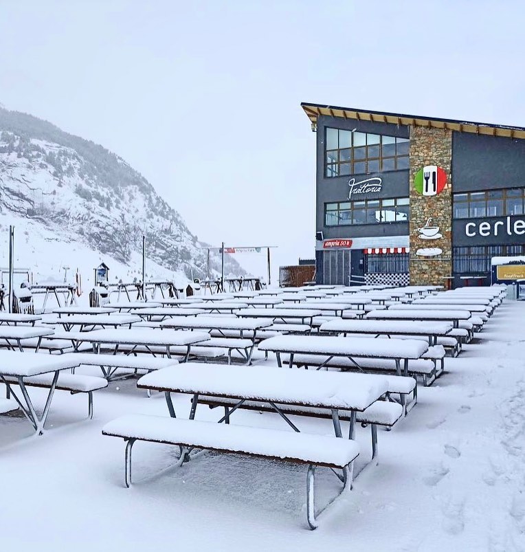
SPAIN / ANDORRA REPORT The unsettled weather that has been the main trend in the Pyrenees in March has continued into a third week with more snowfall along with periods of cloud, fog and strong winds thrown into the mix. Some spring sunshine too of course! Temperatures have been cooler than further north in the Alps, generally staying at or below freezing above 2,000m. Warmer in the valleys of course but highs generally around 5-8C. Spain’s Candanchú (120/265cm / 48/108”) is posting the deepest base in the Pyrenees for the first time this season, partly as bases have dropped at centres previously posting deeper snow. Predictably, Andorra’s Grandvalira (80/120cm / 32/48”) has the largest amount of terrain open, about 90% of its 240km (150 miles) of runs.
SPAIN / ANDORRA FORECAST Increasingly sunny weather for the week ahead with no snow forecast at present. Lows of -10C overnight in the mountains, highs of +10C in the valleys in the daytime.
BULGARIA / ROMANIA REPORT The weather pattern that has kept things warm and dry in the Alps but colder and snowier in the southeast of Europe has continued for the third week of March with more snowfall reports down in Bulgaria and Romania and lows down towards -20C at the top of the slopes in the region. It’s not been getting much above freezing in resorts still either, quite unusually for this time of year. The past few days have seen a mixture of sunshine and light to moderate snow showers. Snow depths are unchanged on a week ago and very good for the start of spring. Bansko (50/200cm / 20/80”) is fully open and posts the deepest base but other resorts in the region are mostly posting similar numbers and are also fully open.
BULGARIA / ROMANIA FORECAST Again, the weather seems to be remaining set in for at least the remainder of this week, with more light snow forecast and fairly low temperatures continuing. Plenty of sunshine too though once the snow clouds clear.
CZECH REPUBLIC / SLOVAKIA REPORT There’s been non-stop sunshine in the Czech and Slovak Republics and there’s not much else to say. Temperatures have been climbing to +10C at altitude and +15C at resort level, so that’s not great news for snow cover, obviously. Temperatures have dropped back below freezing each night though so it is not an around-the-clock thaw so far. The region’s largest ski area Jasná (40/90cm / 16/36”) continues to have around 90% of its slopes open and most ski resorts in the region are open for at least a weekend or two more this season.
CZECH REPUBLIC / SLOVAKIA FORECAST There’s no sign of an end to the sunny weather. Although it will remain warm in valleys it currently looks like it should get cooler up on higher slopes towards the end of the week. But it’s still getting into positive numbers in the afternoon, just not such big ones, slowing the thaw a little.
NORTH AMERICA
NORTH AMERICA INTRO A battle seems to be taking place between winter and spring across North America with temperatures warming and impacting lower slopes, but snow still falling across the continent as cold fronts move across. The latter half of March is therefore continuing largely as per normal, with the first centres in areas like the Midwest switching to summer operations but other resorts in states like Alaska and Colorado announcing extended seasons, even if, in the latter case, it hasn’t been a particularly good snowfall year. But here, as in most other regions, the snow has kept falling over the past week. The biggest fresh accumulations were reported in the Pacific Northwest where up to 60cm (two feet) more has arrived over the past seven days.
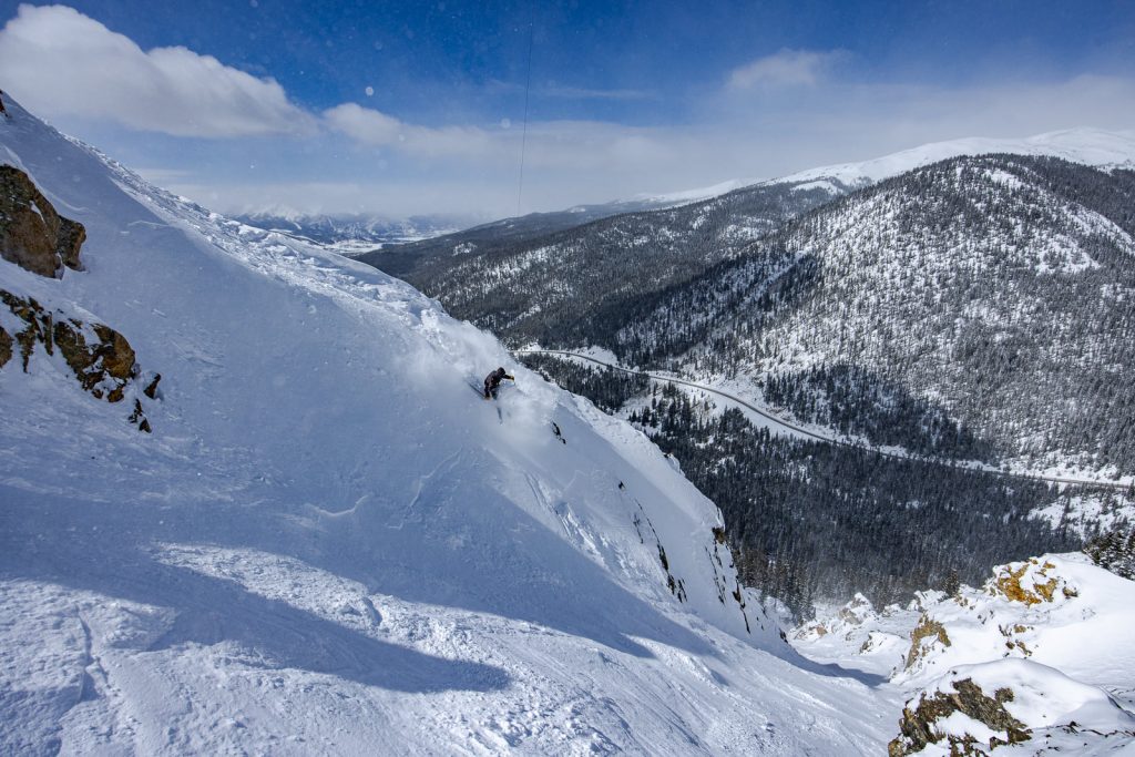
ROCKIES REPORT Several snowstorms in the Rockies over the past week, but they’ve alternated with very warm weather spells to emphasise the changing of the seasons. Colorado’s Wolf Creek (104/120” / 260/300cm) has the deepest snow in the region but also less than two weeks of its 21-22 season to go. However, snow depths are looking good at centres open through to late May too such as Utah’s Snowbird (44/96” / 110/241 cm).
ROCKIES FORECAST Temperatures are set to climb towards the weekend under sunny skies, hitting the 50s in the valleys and the 40s even up above 10,000 feet.
USA WEST REPORT A snowier week in late March than it was for much of January and February with resorts from California to Alaska reporting 6-12” (15-30cm) of fresh snowfall. Alyeska in Alaska, which has had North America’s deepest snowpack for much of 2022 to date, and Mt Baker in Washington State, which holds the record for the most ever recorded snowfall in a season of any resort in the world, are now neck-a-neck for the deepest snowpack. Alyeska has announced that thanks to all the snow lying it will be staying opening longer into spring than it had planned, opening weekends through to May 15th after the original season-end date on April 24th. It says it has had nearly 17 metres (660 inches) of snowfall so far this season. The weekend opening of April 30 to May 1, May 7-8, and May 14-15 will see access to the remaining snow via the “Ted’s Express” chairlift and then offloading from the “Glacier Bowl Express” chairlift.
USA WEST FORECAST Warm and sunny for the next few days with temperatures heading towards the 60sF at resort bases and well above freezing (potentially low 50s) at the top of the slopes too in California, progressively cooler further north. However, another front will see temperatures drop back down towards freezing with fresh snowfall overnight.
MIDWEST REPORT The ski season is winding down quickly in the Midwest with more and more centres ending their 21-22 seasons and switching to activities like golf and mountain biking. However, a few dozen areas are still open and some have posted fresh snowfalls in the past seven days. Granite Peak Ski Area (18/36″ / 45/90″), in Wisconsin, was one of them with six inches (15cm) more snowfall reported going into the weekend. There was also snowfall reported in Michigan and Minneapolis. So there’s definitely still some wintery weather around with temperatures fluctuating between a few degrees below freezing and ten degrees above.
MIDWEST FORECAST A mostly sunny prospect for the next few days with temperatures climbing up into the 50s Fahrenheit for some. Some areas may get precipitation which could be rain as much as snow at times.
USA EAST REPORT Quite a mix of conditions in the east once more over the past week with several snowy days and yo-yoing temperatures from day to day. When not snowing there’s been plenty of sunshine and temperatures well above freezing. At most resorts, the lower mountain is suffering as spring continues to get a grip, but up high there are still ‘primo’ spring conditions at many resorts in the region, and with frequent fresh snow cover at present too. Most areas are open into April and have 80-95% of their slopes still skiable. Smugglers notch (60/120cm / 24/48″) in Vermont is posting the deepest spring base.
USA EAST FORECAST The unsettled weather looks set to continue for the remainder of the week with snow showers forecast, especially for the north of the region. Temperatures range from the high 20s to the low 50s Fahrenheit.
CANADA
CANADA WEST REPORT Quite a snowy week for western Canada with accumulation examples including Big White (222/222cm / 91/91”) reporting a 20cm (8”) accumulation in just 12 hours and Sunshine Village (60/230cm / 24/92”) near Banff, which still has two months of its season left to run, 55cm (22”) in the past week. Both, like most ski areas in the region, remain fully open. Grouse Mountain (300/395cm / 120/158”), above Vancouver on the Pacific coast, has the region’s thickest snowpack.It has been a snowy few days in Western Canada, with some decent dumps for most areas leading in the weekend then more snow falling at many areas at the start of this week too. Temperatures have remained fairly cold too, not getting much above freezing in the mountains in Alberta and inland in BC and only a few degrees warmer down at resort bases. Most ski areas in the region remain fully open and most are staying open for at least another month, or more than two months in the case of a few like Whistler Blackcomb (20/260cm / 8/104”) and Banff’s Sunshine (60/208m / 24/84”). Kimberley (118/370cm / 47/148”) has the region and Canada’s deepest snowpack.
CANADA WEST FORECAST Cool and cloudy with some sunny spells over the coming week, with some snow forecast to end the week in the east of the region around eastern BC and into the Alberta Rockies. Overnight lows around -10C, daytime highs +5C.
CANADA EAST REPORT It was a snowy weekend in eastern Canada with a snow-bearing system moving north from the US, particularly impacting the east of the region. The snowfall started out a little wet on Saturday but became increasingly wintery as the weekend wore on with some areas reporting up to 25cm (10”) of new snow cover to start the week and start springtime. Little change in reported base depths on a week ago with Tremblant (30/300cm / 12/120”) posting the region’s deepest and the most terrain (80km/50 miles/90% of its maximum area) open. The base is much thinner in most other areas, including the region’s second-biggest Mont Ste Anne (35/50cm / 14/20″).
CANADA EAST FORECAST Staying cool for the final week or so of March, although temperatures will increasingly move above freezing. But mostly just by a few degrees, with highs of +3 to +6C. No snow in the immediate forecast, a mixture of sunny and overcast skies.
ASIA
JAPAN REPORT Overall, the deepest snow depths in Japan have dropped another 10% compared to last week with Seki Onsen (400/500cm / 160/200″) now posting a five-metre base, down a metre on the season-high point a fortnight ago. However, there’s fluctuation within that, Geto Kogen (330/480cm / 132/192”) reported a 40cm (16”) accumulation at the weekend and its overall figures moved up a foot (30cm). This is late March so the snow is not quite as light and fluffy as midwinter but this was still a good powder day and the resort aims to stay open through to May 8th. Spring ski season gets underway in Japan later this week with temperatures still hovering a degree or two below freezing.
JAPAN FORECAST Spring is in the air and temperatures are starting to climb up to freezing and just above on Japanese slopes so the thaw is likely to accelerate over the next seven days and precipitation that brought snowfall is increasingly likely to be rain at lower elevations. But snow cover is deep almost everywhere so most slopes should stay open.


