WORLD SNOW ROUNDUP #230

Issued: 16th February 2022
By Patrick “Snowhunter” Thorne
European Roundup
North American Roundup
Asia Roundup
WORLD OVERVIEW
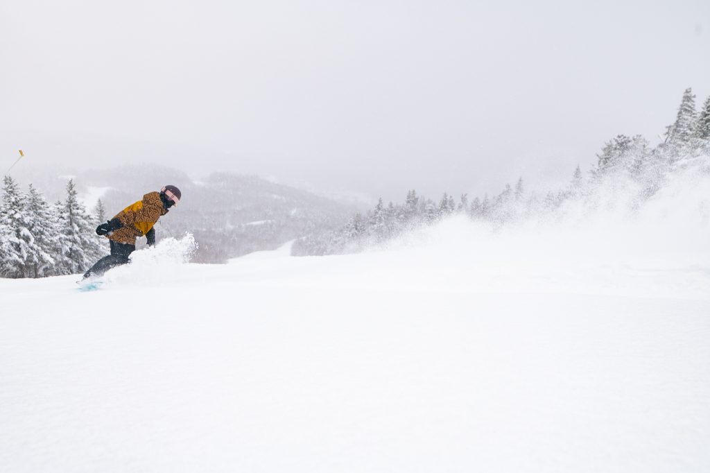
Some snowfall, if not a huge amount, in most areas of the world over the past seven days. Even New Zealand’s Mt Hutt reported 10cm (4″) at the weekend and it is still summertime there. In Europe, there was light to moderate snowfall across the Alps with some snowfall reported in the Dolomites and Pyrenees. Snowfall too up in Scotland and Scandinavia.
There’s been little change in the weather trend of the past few weeks now in North America with continuing dry, sunny and rather warm weather in the west, cold and snowy in the east. With dry and warm weather for nearly two months up to Christmas-New Year week and now dry warm weather for nearly two months since, most western North American ski areas saw more snow in those 5-7 days than they have the other three months of the season combined now.
EUROPE INTRODUCTION
There’s been snowfall across much of the continent. For the Alps, these were the third and fourth snowfalls of the month in the east, the third in the west. More unusually for 2022 so far there was a little fresh snowfall down in the Dolomites and Pyrenees to start the week too. Scandinavia saw more snowfall too and it’s a gradually improving picture, hopefully, in the Scottish Highlands.
AUSTRIA
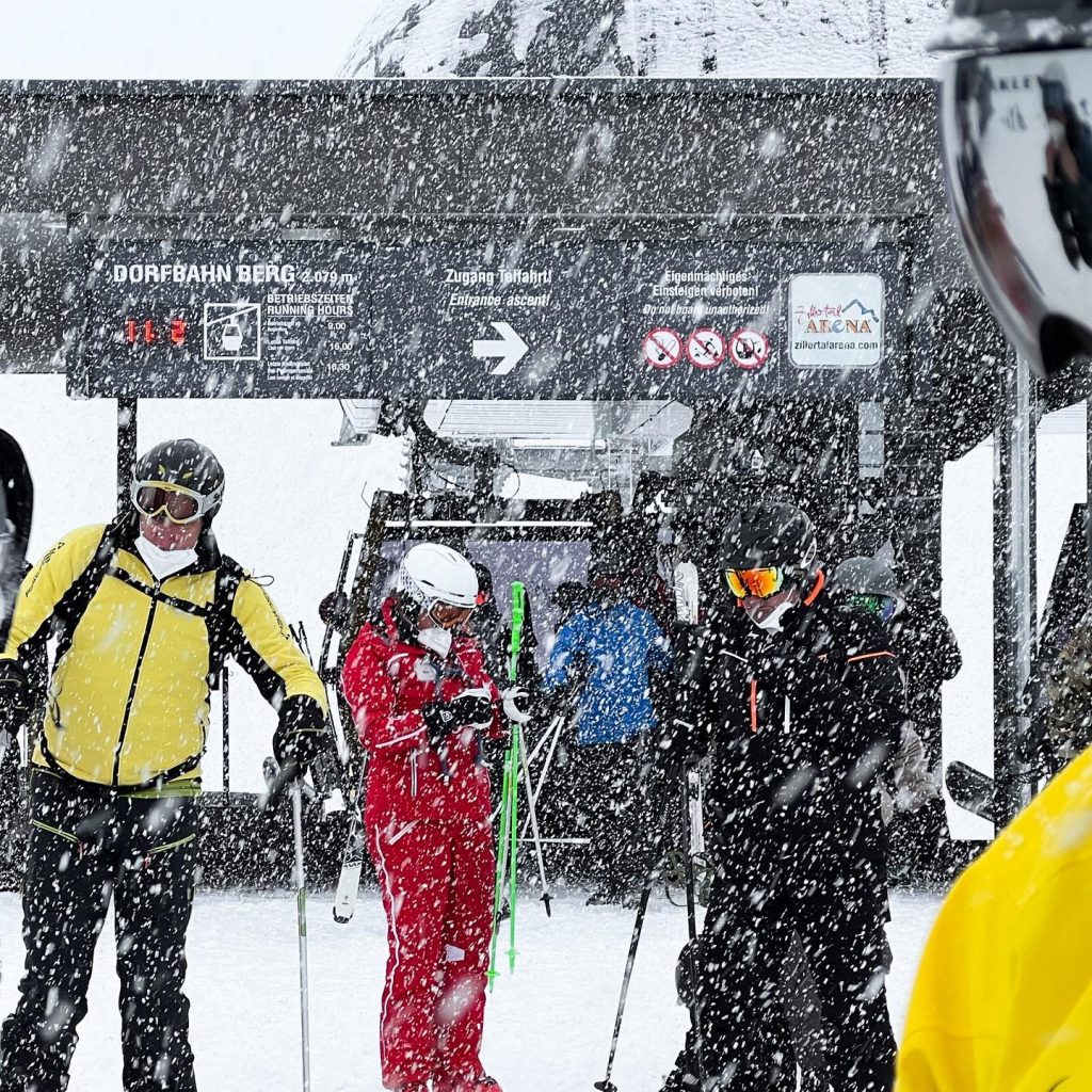
AUSTRIA REPORT Much of Austria enjoyed their third successive Friday of snowfall at the end of last week, but the falls were not quite so big as the previous two or as long-lasting, most seeing 5-15cm, (2-6”) in 24 hours or less. Although a select few saw as much as a foot (30cm). Otherwise, conditions have been mostly dry and often sunny across the country, which is currently posting the deepest snowpack in Europe thanks to those big storms in the first week of the month. That said, Loser (60/330cm / 24/132”) still has the deepest snow on its upper slopes in the country, but that stat is down 20cm (8”) on a week ago as all the fresh stuff has settled. The Skiwelt (100/160cm / 40/64”), Saalbach (85/185cm / 34/74”) and Arlberg (145/260cm / 58/104”) region all have virtually the same amount of terrain open, about 250km (157 miles) of slopes apiece, the largest areas in the country. Temperatures have been getting above freezing at the warmest part of the day across the country at all altitudes, just a few degrees above up high but as much as +10C in resort.
AUSTRIA FORECAST After the past few sunny days, there’s a trend towards lowering temperatures and more clouds through the remainder of the week and the return of snowfall from the north from Friday.
SWITZERLAND REPORT Following another sunny weekend it’s snowy times in Switzerland through midweek with significant snowfalls underway and expected to continue through to Friday across most of the country. It’s good news as bases have not changed much over the past few months now and, if anything, have been going in the wrong direction. Laax (65/275cm / 32/110”) currently has the deepest base in the country and should get 20-30cm (8-12”) of snow from the current storm. The 4 Valleys (35/70cm / 14/28”) has the most terrain open in the country, about 85% of their 400km (250 miles) plus of terrain.
SWITZERLAND FORECAST As mentioned, the current snowfall is expected to continue through to late Thursday or early Friday across most of the country with 30-60cm (12-24”) accumulations expected. No doubt, avalanche danger levels will rise. Skies clearing at the weekend, although some may see more snowfall by Sunday. Temperatures staying low.
FRANCE REPORT It has been the turn of the western Alps to get some snowfall with storm clouds moving in during the last few days after another sunny weekend on French ski slopes. Accumulations of 15-30cm (6-12”) have been widely reported with the snow still falling as we complete this week’s report. This has just about switched favour back to the Alps after an ongoing settling of the snowpack led to Porté Puymorens (80/260cm / 32/104”), in the Pyrenees, going back to the top spot for the country’s deepest base as La Clusaz (60/250cm / 24/100″), which had held that position for a few weeks, dropped back down. The snow in the Pyrenees has now been lying for over two months with few top-ups in the meantime but continues to provide a deep base. That said, it is snowing there too now (see below). Unsurprisingly, the 3 Valley (132cm/182cm / 53/73”) continues to post the most terrain open in the country/continent/world with about 95% of their 600km of slopes open.
FRANCE FORECAST The skies should clear in the latter half of this week with plenty of sunshine once again. Temperatures rising back up to rather warm (+5-+10C) in resort, though around freezing up above 2000m.
ITALY REPORT It has been another sunny week across Italy, except for Tuesday when a front brought moderate snowfall to much of the country, with many resorts reporting 5-17cm (2-6″) of snowfall before the sunshine returned again. Temperatures have been fairly cold with sunshine and snow, just getting a few degrees above freezing down at resort level in the past few days, 10-20 below at 2,000m. The area Cervinia (45/122 cm / 18/49”) shares with Zermatt over the border is the largest open from Italy at the moment with some 280km (175 miles) of runs accessible. Skiworld Ahrntal (83cm/214cm / 33/86″) has the deepest reported snowpack in the country.
ITALY FORECAST Following the snowfall the clouds may linger a day or two in some areas but the sunshine is on the way back and temperatures at lower elevations look like they may climb towards +5 to +10C by the weekend.
GERMANY REPORT There was a little more snowfall at the end of last week on German slopes but most areas have had clear skies and some sunny spells since the weekend began. Temperatures have been a little warmer, getting above freezing (just) even at high elevations in the afternoon, highs of 5-10 degrees above freezing down at resort level. The country’s highest slopes on Zugspitze (250/320cm / 100/128”) still has the deepest base in the country and indeed one of Europe’s deepest, especially for its lower slope depth. Lower altitude Reit im Winkl (57/230cm / 23/92”) is in second place on depth and has the largest ski area open with 40km (25 miles) of slopes.
GERMANY FORECAST A little more sunshine over the next day or two before snowfall is expected to return for the weekend.
SCANDINAVIA REPORT Simply snowy for much of Scandinavia over the past seven days, with temperatures typically in the -5 to -20 Celcius range and some strong winds driving it in at times. Myrkdalen (150/200cm / 60/80”), near, Voss in Western Norway is the first in the region to report a 2m (80”) base this year. The avalanche danger is quite high in some areas of the region after heavy snowfall and strong winds destabilised the snowpack. The resort of Geilo warned that a recent avalanche this week had gone further than before into previously ‘safe’ areas and said that had anyone been caught they would have had little luck even with an airbag due to 2-3m icy boulders in parts of the slide.
SCANDINAVIA FORECAST A very mixed forecast with some areas likely to see the snowfall continuing until later this week, some now drier but expecting another end-of-week dump. However, most do look dry with the chance of the sunshine returning at the weekend. Temperatures, though, staying below freezing.
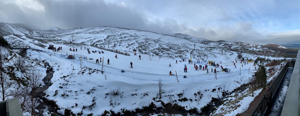
SCOTLAND REPORT A definite improvement in Scotland with the hills turning white through a series of storms last week and Glencoe (20/30cm / 8/16″) opening some lower runs at the end of last week between the violent storm blasts. It and Nevis Range on the west seem to be benefitting the most from the recent snow. But we were back to +10C, in the valleys at least, at the weekend, which did some damage to the new snowpack once again. So really we are predominantly still on the small areas of snow created by all-weather snowmaking machines at the base of slopes at most of the Scottish areas for now.
SCOTLAND FORECAST The forecast continues to be on a knife edge between a good amount of fresh snowfall or damaging rain as temperatures fluctuate between five degrees below and ten degrees above freezing over the coming week. Strong winds at times too.
SPAIN / ANDORRA REPORT The Pyrenees are currently seeing, what is for many parts of the region, the first significant multi-day snowstorm for several months. The snow clouds rolled in on Sunday/Monday and are expected to continue through to the middle of the week bringing light to moderate accumulations of typically 15-30cm (6-12”) though some areas may see more. The region already had the thickest snowpack in western Europe thanks to big accumulations in early December but had slipped a few centimetres behind the Alps. By the time the snowfall finishes in a day or two it may be back to posting the deepest. As it is, Porté Puymorens (80/260cm / 32/104”) in the French Pyrenees, posts the deepest base while Grandvalira (80/13 0cm / 32/52”) in Andorra has the most terrain open with 200km (125 miles) of runs.
SPAIN / ANDORRA FORECAST A return to drier, sunnier weather will follow with the potential for some very warm weekend temperatures reaching +15C in valleys and even +4 to +8C at the top of the slopes
BULGARIA / ROMANIA REPORT It has been a dry week in south-eastern Europe after the snowy start to February. A mixture of sunny and cloudy days with generally excellent conditions and everything open. Temperatures in the five below to five above freezing range. Bulgaria’s Borovets (160/190cm / 64/76”) is posting the most terrain open and the deepest snow in the region with nearly 60km (37 miles of slopes skiable.
BULGARIA / ROMANIA FORECAST It’s looking like full sunshine across the region to see out the week with temperatures slightly warmer, as a result. Daytime highs at resort level touching +10C at times.
CZECH REPUBLIC / SLOVAKIA REPORT It was a largely sunny week in the Slovak and Czech republics with conditions generally reported to be excellent at most centres with the good weather following heavy snowfalls. Temperatures have been consistently cold with few ski centres seeing positive numbers, even down in resort in the afternoon, lows down to 10-15 below freezing. However, things have been more changeable, weatherwise, since Tuesday with more snowfall settling in across both countries. Donovally (80/100cm / 32/40”) reports the region’s deepest snow, Jasna (40/70cm / 16/36”) the most terrain open, around 45km (28 miles).
CZECH REPUBLIC / SLOVAKIA FORECAST Changable conditions with light to moderate snowfall expected to bring 10-20cm (4-8”) of snowfall by the end of the week to many areas. There is a bit of a warm-weather blip forecast for Thursday, which could see lower slopes potentially get rain rather than snowfall, unfortunately.
NORTH AMERICA
NORTH AMERICA INTRO It has been another week of predominantly dry weather in western North America, getting quite warm down at mountain bases and much colder, often snowier weather in the east. There has been up to a 30-degree temperature difference from coast to coast at times. Conditions remain fairly good, if you’re not looking for powder, in the west thanks to the huge snowfalls in late December, which have left all slopes still fully open and the continent’s deepest snowpack still in the west. There has been some fresh snowfall in the far south and the far north with Alaskan ski areas posting the deepest.
ROCKIES REPORT There were a few inches (5cm) of fresh snowfall in Colorado at the start of the weekend, which many resorts claimed was transformative after predominantly dry weather for much of this year. How true that is depends on whom you speak to. After the snowfall, it returned to the 2022 norm of full sunshine but temperatures were cooler since the weekend, not getting much above freezing even down at the base. Park City (40/53” / 101/132cm), in Utah, remains fully open with the largest amount of terrain open in the US. Wolf Creek (81/91” 203/226cm), in southern Colorado, has the region’s thickest snowpack and is also 100% open.
ROCKIES FORECAST It appears to be good news with a 2-3 day midweek period of snowfall due to roll in, potentially bringing the most significant snowfall for several months, if it arrives as expected. 6-12” (15-230cm) of snowfall is forecast by Friday for most resorts in the region.
USA WEST REPORT In North America the dry weather in California is starting to be referred to as ‘historic’ in some media reports as we head towards two months since the last serious snowfall. Although that was such a big one resorts in the area still have plenty of snow lying. Less fresh snowfall in Alaska than in recent weeks but Alyeska (43/160″ / 107/401cm) continues to post the deepest base in the country and indeed the entire continent. Mammoth (70/142″ / 175/355cm) is in second place on both counts and has all runs open. The only real sniff of any snowfall in the last seven days has come to Oregon and Washington State, which reported some fresh snow to start this week after a warm weekend.
USA WEST FORECAST Another week of sunshine and rather warm weather for California but at the other end of the Pacific coast, the snow train looks to be back to making regular drops in Alaska after easing off the past week. Totals of around 20” (50cm) more by the end of the week are forecast. In between these two ends, it’s midway between the two in the Pacific northwest with overcast skies and cold temperatures for Oregon and Washington but not much snow forecast.
MIDWEST REPORT Ski areas in Michigan seemed to get the best of snowfalls at the end of last week which brought up to 8″ (20cm) of fresh snow cover to the region’s slopes. It has remained very cold, if anything, reaching new lows with some centres seeing below zero Fahrenheit at times, and mostly dry. Although most areas have seen at least an inch or two of snowfall. Ski areas in Michigan are also posting the deepest snowpack in the midwest, topped by Crystal Mountain (48/60″ / 120/1590cm), which has every run open.
MIDWEST FORECAST After the very cold weather of the past month, a brief warm spell midweek could see temperatures get a few degrees above freezing and ironically a little rainfall before a rapid plummet back to double digits below freezing once more. Not much snow in the forecast but some for areas including Michigan, again, and South Dakota in the latter half of the week.
USA EAST REPORT After the snowy January and first half of Feb, it has been a drier week, on the whole, in the east. Although with some snowfall at the end of last week in the north and a light accumulation on Tuesday too. There was a brief but worrying warm weather blip, particularly in the south of the area where record highs for early Feb lasted about 24 hours. We’re now back to well below freezing once more though. Killington (20/28” / 50/71cm) has the most terrain open in the region, 100% of its terrain, Smugglers Notch (24/48” / 60/120cm), also fully open and also in Vermont, has the deepest snowpack.
USA EAST FORECAST Dry for the next few days, initially with overcast skies then clearing to full sunshine at the weekend. The worrying thing in the forecast is very warm temperatures, potentially 10 to even 20 degrees above freezing at bases and well above freezing up high too.
CANADA
CANADA WEST REPORT It has been largely dry in western Canada again over the past week. However, skies have been overcast much of the time and there are signs of a change in the air. Some resorts reported fresh snowfall on Tuesday. But temperatures remain rather warm, above freezing, at resort bases, cold (5-10 below freezing) at altitude. The continent’s largest ski area, Whistler Blackcomb (20/236cm / 8/94″), continues to report its terrain fully open, as do most of the other ski areas in the region. On the coast, daytime highs at the mountain base have been reaching double digits again. Kimberley (95/295cm / 38/118″) has the deepest reported base in the west.
CANADA WEST FORECAST After the midweek snowfall it’s looking drier with sunny spells for the rest of the week. Temperatures were cooler than they have been, not getting above freezing even at bases in the Canadian Rockies, highs of +5C at lower elevations over on the Pacific coast.
CANADA EAST REPORT In contrast to western Canada, it has stayed cold and snowy for another week in the east with the consequence that the region’s largest area at Tremblant (30/305cm / 12/122”) has broken through the 3 metre/10 feet upper slope base depth mark and overtaken ski areas in BC to post Canada’s deepest base. That’s quite a change from December when warm, wet weather in the east left most skis areas struggling to open much terrain at all. Temperatures did rise in the region to not far below freezing in the latter half of last week but plummeted back to 20 below at the weekend with more snow falling.
CANADA EAST FORECAST Overcast skies and general cold temperatures (10-20 below freezing) except for Thursday when there’s currently a rather worrying forecast of a temperature spike and potential rain instead of snow. It’s looking more promising again by the weekend though when more snow is forecast.
ASIA
JAPAN REPORT Japan had a public holiday on Friday so there was a long weekend for the country’s skiers to enjoy. Rumours of the border possibly re-opening to allow international skiers in for the final two or three months of the season persist. After a very snowy period, there have been a few dry days over the past week with sunny skies. But temperatures have stayed low, 5 to 15 degrees below freezing. Niseko (240/400cm / 92/160″) has nonetheless hit the four-metre mark with several feet more snowfall over the past seven days. Kiroro (380/530cm / 152/212”) has seen its base depth increase another 40cm (16”) over the past week and is the first in the world this season to go through the 5-metre base depth mark.
JAPAN FORECAST It appears that the period of heavy snowfall over the past few months is easing a little with Japan forecast to receive lighter snow showers but also longer dry spells with mostly overcast skies with occasional sunny periods. Temperatures in the range of freezing down to 10 degrees below.


