WORLD SNOW ROUNDUP #167
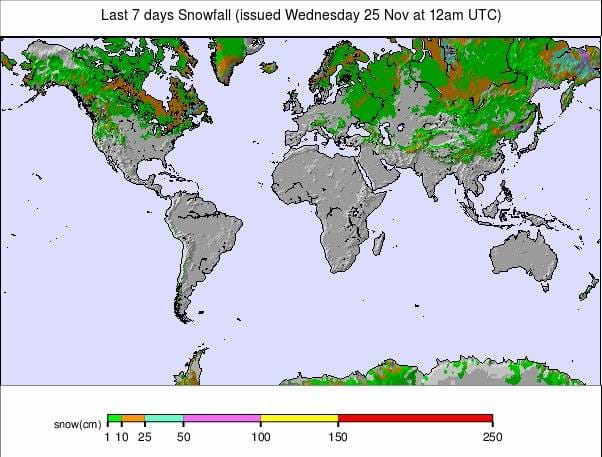
Issued: 25 November 2020
By Patrick “Snowhunter” Thorne
European Roundup
North American Roundup
Asia Roundup
EUROPE INTRODUCTION
The virus and the battle to get infection rates down, unfortunately, remains the main talk in ski areas for another week as most of Europe passes the mid-way point in their November lockdowns. Individual countries are now making decisions on how their lockdowns end and whether ski areas will reopen.
There is much debateas to whether that’s a good idea for general health and wellbeing, or a bad idea to encourage travel and get people together. All this debate is distracting skiers from the thing that would be dominating in their minds. It’s been dry and often warm in most ski areas and there’s not a lot of snow around, some areas would be delaying their openings anyway even if there weren’t the virus lockdowns. The good news is that after another dry, sunny week it’s looking colder then snowier, from this weekend.
Up in Scandinavia, which has also been too warm for much of November, it has been getting colder too and ski areas have been running snow-making systems again and better still, turning white as natural snowfalls.
AUSTRIA
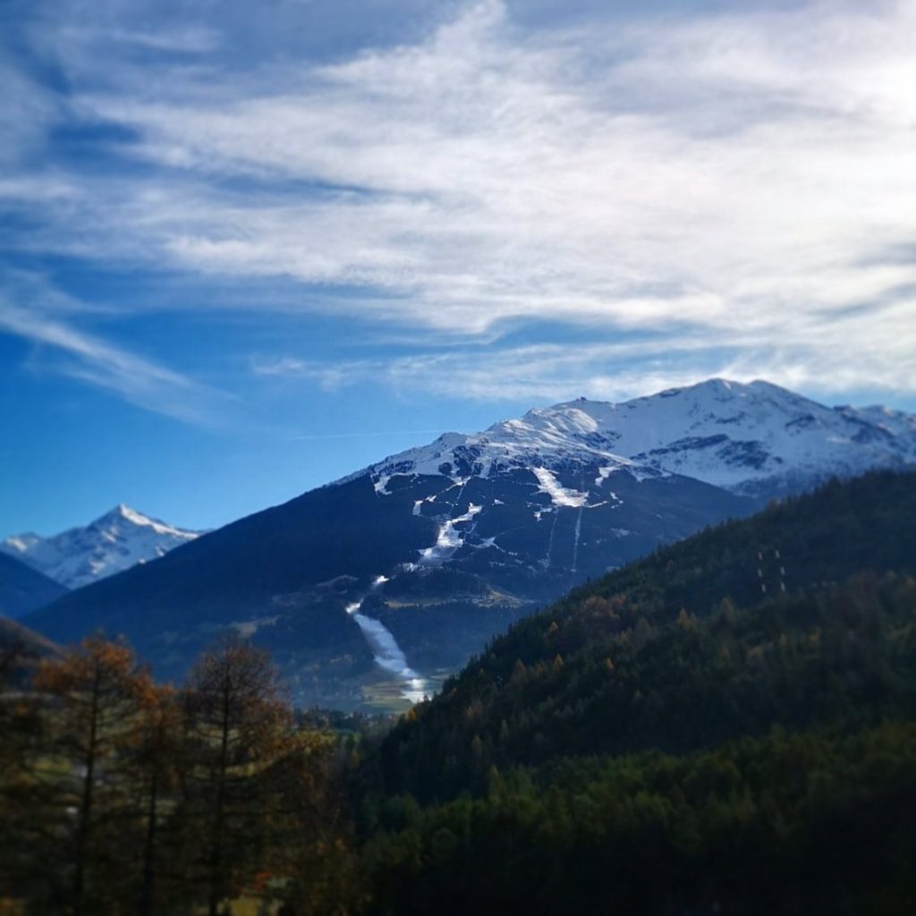
AUSTRIA REPORT| We’re now more than half way through Austria’s November lockdown which now extends into the first week of December, so all ski areas remain closed. There’s not been much fresh snowfall, again, but it has been cold enough at times for snow-making systems to fire up on higher slopes. Up on the glaciers, conditions remain good after the September and October snowfalls with temperatures generally staying at or below freezing at high altitudes.
It has just been mostly dry and mostly too warm for snowfall or snow-making lower down, so far. The Stubai hosted a World Cup freestyle competition at the weekend and Lech-Zurs is due to host more World Cup racing with a competition this weekend, delayed from the middle of the month.
AUSTRIA FORECAST| It does not look great for the end of November if we’re looking for snow with nothing much in the forecast and, in fact by contrast, still more wall-to-wall sunshine into the weekend. In the longer term though, the forecast is more promising with temperatures dropping below freezing day and night even in the valleys and snow is expected in many areas to start next week.
SWITZERLAND
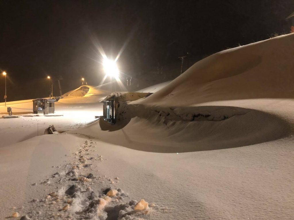
SWITZERLAND REPORT| Swiss resorts continue to boast the deepest snow in Europe and remain the only centres open in the Alps, although the November lockdowns in Austria, France, Italy and Germany are nearing their ends, so the competitions may be back over the next few weeks. There has been some fresh snow up high, but not much, over the past week with temperatures cool but conditions largely dry and sunny. Zermatt (0/220cm / 0/88”) continues to post the deepest base in the world at present, up on Europe’s highest runs.
Saas-Fee (0/210cm / 0/84″) remains the only area open that already has more than 50km (30 miles) of runs skiable. Most of the 111 open Swiss areas have only been open at weekends through November but Davos (5/70cm / 2/28″) is now open daily and most of the rest will be from this coming weekend. Adelboden and Leukerbad are among half-a-dozen more Swiss areas expected to open for their seasons this weekend.
SWITZERLAND FORECAST| The rest of this week will be dry and sunny once more but temperatures are set to plummet in the latter half of this week and there’s a hope of snowfall, at last, coming in from the east from the weekend.
FRANCE
FRANCE REPORT| France too remains in lockdown and the country’s president was about to announce the plans for coming out of it as we go to press with this week’s snow report. As it is, ski areas remain optimistic that they will be able to start opening from early December, many of them on the weekends they had always intended to. It has been cold enough for snow-making systems to fire up in many areas but there’s a lack of natural snow cover on lower runs and it has remained mostly dry and sunny this week.
FRANCE FORECAST| As with the rest of the Alps the weather is looking dry and sunny for the coming week but there are signs of change going into the weekend with much colder weather right down to resort level, which should allow snow-making systems to fire up, as well as natural snowfall, hopefully early next week.
ITALY
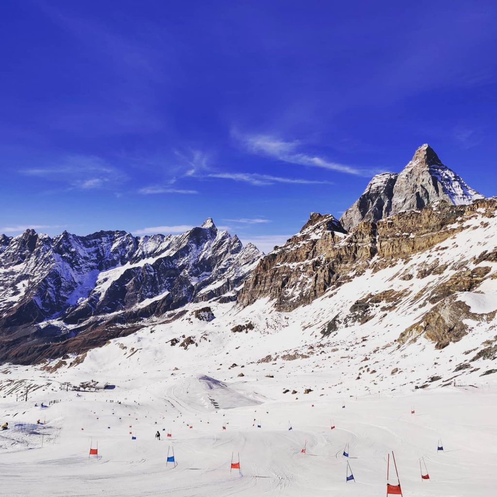
ITALY REPORT| Italy remains in its November lockdown but this final weekend of the month would normally have seen a number of the more snow-sure Italian resorts opening for the winter season. The three areas that were open when the lockdown started would also be open this week and they have been open for race team training if not to the general public. Cervinia (0/220cm / 0/88″) posted pictures or racers competing in glorious conditions at the weekend.
It has indeed been another largely sunny week with temperatures staying around freezing up above 2000 metres but warmer in the valleys. A number of Italian resorts have been running snow-making systems during cold spells though. It would be interesting to know if any would have had to delay opening due to lack of snow cover if they were not forced to stay closed anyway. Currently, its unknown if Italian ski areas will be allowed to open next month
ITALY FORECAST| There’s little change in the forecast for the coming week with more sunshine expected in Italy and little or no precipitation. Temperatures should stay at or below freezing most of the time above around 2000m and 5-15 degrees above freezing at lower elevations, which may challenge pre-season snow-making efforts for some.
GERMANY
GERMANY REPORT| Germany is also currently in a lockdown and also enjoying mostly warm, dry, sunny weather, not the ideal ingredients for a snowy start to the season. The Zugspitze Glacier, the country’s highest area, has continued to post images of very snowy conditions up high. Most German ski areas don’t usually open until mid-December anyway.
GERMANY FORECAST| Sunny weather in Germany until the weekend when snow clouds should roll in across much of the country. Temperatures here too are set to plummet from Thursday/Friday onwards ahead of the snow.
SCANDINAVIA
SCANDINAVIA REPORT| Scandinavia has finally seen a return to colder temperatures and many resorts have finally seen their hills turning white, not just ribbons of machine-made snow on brown hillsides. Levi (25/50cm / 10/20″), in Finland, hosted World Cup ski racing but there remain far fewer areas open at this time of the year than usual, partly due to the warm weather, partly the virus; however, many of the big names look like they’ll start to open this coming weekend.
In terms of the pandemic in Scandinavia, two different approaches seem to be emerging. In Norway, the country’s assistant health director, Espen Rostrup Nakstad, has said this week that with current infection rates the government will not dissuade people from travelling to ski destinations. He says travelling by car means the risk is low. In Sweden though, several destinations have already discouraged people from visiting, as they did in the spring when there was no national lockdown because they fear the potential increased pressure on the health services.
Hemsedal was the first Norwegian ski area to lockdown last winter but this time, so far, the local medical authorities say it is safe to visit, so long as the country as a whole keeps control of the second wave. Finland is reported to have kept infection rates low in the second wave due to tight controls.
SCANDINAVIA FORECAST| There’s little or no snow in the forecast but it should be staying cold at least so snow-making systems can continue to work. There’s little sign of temperatures getting above freezing over the coming week, day or night, although the limited daylight hours in the region now look predominantly sunny, not snowy, as we enter December.
SCOTLAND
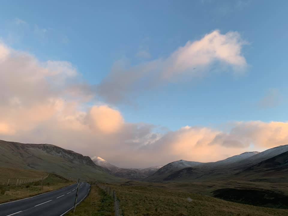
SCOTLAND REPORT| Scotland has seen colder temperatures in recent days and some precipitation too, leading to the Highlands turning white. There’s no sign of any of the country’s five ski areas getting close to open as yet; however, all but Nevis Range are expecting to open before Christmas, but perhaps not much before.
SCOTLAND FORECAST| After the recent snowfall it’s looking like it should be drier in Scotland for the remainder of this week, but temperatures should stay low, which is good news for the existing snow on the tops.
SPAIN / ANDORRA
SPAIN / ANDORRA REPORT| After the snowy October and early November things have been rather warmer and drier in the Pyrenees too and ski areas, which had hoped to open in late November, are now looking towards the first weekend of December at the earliest. Sierra Nevada, Spain’s highest resort, has actually announced it is unsure when it will open due more to pandemic concerns than snow cover. Baqueira Beret says they’ll open on 11th December, they hope.
SPAIN / ANDORRA FORECAST| Further east in the Alps it is looking more promising in the Pyrenees towards the end of this week and into the weekend. Significant snowfall is forecast from Sunday after temperatures drop below freezing day and night later this week. Until then, more sun is forecast.
BULGARIA / ROMANIA REPORT
BULGARIA / ROMANIA REPORT| It’s looking more promising than it has the past few weeks in southwestern Europe with Bulgarian ski areas reporting a light dusting of snow on higher slopes and weather cold enough for snow-making systems to fire up too. Ski centres are currently looking to open in early/mid December in most cases.
BULGARIA / ROMANIA FORECAST| Not yet ideal conditions as whilst it is getting well below freezing on higher slopes overnight it is still climbing up to 10 degrees above freezing in the valleys during the daytime. The result is some limited snow-making opportunities, but not much yet.
Colder weather and a little snowfall is forecast for the weekend.
CZECH REPUBLIC / SLOVAKIA
CZECH REPUBLIC / SLOVAKIA REPORT| Whilst northeastern Europe has been sharing in the sunshine that has been dominating much of Europe for much of November, including this week, it has been colder here than further south and west in the Alps and temperatures have rarely been getting above freezing this week, allowing many resorts to fire up snow-making ahead of opening.
CZECH REPUBLIC / SLOVAKIA FORECAST| It will stay cold but sunny for the next day or so but then snowfall is expected to arrive from the north and east later this week before it reaches the Alps. Significant snowfall is expected from Thursday right through the weekend.
NORTH AMERICA
NORTH AMERICA INTRO| There’s been a mass opening of ski areas across the USA in the past week and more than half of the world’s open areas at present are now found in the US. A dozen or so ski areas are also open in Canada.
The only other country where the number of open ski areas is in double figures is Switzerland. Snow conditions have remained fairly good on the western side of the continent and improved a good deal in the east, where half a dozen resorts opened in states including Massachusetts, Vermont and Maine over the weekend.
There’s not been much natural snowfall here but it has been cold enough for resorts to use snow-making systems to create runs at last. Against all this good news, virus numbers continue to surge in the US and ski centres are very nervous that their states or province may require them to shut down again. There’s a concerted effort to ask skiers and boarders to ensure they abide by pandemic operating rules to help “save the season.”
ROCKIES
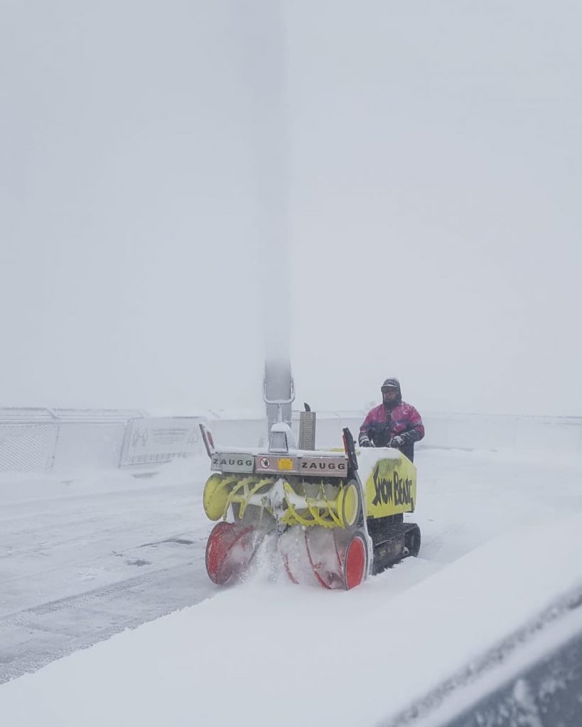
ROCKIES REPORT| Ski areas have been opening up fast in the US Rockies over the past week, stressing the need to operate safely as pandemic cases rise and restrictions increase. There has been more fresh snowfall too with ski areas in Colorado reporting up to eight inches (20cm) more snowfall in the past few days.
The largest ski area in the US, Park City (8/20″ / 20/50cm), when fully open will be among the latest areas to be operational, whilst Lookout Pass (76/87″ / 190/218cm) is posting the deepest base in North America and just an inch less than the current deepest in the world reported by Zermatt (although that includes summer accumulations up on the glacier). Already open areas like Breckenridge (10/18″ / 25/46cm) have been opening more terrain but there are frequently reported issues with all available lift passes selling out for the day at many areas due to limited availability because of limited open terrain and pandemic social-distancing sales restrictions.
ROCKIES FORECAST| It’s a dry and sunny week ahead for the Rockies. Temperatures should stay down below freezing on most mountain slopes but climb up in the daytime to above freezing down at the base at lower lying resorts, not so much at the higher areas in Colorado though.
USA WEST
USA WEST REPORT| Ski areas have been opening on the western side of the US over the past few days from the Arizona Snowbowl in the south up to Mt Baker (3/61″ / 7/152cm) in the north. Big-name areas like Heavenly, Northstar (18/26” / 45/65cm) and Squaw Valley have also opened in California, joining already open Mammoth and Mountain High. The atmosphere is both excited to be re-opening but also nervous with rising coronavirus cases and resulting restrictions.
Tahoe is a high-risk area and indoor dining is currently closed, although ski areas can operate with pandemic spread restrictions in place. As to the snow, there’s been 4-8 inches (10-20cm) of fresh for many in recent days although conditions are borderline in places. Washington State is already posting some of the deepest snow in the world.
USA WEST FORECAST| The week ahead looks predominantly sunny in the west, with temperatures generally well below freezing (as much as 15-20 degrees below at times for some), although climbing up to positive temps at times at resort level in the daytime.
USA MIDWEST REPORT
MIDWEST REPORT| Not much fresh snow to report in the midwest but it has stayed colder and a second Minnesota ski area, Hyland Hill (8/16” / 20/40cm) has opened, joining Wild Mountain (12/18” / 30/45cm) which was the first resort in North America to open for the season last month. Trollhaugen (12/18″ / 30/45cm), in Wisconsin, also remains open and reported an inch (3cm) of fresh snowfall at the weekend. It has two chair lifts and three rope tows open serving seven runs and two terrain parks. More midwestern ski areas have been opening through the week.
MIDWEST FORECAST| The coming week is looking predominantly dry with a mix of sunny and cloudy weather. Temperatures should remain close to freezing, varying between around five degrees above and below depending on the resort.
USA EAST
USA EAST REPORT| Despite the challenges of warm weather the season has finally got underway at two northeast ski areas, Killington (0/18” / 0/45cm) in Vermont and Sunday River (2/12” / 0/30cm) in Maine. Both used snow-making to create ski runs so have limited terrain open so far and with pandemic restrictions limiting numbers, fewer ski passes available. There was a little snowfall to start the week but it has been mostly dry. The good news though is that after the warm-weather through mid-November which led areas to delay opening, it has now got much colder and so snow-making systems have been fired up.
USA EAST FORECAST| Dry and cold sums up the weather in the northeast for the coming week, which should allow more centres to open before Thanksgiving as a result of snow-making. A mixture of sunny and cloudy days.
CANADA
CANADA WEST
CANADA WEST REPORT| The ski season is continuing to get going in Canada where snow conditions are arguably the best in the world at present.. Big-name resorts, Big White (117cm/117cm / 47/47″) and Sun Peaks (95/95cm / 38/38″) are among the latest to open, with Big White posting the deepest base in North America (and probably the deepest fresh snow base in the world) from opening day. Vancouver’s local ski hill at Grouse Mountain (77/77cm / 28/28″) has also opened joining nearby Cypress Mountain (50/60cm / 20/24″) to take the number of larger ski areas to open in BC to four and the Canadian total into double figures.
They join Switzerland and the USA in that achievement for the start of winter 20-21. Coronavirus restrictions are still limiting access for some skiers and boarders though with Cypress Mountain among those again selling out of lift passes at the weekend.
CANADA WEST FORECAST| After some midweek snowfall a dry spell is expected for western Canada from Thursday onwards with mostly sunny weather and some light cloud. Temperatures should remain well below freezing day and night, however, maintaining snow quality and quantity.
CANADA EAST
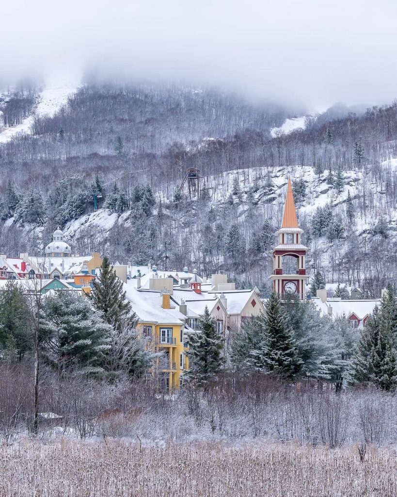
CANADA EAST REPORT| It’s not been a great November in eastern Canada up to now but it has finally turned much colder and snowier with 12cm (5 inches) of snowfall reported on Monday. Mont Saint Sauveur (20/40cm / 8/16″) has re-opened and although ski centres like Tremblant have been forced to delay their planned opening dates snow-making systems have been able to fire up again now and it is good to see natural snowfall on the ground too.
CANADA EAST FORECAST| Changeable weather for eastern Canada with temperatures staying just about at freezing, a few degrees below or above. A mixture of cloudy, sunny and snowy weather with frequent changes in conditions.
ASIA
JAPAN REPORT| The early snowfall in Japan a little over a week ago was unfortunately followed by another warmer spell which set back snow-making and hopes of natural snowfall at a number of the country’s larger areas, some of which had been expected to open this coming weekend. It has been colder and snowing again to start this week with ski areas like Niseko, Furano and Nozawa reporting 10-25cm (4-10 inches) of snowfall on Monday/Tuesday. Opening dates look set to drop back to 5th-12th December now.
JAPAN FORECAST| The forecast is for temperatures to stay fairly low over the coming week with a mixture of dry and snowy days. Unfortunately, the snow may still be rain at times in some areas as it’s not that cold. Thursday and next Tuesday are currently looking best for more snow.


