North America Weekly Snow Roundup #306
- Pacific Northwest records huge 122cm (4ft) snowfall
- Western Canada sees strong late-season powder refresh
- Rockies remain mixed with lighter snowfall totals
- Midwest hit by late-season storm and strong winds
- East Coast swings between spring thaw and winter cold
North America Intro
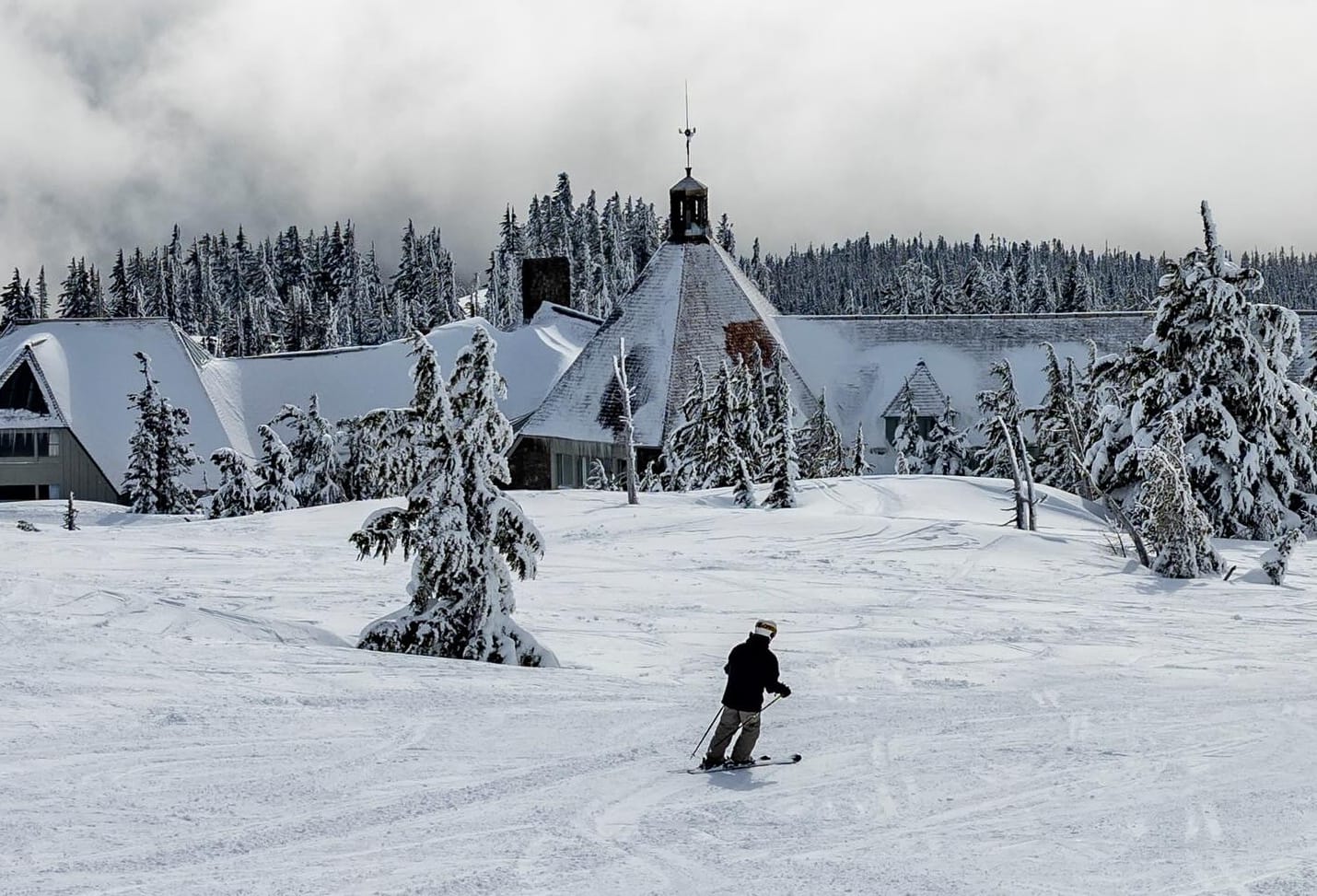
The Pacific Northwest delivered the strongest late-season snowfall on the continent this week. Oregon’s Timberline logged a huge 122 cm (4 feet) in 72 hours, with other regional resorts also reporting major accumulations. In Canada, Mt Seymour picked up 60 cm (two feet), while Alberta resorts added up to 52 cm (21") near Banff.
Further south, the US West remains split, with California seeing early closures while Oregon and Washington benefited from the storm cycle. The Rockies saw lighter 12–25 cm (5–10”) top-ups, although Jackson Hole recorded 30 cm (12”) and pushed its seasonal total beyond 300 inches. In the east, Canada has returned to more consistently wintry conditions after a brief warm spell, while the US Northeast continues to swing between spring warmth, rain and renewed cold, with strong winds impacting operations at times.
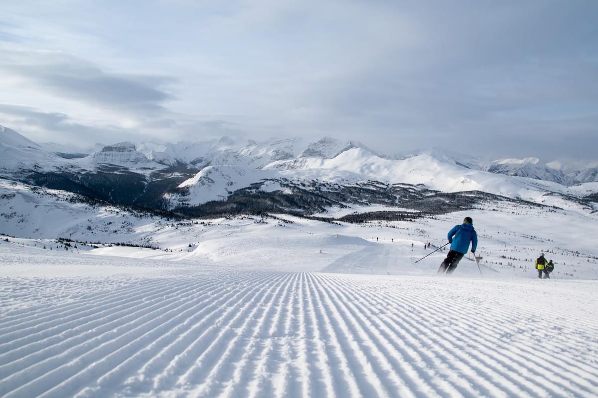
Western Canada Snow Report
Western Canada has seen a solid late-season refresh, with the North Shore mountains recording the biggest totals. Mt Seymour (160/300 cm / 64/120”) posted 60 cm (24”), while Cypress Mountain (180/260 cm / 72/104”) and Grouse Mountain (200/260 cm / 80/104”) both reported around 45 cm (18”).
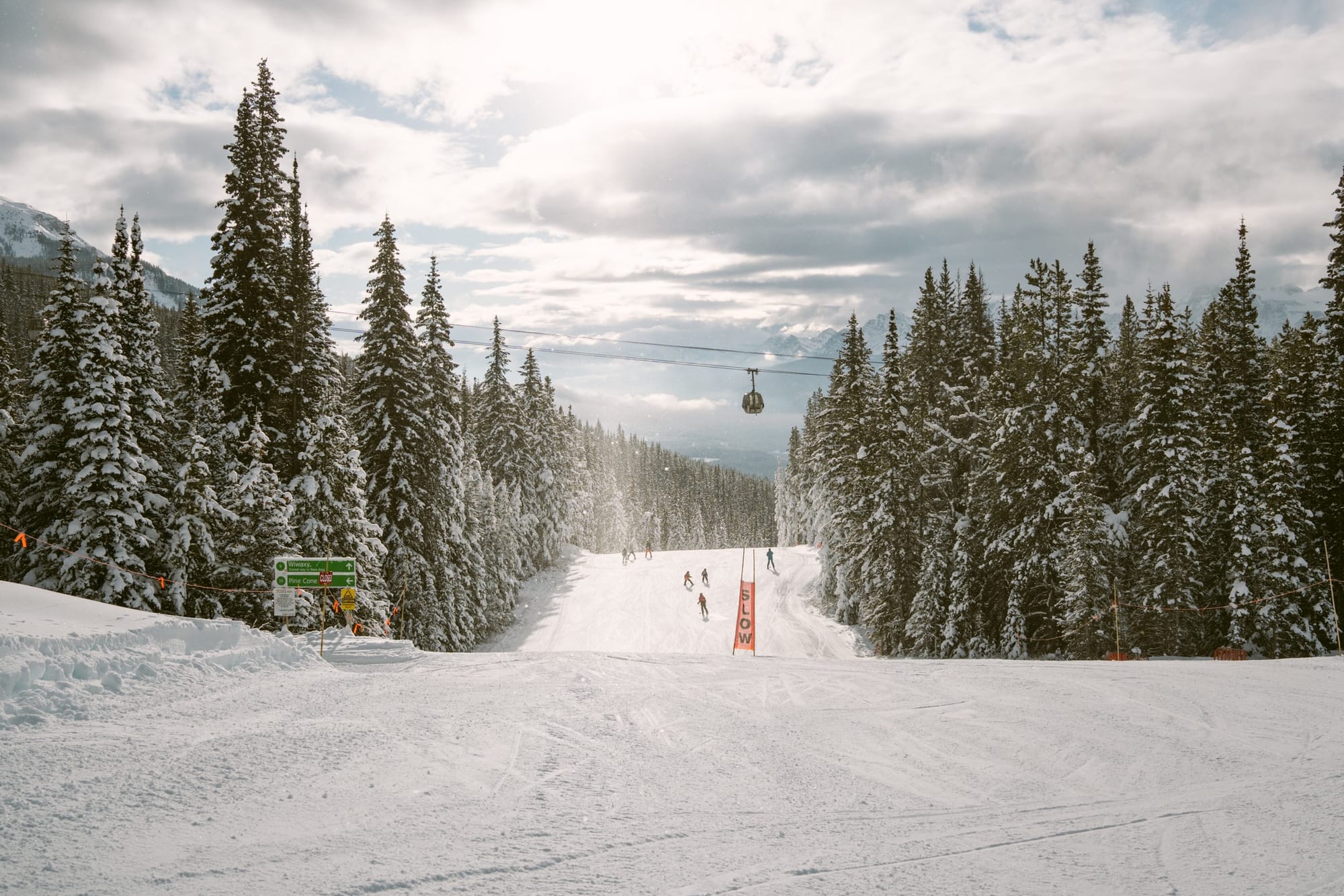
Inland resorts across Alberta and interior British Columbia also saw healthy snowfall, with Banff’s Norquay posting 52 cm (21"). Cold temperatures are maintaining firm mid-winter snow conditions at higher elevations.
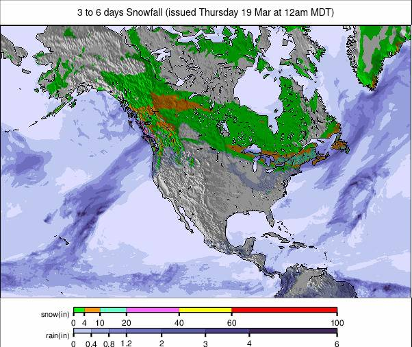
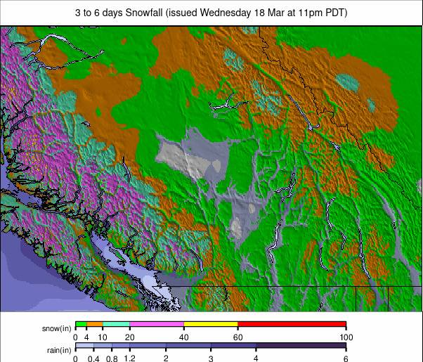
Western Canada Snow Forecast
A cold, mostly settled pattern continues, with summit temperatures between –15°C and –22°C and slightly milder conditions nearer the coast.
Light snowfall is expected at higher elevations, while lower coastal slopes may see mixed precipitation. Clearer nights will help preserve snow quality.
Eastern Canada Snow Report
Eastern Canada has returned to a cold, wintry pattern, with regular light snowfall and low freezing levels across Quebec and Ontario. A brief warm spell early in the week brought rain and sleet, but colder conditions quickly returned. Tremblant (30/60 cm / 12/24”) and Mont-Sainte-Anne (30/50 cm / 12/20”) report firm, reliable surfaces, while Le Massif de Charlevoix remains among the coldest with consistently sub-zero temperatures.
Eastern Canada Snow Forecast
Very cold conditions continue, with temperatures widely between –15°C and –28°C in Quebec and slightly milder in Ontario.
Mostly dry in Quebec, while Ontario may see occasional mixed precipitation. Snow conditions remain well preserved.
US West Coast Snow Report
Conditions remain mixed along the US West Coast. Some California areas, including Mt Shasta, have closed early due to limited snowfall. Further north, Timberline recorded one of the biggest storms of the season, with 48 inches (four feet) of snowfall, temporarily closing during the storm and raising tree well concerns afterwards.
Mt Baker and Mt Hood Meadows also reported around 90 cm (three feet). Snowfall continued through the weekend before conditions turned drier and milder.
US West Coast Snow Forecast
California stays spring-like with sunshine and mild temperatures, while Oregon and Washington turn colder with further snowfall expected at higher elevations.
US Rockies Snow Report
The Rockies have seen a mix of sub-zero temperatures and light to moderate snowfall, generally delivering 12–25 cm (5–10”). Jackson Hole recorded 30 cm (12”) and has now exceeded 300 inches for the season.

Resorts across Colorado report the most terrain open all winter, with some advanced terrain only recently becoming accessible. Utah’s Alta (150/270 cm / 60/108”) continues to post the deepest snowpack in the region.
US Rockies Snow Forecast
Mostly sunny conditions dominate, with limited snowfall and gradually rising temperatures through the week.
US Midwest Snow Report
Many Midwestern ski areas are closing or moving to limited operations as the season winds down. However, a late-season storm at the start of the week delivered fresh snowfall alongside strong winds.
The system, named Storm Iona, was followed by a return to colder conditions after record warmth the previous week. Mount Bohemia (225/225 cm / 90/90”) continues to report the region’s deepest snow and remains fully open.
US Midwest Snow Forecast
A variable spring pattern continues, with a mix of cloud, sunshine and occasional light snowfall, and increasingly softer snow conditions by afternoon.
US East Coast Snow Report
The Northeast continues to see a mix of winter and spring conditions, with fluctuating temperatures, rain and strong winds. Afternoon temperatures have reached into the 50s°F at times, while colder spells continue to return intermittently. Despite disruptions, resorts with deeper snowpack, including Stowe (55/127 cm / 22/51”), still maintain the majority of terrain open.

US East Coast Snow Forecast
A colder pattern holds, with temperatures remaining below freezing at many elevations.
Conditions stay mostly dry with occasional flurries, with firm morning surfaces softening slightly later in the day. Temperatures may rise later in the week but should remain cold enough to preserve coverage.