North America Weekly Roundup #234
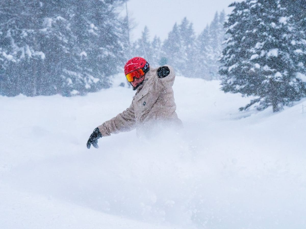
A colder and snowy end to March than in recent weeks across much of North America. It's been snowing hard on the East Coast bringing a boom in late-season skiers, according to local media reports, enjoying up to three feet (90cm) of fresh snowfall over the past week.
Midwest Ski Areas Eye Easter Reopenings Amidst Surprising Snowfall Surge
- Abundant snowfall across the Rockies and West Coast, promising excellent powder conditions.
- Potential reopening of ski areas in the Midwest for Easter despite earlier closures due to warm weather.
- Eastern US ski areas experiencing significant snowfalls leading up to the Easter holiday, providing optimal skiing conditions.
NORTH AMERICA INTRO
There has been several feet of snow in the Rockies and on the West Coast, bringing powder conditions here too, with more forecast. Even the Midwest, where most ski areas have closed after one of the warmest winters on record, has seen plenty of snowfall, too, and several areas say they may now reopen for Easter.
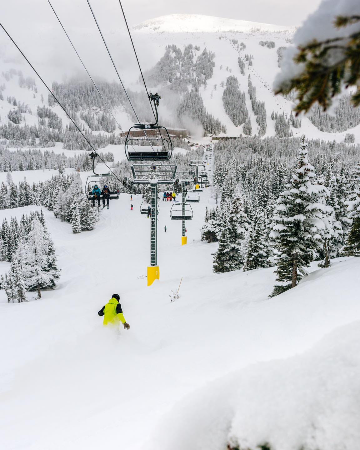
ROCKIES REPORT
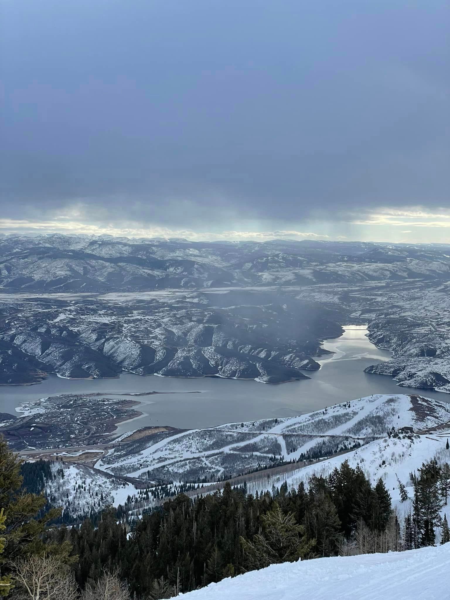
It has been a frequently snowy week in the Rockies, with many areas accumulating several feet more snowfall and most areas 100% open for the Easter holiday period, with powder skiing currently available in abundance. Aspen (56/87” / 140/218cm) posted nearly two feet (60cm) of fresh snowfall through the weekend, Beaver Creek (40/74” / 100/185cm) just slightly less. The deepest reported snow, amongst the deepest in North America, is in Utah, with Alta (44/148" / 110/370cm) posting the very most. Utah also has the largest ski area open in the US at Park City (180/251cm / 72/100”), which has announced it is extending its season later into April.
ROCKIES FORECAST
The snowy weather is expected to ease midweek, and conditions return to sunny for the latter half of this week. Although we'll still see below-freezing temperatures overnight, it's going to be getting warm in the afternoons, into the 50s at bases and high 40s on higher runs.
USA WEST REPORT
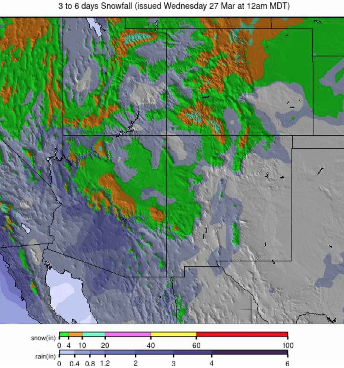
There is a mix of warm and low temperatures on Pacific coasts this week, but certainly plenty of cold periods and fresh snow falling, heaviest on higher slopes, so it’s looking good for the Easter period and the start of April. The three thickest snowpacks in North America are all on the US West with Timberline (114/170" / 285/425cm) on Mt Hood in Oregon, which aims to stay open into August, posting the most and Mammoth Mountain (97/117" / 243/393cm) and The Palisades (44/110/ 110/375cm), with both also usually stay open to late spring, sometimes early summer, taking the next two spots.
USA WEST FORECAST
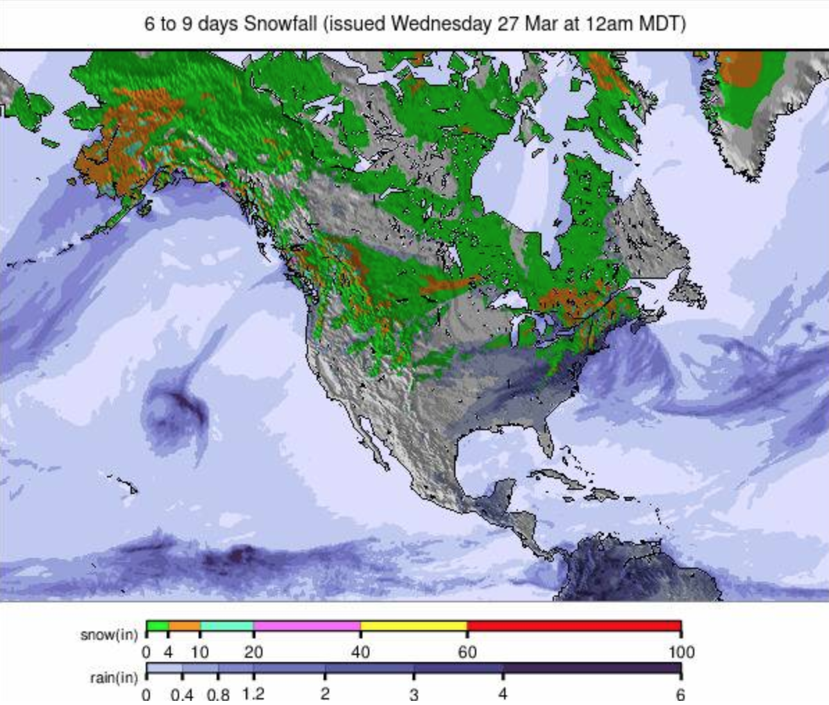
It looks like it’s going to be a snowy end to March for the west coast, too, with heavy snowfall forecast and low temperatures, mostly subzero, forecast. There’s the potential for several feet more snowfall by the weekend.
MIDWEST REPORT
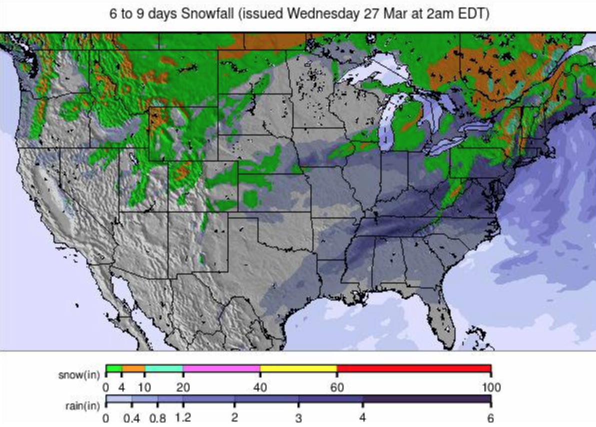
Ninety-five percent of ski areas in the Midwest have now closed for the season, many earlier than usual, reflecting difficulties operating in unusually warm conditions with limited natural snowfall and snowmaking opportunities. That said, the past week has been one of the coldest and snowiest of recent months leaving some of those smaller centers that can reopen fairly easily when conditions allow to consider doing so for a final hurrah. Among them is Wisconsin’s Trollhaugen, who say they’ll reopen Thursday - Saturday for a bonus few days of snow fun. Half of the centers that are still open are in Michigan and most of the rest are in Minnesota or Wisconsin. Giant's Ridge (24/40") 60/100cm), in Minnesota, is the only one still reporting 100% of its slopes open, and Ski Brule (48/56" / 120/140"), in Michigan, has the deepest remaining snow.
MIDWEST FORECAST
The big falls forecast for the Midwest a few days ago have eased back and are now not expected to be as big through the middle of this week. However, some areas should still get over a foot (30cm) of snowfall by the end of Wednesday, one of the best falls of the season. Temperatures are warming now, though, and drier conditions are returning.
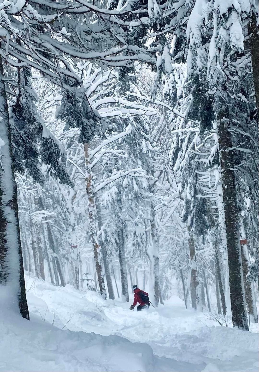
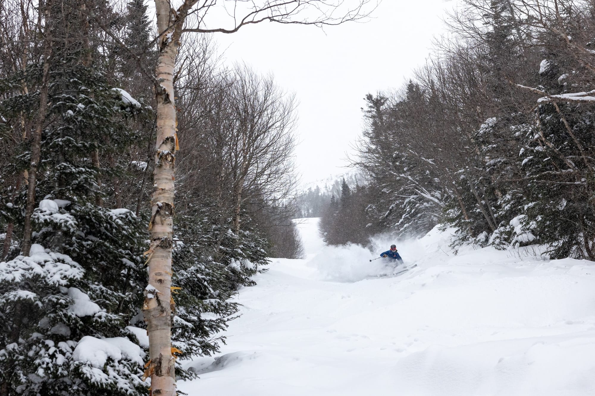
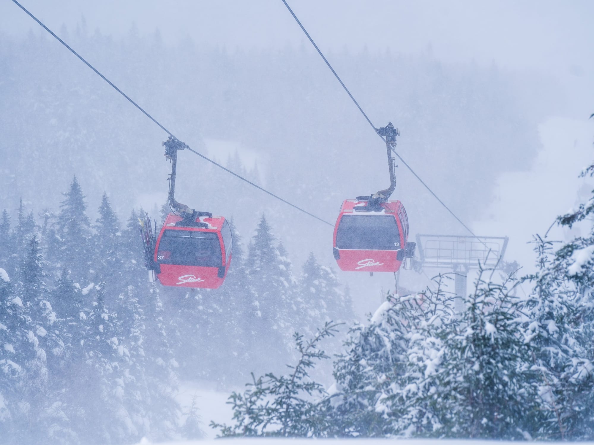
USA EAST REPORT
Mixed news from the east, where last week ski areas in Maine, Vermont, and New York state were reporting decent dumps (storm totals up to 2 feet/60cm) and low temperatures, some of the best conditions of the season in fact when most other parts of North America and the wider ski world were fairly warm and dry. In fact, ski areas in the eastern US have been reporting a fortnight of great snowfalls now in the build-up to the Easter holiday period. It's looking much better than the build-up to Thanksgiving and Christmas/New Year holidays when they struggled to open much terrain with limited natural snowfall and temperatures too warm for snowmaking. Vermont's Smugglers' Notch Resort (14/40" / 35/101cm) has reported over 40" (a meter) of snowfall in the past fortnight, with snow continuing to fall through the weekend, bringing powder conditions. Most other centers in the region have similar stats and conditions. The only downside has been strong winds at times, which have led to lift closures. But at the same time, the longer-term toll of a warmer, wetter-than-usual season and thin bases has been taking its toll, and smaller centers have already begun closing, with more expected to follow after Easter weekend and most by the end of next week. Cranmore, Crotched, and Pats Peak in New Hampshire are among the latest closed for the season a week before Easter, with Pats Peak shutting down operations a week earlier than planned due to the longer-term conditions.
USA EAST FORECAST
More precipitation is forecast through the remainder of this week, but unfortunately, due to rising temperatures, it could rain at times in some areas. More snowfall is likely for others, though, particularly on higher terrain at more northerly located ski areas.
CANADA
CANADA WEST REPORT
After a dry period, which saw a return of warm temperatures, particularly for lower elevations, Whistler Blackcomb (0/224cm / 0/90”) lost a fifth of its previous 3m/10 feet upper slope base depth; however, it is still reporting almost all slopes open. Temperatures have dropped and the snow has been falling again in western Canada. Main resorts in Alberta and BC have been posting 12-24cm (5-10”) accumulations almost daily since last Thursday/Friday, so slopes are getting a constant refresh, particularly higher slopes.
CANADA WEST FORECAST
Staying fairly cold and mostly overcast, but with sunny spells. Daytime highs are +2-3C at resort bases, with overnight lows of -15C on higher slopes. Some light snow showers are likely most days, but only 2-5cm (1-2") accumulations most days.
CANADA EAST REPORT
It’s been a mostly good week in Quebec, with plenty more snowfall, although some centers were forced to close for periods due to strong winds. Speaking on Thursday, a spokesperson for Massif du Sud ski area commented, “Today in the storm was without a doubt the best day of the season so far! We're not just talking about rush and snow quality, we're also talking about a 100% mountain opening! We were all looking forward to it, and many didn't even expect it anymore... and now it's happening! 25cm (10”) down today and another 20cm (8”) expected by Saturday.” Tremblant (0/140cm / 0).