North America Weekly Snow Roundup #303
Weekly Snow News for North America, updated 26 February 2026: California scores up to 90" (225cm), Rockies gain 60cm (2ft), Midwest sees season’s biggest snowfall.

- Western storms deliver season-defining snowfall totals
- California buries lifts with up to 90 inches
- Rockies rebound with two-foot refresh
- East and Midwest hold strong late-season form
North America Intro
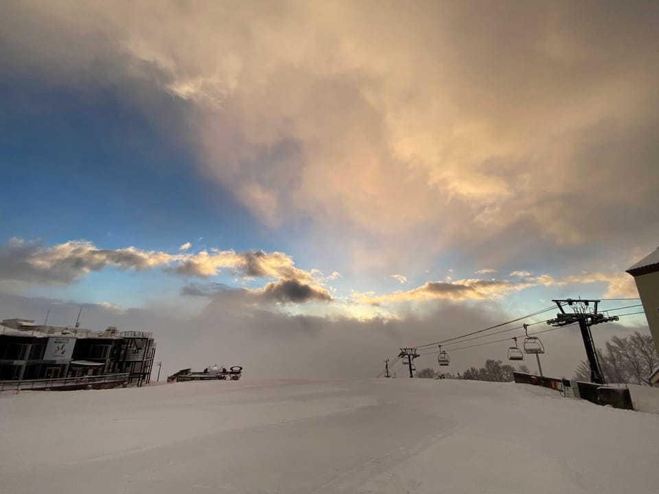
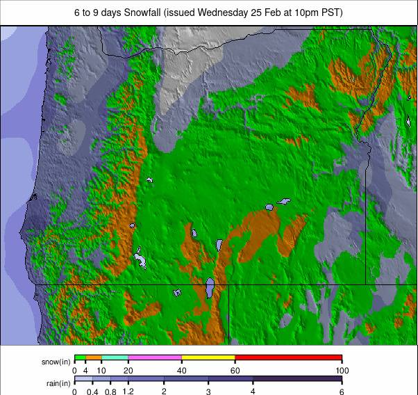
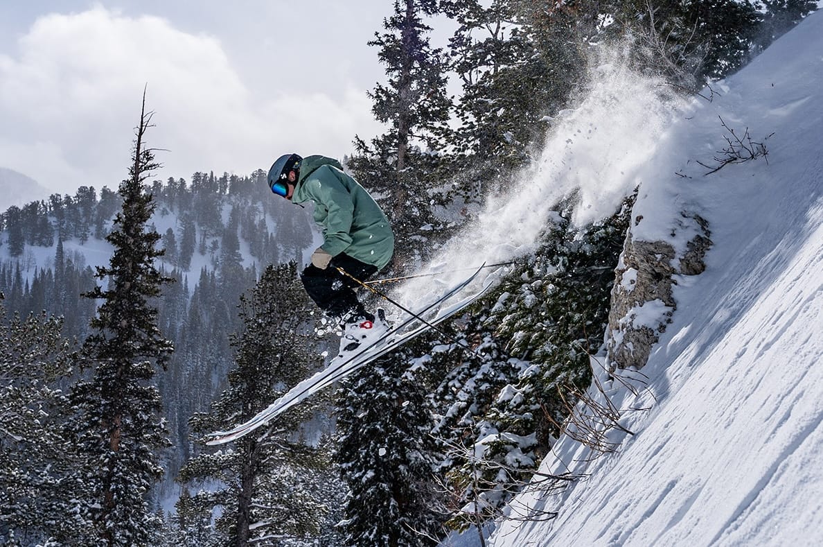
The dominant story this week has been significant snowfall across the western United States. In much of the southern Rockies, two feet (60cm) accumulated over just a few days — the biggest snowfall of the season for many resorts. Further north in Utah and Wyoming, totals reached as high as 60" (1.5m), providing a substantial boost to snowpacks that had already been improving.
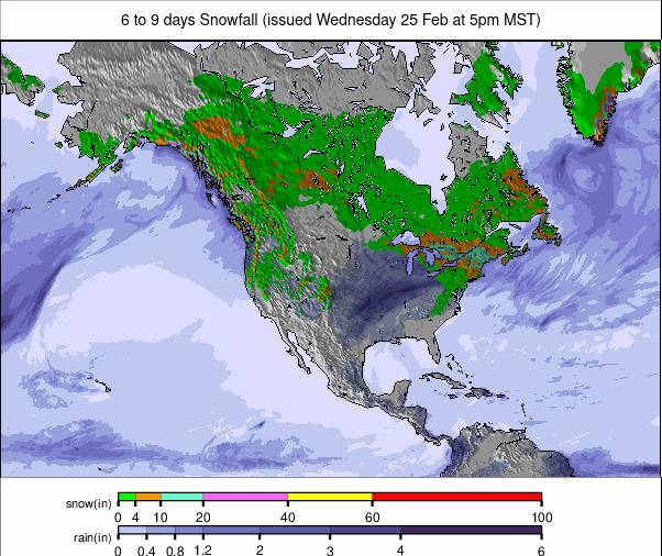
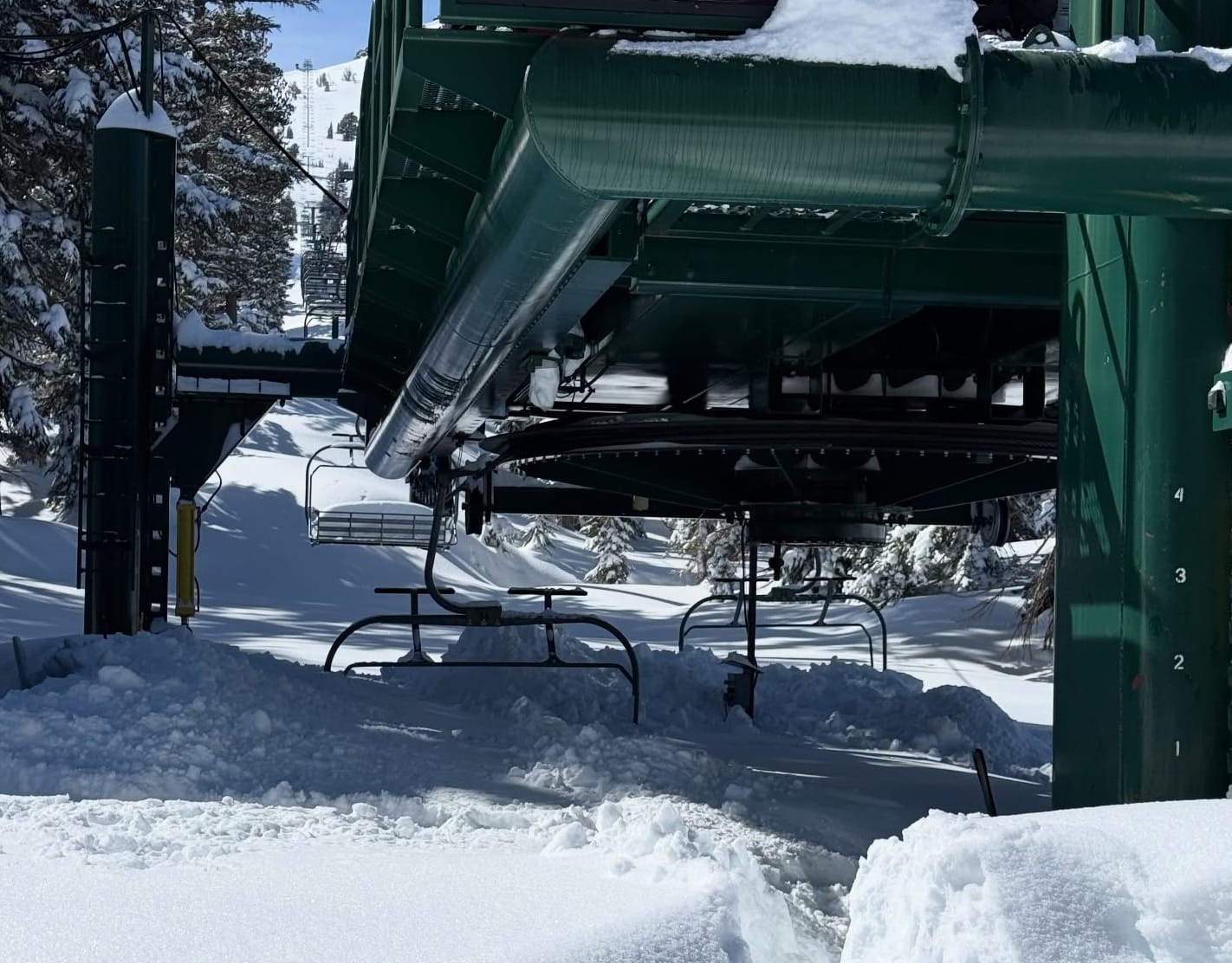
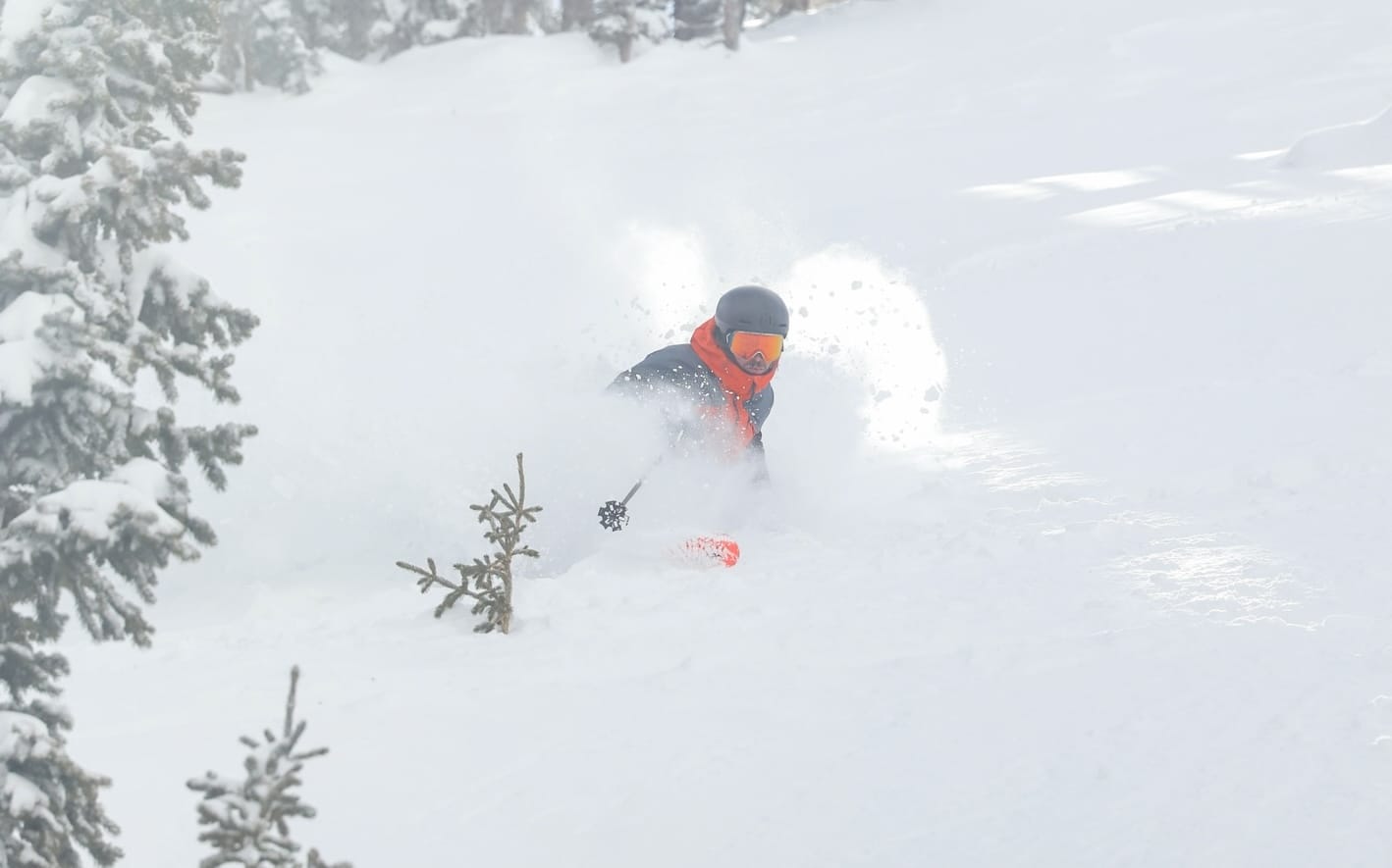
California saw a repeat of its Christmas-to-New-Year blockbuster cycle, with higher slopes reporting up to 90" (225cm). While the snowfall effectively secures the remainder of the season, it also brought very high avalanche danger, tree well hazards, closed roads and temporarily buried lifts. Conditions have since turned sunnier. Further north, Canadian resorts have enjoyed quality powder days, while the East Coast continues one of its strongest seasons in recent years.
Western Canada Snow Report and Ski Conditions
After a dry January and early February, more regular snowfall has returned across Alberta and BC. Accumulations of 10–20cm (4–8") have refreshed slopes, with temperatures generally between freezing and -15°C, preserving snow quality.
Revelstoke (105/264cm / 42/106") reports the deepest base in the region. Most western Canadian ski areas are operating at 90–100% open terrain.
Western Canada Snow Forecast
Cold summit temperatures persist, typically between -20°C and -10°C. Base levels vary more widely, particularly along the milder BC coast. Only light flurries are expected, with interior resorts such as Revelstoke, Kicking Horse and Lake Louise maintaining crisp winter conditions.
Eastern Canada Snow Report and Ski Conditions
Cold, mostly dry weather has continued across Quebec, with temperatures largely between -5°C and -15°C. Ontario has seen slightly milder spells closer to freezing, along with light snow showers.
Mont Tremblant (30/60cm / 12/24") leads for open terrain at 100%, while Camp Fortune (195/195cm / 78/78") reports the deepest snowpack.
Eastern Canada Snow Forecast
Conditions remain wintry with summit temperatures from -20°C to -5°C and bases between -15°C and -1°C. Light snow or flurries remain possible, particularly across Quebec. Lower elevations may briefly approach thaw in Ontario.
US West Coast Snow Report and Ski Conditions
Exceptional snowfall totals were recorded across California. Homewood (86/107” / 216/267cm) reported over seven feet in three days, including a 90” (2.2m) 72-hour total. Heavenly (81”/81” / 203cm/203cm) received nearly five feet (58” / 147cm), with similar figures reported at Palisades (85/105" / 212/262cm).
Mt Shasta (36/36" / 90/90cm), previously closed due to limited snow, reopened after receiving three feet (90cm). Avalanche danger remains very high, and resorts continue to warn about tree wells.
Initial reopening efforts focused on road clearance and lift recovery, but terrain access is steadily expanding. Further north, Oregon and Washington resorts saw steadier snowfall totals of 1–3 feet (30–90cm).
US West Coast Snow Forecast
A mixed week ahead with higher elevations between 20°F and 30°F. Base areas range from 25°F to 50°F depending on latitude. Snowfall is limited short term, though longer-range models suggest potential systems returning later.
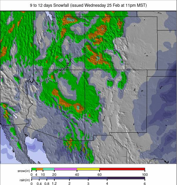
US Rockies Snow Report and Ski Conditions
Snowfall exceeded expectations across the Rockies, significantly improving earlier-season deficits. Utah’s Snowbird (99/99" / 248/248cm) reported nearly four feet (46” / 114cm) in 72 hours.
Deer Valley received 23 inches (57cm), enabling a record 165 of 203 runs to open following its terrain expansion. Colorado resorts posted similar figures, with Crested Butte logging 23” (57cm) in 48 hours. Copper Mountain was able to open more advanced terrain for the first time this season.
US Rockies Snow Forecast
Upper-mountain readings remain between 0°F and 20°F, while base areas vary from 10°F to 45°F. Light accumulations are possible midweek in Colorado and Wyoming, with Utah and New Mexico trending drier.
US Midwest Snow Report and Ski Conditions
An unsettled week brought some of the Midwest’s largest snowfalls of the season, with up to two feet (60cm) recorded in parts of Michigan and Minnesota. Mt Bohemia (80/80" / 200/200cm) received 21" (52cm) in 72 hours and continues to report the region’s deepest base.
Conditions have alternated between sunshine and strong winds, with temperatures dropping to 0°F at times, though daytime highs have occasionally reached freezing.

US Midwest Snow Forecast
Cold but changeable conditions continue. Upper slopes range from 10°F to 28°F, bases 15°F to 40°F. Only light snow showers are expected, mainly in northern Michigan and Minnesota.
US East Coast Snow Report and Ski Conditions
The East Coast remains in strong late-season form. A weekend storm delivered widespread 8–16" (20–40cm) accumulations, producing powder conditions on Sunday.
Temperatures have mostly stayed below freezing, occasionally dropping to single digits Fahrenheit. Most resorts are fully or nearly fully open. Stowe (26/50" / 65/125cm) reports the deepest base in the region.
Since the start of the week, sunshine has alternated with light snow showers, generally adding only 1–2" (2–5cm).
US East Coast Snow Forecast
A mixed and occasionally unsettled pattern continues. Upper-mountain temperatures range from 10°F to 28°F, bases 15°F to 45°F. Light snow or wintry mix is possible in northern New England, while the Mid-Atlantic trends milder.