North America Weekly Snow Roundup #305
Weekly Snow News for North America, updated 12 March 2026: Rockies receive up to 90cm (36”) snowfall while spring warmth spreads across eastern resorts.
- Rockies receive up to 90cm snowfall in 24 hours
- Spring warmth spreads across eastern resorts
- Pacific Northwest turning increasingly snowy
- Whistler Blackcomb remains 95% open
- Midwest resorts begin seasonal closures
North America Intro
Springlike conditions continue to dominate across much of North America. While western regions have experienced a generally mild winter overall, the recent warmth is more unusual along the East Coast, which endured months of bitter cold earlier in the season. Some resorts across the East Coast and Midwest were forced to close temporarily over the past week due to heavy rain.
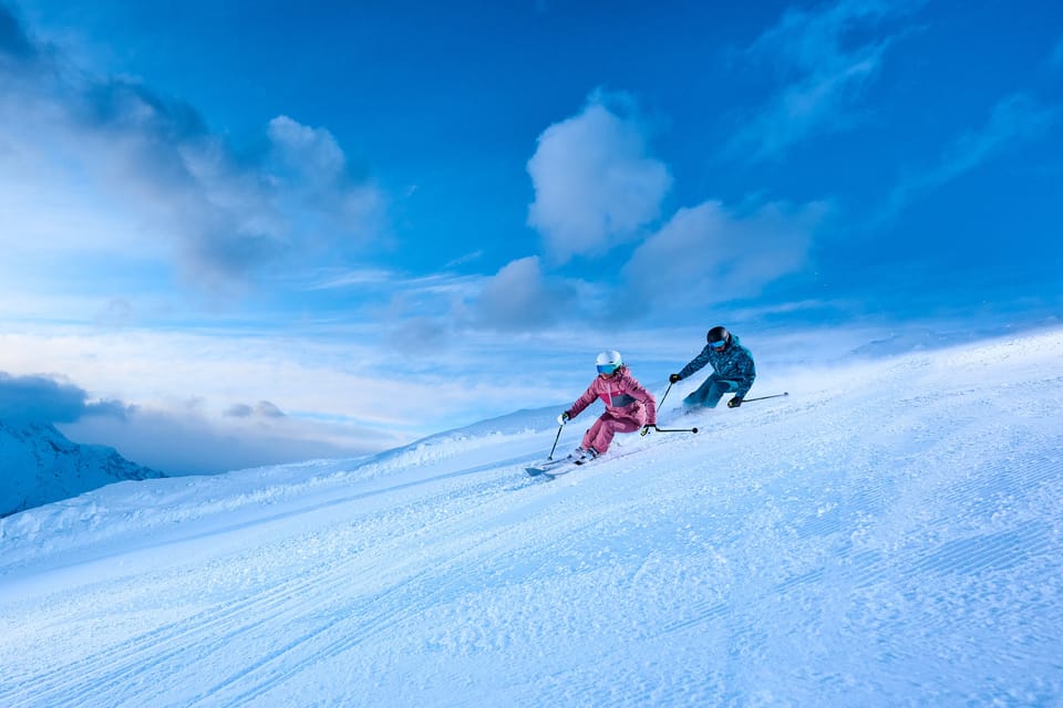
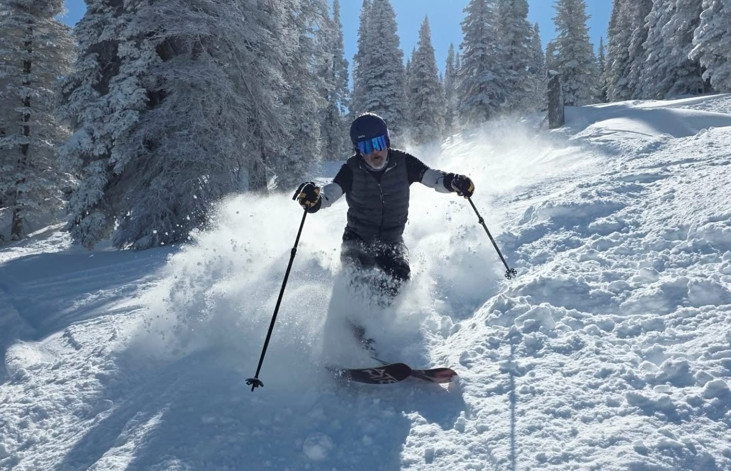
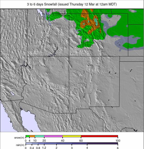
The Rockies did see a brief return of winter conditions heading into last weekend. Several resorts reported significant snowfall totals, with some locations seeing up to three feet (90cm) in 24 hours, though most recorded closer to 6–12 inches (15–30cm). Since then, sunshine has returned and temperatures have been climbing again.
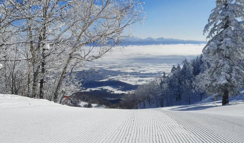
Along the Pacific Coast, conditions have also been largely mild and sunny, although the Pacific Northwest is now beginning to turn more unsettled with increasing snowfall.
Western Canada Snow Report
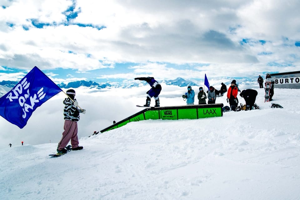
Western Canada has seen a mix of mild weather and occasional snowfall over the past week. Most new snow totals have been modest, typically around 5–10cm (2–4”). Upper slopes have largely remained below freezing, while base areas have reached daytime highs of around +4 to +8°C. Whistler Blackcomb (20/140cm / 8/96”) remains the largest open ski area in North America, reporting approximately 95% of terrain open. Revelstoke (105/275cm / 42/110”) continues to report the deepest snowpack in Canada.
Western Canada Snow Forecast
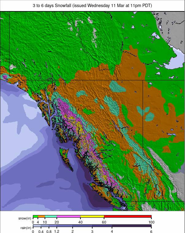
A series of Pacific systems is expected to bring light to moderate snowfall across BC/resorts/A-J">British Columbia’s interior through the week. Resorts including Revelstoke, Sun Peaks and Big White should see regular top-ups, while Alberta’s Rockies — including Lake Louise and Sunshine — may receive heavier snowfall late Friday into Saturday.
Eastern Canada Snow Report
Temperatures have finally warmed up across Eastern Canada after a prolonged period of well-below-freezing weather throughout January and February. Daytime highs are now reaching around +10°C at base levels, with temperatures occasionally rising above freezing even at higher elevations during the afternoon. This shift has meant that precipitation during the past week has often fallen as rain rather than snow, particularly at lower elevations.
Despite the warmer conditions, the snowpack has so far held up reasonably well in terms of terrain availability, with most resorts still reporting close to full operations. Base depths are gradually declining, however. Tremblant — the region’s largest ski area — now reports depths of around 30/60cm (12/24”).
Eastern Canada Snow Forecast
A series of Atlantic systems is expected to bring mixed precipitation to the region from mid-week. Higher-elevation resorts across Québec should see more snowfall, while areas closer to the St. Lawrence may experience a mix of rain and snow due to marginal temperatures.
Further inland, colder air should allow more consistent snowfall through Thursday and Friday. Another system arriving over the weekend could deliver fresh snow to several Québec resorts, with lighter accumulations extending into New Brunswick and Nova Scotia.
US West Coast Snow Report
Sunny skies have dominated California’s Pacific Coast ski resorts this week. Upper-mountain temperatures have generally ranged from the mid-20s to low-40s °F, while base areas have seen much milder conditions, frequently reaching the mid-40s to mid-50s °F. Across the Tahoe region and the Southern Sierra, conditions remain settled and increasingly springlike.
Further north, ski areas in Oregon and Washington have seen occasional light snowfall, with summit temperatures typically in the high teens to upper-20s °F and base temperatures hovering in the low-30s to low-40s °F. Snow showers have continued across the Cascades, helping to refresh surfaces. Further north again, Alaska’s coastal mountains remain the coldest part of the region, with upper-mountain temperatures dipping into the single digits to low-20s °F and intermittent light snowfall.
US West Coast Snow Forecast
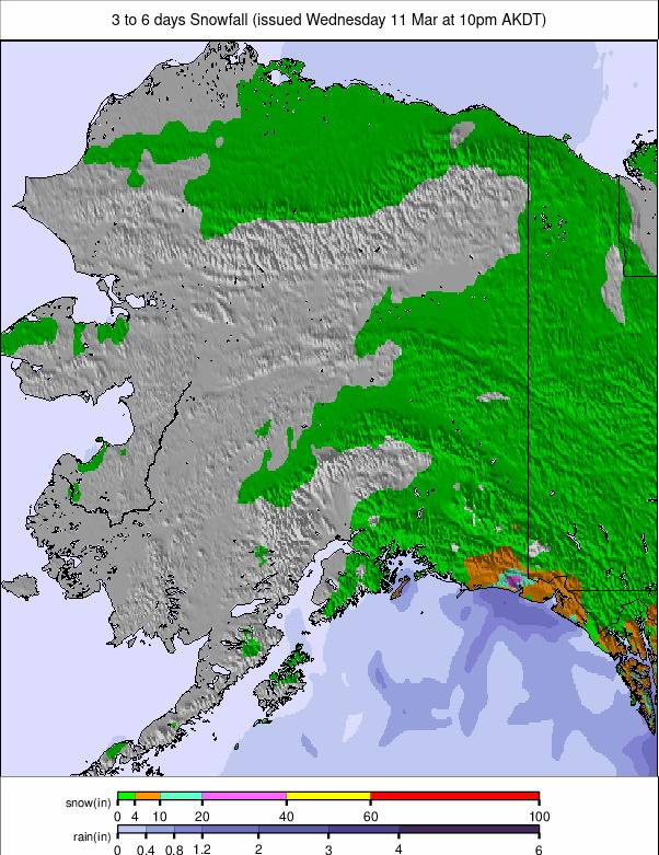
California resorts are expected to remain mostly dry and bright over the coming days. Upper-mountain temperatures should stay in the mid-20s to mid-30s °F, while base areas remain mild in the 40s and 50s. Further north, conditions will turn noticeably snowier across Oregon and Washington as a series of Pacific systems moves inland. Heavier snowfall is expected in the Cascades from mid-week onward, with summit temperatures in the teens to upper-20s °F and bases close to freezing. Alaska should remain colder overall, with intermittent light snow and upper-mountain temperatures generally in the single digits to low-20s °F.
US Rockies Snow Report
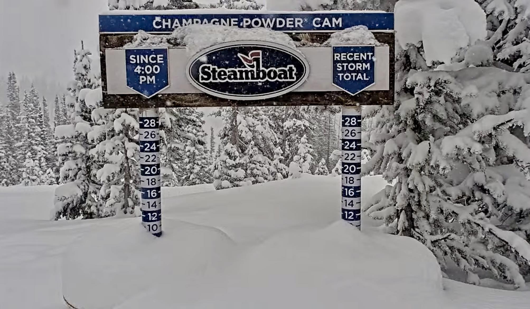
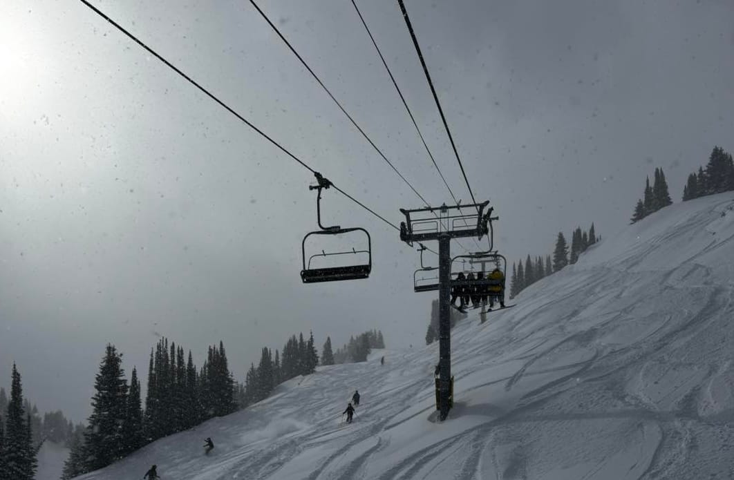
A passing weather front brought a welcome burst of snowfall to the Rocky Mountains last week, delivering powder conditions for the weekend. Many resorts reported 10–20 inches (25–50cm) of fresh snow. Idaho’s Pomerelle Mountain (48/48” / 120/120cm) recorded the largest total by some margin, reporting an impressive 36 inches (90cm) in just 24 hours. Strong winds accompanying the storm briefly forced some resort closures across the region. The fresh snow allowed several resorts to open additional terrain, including Arapahoe Basin’s Montezuma Bowl, which had previously remained closed due to insufficient snow cover. The wintry spell was short-lived, however, with warmer and sunnier conditions quickly returning.
Temperatures have climbed into the high-40s and even low-50s °F in some locations. These warmer conditions are already affecting parts of the southern Rockies. Several ski areas in New Mexico have begun closing for the season. Sandia Peak Ski Area closed last month, while Pajarito Ski Area ended operations last Sunday. Red River Ski Area is expected to remain open for another week, targeting a closing date of March 22.
US Rockies Snow Forecast
High pressure is expected to dominate much of the Rockies from mid-week onward. Colorado, Utah and Wyoming should see a run of clear, sunny days with light winds. Morning conditions will likely remain firm and fast before softening during the afternoon under spring sunshine. Only the far northern Rockies may see brief flurries during the week, but no major snowfall is currently forecast. The dry pattern is expected to persist into the weekend.
US Midwest Snow Report
The ski season is beginning to wind down across the Midwest. Several ski areas in locations more vulnerable to mild weather have already announced their closure. Hidden Valley ski resort near Wildwood, Missouri, was among the first to close last week.
Other resorts hoping to remain open into April — although most will shut by the end of March — are introducing measures to preserve their remaining snowpack. For example, Wisconsin’s Trollhaugen resort has opted to close midweek operations to help maintain conditions for weekends. Resorts still operating have widely reported “slushy snow” conditions during the past week.
US Midwest Snow Forecast
Colder and somewhat snowier weather is expected to return later this week. Temperatures across northern Michigan, Minnesota and Wisconsin may drop to between 10°F and 25°F, with colder readings on exposed peaks.
South Dakota and Iowa should remain slightly milder but still wintry. Light snow showers appear in several resort forecasts, although accumulations are expected to remain modest. The colder conditions should help firm snow surfaces and improve snowmaking opportunities.
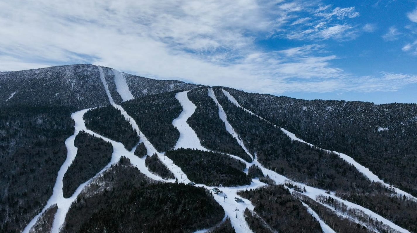
US East Coast Snow Report
The long run of consistently cold, wintry weather across the US East Coast appears to be ending. After months of sub-zero temperatures and frequent snowfall since late November, the region has experienced much milder weather during the past week. Freezing levels have risen into the 40s and 50s °F, and most recent precipitation has fallen as rain or sleet rather than snow.

Despite this shift, overnight temperatures have continued to dip just below freezing in many locations, creating regular freeze–thaw cycles. This has produced classic spring “corn snow” conditions on many slopes. Killington (50/76cm) remains the largest resort in the region and continues to report 100% of its terrain open, a status shared by many other areas.
US East Coast Snow Forecast
A mild and somewhat unsettled pattern is expected to continue across the eastern states. Rain and drizzle may affect resorts across Vermont, New Hampshire and upstate New York during the warm sector of this system. Snowfall will likely be confined to the highest elevations during this period. By Friday, a colder north-westerly airflow is expected to develop, bringing drier air and allowing overnight refreezing to return. The weekend currently looks brighter and largely dry, although no major snowfall is expected.