North America Weekly Snow Roundup #301
Weekly Snow News for North America, updated 12 February 2026: Pacific systems return as Arctic cold grips the East.
- Pacific storms push snow into the Rockies
- Extreme cold grips Eastern North America
- West Coast sees modest but welcome snowfall
- Midwest bases deepen past six feet
- Most major resorts largely open
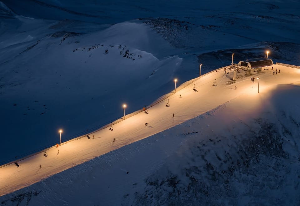
North America Snow Report and Ski Conditions
After months of a fairly clean division between cold, snowy and generally wintery weather in Eastern North America and unusually warm, dry, springlike weather for much of the west, there are a few signs of change this week.
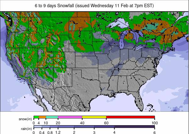
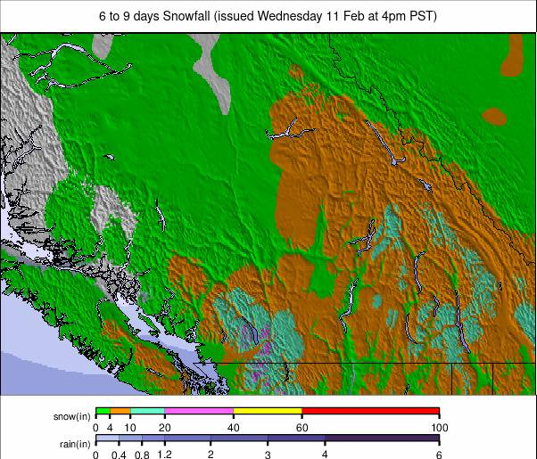
Most notably, several fronts have begun bringing fresh precipitation along the Pacific coast and are now moving into the Rockies. So far, it's been inches rather than feet, and it started as rain in some areas before temperatures dropped, but it's something after the recent dry weeks.
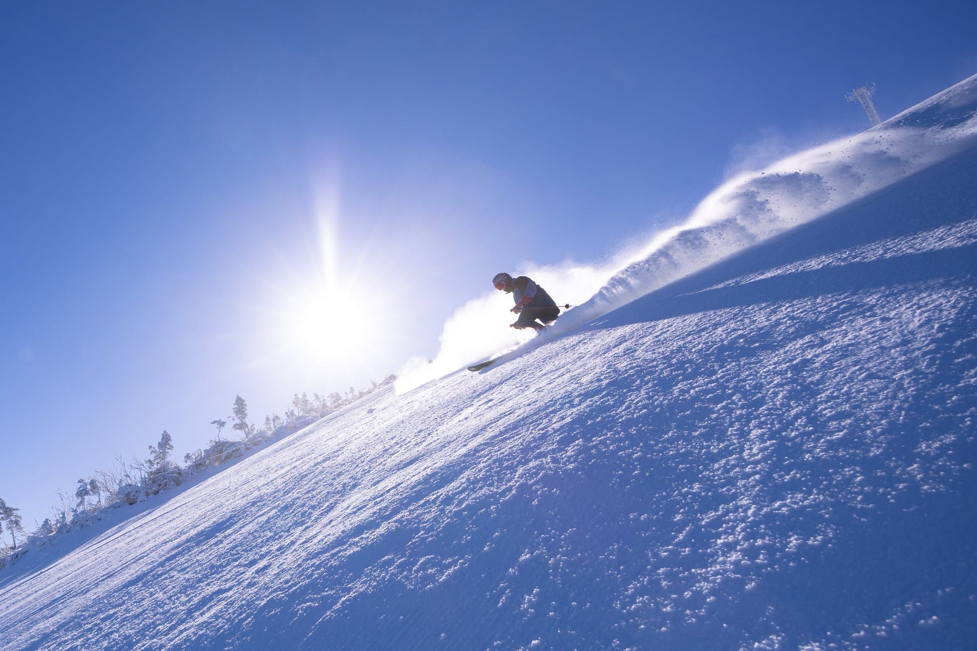
On the East Coast, it has remained full-on winter, and if anything, it got colder still, into the -30s. So, whilst there are reports of more centres closing for lack of snow in Oregon and Washington states in the west, in the east, closures of lifts are more for safety reasons, to prevent danger to skiers in the event of a mechanical failure.
Western Canada Snow Report and Ski Conditions
A fairly uneventful week in terms of snowfall in Western Canada, as has been the case most of this year following the record snowfall in December for much of Alberta and BC.
It's got a little colder again with most areas staying below freezing and overnight low up high around -10C, only mild on lower slopes on the Pacific Coast – again, a familiar pattern.
Most centres in the region remain fully open, with Revelstoke (42/98") posting the deepest cover. Further north, it's a different story, in some parts at least. The remote Yukon has seen temperatures as low as -40C this week, and in the Northwest Territories, there have been very heavy snowfalls of up to a foot a day.
Western Canada Snow Forecast
A continuing mix of light snow, cold temperatures and brighter spells across the major resorts.
British Columbia’s interior sees intermittent flurries and steady sub zero highs, keeping surfaces dry and grippy. Along the coast, Whistler alternates between clearer breaks and occasional light snow at altitude.
In Alberta, Banff Sunshine, Lake Louise and Marmot Basin remain very cold on the upper slopes, with mostly dry conditions and crisp, clear periods.
Eastern Canada Snow Report and Ski Conditions
It has been bitterly cold across Eastern Canada over the past week, with temperatures dropping even lower than they were before.
That means highs of around -15C, lows of -30C, but most of the time a -15 to -25C range, feeling colder with wind chill.
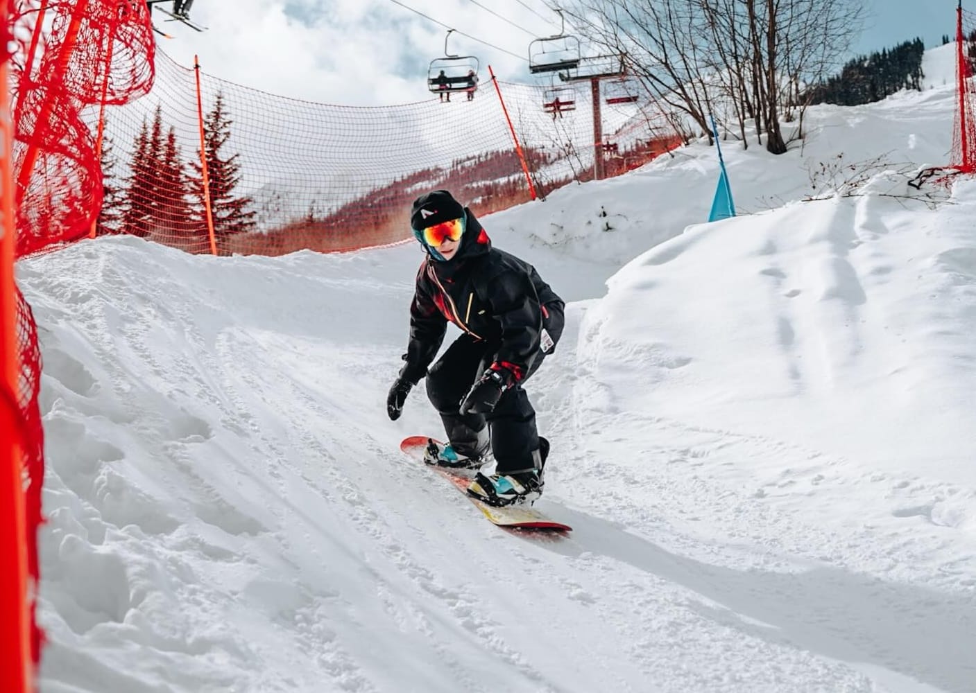
There were a few sunny days at the start of the week, but there's mostly been light snow showers through the week, adding 2-4" and giving the slopes a good refresh most days. For those who can brave the cold, most centres are fully open, or close to it. The region's largest centre, Tremblant (12/24"), is 100% open.
Eastern Canada Snow Forecast
Full winter remains locked in across Eastern Canada, with a mix of cold air, light snowfall, and brighter breaks across Québec and the Maritimes.
Resorts such as Mont Tremblant, Le Massif, Stoneham and Mont Sainte Anne see mainly sub zero temperatures, occasional flurries and steady packed powder conditions on the upper slopes. Further east, areas in New Brunswick and Nova Scotia experience colder nights and intermittent snow showers, helping maintain good coverage despite some wind exposed ridges.
US West Coast Snow Report and Ski Conditions
Some good news for the West: a change in the weather at last brings precipitation, increasingly wintery, over the past few days. Early on, the snow/rain line was up around 7,000 feet, but as colder air followed in, it has been increasingly snowy down to lower elevations, bringing a much-needed refresh to the slopes. In many areas, the snow is falling as we compile this report.
Hence, it's not yet clear quite how much it will add up to by the latter half of this week, but for many areas it's looking like the most for a month or so, if maybe not enough yet to really turn things around at some of the struggling centres in Oregon and Washington state.
So far, though Timberline has posted a 12" accumulation, Mt Bachelor has had 10".Ski Bluewood in Washington state and Mt Shasta in northern California are the latest in the region to announce temporary complete closures due to lack of snow, but hope to be able to reopen within a week.
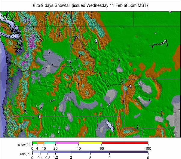
US West Coast Snow Forecast
A continuing mix of new snowfall, mostly light, coupled with colder upper mountain temperatures and occasional clearer spells.
Resorts across Washington and Oregon are expected to pick up light to moderate snow at times, generally in the 2–6 inch range, with ridge top winds often 15–30 mph. California’s Sierra resorts see similar pulses, with higher peaks catching slightly stronger gusts, while colder nights preserve surface quality.
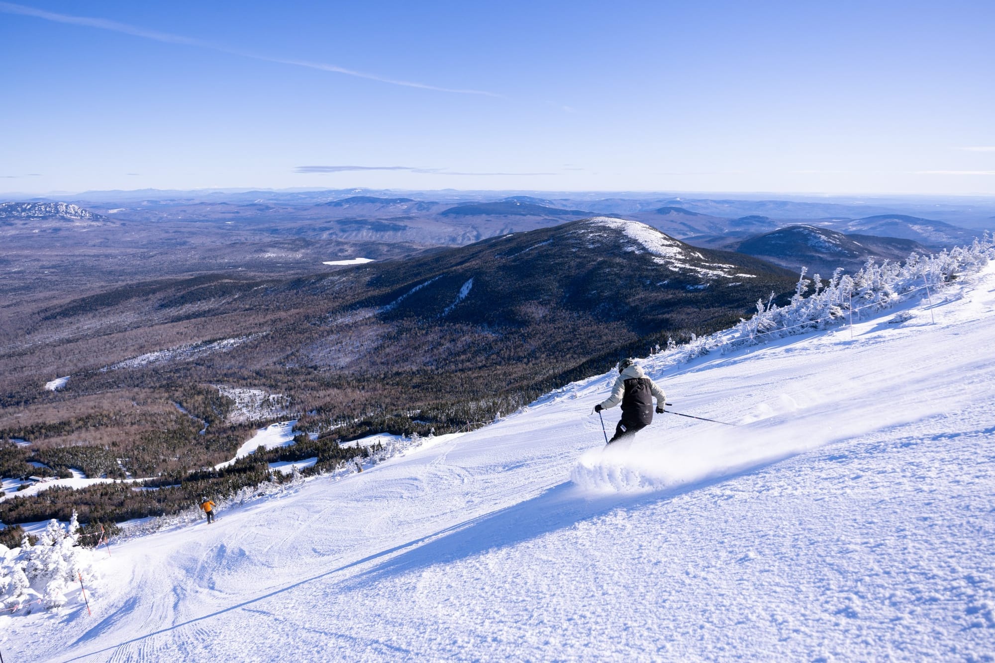
US Rockies Snow Report and Ski Conditions
There are finally signs of the hoped-for change in the weather for the latter half of the season after the challenging past three months. Fronts have started to move precipitation in, at least to the northern Rockies, with ski areas in Idaho, Montana, Wyoming and Utah posting, mostly modest snowfall totals over the past few days, generally in the 3-98” bracket.
Jackson Hole (8/77”) posted a 10” snowfall on Tuesday. Not much, and not really reaching Colorado yet, but the mid- to long-term forecast isn't looking more unsettled, so could this be the change in fortune for the final few months of the season?
As it is, most centres in the region do have the majority of their terrain open, coupling what natural snowfall there has been with heroic snowmaking efforts.The region and country's largest, Utah's Park City (38/28"), continues to post more than 80% of its slopes open.
US Rockies Snow Forecast
A cold, unsettled week continues across the Rocky Mountains, with upper elevation temperatures often running between –8°F and 20°F, while base areas fluctuate from roughly 5°F to 45°F. Several weak systems move through mid to late week, delivering further light to moderate snowfall across Utah, Wyoming and Montana.
Most resorts can expect intermittent top ups of 1–4 inches, with the highest terrain seeing the most consistent accumulations. Winds remain moderate, occasionally strengthening on exposed ridges with gusts of 25–40 mph, which may affect lift operations at times.
US Midwest Snow Report and Ski Conditions
"Sun, snow and low" sums up conditions in the Midwest over the past week, with temperatures remaining below freezing 24-7 in most areas, if not as cold as further east, some prolonged sunny spells, but also some snow showers in the mix with measurable snow reported on ski slopes in most states in the region.
Michigan’s Mount Bohemia (80/80”) is the first in the region to top a 6-foot base and reports all 105 of its trails open.
US Midwest Snow Forecast
Continuing cold but changeable across the US Midwest ski regions, with upper mountain temperatures generally running from about 5°F to 20°F and lower slopes fluctuating between roughly 15°F and 32°F.
Light snow moves through on several days, typically bringing 1–3 inches at a time, with northern Michigan and northern Wisconsin seeing the most consistent top ups. Resorts farther south stay more variable, with brief thaws possible before temperatures dip again. Winds remain moderate, occasionally gusting 20–30 mph on exposed hills, sharpening the chill but limiting major disruption.
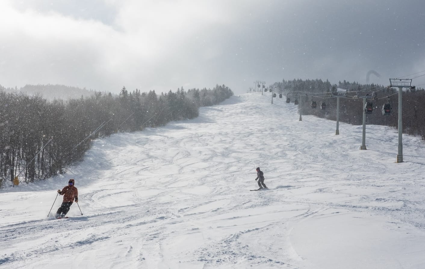
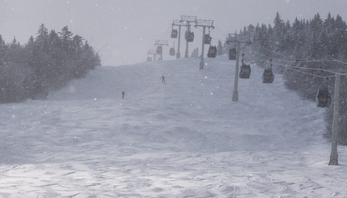
US East Coast Snow Report and Ski Conditions
After a very cold January skiers in the Eastern US might have hoped thing would warm up a little this month, but instead its managed to get colder still, the numbers dropping even lower below zero Fahrenheit, down into the -20s and even -30s, leading to warnings of "dangerous cold" and ski area decision to close lifts with the most exposure danger to users.
Wind chill has been a bigger factor over the past week, too, with wind speeds strengthening at times. Otherwise, it has been largely clear and sunny, with just a few bands of snow moving through. Killington (20/32”) remains 98% open with the most skiable terrain in the region. Most others are close to fully open, too, but with the cold, everyone is advised to wrap up very warm.
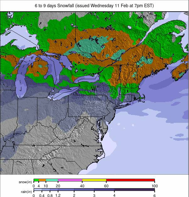
US East Coast Snow Forecast
Finally, a bit warmer across the Appalachian Mountains, with upper mountain temperatures generally running from about 5°F to 20°F and lower slopes ranging from roughly 15°F to 35°F.
Several systems sweep through, bringing periods of light to moderate snowfall, often 1–4 inches at a time, with the higher resorts in Vermont, New Hampshire and Maine seeing the most consistent accumulations. Mid Atlantic areas stay more variable, with snow giving way to brief mixed precipitation as temperatures flirt with freezing. Winds remain moderate, occasionally gusting 25–35 mph on exposed ridges, sharpening the chill.