North America Weekly Snow Roundup #304
Weekly Snow News for North America, updated 4 March 2026: A mixed picture across the continent, with the East Coast still in deep winter after a powerful nor'easter, while the West sees spring-like conditions.
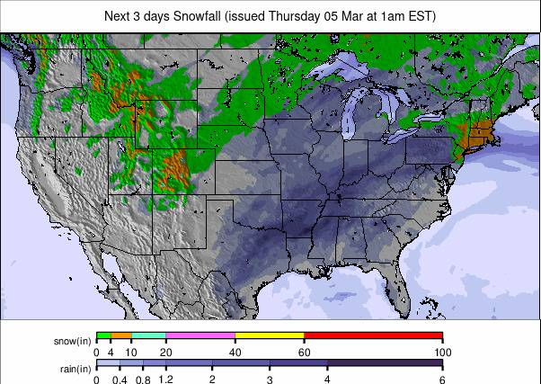
- Powerful nor'easter brings up to 2 feet of snow from New York to Boston
- Mammoth Mountain 100% open with 80/124" of base after huge February snowfalls
- Jackson Hole reports 18" of fresh snow as the Rockies see strong mid-week snowfall
- Oregon's Hoodoo ski area pauses operations after floodwaters submerge three lifts
North America Intro
A mixed picture across North America this week, with the west divided between sunny spells and snow showers, the East still in midwinter mode, with more big snowstorms making winter 25/26 set to go down as one of the most wintry in years there.
The hoped-for switch to full-on cold, snowy weather in the west hasn't really come about, although most areas along the Pacific Coast and in the Rockies have been posting snow showers, in some cases, in the north of the region, adding up to 3–4 feet (90–120cm) over seven days. However, it's still not that cold, and some smaller, lower centres have already decided to give up and close until next season, saying what they're getting is too little too late. Against that, some big-name resorts are opening more terrain and getting closer to 100% open than they have been already; some are already there.
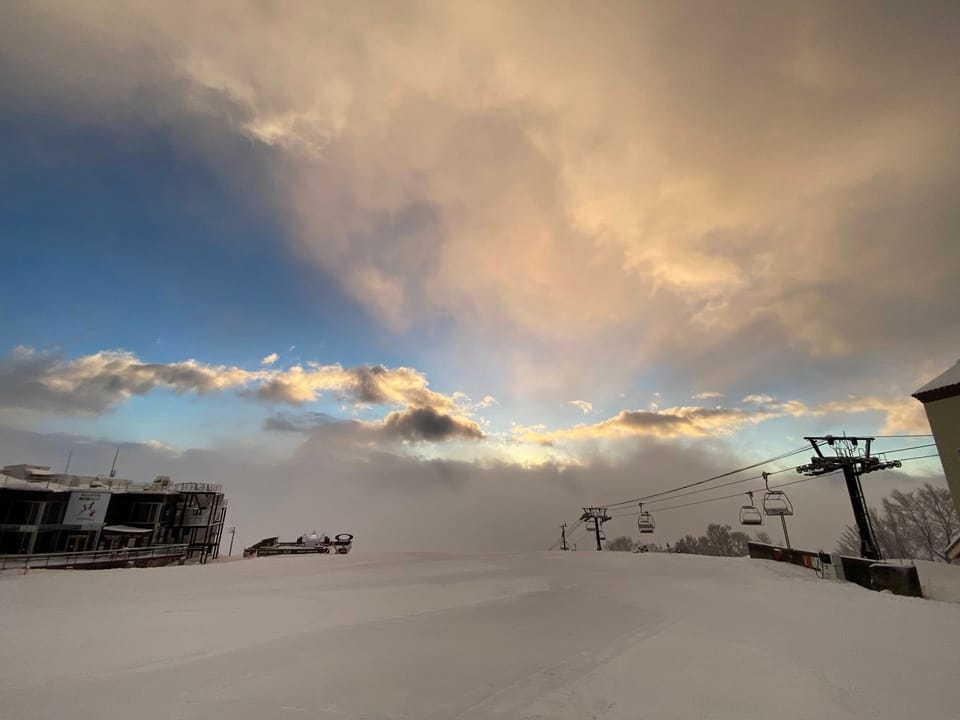
On the East Coast, temperatures are mostly still well below freezing, and it keeps dumping, with stories of skiers and boarders on city streets and in parks making not just ski press but also mainstream media headlines.
Canada West Snow Report
It's been a mostly sunny week across western Canada with light-to-moderate snow showers at times. Most major resorts are reporting deep upper‑mountain bases and the vast majority of terrain open. Whistler Blackcomb (20/242cm / 8/97"), while interior BC/resorts/A-J">British Columbia resorts such as Sun Peaks, SilverStar, Big White, and Fernie are operating with 60–144cm bases and 75–96% of runs open. Alberta's Banff Sunshine and Lake Louise continue to hold strong mid‑winter cover, with 85–105cm (34–42") bases and almost all runs open.
Overall, although meteorological springtime is here, conditions remain reliably wintry across the region. Official bodies have also been warning of high avalanche danger with fresh snow on an old, weak snow surface, and strong winds also playing their part.
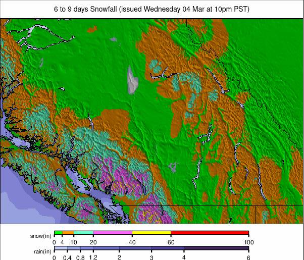
Canada West Snow Forecast
Western Canada turns markedly colder at altitude this week, with summit temperatures commonly between −20°C and −10°C across major resorts such as Whistler Blackcomb, Revelstoke, Kicking Horse, Lake Louise and Sunshine Village. Mid‑mountain levels trend closer to −15°C to −6°C, while bases fluctuate from −12°C to +6°C, depending on region and elevation. Frequent light snow showers move through the interior ranges, with Whistler, Revelstoke, Kicking Horse and the Kootenay resorts seeing regular top‑ups. Winds vary from light to moderate, occasionally fresh on exposed ridges, keeping the air feeling colder.
Canada East Snow Report
Snow conditions across eastern Canada are consistently cold, well‑covered, and largely fully open, with major resorts operating at or near full capacity. Tremblant, Stoneham, and Le Massif all report 100% of terrain open, with upper‑mountain depths of 50–60cm (20–24") and bases around 30–35cm (12–14"). Ontario's Blue Mountain stands out with a notably deep 90–101cm (44–45") base, keeping 99% of runs available.
In Atlantic Canada, Cape Smokey is fully open but with a thin 25–35cm (10–14") of cover. Overall, the region is holding firm mid‑winter snowpack under sustained sub‑zero temperatures, supporting reliable skiing across Quebec, Ontario, and the Maritimes.
Canada East Snow Forecast
Eastern Canada stays bitterly cold in the mountains this week, with many major Quebec resorts such as Tremblant, Mont‑Sainte‑Anne, Stoneham and Le Massif showing summit temperatures around −18°C to −6°C and bases typically −16°C to −3°C. Ontario hills are milder, with Blue Mountain and Mount St. Louis–Moonstone seeing mountain highs from −1°C to +4°C and bases reaching 0°C to +5°C. Winds vary from light to moderate, and while conditions are mostly dry, a few areas pick up light snow, notably parts of Quebec and the Maritimes, where temperatures remain well below freezing. A brief mid‑week warm-up brings 0°C to +6°C at lower elevations before colder air returns.
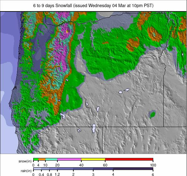
US West Coast Snow Report
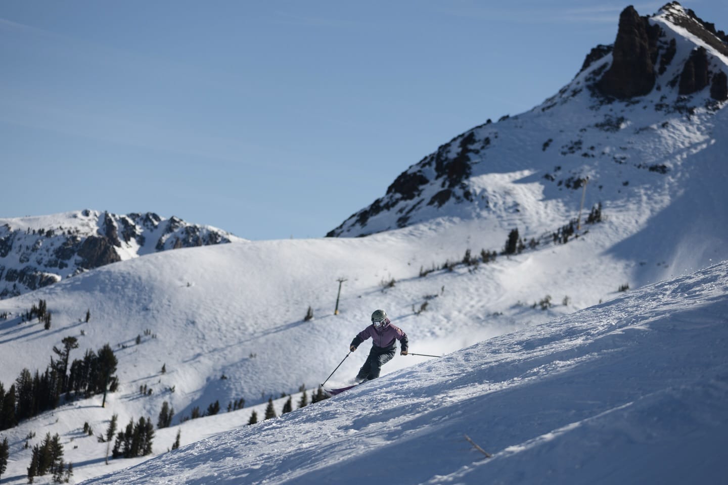
The hoped-for big change in conditions in the west for the final month or two of the season hasn't really materialised. After last week's good tallies, things have improved with more smaller falls, but we're mostly back to the dry, sunny weather with rather mild temperatures. Things are looking good in California, though, with Mammoth Mountain (80/124" / 200/310cm) 100% open and many other centres in the state in a similar position after the huge February falls there.
Although that recent snowfall was cause for celebration, it seems some ski areas can't get a break. After briefly reopening following a snow‑starved winter, Oregon's Hoodoo ski area was hit by warm storms that drenched the Central Cascades snowpack, flooding its low‑elevation base and submerging three lifts in water. Operations had to be paused again while the ski area waited for floodwaters to drop.
US West Coast Weather and Snow Forecast
A warm, springlike pattern continues across the US Pacific Coast ranges this week, with freezing levels climbing and only brief overnight refreezes. California's Sierra resorts run warmest, with summit highs mostly mid-40s to low-50s °F and bases often mid-50s to low-60s °F, keeping snow soft. Oregon and the Pacific Northwest stay slightly cooler but still see repeated thaws, with mid-mountain temperatures in the low-30s to mid-40s °F. Washington's higher peaks dip below freezing overnight before returning to 50–60°F at base by afternoon. No major storms are expected; conditions stay mostly dry with variable cloud.
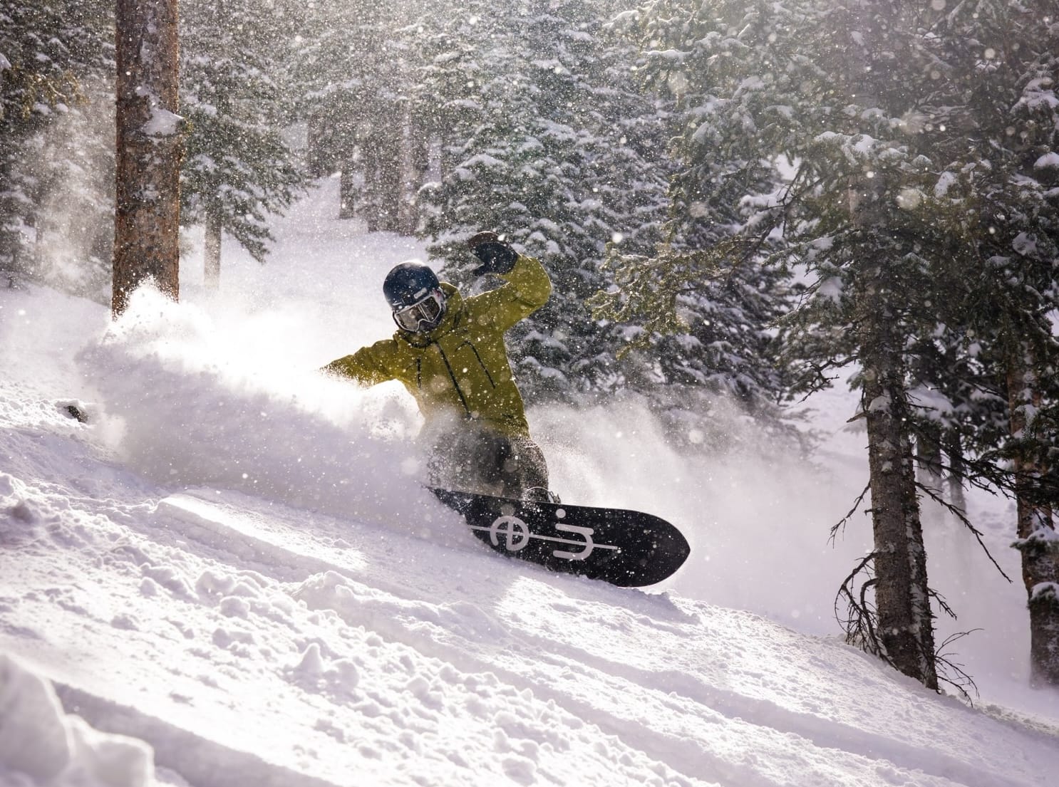
US Rockies Snow Report
The Rockies have seen further good snowfalls over the past week, interspersed by mild, sunny days. Wyoming saw ski areas posting up to two feet (60cm) of snowfall going into the weekend, with Jackson Hole (16/99" / 40/246cm) reporting 18" (46cm). Despite the fresh snowfall of recent weeks, though, the overall season of warm, wet weather has led some smaller, lower centres to declare their attempts to stay open for 25/26 are now over. Among them are Snowhaven and Bald Mountain in central Idaho, which are ending their ski seasons. Snowhaven opened for only one January weekend, while Bald Mountain and Cottonwood Butte never opened. Passholders can roll over their purchases to next winter.
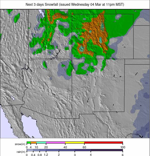
US Rockies Snow Forecast
A colder, more wintry pattern holds across the Rockies this week, with regular overnight freezes and a mix of sun, cloud and light snow pulses. Summit temperatures commonly sit 0–20°F, with the highest Colorado and Wyoming peaks dipping below 0°F at times. Bases trend milder, generally 25–40°F, bringing daytime softening in lower terrain. A mid‑week disturbance brings scattered light snow, especially in Colorado and northern Utah, before clearing to brighter, colder conditions. Freeze–thaw cycles remain widespread, but overall, the Rockies stay notably colder and more wintry than the Pacific Coast ranges.
US Midwest Snow Report
Snow conditions across the Midwestern US are seeing thaw‑softened surfaces, and many are mostly reliant on machine‑made snow, with temperatures hovering near or just above freezing. Many resorts in Minnesota, Wisconsin, and Michigan are seeing highs in the mid-30s to low-40s °F, leading to soft granular surfaces in the afternoon. Great Lakes hills are experiencing intermittent freeze–thaw cycles, briefly firming the snow overnight before daytime warmth breaks it down again.
The Dakotas remain slightly cooler but still sit above freezing most afternoons, limiting preservation. Overall, skiing is limited, soft, and highly weather‑dependent.
US Midwest Snow Forecast
A colder, more unsettled spell sits over the US Midwest's ski hills this week, with frequent light snow, sharp overnight freezes and only brief daytime thaws. Highs on the slopes generally reach the mid-20s to mid-30s °F, while nights fall well below freezing, keeping machine‑groomed and packed‑powder surfaces in good shape.
A series of weak disturbances brings occasional light accumulations, especially across Minnesota, Wisconsin and Michigan, but no major storm is expected. Lower‑elevation areas in Ohio and Missouri see more variability, with daytime softening followed by firm refreezes.
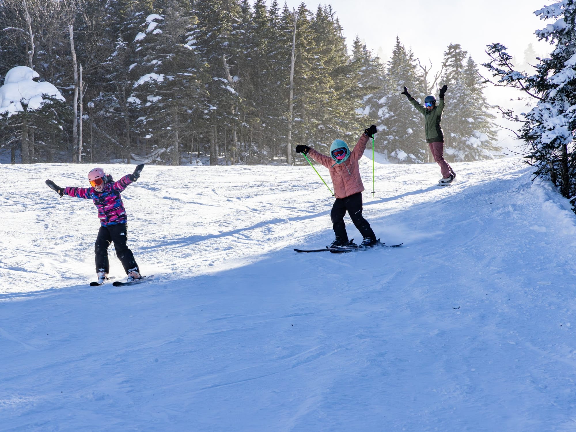
US East Coast Snow Report
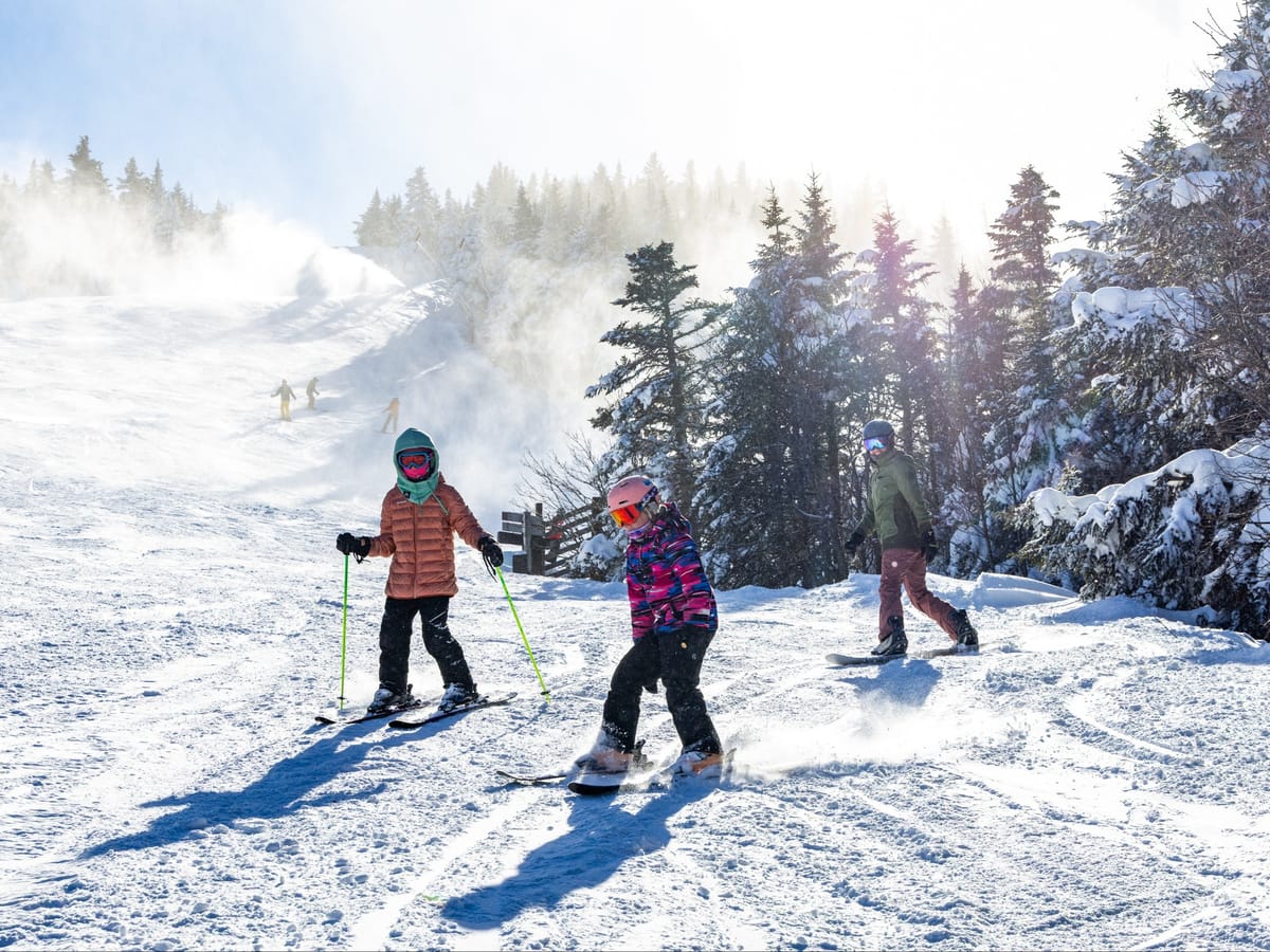
Snow conditions across the Eastern US are cold, snowy, and recently boosted by major coastal storms, with many resorts operating at or near full capacity. A powerful nor'easter brought heavy snowfall and blizzard conditions to cities from New York to Boston last week, with travel bans, school closures, and up to two feet of new snow reported in parts of the Northeast.
This fresh snow has reinforced already strong mountain coverage: Killington, Stowe, Whiteface, Okemo, Bretton Woods, and Loon are all 97–100% open, with upper‑mountain depths ranging from 76–121cm and solid base levels across Vermont, New Hampshire, Maine, and New York.
US East Coast Snow Forecast
A volatile, late‑winter pattern dominates the Eastern US ski regions this week, swinging between sharp freezes, brief thaws and periodic light snow or mixed precipitation. Summit temperatures across northern New England typically run 0–20°F, with the coldest peaks in Vermont, New Hampshire and Maine frequently dropping below 0°F overnight. Base areas fluctuate more, generally 20–35°F, with occasional pushes into the upper-30s to low-40s °F during milder spells. Light snow pulses favor the higher Green and White Mountains, while lower‑elevation Mid‑Atlantic hills see more mixed precipitation and firmer morning surfaces after overnight freezes.