Europe Weekly Snow Roundup #303
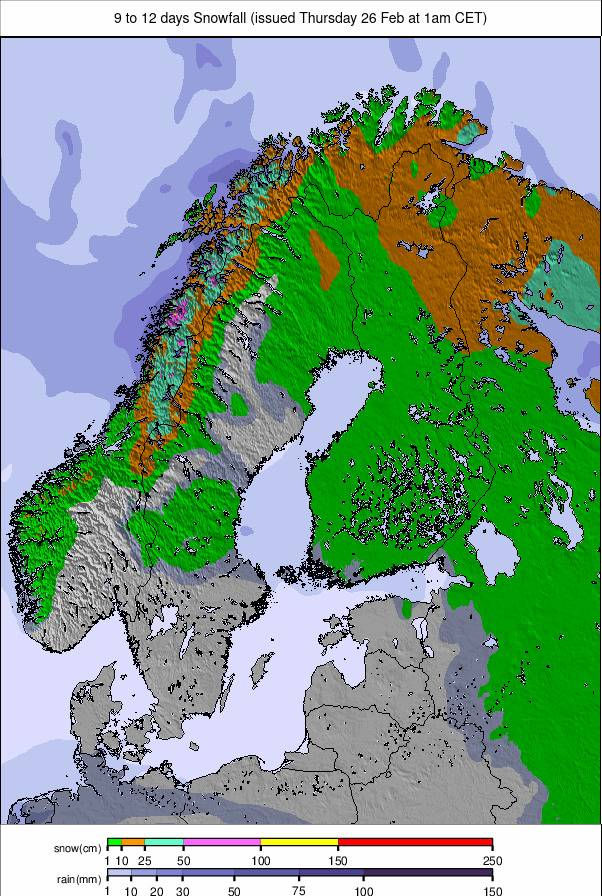
Weekly Snow News for Europe, updated 26 February 2026: Alps settle after 3m (10ft) storm cycle, Alpe d’Huez reaches 4m base, Scotland enjoying strongest season in years.
- The Alps emerge from a seven-day, 3m storm cycle
- France breaks the 4m base barrier as skies clear
- Fresh snow lingers in Austria and the eastern ranges
- Scotland enjoys its strongest and most complete winter in years
Europe Intro
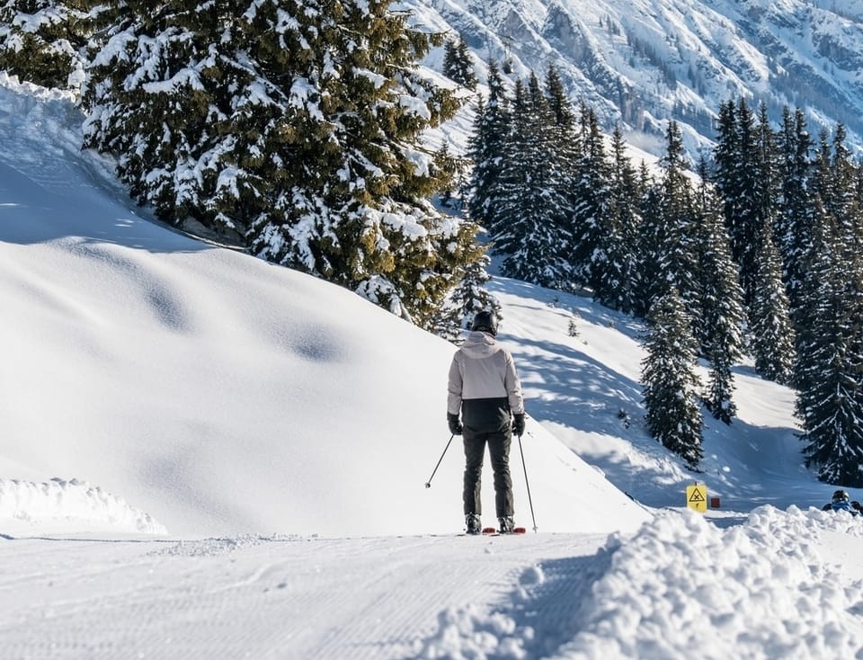
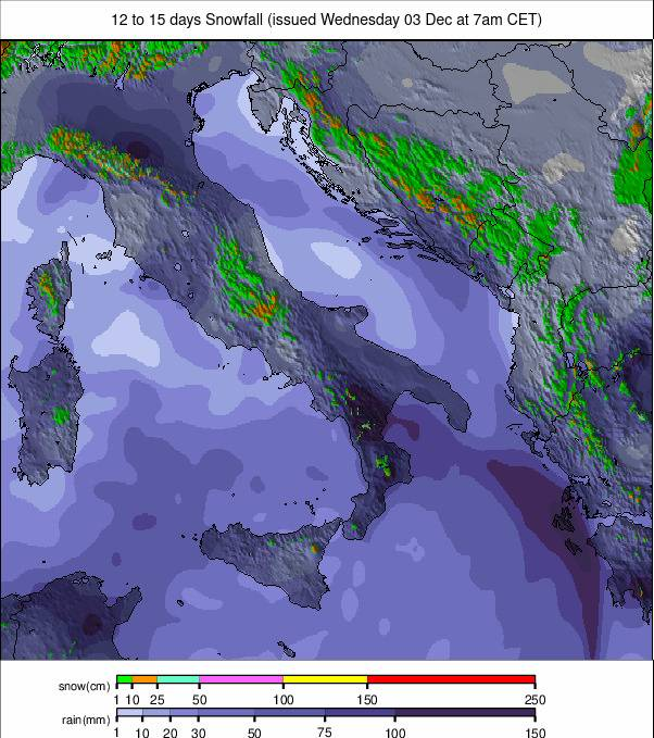
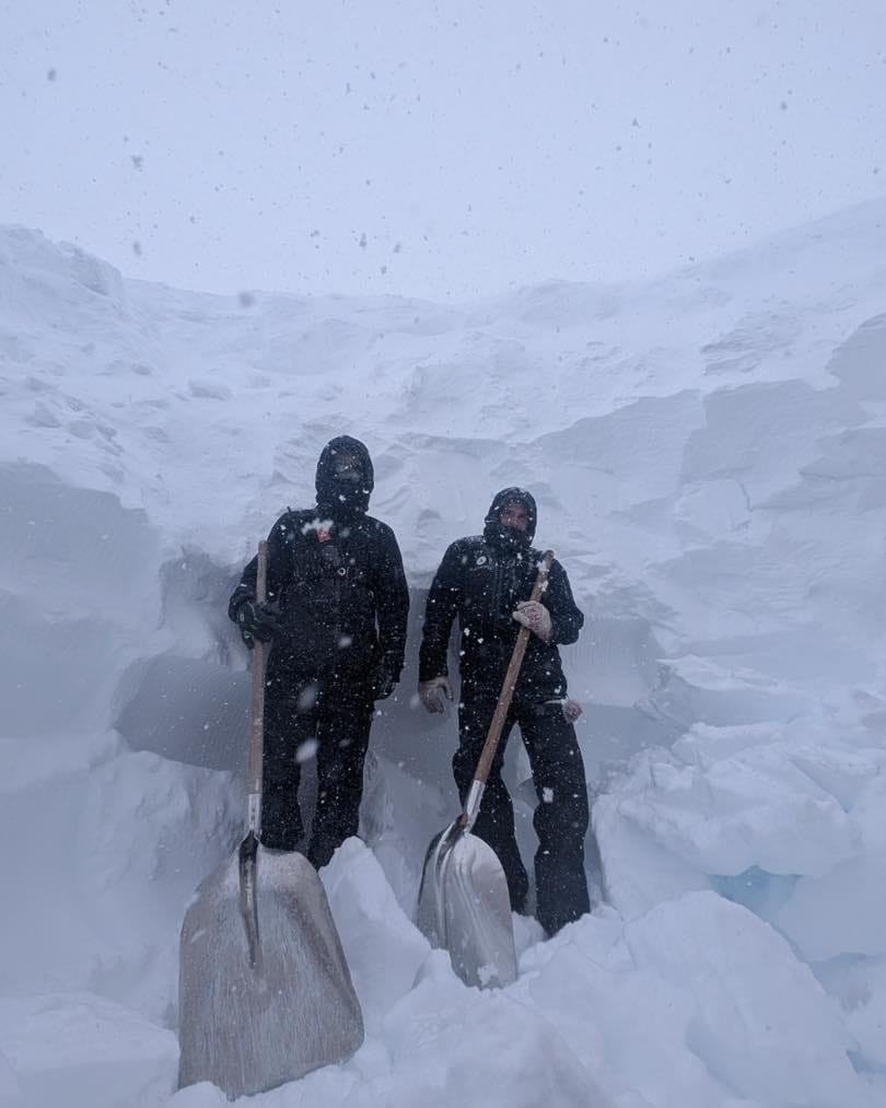
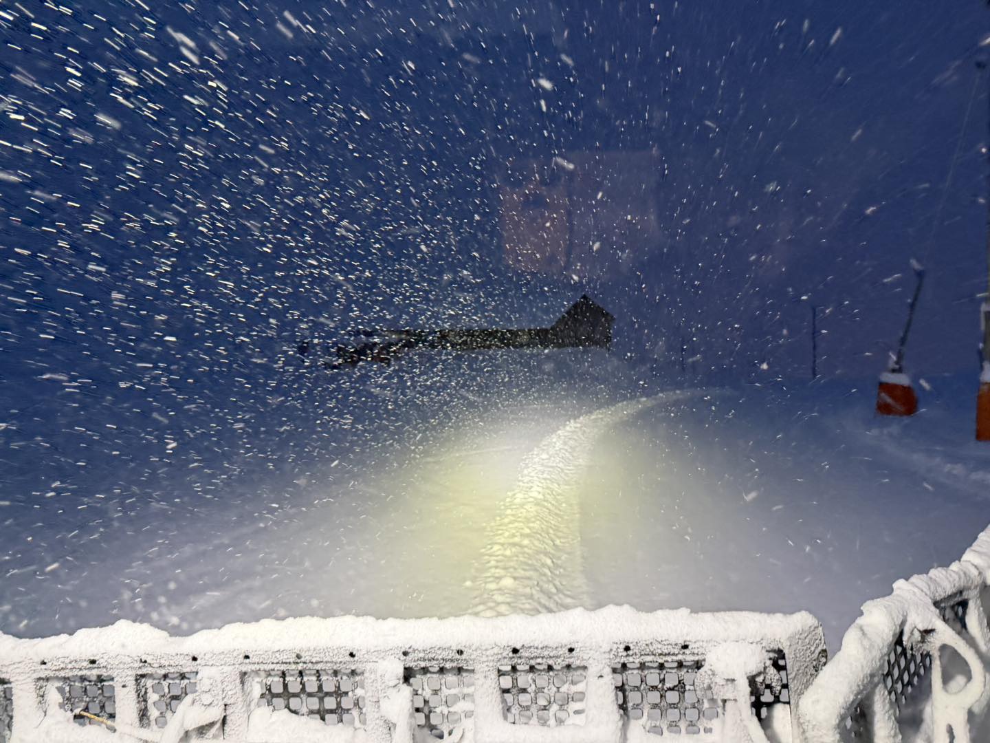
After weeks of exceptional snowfall in the Alps — peaking at up to 3m (10 feet) in seven days on high western terrain — conditions have settled since the weekend. Resorts are reporting calmer, milder and increasingly springlike weather. Avalanche danger remains very high in many areas, but more terrain has been reopening as slopes are secured.
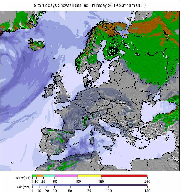
Elsewhere, sunshine has returned to the Pyrenees. Snowfall has lingered further east, with Austria and parts of Eastern Europe seeing additional light to moderate accumulations. Scotland continues its strongest season in years, while Scandinavia remains cold with slopes close to fully open.
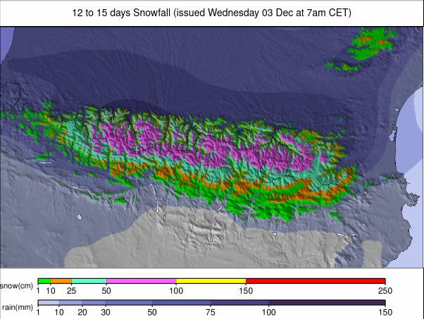
Austria Snow Report and Ski Conditions
Austria saw the most snowfall among the major Alpine nations over the weekend, continuing into the first half of this week with modest daily top-ups of a few centimetres (around an inch). Although totals have been lower than further west this month, avalanche danger remains high — especially in western regions — with ratings of 4 to 5. The fresh snow has pushed the first Austrian ski area past a 2m base this season. Little Ifen (75/240cm / 30/96”) in Vorarlberg now reports the country’s deepest cover.

Austria Snow Forecast
A mostly settled, mild spell continues. Mountain temperatures range between –7°C and –1°C, reaching 3–4°C in western areas, while valleys climb to +5 to +10°C. Little new snowfall is expected. High shaded slopes stay firm; lower pistes soften during afternoons.
France Snow Report and Ski Conditions
Nearly two weeks of stormy weather in the French Alps ended at the weekend, replaced by sunshine and rising temperatures. Valley highs near 1,000m have reached +10°C, with freezing levels climbing above 2,500m. Even higher elevations have edged a few degrees above freezing at times. Avalanche danger remains high, but calmer conditions have allowed resorts to reopen terrain.
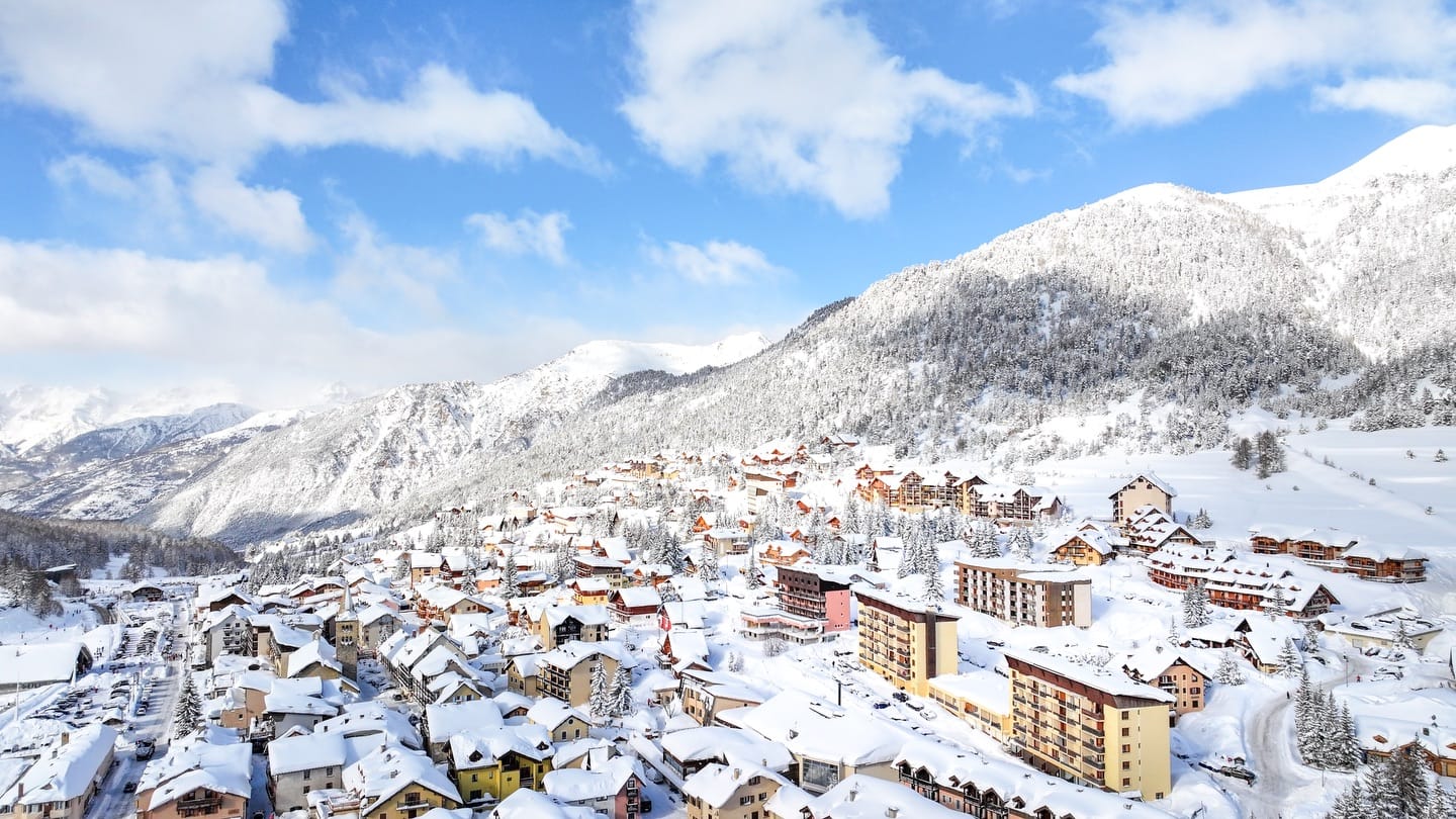
Alpe d’Huez (240/400cm / 96/160”) has become the first resort in France to reach a 4m base this season — currently the deepest reported in Europe. Holidaymakers arriving for the second week of French school holidays are finding far more terrain open than last week.
France Snow Forecast
Mild late-February conditions persist with freezing levels above 2,000m. High-altitude resorts such as Tignes, Val Thorens and La Plagne maintain summit temperatures between -10°C and 0°C. Sunshine dominates, with only limited flurries at higher elevations.
Italy Snow Report and Ski Conditions
Italy’s February run of major snowstorms has eased, returning resorts to predominantly sunny conditions. Avalanche danger remains particularly high in the northwest and northeast.
Snowfall disrupted some late 2026 Winter Olympics freestyle events in Livigno last week. Via Lattea (35/260cm / 14/104”) — including Sestriere, Sauze d’Oulx, San Sicario and Claviere — leads the country with nearly 340km (210+ miles) of slopes open.
Italy Snow Forecast
Freezing levels are climbing with many mid-mountain areas above zero during the day. Higher terrain in the Dolomites and Aosta Valley stays colder (-7°C to +2°C). Valley highs may reach +10°C. Snowfall prospects remain very limited.
Switzerland Snow Report and Ski Conditions
Storm systems impacted the entire country last week, with western regions seeing the heaviest snowfall and highest avalanche danger. Adelboden (20/140cm / 8/56”) and St Moritz (50/140cm / 20/56”) both recorded over 80cm (32”) in three days. Conditions have since turned sunny and milder, particularly in lower valleys. Les Portes du Soleil (90/350cm / 36/140”) reports the deepest snow in Switzerland.
Switzerland Snow Forecast
Dry, sunny weather continues. High-altitude areas see –10°C to –2°C, while bases range widely from –12°C to 7°C. No significant new snowfall is expected.
Pyrenees Snow Report and Ski Conditions
After months of unsettled, snowy weather delivering the region’s deepest cover in years, conditions have turned predominantly sunny and calmer.
Afternoon valley temperatures are reaching +10°C, with higher slopes a few degrees above freezing. Avalanche danger off-piste remains high. Grandvalira (230/310cm / 92/124") leads with 240km (150 miles) of runs, 99% open — the most terrain available this winter.
Pyrenees Snow Forecast
Sunny, settled weather continues. Valleys near +10°C, mid-mountain 0 to +5°C, upper slopes –10°C to –1°C. Snow lines sit near 2,000m. Only light showers possible later in the week.
Scandinavia Ski Season Update and Snow Forecast
Temperatures have moderated slightly to between –5°C and –15°C, though –30°C was recorded in Lapland at the weekend. Snow showers have delivered 10–20cm (4–8") top-ups, with Røldal in Norway reporting 25cm (10”) overnight Monday.
Most ski centres report 90–100% terrain open. Tänndalen (75/135cm / 30/54") posts the region’s deepest base.
Scandinavia Weather and Snow Forecast
Cold conditions persist with mountain temperatures –20°C to –4°C. Limited fresh snowfall is expected; snow quality remains crisp.
Eastern Europe Snow Report and Ski Conditions
The Carpathians have seen a colder, snowier week than western Europe, with 10–20cm (4–8") fresh snow since Sunday and temperatures between –5°C and +5°C. Most resorts across Bulgaria, Serbia, Slovenia, Czechia, Slovakia and Poland report 80–100% operations.
Bansko (190/150cm / 4/60"), Borovets (135/140cm / 54/56") and Pamporovo (75/120cm / 30/48") maintain strong upper mountain bases. Jasna (40/90cm / 16/36") is 90% open.
Eastern Europe Weather and Snow Forecast
Sub-zero mountain temperatures continue (–16°C to –6°C). Light snowfall remains possible, especially in higher Bulgarian and Slovak areas. Lower valleys may briefly thaw.
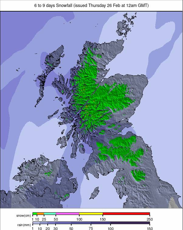
Scotland Snow Report and Ski Conditions
This is Scotland’s best season in many years. After a mixed December, January and February have delivered sustained cold and regular snowfall.
All five centres are open simultaneously for the first time since 2024, with four reporting most terrain available.
Recent snowfall has been accompanied by occasional strong winds and low visibility. Valley temperatures have reached double figures, with rain at lower levels at times, though most centres retain top-to-bottom coverage.
Nevis currently has more limited terrain and plans reopening from Thursday 26th.
Scotland Snow Forecast
Mild afternoons near +10°C in valleys. Summit temperatures –4°C to +4°C. Frequent showers may bring snowfall on higher terrain.