Alternatively, you can now use your Outside account to sign in to any brand in the Outside digital ecosystem, including Snow-Forecast, Surf-Forecast, and Mountain-Forecast.
The snow forecast for Seefeld is: Heavy rain (total 48.0mm), heaviest during Mon night. Warm (max 22°C on Tue afternoon, min 14°C on Mon night). Wind will be generally light.
Seefeld Weather (Next 3 days): The snow forecast for Seefeld is: Heavy rain (total 48.0mm), heaviest during Mon night. Warm (max 22°C on Tue afternoon, min 14°C on Mon night). Wind will be generally light.
Seefeld Weather (Days 4-6): Heavy rain (total 40.0mm), heaviest during Sun afternoon. Warm (max 21°C on Fri afternoon, min 12°C on Sun afternoon). Wind will be generally light.
Seefeld Live Weather
Resort
Snow Depth
Temp. (°C)
Wind (km/h)
Weather
Top Lift:
0.0m
12
Middle Lift:
14
Bottom Lift:
0.0m
15
Powered by Snow-Forecast.com
Seefeld Weather
(Next 3 days):
The snow forecast for Seefeld is: Heavy rain (total 48.0mm), heaviest during Mon night. Warm (max 22°C on Tue afternoon, min 14°C on Mon night). Wind will be generally light.
Seefeld Weather (Days 4-6):
Heavy rain (total 40.0mm), heaviest during Sun afternoon. Warm (max 21°C on Fri afternoon, min 12°C on Sun afternoon). Wind will be generally light.
The above table gives the weather forecast for Seefeld at the specific elevation of 1650 m. Our sophisticated weather models allow us to provide snow forecasts for the top, middle and bottom ski stations of Seefeld. To access the weather forecasts for the other elevations, use the tab navigation above the table. For a wider view of the weather, check out the Weather Map of Austria.
Click here to read further information on freezing levels and how we forecast our temperatures.
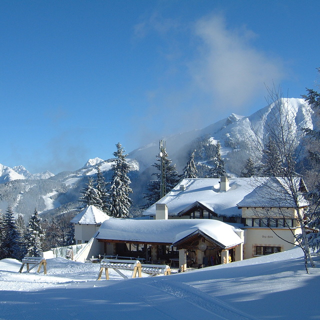
I’ve been visiting Seefeld yearly for almost 20 years since learning to ski here as a 30 year old. It’s a fabulous resort for beginners with a dedicated slope (Birkenlift & Geigenbühel t-bar drag lifts) that is a lovely area to master those snow plough turns. As it’s purely a beginners area there are no fast skiers flying past you, it feels very safe. It’s in town so you can walk to it and there are loads of ski rental shops a minute away. You can buy lift passes at the drag lift here. After that you move up to the 2 other main areas. Gschwandtkopf slope is a 15 min walk or 5 mins on the free bus, there’s also a free car park if you have a car. It’s a fantastic slope, a chair lift up the front and this slope has numerous ways to come down, you can make this slope as easy or hard as you wish. Straight down the right hand side is pretty much a red run but amble down the left side and it’s a lovely undulating easy blue. A great slope to build your confidence. There are also a couple of blue runs down the back, a bit narrower and great fun but only accessible on a T bar drag lift. Fab lunch stops at the top and bottom of the chair lift. You get the morning sun here but it’s colder and shady from mid afternoon. Next you take on the Rosshütte area. A 10 min free bus ride from town or also has a free car park. This is the largest of the areas in Seefeld. To the right you have a heated chairlift that takes you to a perfect blue run. A little narrow at first then a huge wide blue slope. There is also a great red off this chair. A train takes you to the top or a couple of chair lifts. The reds on this slope are decent easier reds. The blues are all excellent blues, nothing scary and never too busy. There are only 2 black runs. The black at the very top above the train is short and an easy black if it’s not windy. The short black in the trees is nearly always sheet ice and steep, a proper black run! If you’re looking for extensive terrain and tough skiing then there are better resorts. For leisurely fun confidence building this is the perfect resort. We come here every year for a week and then do a week in the 3 valleys for more extensive terrain. It’s also a beautiful town, no real apres ski but a nice place to potter and shop and drink hot chocolate.
I’ve been visiting Seefeld yearly for almost 20 years since learning to ski here as a 30 year old. It’s a fabulous resort for beginners with a dedicated slope (Birkenlift & Geigenbühel t-bar drag lifts) that is a lovely area to master those snow plough turns. As it’s purely a beginners area there are no fast skiers flying past you, it feels very safe. It’s in town so you can walk to it and there are loads of ski rental shops a minute away. You can buy lift passes at the drag lift here. After that you move up to the 2 other main areas. Gschwandtkopf slope is a 15 min walk or 5 mins on the free bus, there’s also a free car park if you have a car. It’s a fantastic slope, a chair lift up the front and this slope has numerous ways to come down, you can make this slope as easy or hard as you wish. Straight down the right hand side is pretty much a red run but amble down the left side and it’s a lovely undulating easy blue. A great slope to build your confidence. There are also a couple of blue runs down the back, a bit narrower and great fun but only accessible on a T bar drag lift. Fab lunch stops at the top and bottom of the chair lift. You get the morning sun here but it’s colder and shady from mid afternoon. Next you take on the Rosshütte area. A 10 min free bus ride from town or also has a free car park. This is the largest of the areas in Seefeld. To the right you have a heated chairlift that takes you to a perfect blue run. A little narrow at first then a huge wide blue slope. There is also a great red off this chair. A train takes you to the top or a couple of chair lifts. The reds on this slope are decent easier reds. The blues are all excellent blues, nothing scary and never too busy. There are only 2 black runs. The black at the very top above the train is short and an easy black if it’s not windy. The short black in the trees is nearly always sheet ice and steep, a proper black run! If you’re looking for extensive terrain and tough skiing then there are better resorts. For leisurely fun confidence building this is the perfect resort. We come here every year for a week and then do a week in the 3 valleys for more extensive terrain. It’s also a beautiful town, no real apres ski but a nice place to potter and shop and drink hot chocolate.
Free Snow-Forecast.com weather widget for your website
The Seefeld skiing weather widget is available to embed on external websites free of charge. It provides a daily summary of our Seefeld snow forecast and current weather conditions. Simply go to the feed configuration page and follow the 3 simple steps to grab the custom html code snippet and paste it into your own site. You can choose the snow forecast elevation (summit, mid-mountain or bottom lift) and metric/imperial units for the snow forecast feed to suit your own website…. Click here to get the code.


 Nearest