WORLD SNOW ROUNDUP #214
(Updated 8 November 2023) A comprehensive review of snow conditions, weather, and updates for Europe, North America and Asia's winter sports destinations.
Issued: 8th November 2023
By Patrick “Snowhunter” Thorne
World Overview
We’re into the home straight for the start of the 23-24 ski season now and the number of ski areas
worldwide has doubled from a little over a dozen a week ago to more than 30 now. About half of
these have opened since the weekend in Canada and the US where there are now more than 10
areas open compared to the one a week ago, while Europe has seen more centres open in the Alps
and Scandinavia.
There’s not actually been a whole amount of new snow this week in North America, but colder
temperatures in the East and Midwest have allowed resorts to begin opening there thanks to
snow-making. In the Alps, by contrast, the cold temperatures have continued and met an incoming
storm with the resort that some pretty healthy snowfalls, up to 60cm/2 feet up high but with a
decent dump down to valley floors, have been recorded. The Alps have seen the heaviest falls but it
has also been snowing in the Pyrenees, Tatras, Scotland and Scandinavia among others. For this
point in the season therefore things are starting to look good. We just need it to continue through
November. So far that’s looking quite promising too.
Europe
EUROPE INTRO
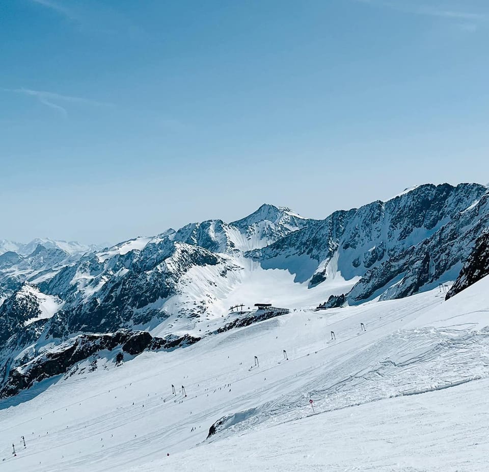
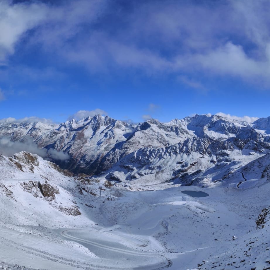
The Alps have had their snowiest and coldest week of the autumn so far, with snow falling to ever lower levels and with ever bigger accumulations up high, pretty much every day of the last week. The number of ski areas open is now in double figures, mostly in Austria and Switzerland with still nowhere open in France. The amount of terrain open and posted snow depths for those that are open continues to grow too. Up in Scandinavia, the snow keeps falling as well and we have the first Norwegian winter resort open joining those already opened in October in Finland and Sweden. Elsewhere, there’s been more snowfall reported on many other mountain ranges across Europe, including the Tatras in Slovakia and Scotland’s Cairngorms. Nowhere is open outside of the Alps and Scandinavia yet but the direction of travel is good and we just need it to stay snowy everywhere through November and things will be looking great for the start of the main season next month.
AUSTRIA REPORT
Austria continues to have the most ski areas open, just about, with a sixth glacier resort and the first to open this winter outside of Tirol, the Kitzsteinhorn (0/60cm / 0/24”) above Kaprun near Zell am See in Salzburgerland, the latest to open, last Friday the 3rd. It had delayed several times during the warm, dry start of autumn, but benefitted from the cold and snowy past seven days that have transformed conditions for the better, albeit with stormy weather closing centres like Hintertux and Stubai (0/40cm / 0/16”) at times. Solden (0/100 cm / 0/40″) has one of the largest areas open in the Alps so far with 24km (15 miles) of slopes. The Pitztal (20/30cm / 8/12”) and Kaunertal (0/47cm / 0/19”) are also open. It looks like Canada, Switzerland and the US might all overtake Austria next week as they each have quite a few planned extra centres opening, whereas Austria just has one more glacier, the Molltal (0/70cm / 0/28”) in Carinthia that has been delaying opening so far before the first non-glacier ski areas like Obergurgl and Obertauern start opening in a few weeks. Kitzbuhel says they’ll open on Friday thanks to snow-farming, snow-making and natural snowfall. Schladming has now announced that they’re opening too.
AUSTRIA FORECAST
Staying cold with a mix of clear and overcast conditions. Overnight lows down to -10 to -15C on high peaks and not getting above freezing in the daytime. Less snow forecast, but potentially a 10-20cm fall on high slopes to end the week.
SWITZERLAND REPORT
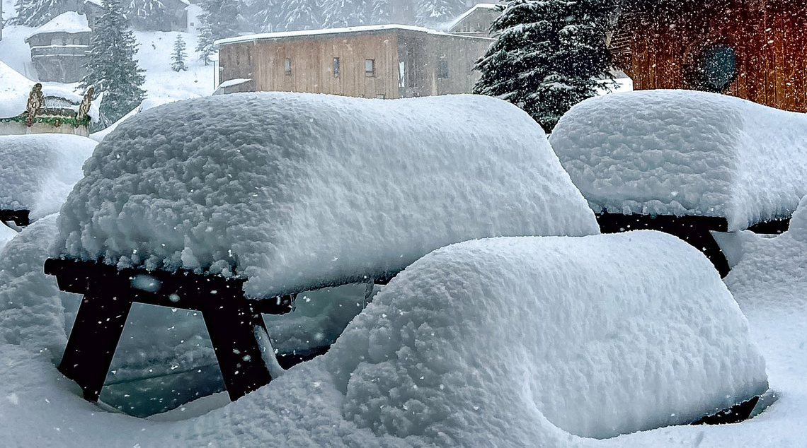
More Swiss ski areas have opened for their 23-24 seasons this week with several more opening soon. Mürren (0/20cm / 0/8”) is the latest to offer a few kilometres of slopes up his on the Schilthorn. It joins already open Zermatt (0/200cm / 0/80”), the Diavolezza glacier near St Moritz and Saas-Fee (0/240cm / 0/96″), which is posting the deepest snowpack in the world at present. The numbers are going in the right direction too with Swiss centres also seeing lots of fresh snowfall at the end of last week and through the weekend, up to half a metre (20″) in fact. All the snowfall and stormy weather actually led Glacier 3000 near Gstaad to announce it was delaying its planned opening last weekend to this coming Thursday the 9th. Davos is lined up to open its Parsenn slopes the next day and Verbier has announced it will open on weekends in November from this Saturday, having posted video of its slopes being groomed after the snowfall and its snow stake showing a 60cm (2 foot) fresh snowfall accumulation. Another Swiss area expected to open soon is Arosa.
SWITZERLAND FORECAST
Staying cold with subzero temperatures day and night above about 2,000m altitude. Skies are overcast most of the time but there’s not much snowfall in the forecast, mostly just a few inches here and there for now.
FRANCE REPORT
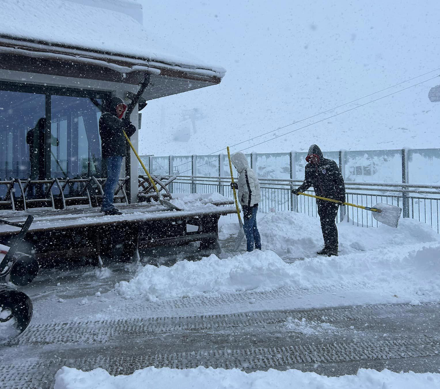
Fresh snowfall has been reported throughout the past week down to ever-lower levels in the French Alps. Ski areas have been posting images of deep snow up above 2,500m and snow down to ever-lower resort levels too. Les Arcs and Val d’Isere both reported 20-40cm (8-16”) accumulations over the weekend and resorts like Les Gets and Chatel posted images of heavy snowfall on resort streets. By Monday Avoriaz was posting that it had passed 60cm (2 feet) of snowfall at resort level (1800m) in the past 72 hours. However, there remain no French ski areas open with Tignes decision to give up on autumn opening, so currently no areas are planning to open before the final few days of this month when ski areas including Chamonix, Tignes and Val Thorens all plan to open.
FRANCE FORECAST
Temperatures staying low and after a drier few days midweek with some sunshine, the next front is expected to bring further substantial snowfalls over the last few days of the week and into the weekend.
ITALY REPORT
It’s been a good week in the Italian Alps and Dolomites with higher slopes seeing as much as half a metre of fresh snowfall, really transforming conditions. Cervinia is reported to now have terrain open on the Italian side of the border rather than just providing uplift to the highest glacier terrain on the Swiss side. Among the biggest falls reported were 50cm for Livigno (opening 2nd December) and 40cm (16”) in 24 hours at Val Senales/Schnalstal, which would usually have been open for over a month of autumn glacier skiing by now but this year hasn’t opened yet due to a big renovation and upgrade project for its access cable car. The Passo Stelvio summer ski area has ended its five-month season and for a few days over the weekend there was nowhere open in Italy, other than the Cervinia glacier access, but Sulden, in the Ortler Alps, opened for its 23-24 season on Monday.
ITALY FORECAST
It should stay cold for the coming week, generally remaining below freezing to low levels, and getting to -10C below up high and overnight in the Italian mountains. Sunny and dry for the next few days but a new front should bring fresh moderate snowfalls by the weekend.
GERMANY REPORT
Germany’s highest slopes at Zugspitze have seen some good snowfalls over the past few weeks. It’s likely to be the first area to open in the country but isn’t expected to open until 1st December, whatever the snow conditions, when it will begin a five-month season. Lower elevations have reported unseasonably mild weather on the whole.
GERMANY FORECAST
Cold temperatures and increasingly frequent snow showers are expected in Germany for the remainder of this week, with temperatures below freezing overnight and only a few degrees above in the daytime on mountain slopes.
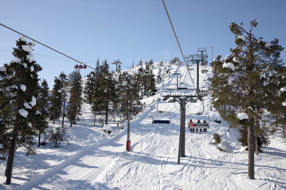
SCANDINAVIA REPORT
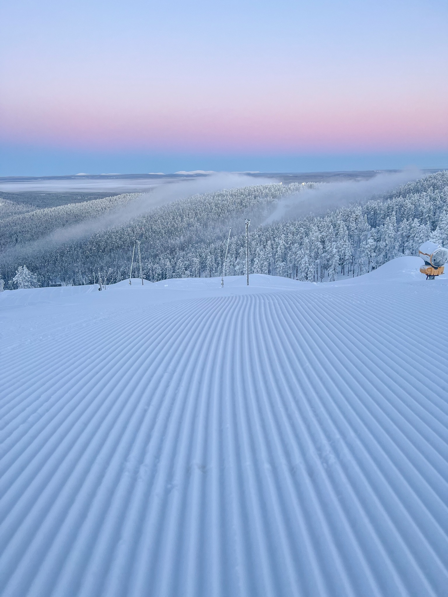
Three more centres have opened for their 23-24 seasons in Norway and Sweden, taking the total for the region open so far up to seven. It has remained cold (overnight lows into the negative teens Celsius in Lapland and remaining below freezing in the daytime and not much warmer further south) with frequent light to moderate snow showers. In Norway, Kvitfjell (15/20 cm / 6/8”) is the first non-glacier area to open, joining the summer ski Galdhøpiggen centre (30/100cm / 12/40”) as it winds down for 2023. In Sweden, Tärnaby (10/10 cm 4/4”) and Idre Fjall have opened at the weekend, joining Kåbdalis (12/36” / 30/90 cm ). Then up in Lapland, Levi (10/30cm / 4/12″) and Ruka (20/30cm / 8/12″) have already been open for a month of their seven-month seasons. Both are gradually opening more runs and are now up at around 5km (3 miles) of slopes open each.
SCANDINAVIA FORECAST
Mostly cloudy weather for the week ahead with some light snow showers. Temperatures typically remain below freezing, particularly in the north, day and night, with Lapland seeing -5 to -20C through the 24-hour cycle. Possibility of clearer skies and some sunshine towards the end of the week but daylight hours are also rapidly decreasing.
SCOTLAND REPORT
Cold weather met the latest storms in Scotland at the end of last week with snow falling to quite low levels and the snow gates being closed on the road up to the Cairngorm ski area. This is hopefully a positive sign for the season to come.
SCOTLAND FORECAST
Temperatures will remain close to freezing on Scottish mountain peaks with snow expected to continue to fall on higher slopes, and rain in valleys.
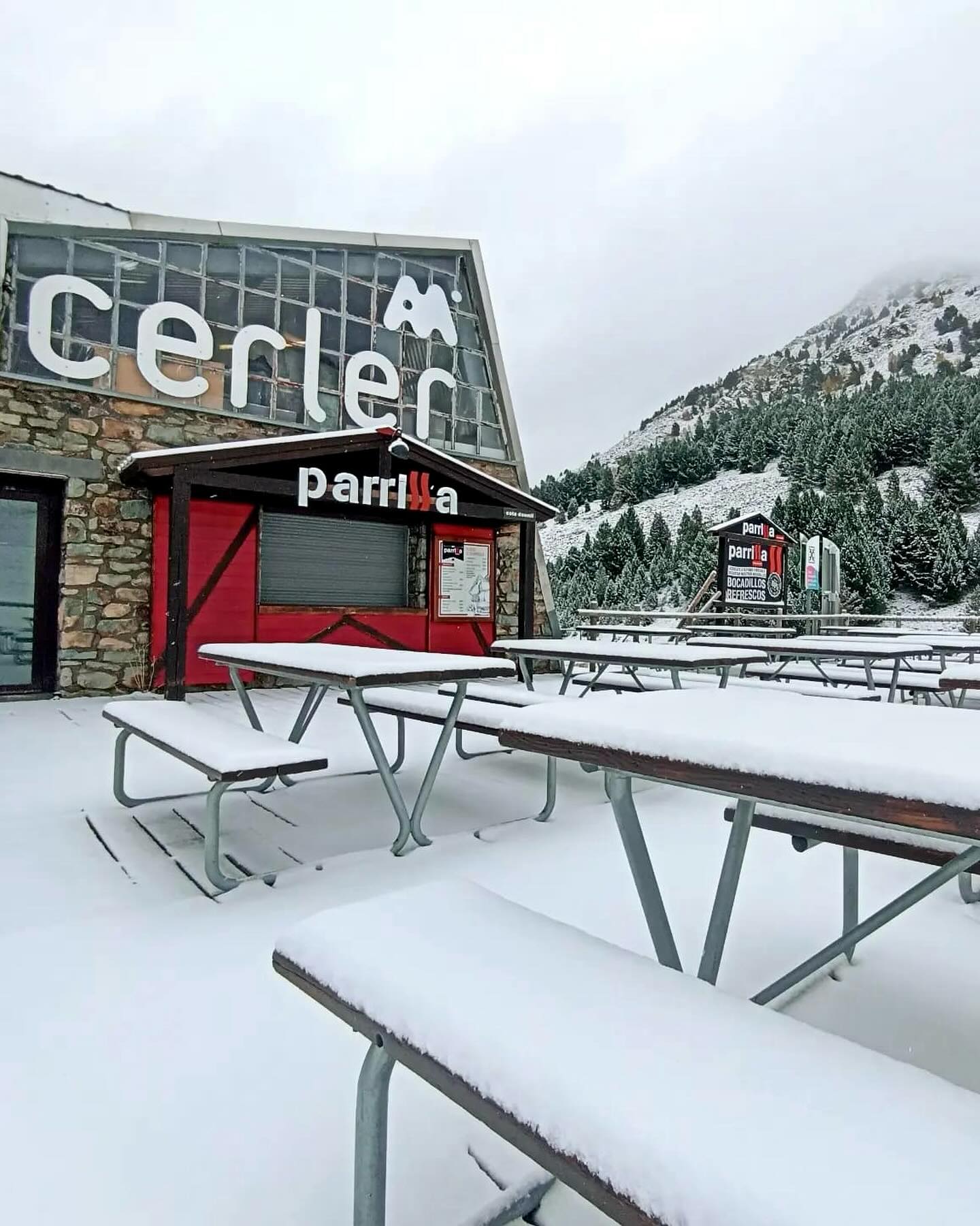
SPAIN / ANDORRA REPORT
The Pyrenees have reported snowfall too if not as much as the Alps, with resorts including Cauterets in France and Baqueira Beret and Cerler in Spain noting lots of snowfall on their higher slopes. Nowhere is expected to open in the Pyrenees until the final days of the month, but a big early snowfall could see some open early. So far there’s no sign of that coming though.
SPAIN / ANDORRA FORECAST
Temperatures staying cold and well below freezing overnight. There’s snow forecast most days for the coming week, generally getting cold enough for snow-making, but it’s not expected to bring a lot of snowfall, just a few centimetres (an inch or so) each time.
BULGARIA / ROMANIA REPORT
There has been some snowfall on high peaks in south-easterly European mountains in recent weeks, but there are no plans for any to open before early December at present. A big early dump could change that for some though.
BULGARIA / ROMANIA FORECAST
Mostly sunny at present with temperatures still reaching +10C or higher in the afternoons in valleys. However, closer to freezing at the top of the slopes and well below overnight. Snow flurries are possible here into the weekend and it should be cold enough to turn on higher-altitude snow-making systems.
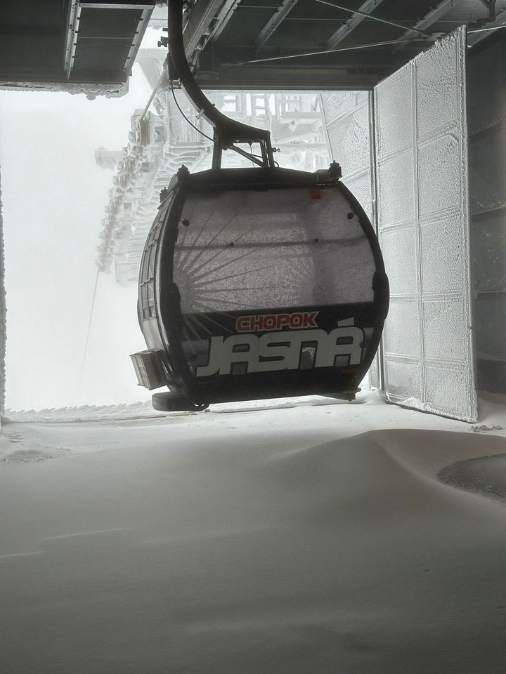
CZECH REPUBLIC / SLOVAKIA REPORT
There’s been more snow on higher slopes in the region this last week with Jasna posting snowy images. However, nowhere is expected to open until the end of this month.
CZECH REPUBLIC / SLOVAKIA FORECAST
Mostly dry conditions for the coming week with sunny periods and temperatures mostly in the -5 to +5C range in mountain areas. A new front is expected early next week that could bring more significant falls, but a bit of a way off for certainty at this point.
NORTH AMERICA INTRO
We’ve gone from one North American ski area open a week ago to double-figures this week with the numbers likely to double or triple again by next week when some big-name ski areas including Breckenridge, Mammoth and Vail are expected to have opened. The past week has actually had less snow in the west than the one before but overnight lows have facilitated snowmaking. There has been snowfall for New England though and the first resort has opened in Vermont, as well as several in the Midwest, all thanks to snow-making. North of the border we’ve had half a dozen areas open in Canada, most in Alberta thanks to natural snowfall, but the first by 24 hours was in Quebec thanks to snow-making.
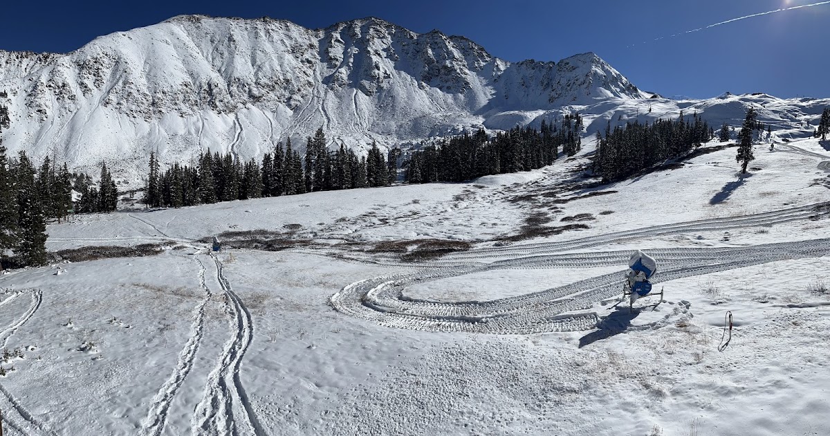
ROCKIES REPORT
Keystone (4/18” / 10/45cm) became the second ski area to open in Colorado, with about two miles (3km) of trails open initially from the 1st of November. It joined the already open Arapahoe Basin, which has now opened more terrain. The big surprise was a third Colorado area, Eldora, opening on Saturday a fortnight earlier than expected; all taking advantage of some great late October/early November snowfalls coupled with cold temperatures for snow-making. The past week has not been quite so good for base building, with lots of sunshine and daytime highs in the 40s and 50s, but overnight lows continue to be good for snow-making. Some of the region’s big name resorts including Breckenridge and Vail are expected to open later this week.
ROCKIES FORECAST
A front is expected to bring cold temperatures (freezing down to mid-teens Fahrenheit) over the next few days before sunshine returns to end the week and continue through the weekend.
USA WEST REPORT
The start of the western US ski season is only days away now with Mt Rose and Mammoth both targeting Friday the 10th to open. In Mammoth’s case only three months after its extra-long 22-23 season ended in mid-August. A front brought a little snowfall at the start of the week but, otherwise, it has been mostly sunny, although cold enough for snow-making up high.
USA WEST FORECAST
Remaining mostly dry and sunny with temperatures dropping below freezing overnight, and high 30s/low 40s on ski slopes in the daytime.
MIDWEST REPORT
Snowfall on Halloween across the Midwest, just after we completed our report last week, led to the first ski centre in the Midwest, Minnesota’s Wild Mountain, opening for its 23-24 season, the second to open in the US and North America (and three weeks later than in 2022 when it claimed first place). Wisconsin’s Trollhaugen, which had already opened for a rail jam in early October using snow saved from last season, opened on Thursday 2nd, also with a mix of natural and machine-made snow.
MIDWEST FORECAST
A fairly promising forecast with temperatures remaining around freezing across the region. Mostly clear skies midweek but the chance of a few centimetres of snowfall to end the week, although we’re on the rain/sleet/snow borderline.
USA EAST REPORT
It has been a snowy week in the eastern US too with light to moderate falls reported by ski areas in New Hampshire, Vermont, Maine and New York among others. Killington (0/14″ / 0/35cm) is the first to open in the east, using snow-making to open about half a mile of ski slopes for advanced skiers and boarders only, requiring a hike from the top of the gondola. They’re hoping to have their signature Superstar trail open soon, however. The largest ski area in the east began opening to lift pass holders on Friday then everyone else from the weekend.
USA EAST FORECAST
Conditions remain fairly marginal with temperatures within an 8-degree range on either side of freezing and some sunny, some cloudy days. The clouds will bring precipitation, which will vary between rain, sleet and snow depending on temperatures. Similarly, some nights will be cold enough for more snow-making, others not.
CANADA
CANADA WEST REPORT
Things have been moving quickly in Western Canada. Banff’s Mt Norquay (30/43cm / 12/17”) was the first in the region to open for the 23-24 season on Friday last week, a day earlier than planned, but it was joined by Lake Louise (30/30cm / 12/12”), opening a week earlier than planned. A third resort in the region, Nakiska (5/25cm / 2/10”), opened for a weekend preview on Saturday and Sunday. The first major snowfall of the season blanketed the Canadian Rockies last week, dropping an impressive 29cm (11.5”) in just 48 hours. In addition, cooler temperatures settled in, creating ideal conditions for snow-making to supplement the natural snow base. With a dusting of fresh snow for opening day, Mt. Norquay had a mix of locals, visitors, former Olympians and national team athletes all excited to once again be sliding on snow for opening day with the Cascade Chair spinning as well as the magic carpet in the Sundance Learning Area. At Lake Louise Opening Day saw commemorative T-shirts reserved for the first 200 riders on the Glacier Express Chair. Once on-mountain, accessible terrain included Wiwaxy, Bald Eagle, and parts of Easy Street. Peels of laughter and cheers wafted skyward as groups of riders took turns stomping tricks on tabletop jumps, boxes and rails in the terrain park. The third Alberta ski area, Sunshine, as well as Jasper’s Marmot Basin to the north, are expected to open for the season later this week.
CANADA WEST FORECAST
There’s not much snow forecast over the next seven days but, otherwise, it is looking good with temperatures peaking at around zero in the day and getting to -10C overnight, so good snow-making. Light falls most days expected, just a few centimetres, but that should be a good refresh each morning and there could be heavier, localised snow showers.
CANADA EAST REPORT
Despite it being a rather warm October, a dip in temperatures in the final days of last month allowed Quebec’s Sommet Sainte Sauveur to sneak under the wire and become the first ski centre to open not just in the east, but in all of Canada, last Thursday, November 2nd. It has had some natural snowfall, which was also reported by other ski areas in the region like Tremblant, but, of course, used snow-making to create its first run of 23-24.
CANADA EAST FORECAST
A mixture of sunny and overcast skiers with temperatures typically in the -5 to +5C range. Opportunities for snow-making at times therefore but not much natural snowfall in the forecast.
JAPAN REPORT
Japan’s larger resorts have started specifying opening dates and many are aiming for the last weekend in November or the first in December. For now, it’s the Yeti all-weather snowmachine-made slope below Mt Fuji that’s open and most of the snow that fell a week or so down to low levels elsewhere has retreated up the mountainsides to some extent with warmer, wetter weather this past week for most.
JAPAN FORECAST
Not looking that promising at present with daytime temperatures in valleys as high as +18C and overnight lows on high peaks not set to get below freezing overnight very often for the remainder of this week. There is a chance of some snow flurries on high points at the weekend though.