WORLD SNOW ROUNDUP #207
Issued: 6th September 2023
By Patrick “Snowhunter” Thorne
World Overview
It’s September, the start of spring by the meteorological measure of the seasons in the southern hemisphere, and things are looking pretty good in most of the region’s main ski nations as we enter what is for most the final month of their 2023 season. New Zealand’s areas continue to post great conditions and in South America most centres there are reporting some epic powder days after the huge snowfall that ended August.
Unfortunately, Australia appears to have the weakest position as we start September with several centres closed, bases rapidly thinning and resorts that are still open down to 30-50% of slopes still skiable for the final weeks of the season. Prolonged periods of warm temperatures and consequential rain rather than snowfall are to blame.
The 2023 ski season is over in southern Africa.
In the northern hemisphere, the start of autumn/fall is here by the meteorological measure of the seasons. Anticipation is building for the start of the 23-24 season.
In Europe, after the cool weather and snowfall in the Alps last week, things have unfortunately begun to warm up again since the weekend. However, four centres remain open and more are set to join them in just over a fortnight’s time now.
North America currently has nowhere open at present, unless we’re including the year-round indoor snow skiing of New Jersey. However, there was some snowfall reported on high slopes in Utah on Monday and snow-making is due to begin at the end of the month with the first resorts expected to open for winter 23-24 in October.
Southern Hemisphere
AUSTRALIA REPORT
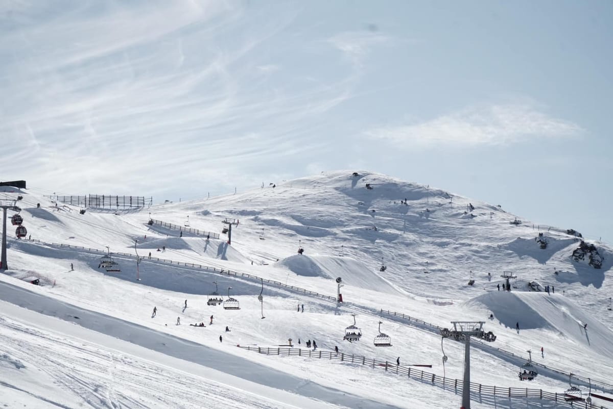
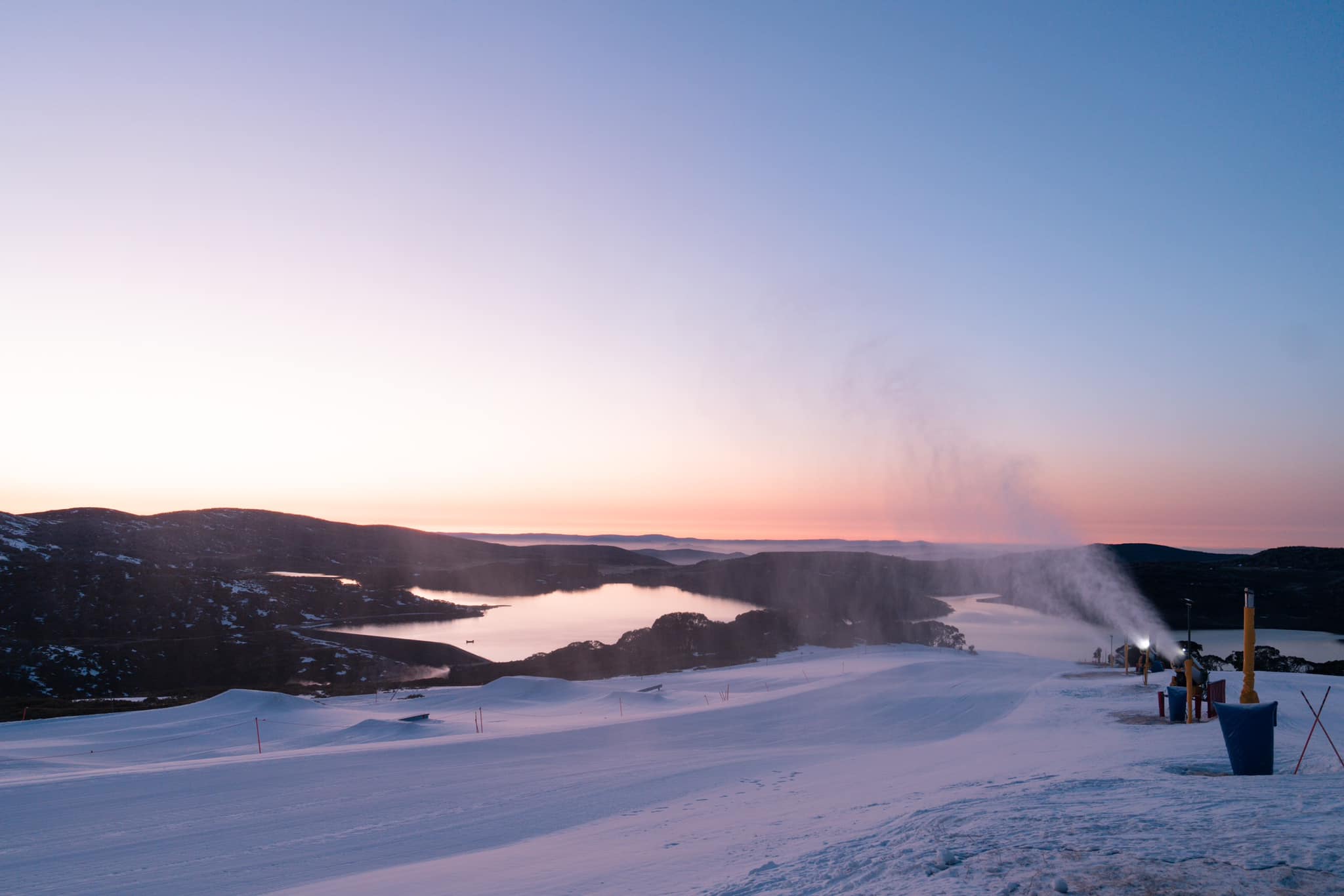
Now that spring is here and the final month of the season, Australian ski areas appear to be now accepting that they are losing the battle they’ve been waging for the past few months against above-average temperatures. A second ski area, Mt Baw Baw, joined Selwyn Resort in announcing it could no longer keep any slopes open as warm weather and rain rather than snowfall impacted the thin cover remaining and both have now announced that their 2023 ski seasons are over. Mt Hotham (20/40cm / 8/16”) is still open but announced at the weekend that after 68 days and countless hours of grooming and snow-making operations, they have closed their Heavenly Valley sector for the season. Snow on the slopes in that area has been pushed down to Slalom Gully to ensure they can keep the Village Loop running as long as possible. “We remain committed to keeping as much terrain open, as safely as possible, for as long as we can throughout our final month of operations,” a resort spokesperson said. That was helped by snow flurries on Tuesday morning. There’s about a third of the full area left open there and it’s a similar story at Mt Buller (9/54cm / 4/22”). Perisher (50/120cm / 20/48”) still has the deepest snow and most terrain open, but the latter stat has dropped from around 75% to 55% of its full area open. It’s the only resort still posting a snow depth above the metre mark though. Thredbo (30/60cm / 12/24”) and Falls Creek (30/50cm / 12/20”) are both also down to around half of their terrain still open. The latter noted snow-making was ongoing and -4C overnight.
AUSTRALIA FORECAST
There’s little change in the forecast or the week ahead with more wall-to-wall sunshine expected and temperatures in the -8 to +8C range. The overnight lows appear to still be enough for snow-making guns to be fired up, but it’s perhaps a little late in the season for much snow-making to be worthwhile.
NEW ZEALAND REPORT
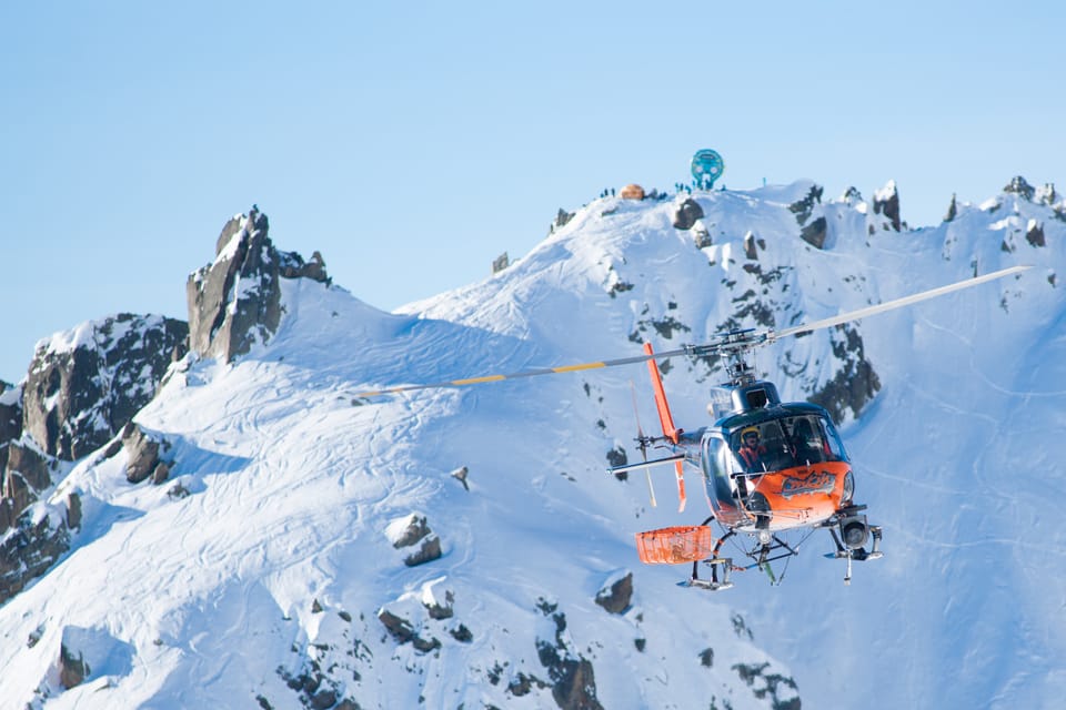
New Zealand’s ski areas continue to report some of the best conditions of the season with temperatures remaining fairly cool after the snowfall last month. Turoa (130/255cm / 52/102″), on Mt Ruapehu, on the North Island and Mt Hutt (120/215cm / 48/86″), on the South Island, are both reporting the two deepest snowpacks in the world at present. Mt Hutt is also one of the very few ski areas currently posting 100% of their slopes open, the most in the country with 40km (25 miles) of slopes. Many of the world’s best young skiers and boarders were in action in Cardrona (55/65cm / 22/26”) last week competing at the 2023 FIS Freeski and Snowboard Park & Pipe Junior World Championships, itself part of Winter Games NZ, the southern hemisphere’s largest winter sports event.
NEW ZEALAND FORECAST
It’s a mostly sunny week ahead with temperatures close to freezing overnight with daytime highs in the +5 to +8C at resort bases. Some light snowfall is expected on Wednesday/Thursday when overnight lows of around -5C are forecast.
ARGENTINA REPORT
Argentinian ski areas have mostly had quite a cool and, for some, a snowy week, although mostly it has just been 5-10cm (2-4”) a day rather than any significant snowfalls. But the light snow has refreshed surfaces. At the same time though we’re into the final weeks of winter 2023 for most resorts now and the amount of terrain open has been dropping, even as bases continue to grow. Catedral (20/110cm / 8/44”) near ski town Bariloche, for example, had been posting 80% of its slopes open a week ago but it is down to 60% now, even if that’s still the largest area open in the world at present with about 70km (35 miles) of runs. To be fair, Las Leñas (80/120 cm / 32/48”) and Chapelco (14/126 cm / 6/50”) each have about 90% of their slopes open.
ARGENTINA FORECAST
Remaining fairly cool with temperatures typically in the -5 to +5C range through the 24-hour cycle. Overcast skies with little sunshine are expected but more light snowfall is forecast daily for most areas right through to the weekend.
CHILE REPORT
It has been a mixed bag of weather in Chile with another major snowstorm hitting from the weekend through the start of this week, but with it being springtime now and temperatures rising a little, it’s been a case of torrential rain for some and deep powder for others. Obviously, the consequences of that have been epic conditions for those who got the powder, but bad news (and in the case of Lagunillas (30/45cm / 12/18”), closure) as torrential rain hit the thin snowpack. Going back to the luckier resorts though. Portillo (185/200cm / 74/80”) saw 40cm (16”) of snowfall over the weekend and more snow since, although apart from the great conditions an inevitable result was that access roads closed. It has by far the deepest reported snowpack in the country but El Colorado (10/50cm / 4/20”) is posting the most terrain open, about 80% of its slopes and 40km/25 miles of runs, the most of the season so far.
CHILE FORECAST
There’s no real end to the snowfall in sight although lighter accumulations are expected for the remainder of this week, perhaps 5-10cm (2-4″) daily for most areas. Temperatures will be mostly below freezing day and night on higher slopes with lows of -6C overnight, but on lower slopes we could see daytime highs of +6C and rain rather than snow at times.
Europe
EUROPE INTRO
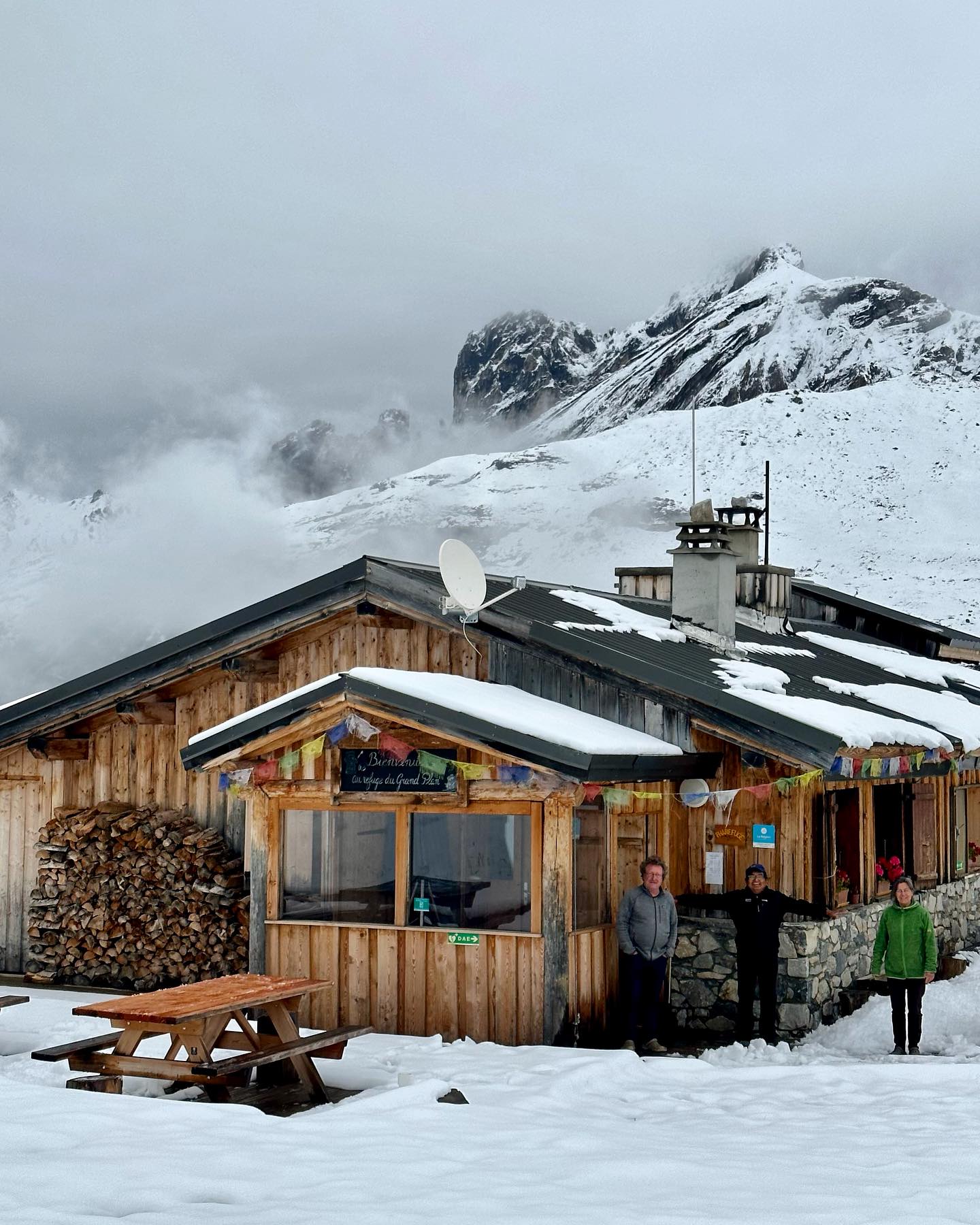
It is a much-improved picture in the Alps to start September with snow still lying on high slopes a week after the late August falls above 1500m. Temperatures have warmed up again but nothing like as much as in July and August and overnight lows on glaciers have been back down below freezing. It is back to full sun now though and with daytime highs getting to double figures again at 3,000m there’s a bit of a fresh onslaught of warm weather to get through this week. We would normally be talking about the first of the autumn openings for glaciers this week but target opening dates are a week or two later. So still 2-3 weeks away for most, and one, Italy’s Val Senales, won’t open in autumn this year due to lift upgrade works. There are five centres open in four countries in Europe again though with Passo Stelvio reopening with the new snowfall last week. Up in Scandinavia, Norway’s highest ski slopes are also still open for the fifth choice on top of the four alpine glaciers. For a little novelty Portugal’s only ski slopes at Serra de Estrela turned white at the weekend but the centre, at 2,000m, confirmed this was due to a build-up of hail, not snow.
AUSTRIA REPORT
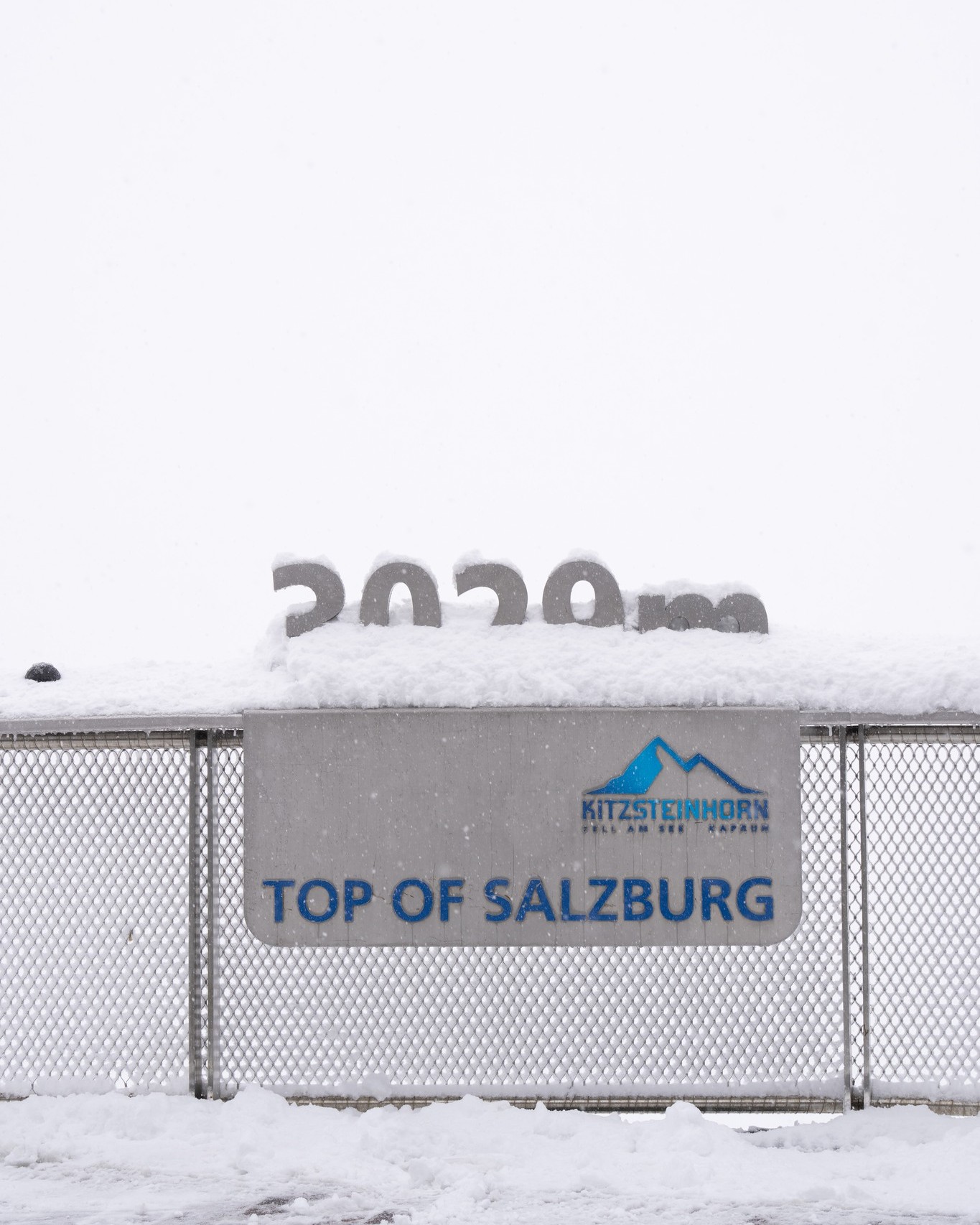
Austria will hopefully end September with at least five glacier ski areas open, but right now it’s just the year-round Hintertux glacier (0/20cm / 0/8”) still operating with a painfully thin base on the glacial ice and just 2km (a mile and a quarter ) of slopes open. Despite these grim stats the recent snowfall and lower temperatures have eased the pressure slightly. The Kauntertal, Pitztal, Solden and Kitzsteinhorn glaciers are due to open for their 23-24 ski seasons over the final weekends of September.
AUSTRIA FORECAST
Unfortunately, a predominantly warm week ahead with daytime highs getting to double figures above Celsius and overnight lows not making it down below freezing even on the highest slopes. Stubbornly staying a few degrees above zero Celsius instead.
SWITZERLAND REPORT
After reporting its base dropping from 2.5 metres (100”) to 2 metres (80”) during the heat of the final weeks of August, Saas-Fee (0/210cm / 0/84”) has seen its base recover by 10cm (4”) with the cold and snowy weather of last week. It and Zermatt (0/100 cm / 0/40”) are the two centres currently open in Switzerland, both with around 12km (7.5 miles) of slopes open. Temperatures have been rising again and the sunshine has returned after the snowfall, but so far it remains cooler than before the snowstorm blew in.
SWITZERLAND FORECAST
Sunny weather will continue to dominate this week but temperatures should get back to around freezing overnight with daytime highs of around +5C at 3,500m. There’s a chance of snowfall later in the evening and overnight towards the end of the week.
FRANCE REPORT
There are currently no ski areas open in France for skiing and none that plan to open until Tignes and Val Thorens, among others, at the end of November. The exception is Les 2 Alps which is aiming to open for a fortnight over the final week of October and the first week of November for glacier skiing including ski cross and snowboard Cross World Cup competitions, if conditions are good. The snow line has moved up from the 1500m mark it reached a week ago and is now up to around 2500m from the fresh snowfall that ended August.
FRANCE FORECAST
Mosty sunny weather with temperatures climbing back to double-figures at 3,000m in the afternoons. So the snow will be melting to ever higher elevations. Dropping back below freezing overnight.
ITALY REPORT
The good news from Italy is that Passo Stelvio (0/30cm / 0/12”) said that the recent snowfall (they reported 30cm/a foot in the final days of August), coupled with the low temperatures that have come with it meant that it could re-open at the weekend after only a week’s closure, a much better result than the month or so closed around this period a year ago. With Cervina closing its access to the glacier slopes above Zermatt for a final month in September before beginning 365-day access from October on, and with Val Senales not opening this autumn as its cable car is being upgraded, it means that Passo Stelvio will be the only centre open in Italy this month. It reports open terrain is 4km (2.5 miles) compared to 3km (2 miles) when it shut down but hasn’t increased its thin base stats despite the new snow.
ITALY FORECAST
Mostly warm and sunny weather ahead, which may not bode well for Passo Stelvio continuing to stay open. Overnight lows back a degree or two below freezing but with daytime highs at the top of the glacier touching +10C in the hottest hours of the day.
SCANDINAVIA REPORT
Norway’s Galdhøpiggen ski area (0/100cm / 0/40”) with the highest ski lift in Scandinavia, continues to operate. Most years it closes for a few weeks in late summer but so far this year that doesn’t seem to have happened. The last week has seen temperatures in the -5 to +8C range with some rain, sleet and snow between sunny spells. It’s just a month now until the leading Lapland ski areas of Levi and Ruka in Finland are expected to open a similar few kilometres (mile or so) of slopes each, the same as Galdhøpiggen, in their cases by recycling snow stored undercover from last winter back out onto their slopes using snow farming techniques.
SCANDINAVIA FORECAST
It’s looking quite sunny for the remainder of this week and with daytime highs hitting +1C it may be challenging for ongoing operations at Galdhøpiggen. Overnight temperatures getting back down close to freezing though.
USA REPORT
There remains nowhere currently open in North America unless we are counting the popular indoor snow slopes of Big Snow in New Jersey. But snow has been reported falling on high slopes on each side of the US. In the west, Mt Hood Meadows, in Oregon, said it had a dusting of snow at the weekend and then Utah resorts including Alta, Snowbird and Solitude posted some fresh snowy images on Monday afternoon. They reported less than four months since their last snowfall at the end of the epic-snowfall-totals 22-23 season and less than 75 days to go to the start of their 23-24 season. In the east, the Mt Washington Observatory at a high point in New Hampshire’s White Mountains, and a springtime mecca for ski tourers, also noted a small overnight snow shower. But got anticipation levels rising. As it is the 23-24 season is expected to kick off next month either on high slopes in the Colorado Rockies or at small centres in the Midwest, in both cases mostly down to snow-making, although a big early natural snowfall could transform things. Loveland says it expects to start snow-making at the end of September.
USA FORECAST
Temperatures now getting a degree or two below freezing overnight on America’s highest slopes. Unfortunately, tough daytime highs in the 50s and 60s would kill off an early snow cover, and it still needs to get a few degrees cooler for snow-making machines to be able to work overnight anyway. But we’re moving in the right direction. Mostly sunny skies, clear at night, in the forecast.