North America Weekly Roundup #233
(Updated 20 March 2024) A comprehensive review of snow conditions, weather, and updates for North America's winter sports destinations.
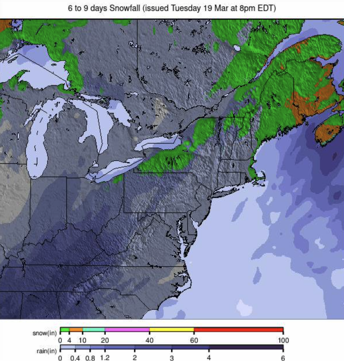
Rockies Blizzard Chaos: Powder Paradox Closes Resorts
- The Rockies experienced significant snowfall, causing temporary closures due to hazardous conditions, while Alta in Utah continues to boast deep snow totals.
- Western US resorts are winding down, but Timberline in Oregon and The Palisades in California extend their seasons, with more snow expected next week.
- In the Midwest, ski season is fading with only a few centers still open, while the US East sees a late-season boost with modest snowfall and cold temperatures.
NORTH AMERICA INTRO
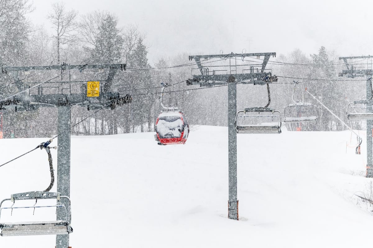
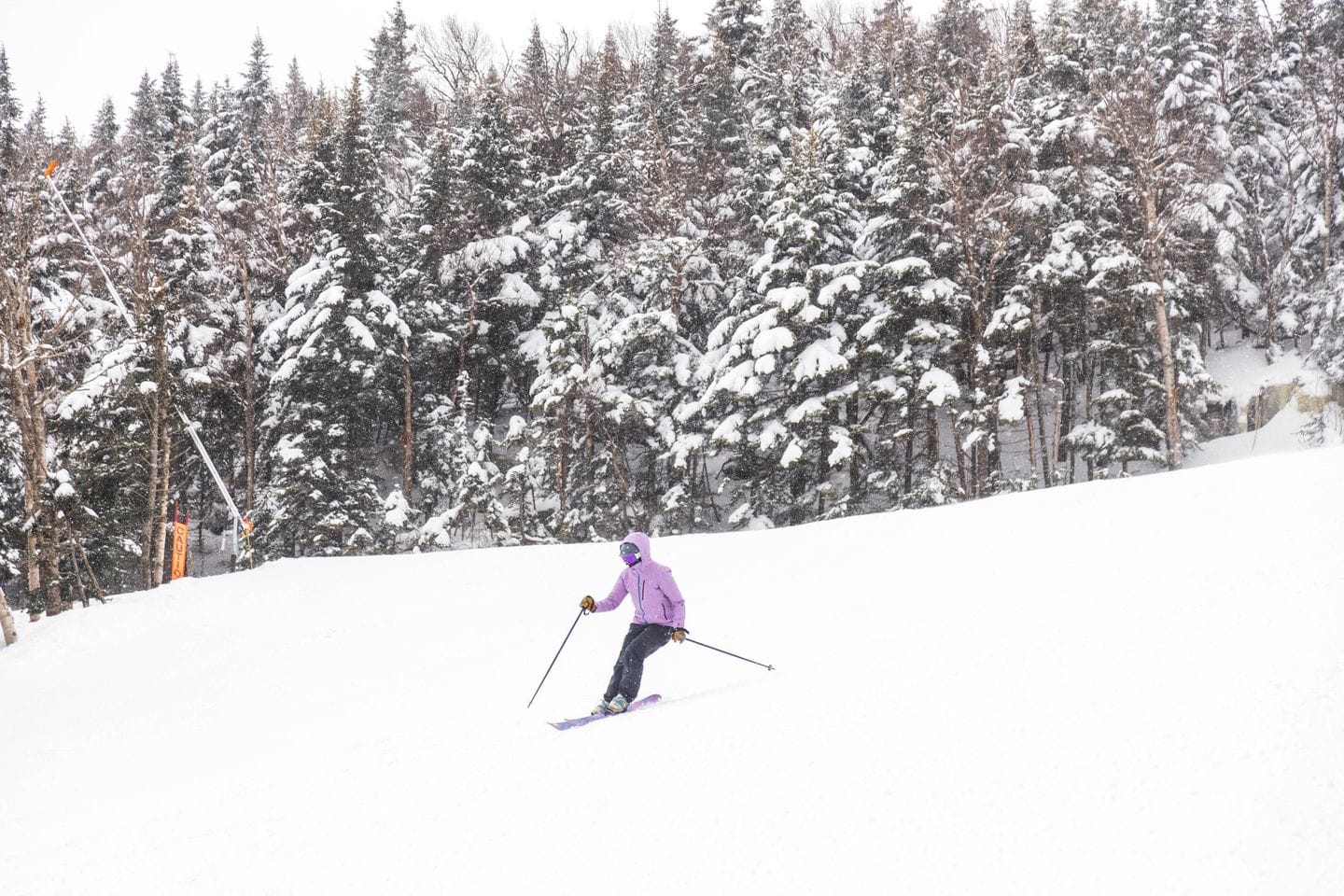
Some of the biggest falls this week have been in the Rockies where there were powder conditions in many areas at the weekend. So much so centres were briefly closed due to access road closures, avalanche danger or gale force winds making operations unsafe. The other region posting some colder weather and snowfall through the week was the East Coast, but lighter falls over a longer here. Many ski areas are into their final week or two of the season, but we're also seeing a growing number of centres announce extended seasons, some thanks to recent snowfalls, others just as that's how they do it to build late-season excitement almost every year anyway!
ROCKIES REPORT
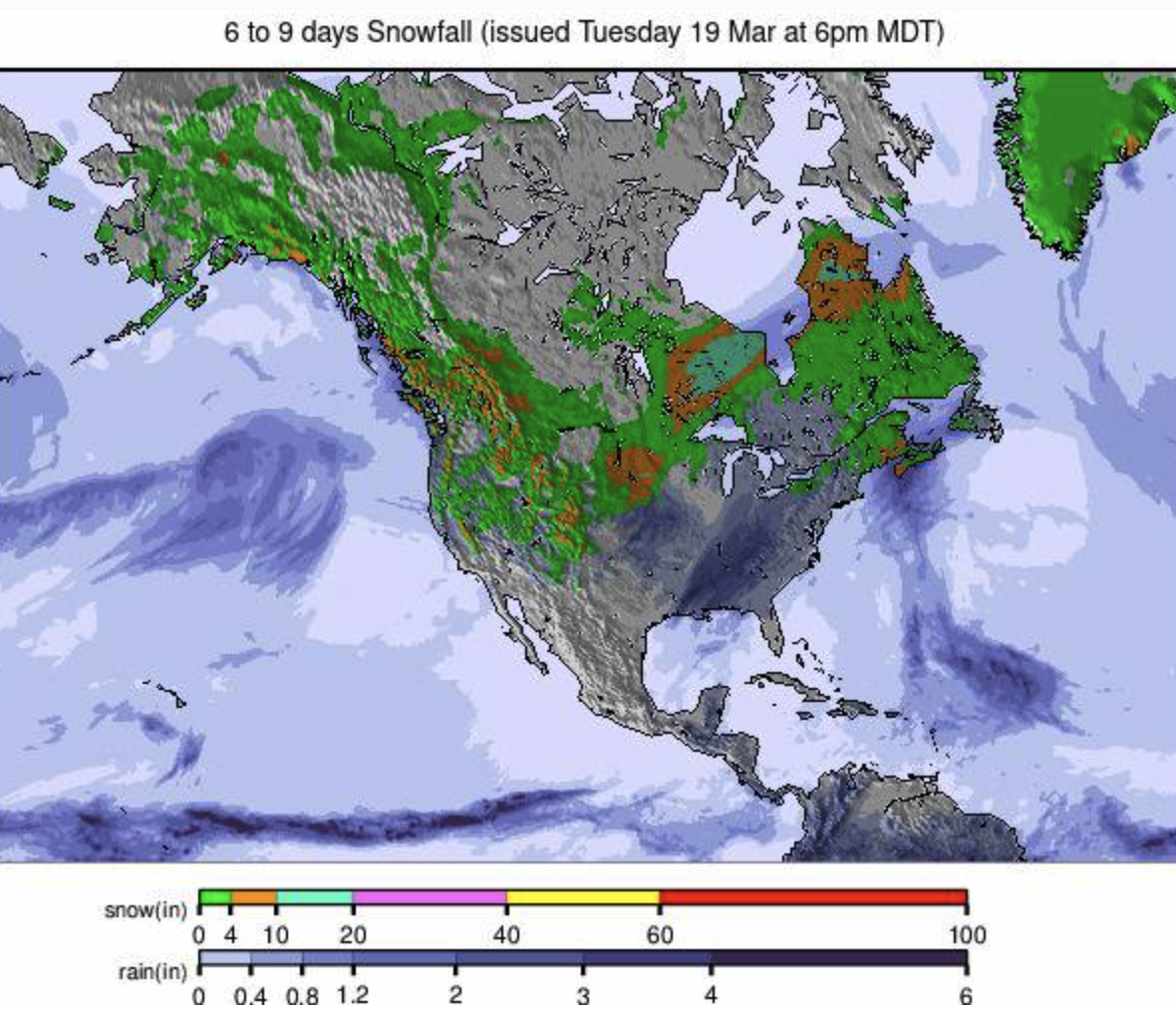
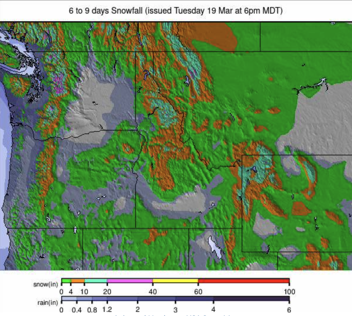
There were some good snowfalls in the Rockies in the latter half of last week, with accumulations of several feet reported; however the snow arrived with gale force winds, closing some centres including Arapahoe Basin (36/73" / 90/170cm), while Loveland (30/64" / 75/160cm) said it was closed as the main I 70 freeway up to the mountains from Denver was closed, preventing staff and guests arriving. The weekend saw fresh powder turns, though, as the sunshine returned. Up in Utah, the latest accumulations have taken Alta's (60/160" / 150/399cm) season total through the over 500 inches (12.5m) season snowfall to date mark, a healthy number if not up at the 9+ metres 22.5m last winter. It has been posting North America's deepest snow for much of the season and remains in second spot.
ROCKIES FORECAST
Mostly dry and sunny weather for the rest of this week. Valley highs in the high 40s, low 50s and just the odd light snow showers. Colder and snowier at the weekend with 6-12" (15-30cm) accumulations possible.
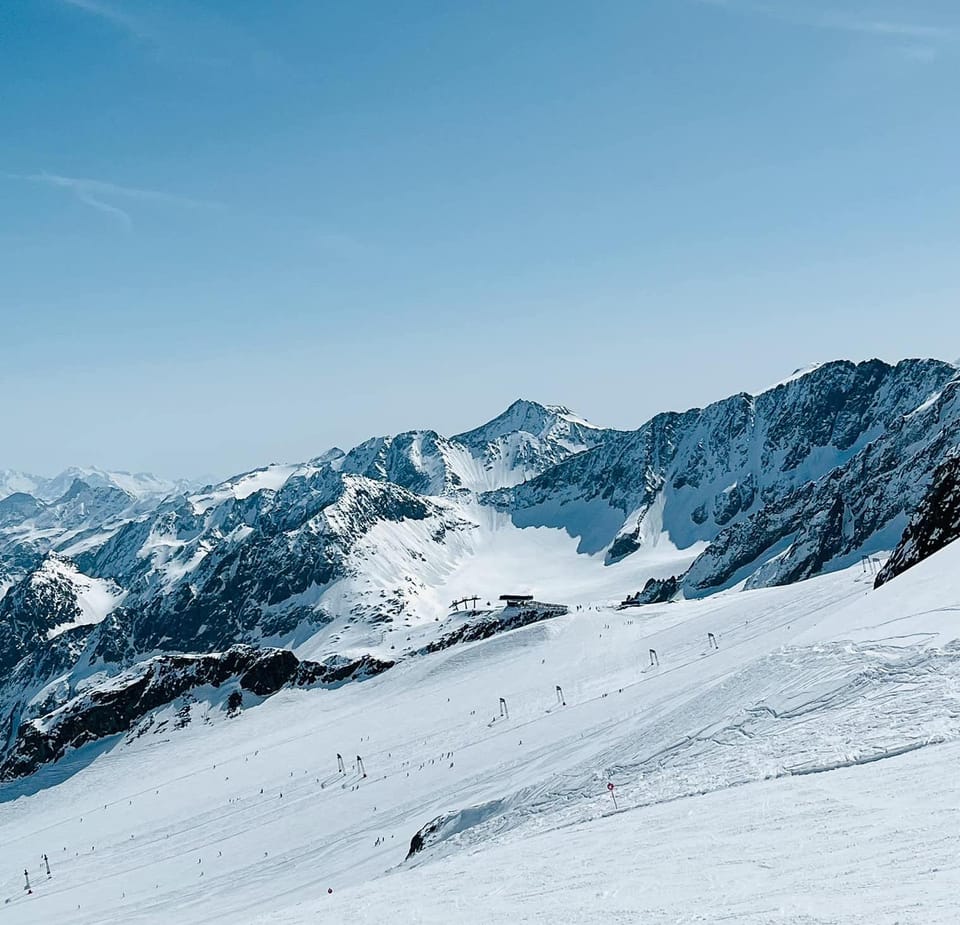
USA WEST REPORT
It has been a largely dry and sunny week in the Western US, with the impact of the giant storm at the start of this month starting to lessen. That said, the deepest snowpacks in North America remain in the region, with Oregon's Timberline (122/162" / 305/405cm), which boasts the continent's longest ski season, looking in good shape to see it through spring and hopefully into summer on the Palmer snowfield. Meanwhile, in California, The Palisades (53/119" / 132/296cm) has announced that it is extending its season to the end of the Memorial Day weekend thanks to all the snowfall there, although it does usually stay open to at least then anyway. Crystal Mountain in Washington state to the north has announced that it's extending its season to open weekends to the end of April after the recent snowfalls there.
USA WEST FORECAST
There will be mostly dry and sunny weather through the week, with temperatures getting into the 50s at resort base levels in California. But a temperature drop and heavy snowfall are currently in the forecast, with potentially more than a foot (30cm) of snowfall for the start of next week.
MIDWEST REPORT
The season is definitely on its way out in the Midwest, with only about a dozen centres left open; around 90% have closed, many earlier than they had hoped because of the poor conditions for much of this season and now warm spring temperatures ending all remaining hope of a late reprieve. The centres still open are mostly in Michigan, Minnesota and Wisconsin. Ski Brule (48/56" / 120/140") in Michigan continues to post the deepest base in the region and has 100% of its slopes still open, it says. However, some of the most snowsure resorts, like Minnesota's Wild Mountain and Wisconsin's Trollhaugen, which opened in October, have announced they've closed for the season already, so that's not a good sign for anywhere staying open past Easter.
MIDWEST FORECAST
It will be a cold latter half of the week, with temperatures down to the high teens and not getting much above freezing in the ski areas. A few inches of snowfall are expected by the weekend.
USA EAST REPORT
Winter has been having a final blast in the US East with more cold temperatures and snowfall in the final week of astronomical wintertime after a warm few days at the end of last week. Accumulations have been generally modest, an inch or two (2-5cm) most days, and temperatures in the 20th to high 30s. With many areas in the region planning to end their season for the Easter weekend and others going on to the eclipse weekend in just over a fortnight, it's a good final boost. Killington (8/18" / 20/45cm) continues to report it is still over 90% open despite its thin base.
USA EAST FORECAST
A cold end to the week and weekend with temperatures mostly staying below freezing and dropping down into the teens Fahrenheit at the weekend. A few inches of snow is expected daily in most areas, as much as 6" (15cm) at the weekend.
CANADA WEST REPORT
The snowfalls in western Canada last week began to add up to some quite impressive totals - Whistler Blackcomb (10/280cm / 4/112") posting nearly 1.5m (5 feet) on higher slopes over the 7 days to last Thursday, for example. The improvement was most noticeable at smaller areas like Cypress Mountain (65/302cm / 26/121") and Grouse Mountain further down the coast towards Vancouver, though, which went from almost unable to open anything for much of this winter to finally being almost fully open. Since the weekend, though, we are back to mostly warm, sunny weather, with valley highs at Whistler reaching _15C, so very warm. Despite that, though, most destination resorts in western Canada continue to have most of their slopes still open.
CANADA WEST FORECAST
Unfortunately, the warm temperatures of recent days look set to continue through the weekend. However, it looks like we'll be back down towards freezing to low levels by Saturday, with snow showers increasingly likely into next week.
CANADA EAST REPORT
Cold and snowy weather continued in Quebec until late last week, with 10-30cm (4-12") accumulations reported in the few days up to the weekend; since then, it has been mostly dry but remained fairly cool, if not cold, with temperatures mostly in the freezing to +5C range. Tremblant (0/140cm / 0/56") continues to post both the deepest snow on its upper mountain and the most terrain open in the region - around 80% of its runs are still available. Mont Sainte Anne (70/95cm /28/38") has the second most but is only 2/3 open now.
CANADA EAST FORECAST
Staying cold for the remainder of the week and the start of astronomical springtime. Temperatures range from -10C to +5C, with some light snow showers initially but drier and sunnier for most heading into the weekend.