Europe Weekly Roundup #233
(Updates 20 March 2024) A comprehensive review of snow conditions, weather, and updates for Europe's winter sports destinations.
Alpine World Cup in Austria: Upper Slopes Thrive Amidst Spring Thaw
- Spring conditions prevail across much of Europe, with varying snow conditions and temperatures, making mornings the best time for skiing.
- Austria is hosting the Alpine World Cup Tour Finals, with upper snow slopes improving but lower elevations experiencing warm temperatures and rain.
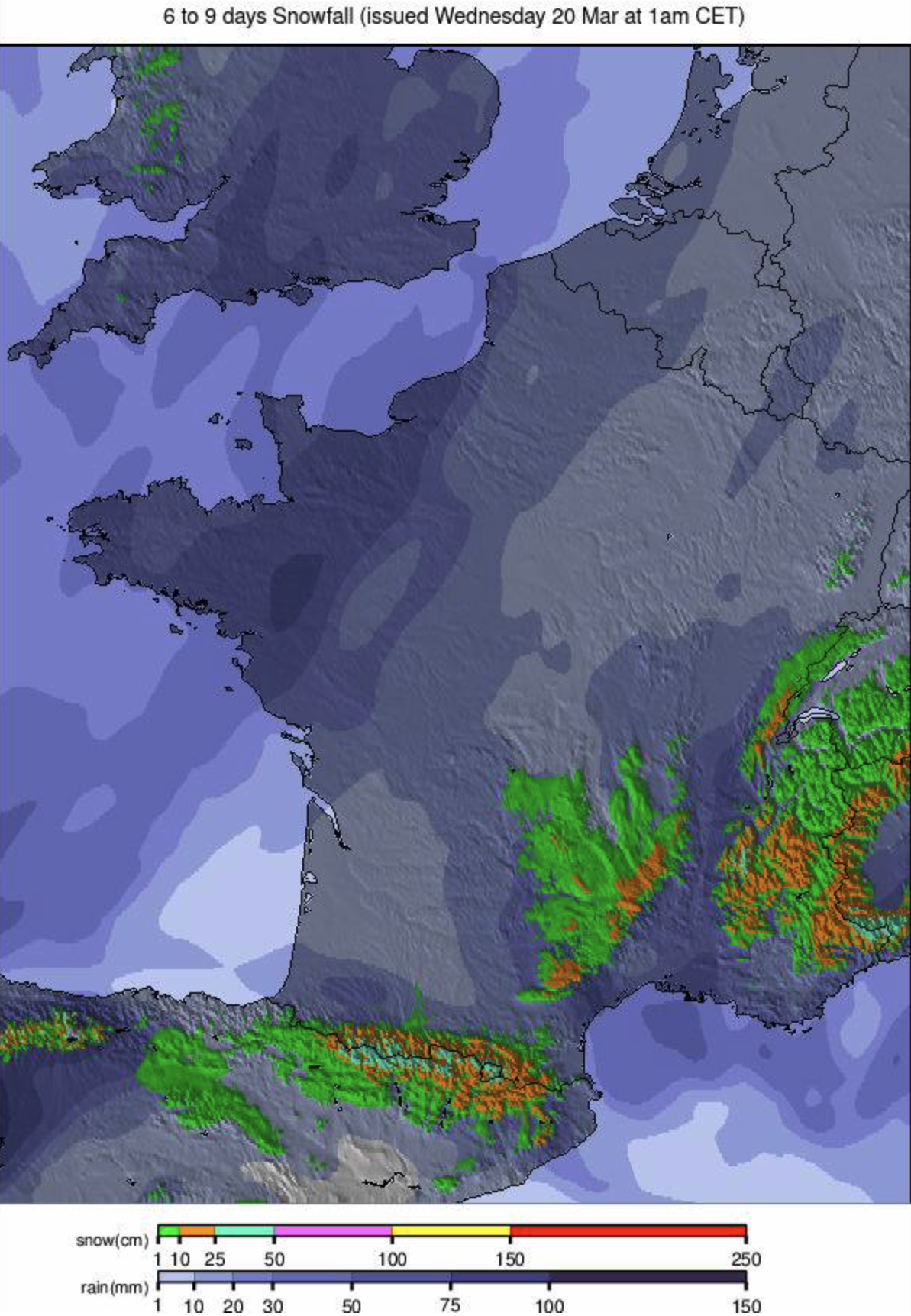
- France boasts extended ski seasons with major resorts open into April and May, offering ample terrain and deep snow.
EUROPE INTRO
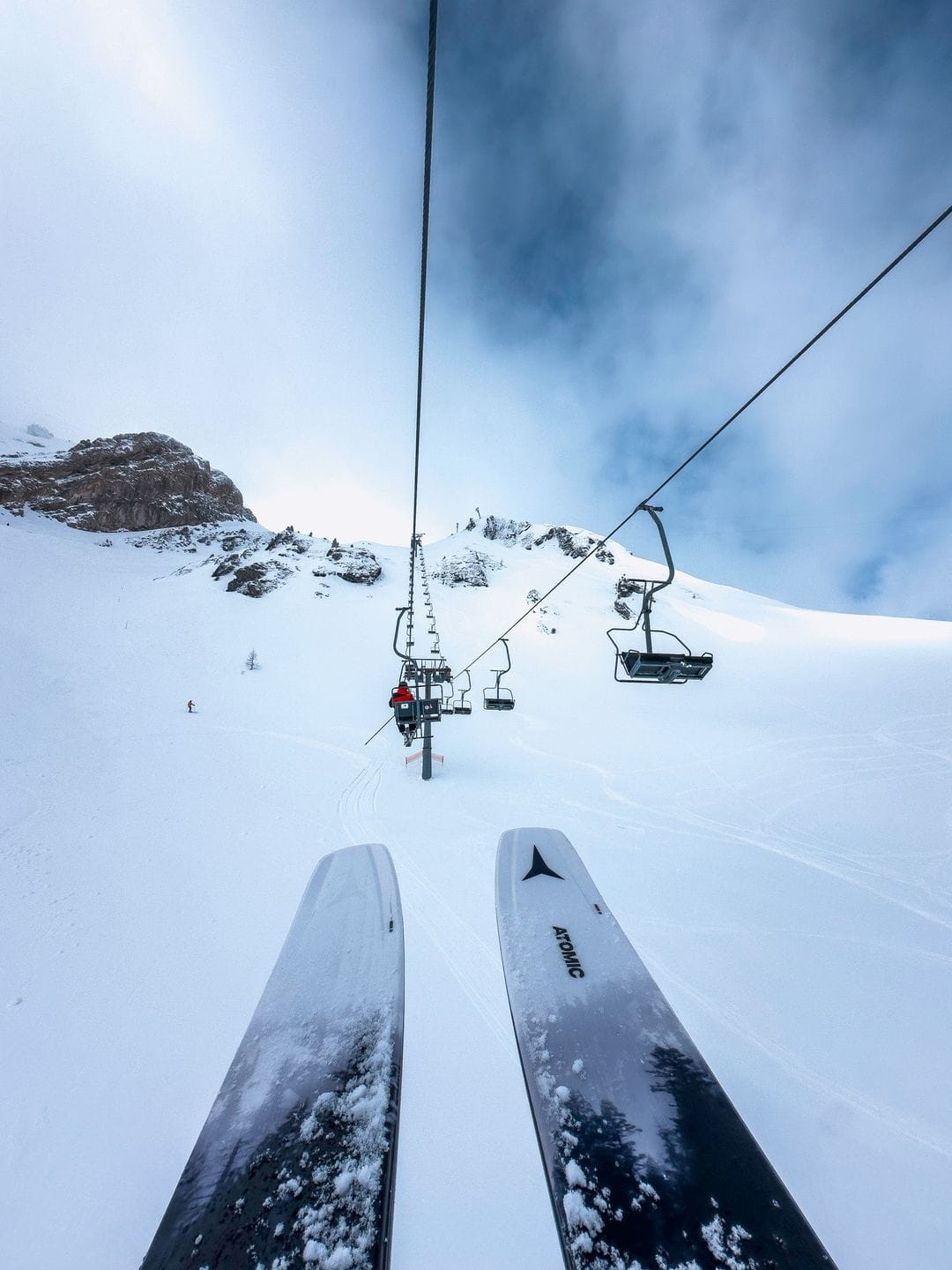
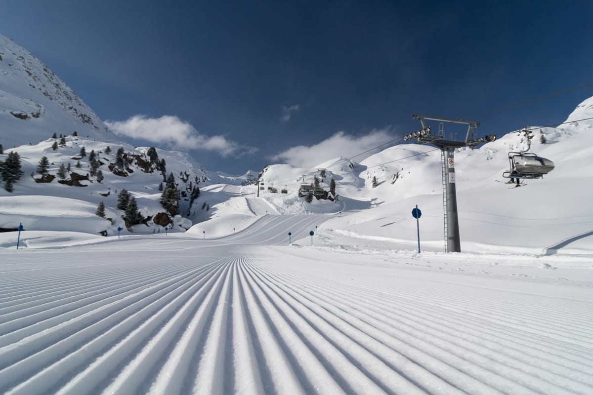
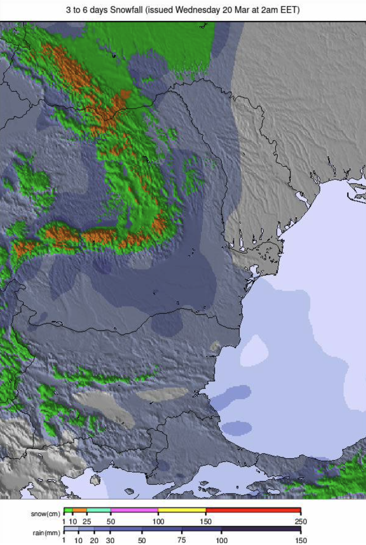
Spring conditions are continuing to take hold across much of Europe, with only northern Scandinavia continuing to post consistently subzero temperatures. There's been fresh snowfall on higher slopes and at northerly latitudes, however, but there have been more showers over the last seven days rather than major snowfall events. It's also been falling as rain on lower runs in the afternoons. The snowpack continues to thaw, particularly in valleys of course, and in fact, upper base depths are holding fairly steady. Those resorts maintaining top-to-bottom snow cover have just ribbons of white down to their bases, while others have given up trying. The continent's big areas remain close to open fully; some, like the world's biggest, the 3 Valleys and Grandvalira in the Pyrenees, are posting the most terrain they've had open all season. The big picture is essentially freeze-thaw conditions for most ski areas across the continent, the best conditions in the mornings.
AUSTRIA REPORT
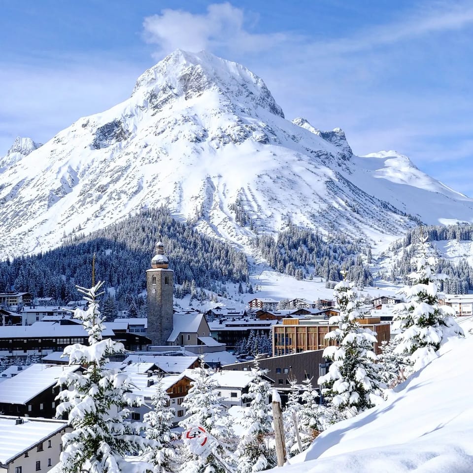
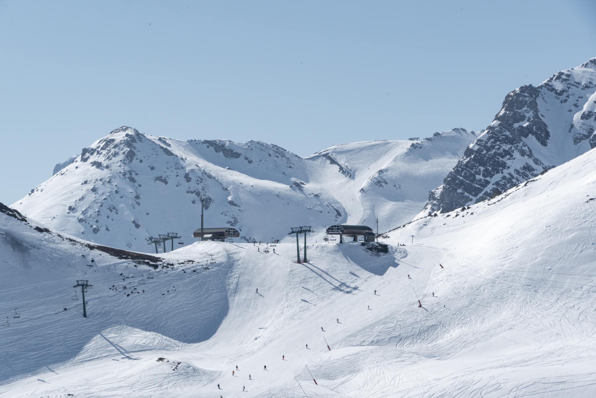
Austria is the focus of the skiing world spotlight this week as it hosts the Alpine World Cup Tour Finals last weekend and next at Saalbach Hinterglemm (50/120cm / 20/48") ahead of staging the 2025 World Championships in less than a year's time. Although the valley floor is green, the upper snow slopes are in much better shape than they were at the start of this month, thanks to the significant snowfalls through the first few weeks of March. It has kept snowing, on and off, as the freezing point has moved between 1500 and 2500m over the last week, with lots of sunshine in between times. Valley temperatures have reached +15C at 1000m, so rain and fast thawing on/of any snow left down low. The Arlberg region around St Anton and Lech (45/375cm / 18/150") has the most runs open in the country, still nearly 90% of its slopes, but there's deeper snow lying on several of Austria's glaciers.
AUSTRIA FORECAST
Some very warm temperatures are expected at lower resorts like Kitzbuhel and Mayrhofen, which may see afternoon highs of +18C later this week. It is hard to maintain even the white ribbons of snow remaining on the valley floors and wet snow conditions. Mostly dry weather but with occasional showers, most likely rain except up on high slopes, including glaciers.
SWITZERLAND REPORT
The snowy weather on Swissslopes over the past three weeks has been easing through the weekend, with the snow still falling but lighter showers on higher slopes. Arosa Lenzerheide(45/228cm / 18/91") posted one of the last sizable accumulations of the past week, posting 25cm (10") over the weekend. Adelboden (0/150 / 0/60") and Andermatt (70/220cm / 28/88") added about 15cm (6") each. It is springlike of course, with valley temperatures reaching +10C in the afternoons, so freeze-thaw and the next conditions earlier in the day on higher ground, but most Swiss areas report 80-100%v of their slopes still open and a number including Saas Fee (94/420cm / 37/168") and Laax (0/445cm / 178") have more than four metres (160") of snow lying on higher slopes.
SWITZERLAND FORECAST
Conditions continue to be mixed, with rain, sleet, snow showers, and sunny spells. The freezing point will be well above 2,000m, and valley temperatures will be in double figures. Unfortunately, a lot of the precipitation is likely to be rain rather than snowfall.
FRANCE REPORT
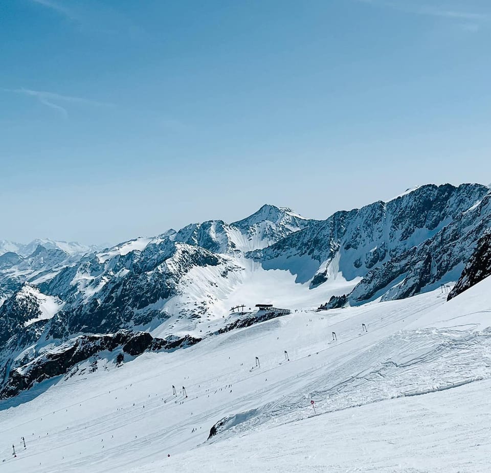
Most of the large French areas are open for another month, to the latter half of April, with some like Chamonix, Tignes and Val Thorens(150/220ccm / 60/88") open into early May and Les 2 Alpes planning to keep its glacier open top the start of July. France also has the areas with the most open terrain as we near the Easter Holidays, Les 3 Vallees is now at 98% open, the most of the season, and is posting the world's deepest snow at Alpe d'Huez (103/480cm / 41/192"). So, in other words, a very positive picture for the start of astronomical springtime. After the big snowfalls of early March, the past week has seen more light to moderate snow showers on higher slopes for most Frenchareas, with temperatures reaching +10C, bringing rain to valleys.
FRANCE FORECAST
It's turning much warmer over the coming week, with not much precipitation forecast. Valley highs will top +15C at 1,000m in the afternoons, and the freezing point will move up above 3,000 m. So expect ever-faster thawing on lower slopes, with the best conditions above 2,000m.
ITALY REPORT
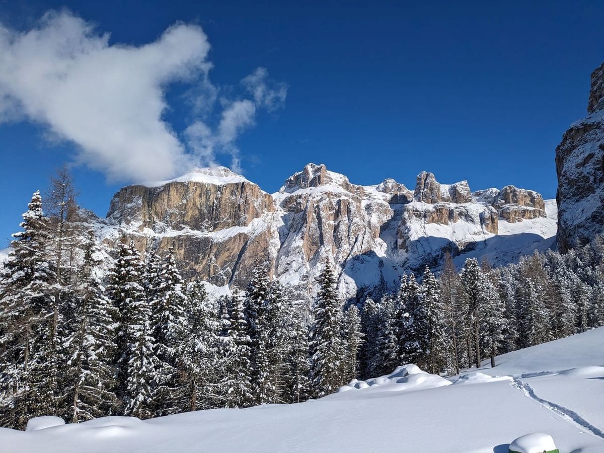
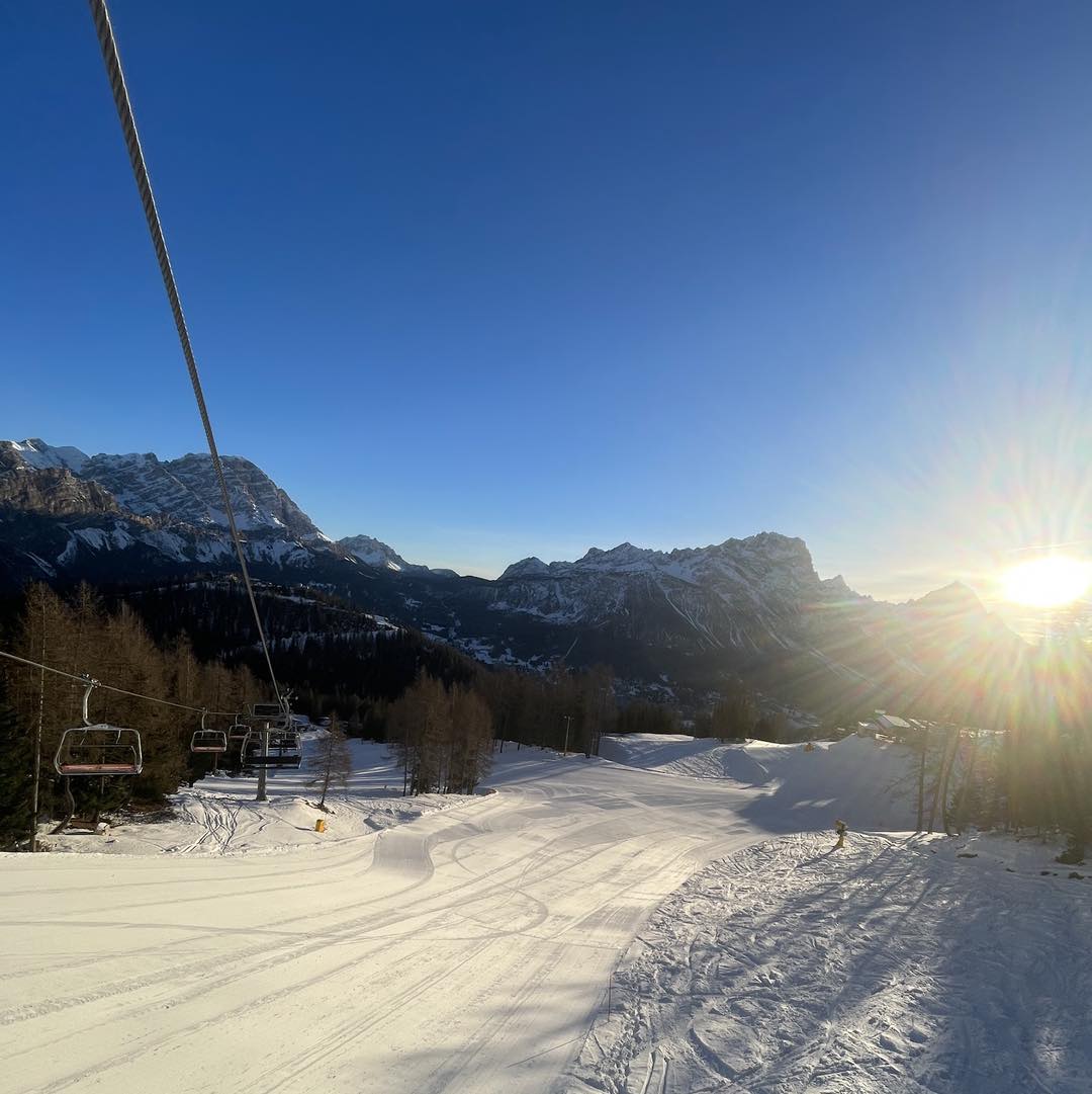
After the big snowfalls last week, the past seven days have been much drier across Italy. There have still been some snow showers, though mostly light. Spring temperatures have been climbing, though, reaching +15C in some lower valleys, although still getting below freezing overnight above 2,000m, so freeze-thaw conditions and best conditions are up high. Most of Italy's larger areas remain open, and the majority have 75-100% of their runs still skiable as the easter holiday period nears. Cervinia (30/250cm / 12/100") has the most terrain accessible from Italy open with 300km (187 miles) of runs available, about 93% of the area it shares with Zermatt. Val Gardena (80/100cm / 32/40") has the largest single area open in the Dolomites, reporting all 181km (113 miles) of runs open.
ITALY FORECAST
It is mostly warm and sunny, with valley temperatures peaking at -15C in the afternoons. The freezing point is above 2,000m, so mostly above-freezing temperatures impact snow conditions. Only high slopes above around 2,500m get an overnight freeze.
GERMANY REPORT
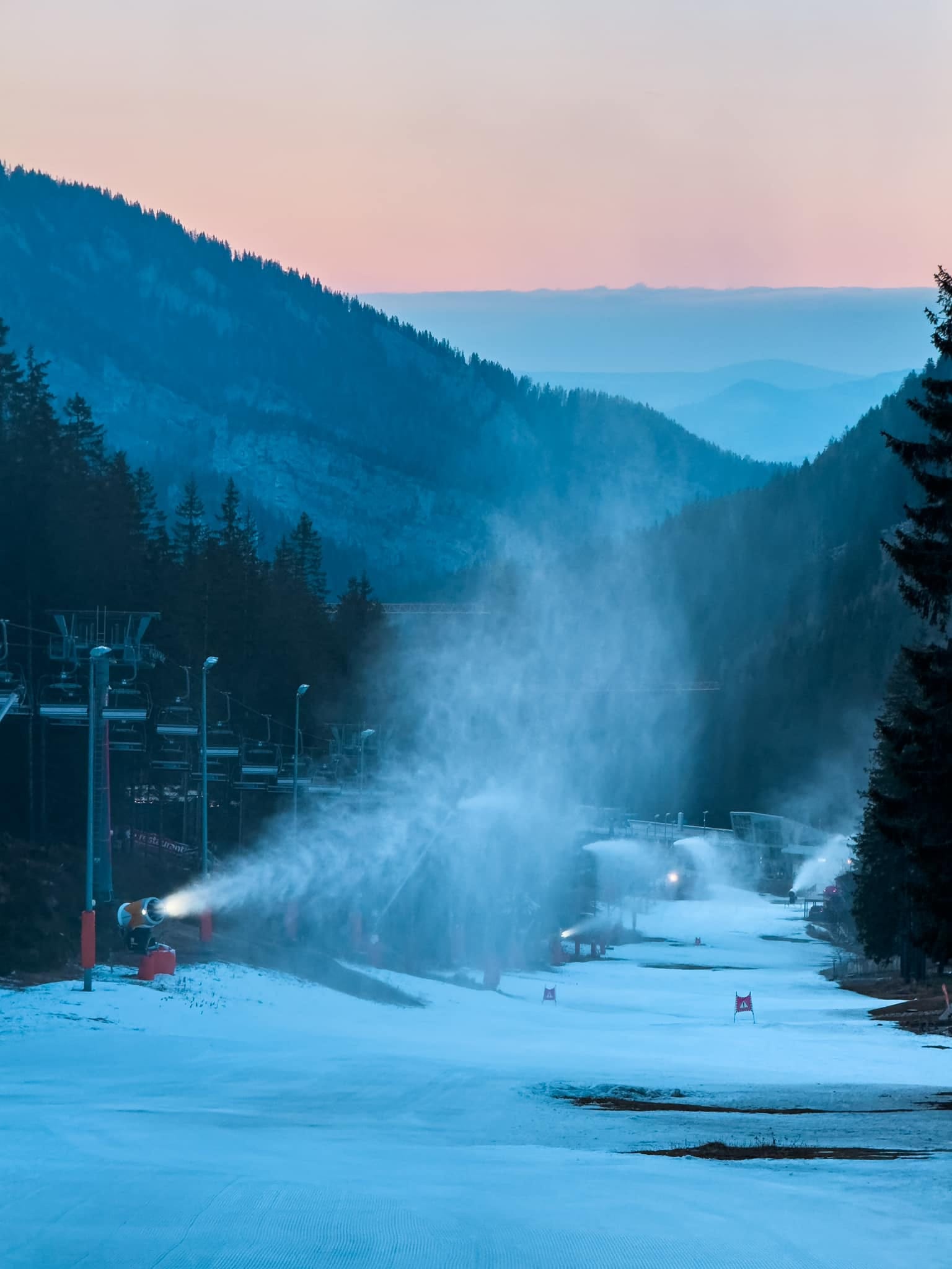
About 10% of Germany's major ski areas remain open, the rest succumbing to the warm temperatures. It's been back up into the low teens in the afternoons below 1000m this week but stayed closer to freezing, though still a few degrees above, on the country's still open high slopes. As with much of Europe, there's been a mixture of snow/sleet/rain showers and sunny spells through the week. The Fellhorn (40/145cm / 16/58") ski area at Oberstdorfcontinues to post the most terrain open in the country with 100% of their runs, 34km (21 miles) of slopes still open.
GERMANY FORECAST
It was a warm end to the week, with temperatures reaching +16C in valleys and +15C at 2,000m. It was mostly sunny with occasional showers, falling mostly as rain, with snow on the highest slopes.
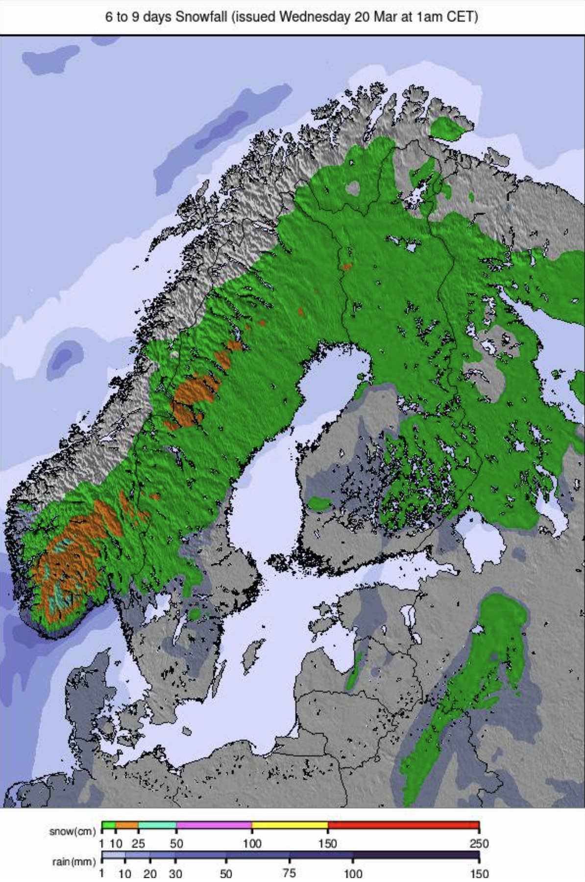
SCANDINAVIA REPORT
A generally good week for much of Scandinavia with fresh snow showers across the region and temperatures mostly cool/cold, especially when compared to lower elevations in the Alps. The longer daylight hours have also led a growing number of areas to add 30-60 minutes to their afternoon opening hours, with Finland's Ruka saying they're keeping their slopes open until 7 pm each evening. The region's largest area, Sweden's à re (60/106cm / 24/42"), has hit 100% open with all 90km+ (57 miles) of slopes operational and all lifts turning. Most other resorts in the region are at 90-100% operations right now, too.
SCANDINAVIA FORECAST
Continuing fairly cold at most Scandinavian ski areas, temperatures ranging from -15C overnight on high slopes to +5C in valleys in the daytime at more southerly areas, colder further north. Overcast skies with just light occasional snow showers are expected.
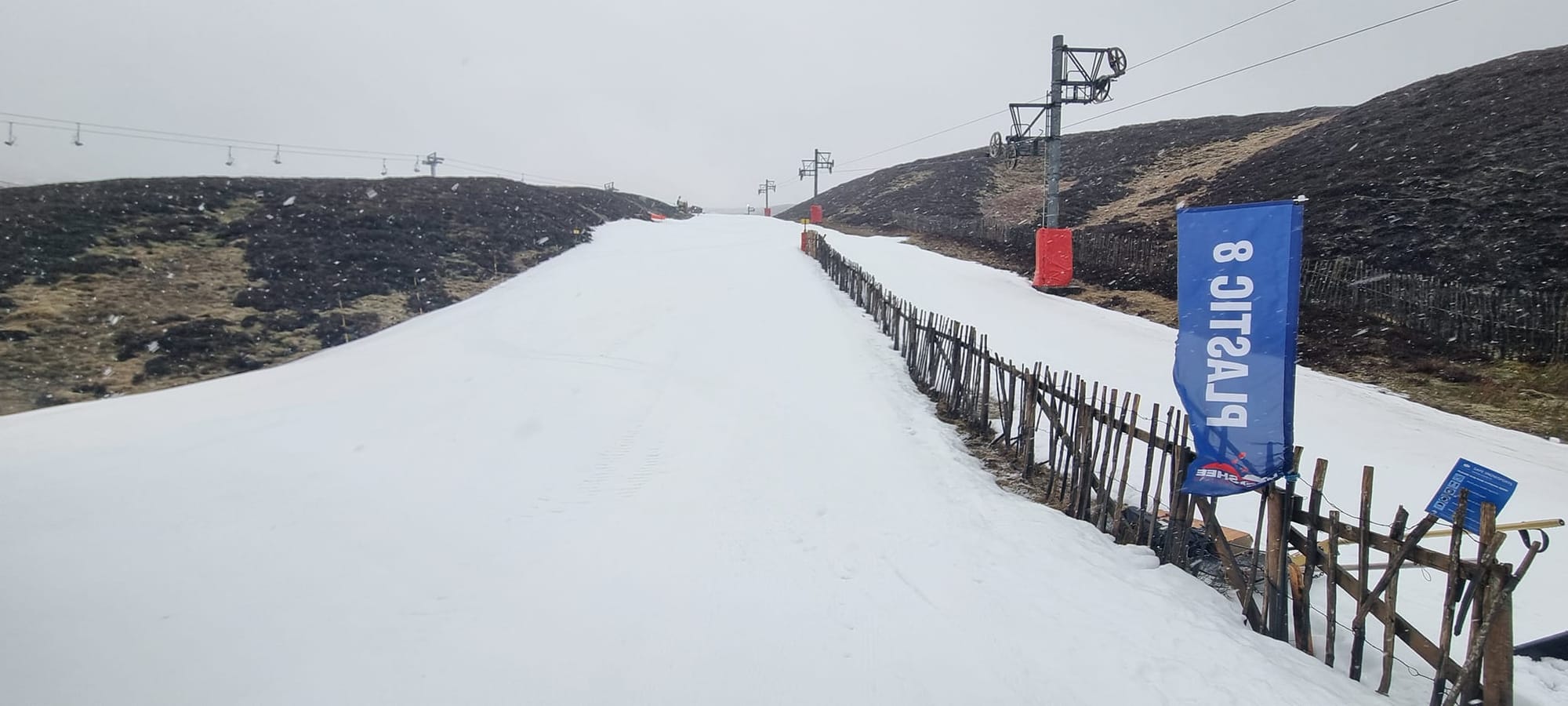
SCOTLAND REPORT
Scottish centres continue to struggle to open much terrain with the Easter fortnight approaching fast, and centres are keen to offer what they can. There have been some overnight subzero temperatures and some heavy snowfall on the upper mountains, but it's also been increasingly warm by the afternoons. As a result, Glencoe and Cairngorm have some fresh cover have quite a lot open on their upper mountains. In Cairngorm's case, there remains the need to hike 30 minutes uphill and back down at the end with your ski gear, with the funicular to the top still out of action, so it's for determined good skiers only. The Lecht and Glenshee are focused on their nursery slope areas, and a little more besides, maintained with their all-weather snowmaking guns. Nevis Range is unable to offer snowsports still at present.
SCOTLAND FORECAST
Unfortunately, there are fairly warm temperatures of +10C or more forecast through much of this week at low elevations and gales are also expected just before the weekend so it appears that maintaining what natural cover this is through into the Easter holidays next week will be challenging.
SPAIN / ANDORRA REPORT
After the huge snowfalls over the first half of March that transformed the Pyrenees from snow-starved to buried-deep, it has been a drier, sunnier, warmer week, although with some showers still - but now rain down low, with more snow up high. Thanks to all that snowfall, though, there's more terrain open still than there has been all season, and the runs will stay open longer than planned, to mid-April. Andorra's huge Grandvalira area (110/185cm / 44/74") has about 90% of its slopes open, around 200km (125 miles) of runs, the most in the region.
SPAIN / ANDORRA
FORECAST It's looking much more springlike for the remainder of this week, with temperatures reaching +15C in valleys and +10C even on high slopes in the afternoons. Although there's more sunshine expected, forecast precipitation is likely to be rain.
BULGARIA / ROMANIA REPORT
It's been mostly sunny with just some light snow showers on high slopes in Bulgaria and Romania. Temperatures swing between -10C overnight at the top of the mountain to +10C in the resort in the afternoon, so the snow cover is upper mountain and conditions freeze-thaw. Most areas in the region still have 60-70% of their slopes open, although Vitosha (50/70cm / 20/28") is down to 25%. Bansko (5/125cm / 2/50") has the deepest base up high and most terrain open in the region, but its long home run is getting very thin now at the base.
BULGARIA / ROMANIA FORECAST
Continuing much the same with plenty more sunshine and very little precipitation forecast. Temperatures continue to drop low at night but warm spring days.
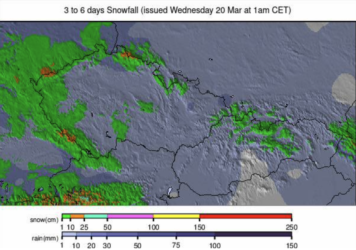
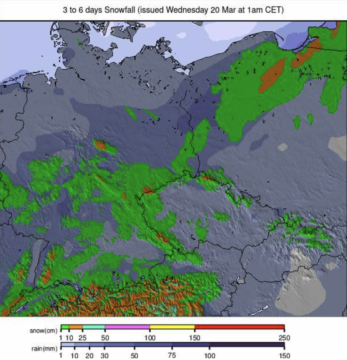
CZECH REPUBLIC / SLOVAKIA REPORT
We're down to about 10% of Czech and Slovak ski areas still operating, of course the bigger resorts. Most have now closed their lower runs as spring gathers pace but still have 40-70% of their overall terrain open on the upper mountain. The past week has seen cooler temperatures than many other parts of mainland Europe, with subzero temperatures on high runs and valleys only getting to +6C, but with thin cover, the spring thaw is still making rapid progress. Unsurprisingly, the biggest area, Slovakia's Jasna (30/60cm / 12/24"), still has the most open, about two-thirds of its full terrain.
CZECH REPUBLIC / SLOVAKIA FORECAST
A sunny spell midweek will give way to more mixed conditions to end the week, including precipitation, but with temperatures rising to +10C even at higher elevations, this is more likely to be rain than snow.