Elevate Your Adventure: a Guide to our Terrain Maps
Access to detailed mapping is a big part of outdoor sports, whether it's hiking, backcountry skiing or snowboarding or simply navigating to the nearest bar or restaurant to relax and reflect on a day in the snow. Maps have been the essence of Snow-Forecast.com since our inception back in 2000.
Snow-Forecast.com started life as a single map of the European Alps that showed coloured contours depicting amounts of forecast or accumulated snowfall. Have a look at the Internet Archive to see the early site.
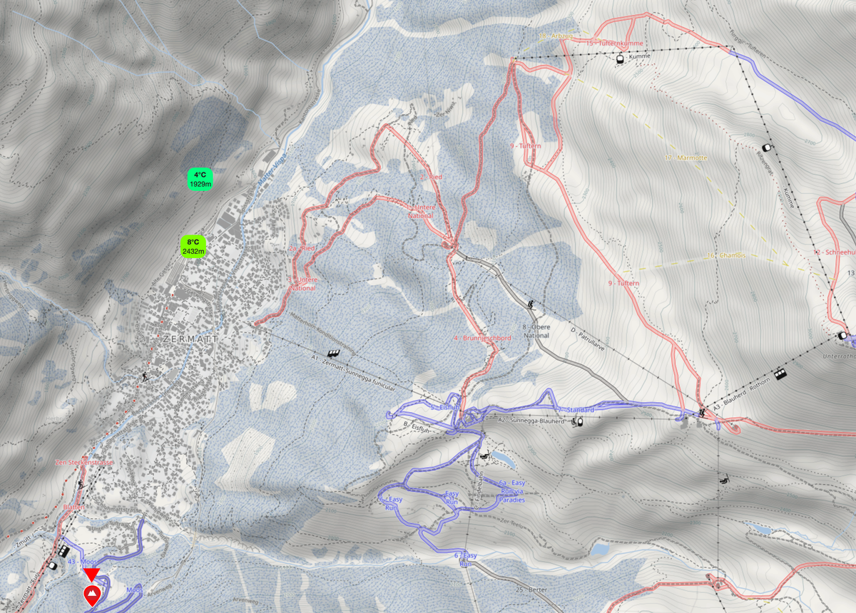
Today, on all our resort forecast pages and mobile apps, you will find highly detailed, interactive maps showing shaded topography overlain by useful information for snow sports enthusiasts. These maps are derived from the OpenTopo project.
OpenTopo maps, as part of an open-source project, derive their detailed topographical data primarily from the Shuttle Radar Topography Mission (SRTM). SRTM was a joint endeavour by NASA and NGA (National Geospatial-Intelligence Agency) that used radar technology to capture high-resolution elevation data of the Earth’s surface. This rich dataset forms the backbone of OpenTopo maps, enabling them to accurately depict terrain features such as elevation contours, mountains, and valleys. Integrating SRTM data ensures that OpenTopo maps provide a comprehensive and precise representation of the landscape, which is valuable for various applications from environmental studies to outdoor recreation planning.
Our terrain maps also have ski lifts and trails/pistes as an overlay courtesy of OpenSnowMap. OpenSnowMap is a collaborative platform where volunteers contribute to enriching and updating the map's extensive database. This community-driven project relies on the efforts of numerous enthusiasts who provide valuable updates on ski trails, lifts, and snow conditions, ensuring that the map remains a reliable and comprehensive resource for winter sports enthusiasts..
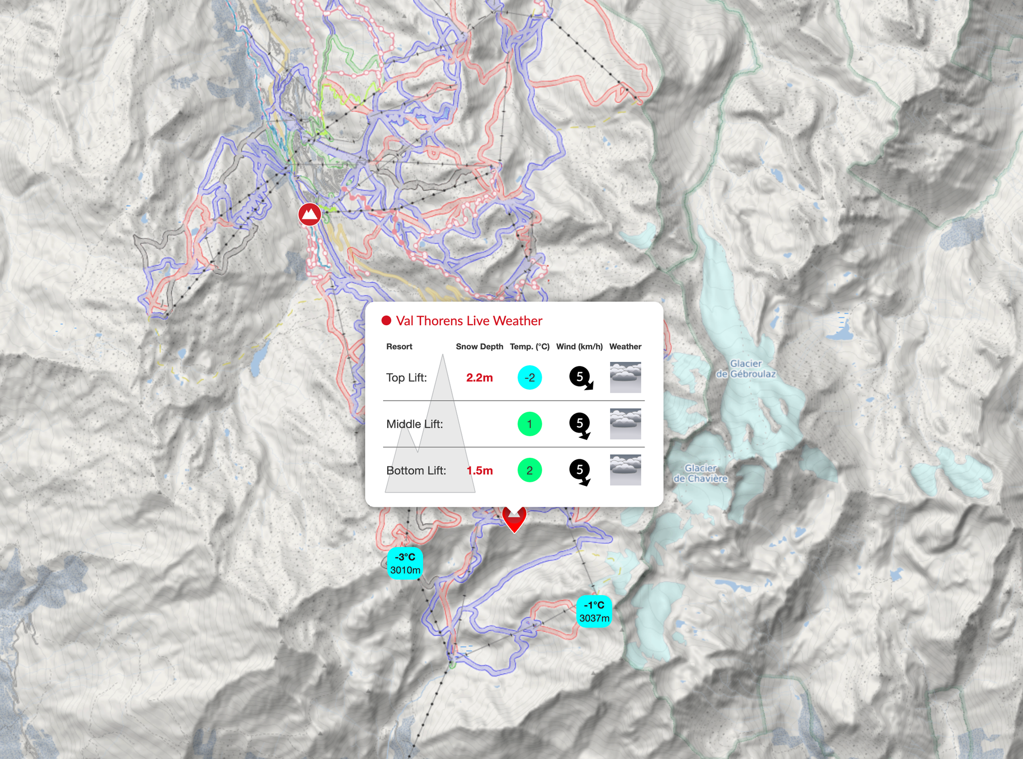
We have added the current conditions at each elevation, along with live weather observations from nearby stations.
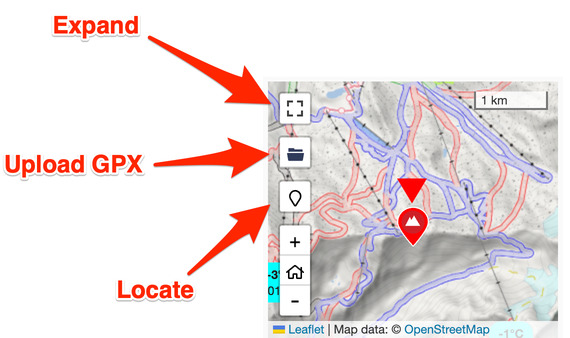
We are in the process of building enhanced mapping capabilities into our mobile apps to make them an ideal partner on the mountain. The image below shows three important controls on the map. Expanding the map switches to a full-screen view, enabling the maximum detail to explore the mountains. If you have a GPS log of a previous day's activities or want to upload a planned route, then the folder icon allows users to upload a track on the map. Lastly, the locate button shows your current position on the map using your geolocation.
Our sister sites (surf-forecast.com and tide-forecast.com) also make good use of this mapping technology for users who may be interested in water-based activities or exploring mountains beyond ski resorts.