

Global Weekly Snow Roundup #318
Weekly Snow News for the world, updated 11 June 2026: Australia's season begins, Val d’Isère reopens and major snowfall is forecast for the Andes.

Next 3 days weather summary:Mostly dry. Mild temperatures (max 9°C on Sat morning, min 4°C on Fri morning). Wind will be generally light. | Days 4-6 weather summary:Mostly dry. Very mild (max 10°C on Wed afternoon, min 5°C on Mon night). Wind will be generally light. | |||||||||||||||||
Friday 12 | Saturday 13 | Sunday 14 | Monday 15 | Tuesday 16 | Wednesday 17 | |||||||||||||
AM | PM | night | AM | PM | night | AM | PM | night | AM | PM | night | AM | PM | night | AM | PM | night | |
clear | clear | clear | clear | clear | some clouds | some clouds | clear | some clouds | clear | clear | clear | some clouds | some clouds | clear | clear | some clouds | clear | |
km/h | ||||||||||||||||||
Snow map |  |  |  |  |  |  | ||||||||||||
— | — | — | — | — | — | — | — | — | — | — | — | — | — | — | — | — | — | |
— | — | — | — | — | — | — | — | — | — | — | — | — | — | — | — | — | — | |
max °C | 6 | 7 | 8 | 9 | 9 | 9 | 8 | 8 | 7 | 6 | 7 | 6 | 7 | 8 | 8 | 8 | 10 | 9 |
min °C | 4 | 7 | 7 | 9 | 9 | 8 | 8 | 8 | 6 | 6 | 7 | 5 | 7 | 8 | 7 | 7 | 10 | 8 |
1 | 4 | 4 | 8 | 8 | 7 | 6 | 6 | 4 | 4 | 5 | 3 | 7 | 6 | 6 | 7 | 10 | 8 | |
63 | 64 | 38 | 21 | 52 | 31 | 21 | 47 | 33 | 38 | 55 | 35 | 40 | 64 | 57 | 59 | 67 | 65 | |
3700 | 3800 | 4200 | 4200 | 4050 | 4100 | 3950 | 3850 | 3850 | 3650 | 3750 | 3750 | 3700 | 3800 | 3950 | 3900 | 4250 | 4200 | |
5:45 | — | — | 5:45 | — | — | 5:45 | — | — | 5:45 | — | — | 5:45 | — | — | 5:45 | — | — | |
— | — | 9:21 | — | — | 9:22 | — | — | 9:22 | — | — | 9:22 | — | — | 9:22 | — | — | 9:22 | |
Go pro and carve into:
Avalanche information: European Avalanche Warning Services (EAWS)
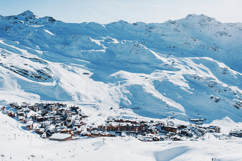
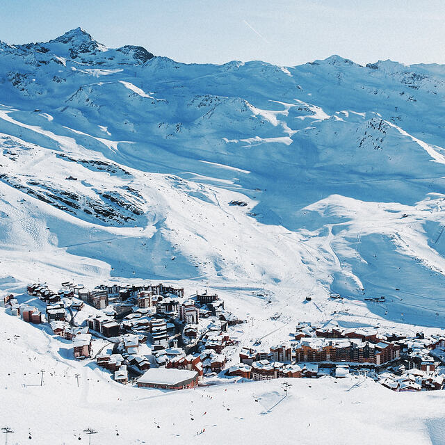
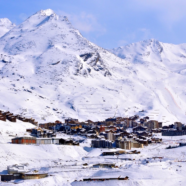
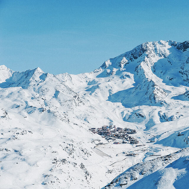
Latest snow reports near Val Thorens:
| Top snow depth: | 0 cm |
|---|---|
| Bottom snow depth: | 0 cm |
| Fresh snowfall depth: | — |
| Last snowfall: | 4 Jun 2026 |
| Snow Alerts | Create Alert |
0.1 | Bluebird Powder days Fresh snow, mostly sunny, light wind. |
|---|---|
0.1 | Powder days Fresh snow, limited sun, any wind. |
0.0 | Bluebird days Average snow, mostly sunny, light wind. |
The above table gives the weather forecast for Val Thorens at the specific elevation of 2765 m. Our sophisticated weather models allow us to provide snow forecasts for the top, middle and bottom ski stations of Val Thorens. To access the weather forecasts for the other elevations, use the tab navigation above the table. For a wider view of the weather, check out the Weather Map of France.
Click here to read further information on freezing levels and how we forecast our temperatures.
Overall 4.3 Based on 79 votes and 44 reviews
We visited Val Thorens 15th to 22nd February (half term) and had a fantastic holiday. We had a family group of 6, in a range of ages from 8 to 61. The ski resort has something for everyone. We were blessed with magnificent sunny weather and lots of snow. We stayed in Le Cheval Blanc apartments that are located right on the slopes, with operator Crystal Ski. The trip up from Chambery airport is long (over 3.5 hours), but once in VT that’s quickly forgotten. The big advantage of VT in these days of uncertain weather, is the elevation. With the village set at 2300m, the resort is very snow assured. From the apartments you can quickly travel to 3 adjacent high quality ski resorts - Les Menuires, Meribel and Courchevel. The lifts and facilities in all 4 resorts are modern with very efficient double access 6 man chair lifts. The only slight challenge was the occasional long queue for the lifts but that was due to the half term holiday. But with over 500km of slopes to explore there are lots of quieter areas. I’d recommend parts of Les Menuires and the Orelle area. All in all, it’s a fantastic ski resort that won’t disappoint.
Guy from Austria writes:
We visited Val Thorens 15th to 22nd February (half term) and had a fantastic holiday. We had a family group of 6, in a range of ages from 8 to 61. The ski resort has something for everyone. We were blessed with magnificent sunny weather and lots of snow.
We stayed in Le Cheval Blanc apartments that are located right on the slopes, with operator Crystal Ski. The trip up from Chambery airport is long (over 3.5 hours), but once in VT that’s quickly forgotten. The big advantage of VT in these days of uncertain weather, is the elevation. With the village set at 2300m, the resort is very snow assured. From the apartments you can quickly travel to 3 adjacent high quality ski resorts - Les Menuires, Meribel and Courchevel. The lifts and facilities in all 4 resorts are modern with very efficient double access 6 man chair lifts.
The only slight challenge was the occasional long queue for the lifts but that was due to the half term holiday. But with over 500km of slopes to explore there are lots of quieter areas. I’d recommend parts of Les Menuires and the Orelle area. All in all, it’s a fantastic ski resort that won’t disappoint.


 Nearest