

Global Weekly Snow Roundup #318
Weekly Snow News for the world, updated 11 June 2026: Australia's season begins, Val d’Isère reopens and major snowfall is forecast for the Andes.

Next 3 days weather summary:Light rain (total 4.0mm) at first, then becoming colder with a dusting of snow on Mon night. Freeze-thaw conditions (max 4°C on Sun afternoon, min 0°C on Mon night). Winds decreasing (fresh winds from the WNW on Mon morning, light winds from the SW by Mon night). | Days 4-6 weather summary:Mostly dry. Freeze-thaw conditions (max 1°C on Thu morning, min -1°C on Tue afternoon). Wind will be generally light. | |||||||||||||||||
Saturday 13 | Sunday 14 | Monday 15 | Tuesday 16 | Wednesday 17 | Thursday 18 | |||||||||||||
AM | PM | night | AM | PM | night | AM | PM | night | AM | PM | night | AM | PM | night | AM | PM | night | |
clear | some clouds | some clouds | light rain | light rain | rain shwrs | light snow | snow shwrs | light snow | light snow | snow shwrs | clear | cloudy | clear | some clouds | clear | some clouds | clear | |
km/h | ||||||||||||||||||
Snow map | 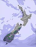 | 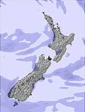 | 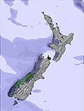 |  |  |  | ||||||||||||
— | — | — | — | — | — | — | — | 3 | — | — | — | — | — | — | — | — | — | |
— | — | — | 2 | 1 | 1 | — | — | — | — | — | — | — | — | — | — | — | — | |
max °C | 3 | 2 | 3 | 3 | 4 | 3 | 1 | 1 | 2 | 0 | -1 | -1 | 0 | 0 | 0 | 1 | 1 | 1 |
min °C | 3 | 2 | 3 | 3 | 3 | 2 | 1 | 1 | 0 | 0 | -1 | -1 | -1 | 0 | 0 | 0 | 0 | 0 |
-1 | -3 | -2 | -2 | -2 | -4 | -6 | -5 | -3 | 0 | -4 | -4 | -7 | -5 | -4 | 0 | -4 | -4 | |
47 | 88 | 94 | 87 | 85 | 81 | 86 | 74 | 98 | 79 | 80 | 64 | 75 | 67 | 65 | 65 | 69 | 71 | |
2500 | 2400 | 2350 | 2750 | 2850 | 2900 | 2250 | 2300 | 2150 | 1950 | 1850 | 1550 | 1600 | 1900 | 2000 | 1900 | 2100 | 2000 | |
7:33 | — | — | 7:33 | — | — | 7:35 | — | — | 7:35 | — | — | 7:35 | — | — | 7:35 | — | — | |
— | 5:00 | — | — | 5:00 | — | — | 5:00 | — | — | 5:00 | — | — | 5:00 | — | — | 5:00 | — | |
Go pro and carve into:
Avalanche information: New Zealand Avalanche Advisory
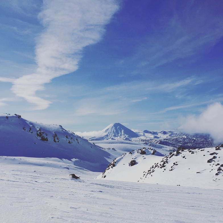
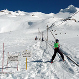
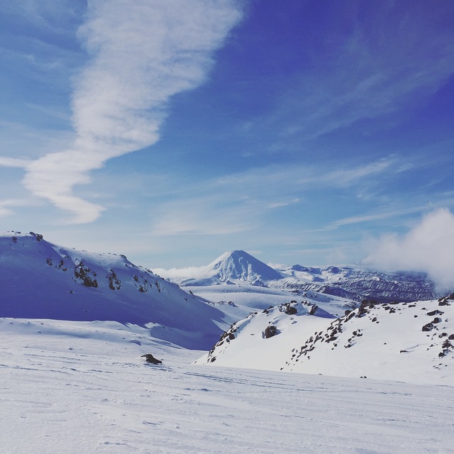
Latest snow reports near Tukino:
| Top snow depth: | — |
|---|---|
| Bottom snow depth: | — |
| Fresh snowfall depth: | — |
| Last snowfall: | 22 Apr 2026 |
| Snow Alerts | Create Alert |
0.2 | Bluebird Powder days Fresh snow, mostly sunny, light wind. |
|---|---|
0.4 | Powder days Fresh snow, limited sun, any wind. |
0.5 | Bluebird days Average snow, mostly sunny, light wind. |
The above table gives the weather forecast for Tukino at the specific elevation of 1910 m. Our sophisticated weather models allow us to provide snow forecasts for the top, middle and bottom ski stations of Tukino. To access the weather forecasts for the other elevations, use the tab navigation above the table. For a wider view of the weather, check out the Weather Map of New Zealand.
Click here to read further information on freezing levels and how we forecast our temperatures.
Overall 2.7 Based on 6 votes and 4 reviews
The staff members are the most unhelpful, racist and obnoxious people in New Zealand! Avoid, avoid, avoid!
Jasmine from Italy writes:
The staff members are the most unhelpful, racist and obnoxious people in New Zealand! Avoid, avoid, avoid!


 Nearest