Brazil Wins South America's First Winter Olympic Medal
Brazil celebrated a landmark moment at the Winter Olympics today as Lucas Pinheiro Braathen stormed to gold in the Giant Slalom at Bormio — the nation’s first medal at the Winter Games.


Tsuruga Kokusai Weather (Next 3 days): The snow forecast for Tsuruga Kokusai is: Drizzle at first, then turning colder with dusting of snow on Wed night. Freeze-thaw conditions (max 5°C on Wed morning, min -2°C on Wed night). Winds increasing (calm on Tue night, fresh winds from the WNW by Wed afternoon).
Tsuruga Kokusai Weather (Days 4-6): Mostly dry. Freeze-thaw conditions (max 11°C on Sun afternoon, min -1°C on Thu night). Wind will be generally light.
| Resort | Snow Depth | Temp. (°C) | Wind (km/h) | Weather | ||
|---|---|---|---|---|---|---|
| Top Lift: | 0 | |||||
| Bottom Lift: | 0 |
Latest snow reports near Tsuruga Kokusai:
Partly cloudy at Okuibuki. Light winds here. Temperatures are around freezing. A few inches of new snow. Every lift is open. Icy pistes. from Okuibuki

Tuesday 17 | Wednesday 18 | Thursday 19 | Friday 20 | Saturday 21 | ||||||||||||
night | AM | PM | night | AM | PM | night | AM | PM | night | AM | PM | night | AM | PM | night | |
some clouds | some clouds | some clouds | clear | clear | light snow | light snow | some clouds | clear | some clouds | clear | some clouds | clear | clear | clear | clear | |
km/h | ||||||||||||||||
Snow map | 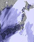 | 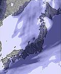 | 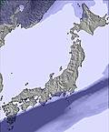 | 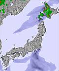 | 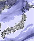 |  | ||||||||||
— | — | — | — | — | 1 | 2 | — | — | — | — | — | — | — | — | — | |
— | — | — | — | — | 1 | — | — | — | — | — | — | — | — | — | — | |
max °C | 0 | 3 | 3 | 0 | 5 | 5 | -1 | 1 | 2 | -1 | 5 | 6 | 3 | 8 | 9 | 5 |
min °C | -1 | 1 | 1 | 0 | 3 | 2 | -2 | -1 | 0 | -1 | 2 | 3 | 2 | 6 | 6 | 3 |
-6 | -2 | 0 | 0 | 1 | -4 | -9 | -7 | -4 | -4 | 2 | 1 | 1 | 6 | 6 | 0 | |
68 | 54 | 56 | 69 | 60 | 62 | 74 | 66 | 50 | 60 | 42 | 47 | 67 | 51 | 40 | 56 | |
400 | 550 | 750 | 550 | 700 | 900 | 200 | 300 | 600 | 0 | 900 | 1050 | 950 | 1250 | 1500 | 2000 | |
— | 6:39 | — | — | 6:39 | — | — | 6:37 | — | — | 6:37 | — | — | 6:35 | — | — | |
— | — | 5:37 | — | — | 5:38 | — | — | 5:39 | — | — | 5:40 | — | — | 5:42 | — | |
Drizzle at first, then turning colder with dusting of snow on Wed night. Freeze-thaw conditions (max 5°C on Wed morning, min -2°C on Wed night). Winds increasing (calm on Tue night, fresh winds from the WNW by Wed afternoon).
Mostly dry. Freeze-thaw conditions (max 11°C on Sun afternoon, min -1°C on Thu night). Wind will be generally light.
Latest snow reports near Tsuruga Kokusai:
Partly cloudy at Okuibuki. Light winds here. Temperatures are around freezing. A few inches of new snow. Every lift is open. Icy pistes. from Okuibuki
| Top snow depth: | — |
|---|---|
| Bottom snow depth: | — |
| Fresh snowfall depth: | — |
| Last snowfall: | 8 Feb 2026 |
| Snow Alerts | Create Alert |
0.1 | Bluebird Powder days Fresh snow, mostly sunny, light wind. |
|---|---|
1.2 | Powder days Fresh snow, limited sun, any wind. |
0.1 | Bluebird days Average snow, mostly sunny, light wind. |
The above table gives the weather forecast for Tsuruga Kokusai at the specific elevation of 430 m. Our sophisticated weather models allow us to provide snow forecasts for the top, middle and bottom ski stations of Tsuruga Kokusai. To access the weather forecasts for the other elevations, use the tab navigation above the table. For a wider view of the weather, check out the Weather Map of Japan.
Click here to read further information on freezing levels and how we forecast our temperatures.


 Nearest