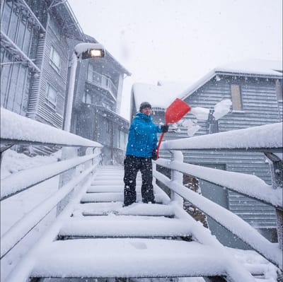
"March Madness" As Snowfall Hits Australia In Early Autumn
Winter made an early-season entrance in Australia overnight, with a polar blast from the Antarctic dumping up to 15cm of fresh snow on the slopes as temperatures tumbled to around -2.C.


St. Blasien-Menzenschwand/Spießhorn Weather (Next 3 days): The snow forecast for St. Blasien-Menzenschwand/Spießhorn is: Some drizzle, heaviest during Fri afternoon. Freeze-thaw conditions (max 8°C on Sat afternoon, min -1°C on Thu morning). Wind will be generally light.
St. Blasien-Menzenschwand/Spießhorn Weather (Days 4-6): Light rain (total 4.0mm), mostly falling on Sun night. Very mild (max 14°C on Tue afternoon, min 6°C on Sun night). Winds decreasing (fresh winds from the WSW on Sun morning, calm by Tue night).
| Resort | Snow Depth | Temp. (°C) | Wind (km/h) | Weather | ||
|---|---|---|---|---|---|---|
| Top Lift: | 0.0 m | -2 | ||||
| Middle Lift: | -2 | |||||
| Bottom Lift: | 0.0 m | -3 |

Thursday 2 | Friday 3 | Saturday 4 | Sunday 5 | Monday 6 | Tuesday 7 | |||||||||||||
AM | PM | night | AM | PM | night | AM | PM | night | AM | PM | night | AM | PM | night | AM | PM | night | |
some clouds | some clouds | snow shwrs | some clouds | light rain | some clouds | cloudy | some clouds | some clouds | clear | some clouds | light rain | clear | clear | clear | clear | clear | rain shwrs | |
km/h | ||||||||||||||||||
Snow map |  |  |  |  |  |  | ||||||||||||
— | — | — | — | — | — | — | — | — | — | — | — | — | — | — | — | — | — | |
— | — | — | — | 1 | — | — | — | — | — | — | 3 | — | — | — | — | — | 1 | |
max °C | 0 | 3 | 2 | 2 | 4 | 3 | 5 | 8 | 8 | 10 | 11 | 10 | 7 | 11 | 9 | 12 | 14 | 13 |
min °C | -1 | 2 | 0 | 0 | 3 | 3 | 4 | 6 | 7 | 8 | 11 | 6 | 6 | 10 | 9 | 10 | 14 | 11 |
-6 | -1 | -2 | -2 | 0 | -1 | 0 | 4 | 5 | 4 | 8 | 5 | 5 | 10 | 9 | 9 | 14 | 11 | |
90 | 79 | 84 | 90 | 76 | 81 | 93 | 86 | 71 | 69 | 74 | 86 | 87 | 69 | 76 | 56 | 53 | 68 | |
1100 | 1500 | 1250 | 1300 | 1700 | 1750 | 2100 | 2500 | 2700 | 2700 | 2600 | 2300 | 2250 | 2950 | 3200 | 3100 | 2950 | 2800 | |
7:05 | — | — | 7:03 | — | — | 7:01 | — | — | 6:58 | — | — | 6:56 | — | — | 6:54 | — | — | |
— | 7:58 | — | — | 7:59 | — | — | — | 8:00 | — | — | 8:01 | — | — | 8:02 | — | — | 8:05 | |
Some drizzle, heaviest during Fri afternoon. Freeze-thaw conditions (max 8°C on Sat afternoon, min -1°C on Thu morning). Wind will be generally light.
Light rain (total 4.0mm), mostly falling on Sun night. Very mild (max 14°C on Tue afternoon, min 6°C on Sun night). Winds decreasing (fresh winds from the WSW on Sun morning, calm by Tue night).
Latest snow reports near St. Blasien-Menzenschwand/Spießhorn:
| Top snow depth: | 0 cm |
|---|---|
| Bottom snow depth: | 0 cm |
| Fresh snowfall depth: | 4 cm |
| Last snowfall: | 1 Apr 2026 |
| Snow Alerts | Create Alert |
0.3 | Bluebird Powder days Fresh snow, mostly sunny, light wind. |
|---|---|
0.4 | Powder days Fresh snow, limited sun, any wind. |
0.4 | Bluebird days Average snow, mostly sunny, light wind. |
The above table gives the weather forecast for St. Blasien-Menzenschwand/Spießhorn at the specific elevation of 1100 m. Our sophisticated weather models allow us to provide snow forecasts for the top, middle and bottom ski stations of St. Blasien-Menzenschwand/Spießhorn. To access the weather forecasts for the other elevations, use the tab navigation above the table. For a wider view of the weather, check out the Weather Map of Germany.
Click here to read further information on freezing levels and how we forecast our temperatures.
Resort name is also written as St. Blasien-Menzenschwand-Spiesshorn.
Overall 1.8 Based on 10 votes and 1 review
There are many cross-country trails once the snow gets deep enough.
Julian from Germany writes:
There are many cross-country trails once the snow gets deep enough.
Click here to submit your own review of St. Blasien-Menzenschwand/Spießhorn


 Nearest