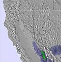
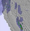
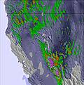
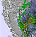
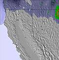
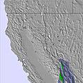
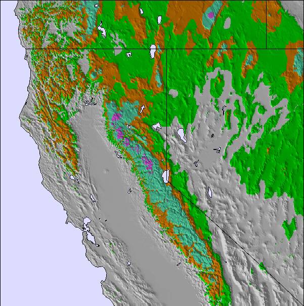
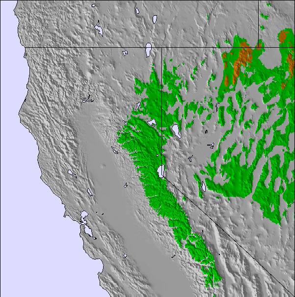
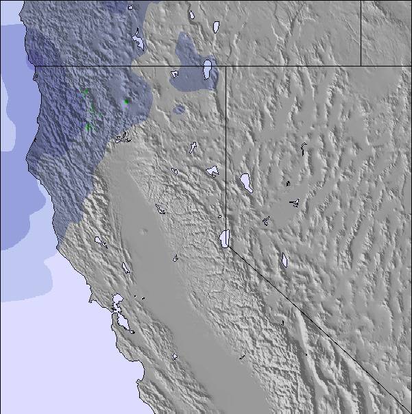
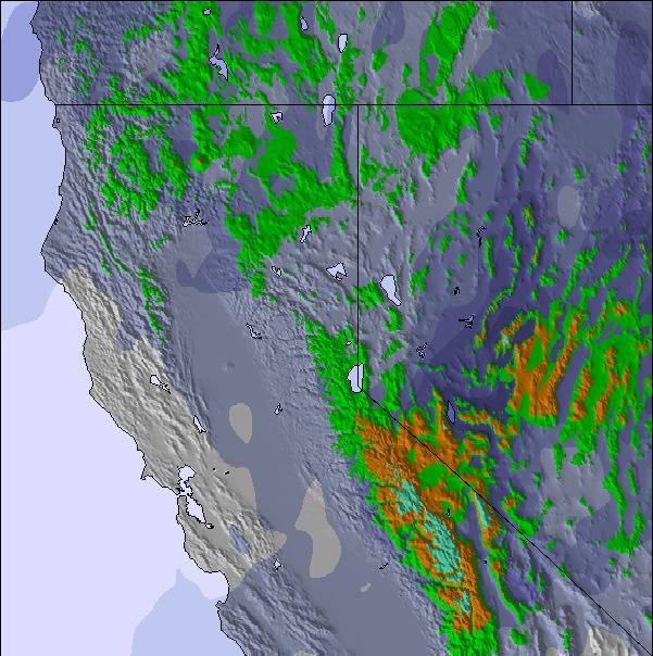
The above table gives the weather forecast for Soda Springs at the specific elevation of 2156 m. Our sophisticated weather models allow us to provide snow forecasts for the top, middle and bottom ski stations of Soda Springs. To access the weather forecasts for the other elevations, use the tab navigation above the table. For a wider view of the weather, check out the Weather Map of United States.
Click here to read further information on freezing levels and how we forecast our temperatures.
I took my 6 1/2 year old grandson to Soda Springs late December 2014. It was his first time on skis and he found the Planet Kids very enjoyable. He learnt very quickly to get down the variety of very short slopes and finish standing up. He had one lesson that helped a lot. There are other activities to do there for the tots and when your child is tired or lost interest.
The staff are very courteous, patient and knowledgable. It was a pleasure doing business there.
I would have been happier if some of the parents and kids, who chose not to use the magic carpet to get to the top again, would walk up at the sides and not in the middle of the slope when there are kids that are not in control of their speed or direction either waiting for them to get out of the way or get to the top. I found this habit was dangerous and not in line with piste practice of keeping the slope clear.
I will definitely go back.
I took my 6 1/2 year old grandson to Soda Springs late December 2014. It was his first time on skis and he found the Planet Kids very enjoyable. He learnt very quickly to get down the variety of very short slopes and finish standing up. He had one lesson that helped a lot. There are other activities to do there for the tots and when your child is tired or lost interest.
The staff are very courteous, patient and knowledgable. It was a pleasure doing business there.
I would have been happier if some of the parents and kids, who chose not to use the magic carpet to get to the top again, would walk up at the sides and not in the middle of the slope when there are kids that are not in control of their speed or direction either waiting for them to get out of the way or get to the top. I found this habit was dangerous and not in line with piste practice of keeping the slope clear.
Free Snow-Forecast.com weather widget for your website
Embed the Soda Springs weather widget on your site for free. It provides a weekly snapshot of snow and rain conditions across all elevations. Follow the two quick steps to grab your custom code and paste it into your site. Choose between metric or imperial units. Click here to get the code.


 Nearest