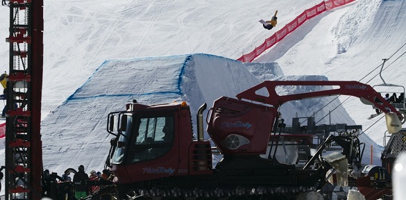
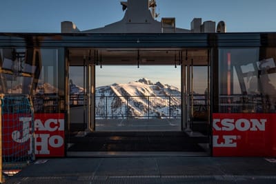
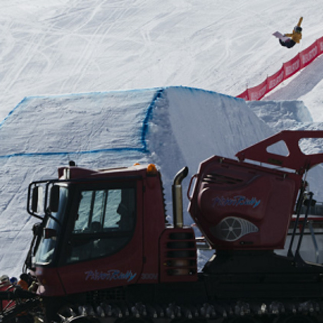
Snow Park snow
Ski New Zealand

Snow Park Snow Forecast

Weather Forecast for Snow Park at 1530 m
Issued: 11 am  18 Sep 2025 (local time)

New snow in Snow Park

0.5cm0.2in
Thu 18th (PM)
The snow forecast for Snow Park is: A moderate fall of snow, heaviest on Sat night. Freeze-thaw conditions (max 1°C on Fri afternoon, min -6°C on Thu night). Winds increasing (calm on Thu night, strong winds from the NNW by Sat night).

Snow Park Weather (Next 3 days): The snow forecast for Snow Park is: A moderate fall of snow, heaviest on Sat night. Freeze-thaw conditions (max 1°C on Fri afternoon, min -6°C on Thu night). Winds increasing (calm on Thu night, strong winds from the NNW by Sat night).

Snow Park Weather (Days 4-6): A moderate fall of snow, heaviest on Tue night. Freeze-thaw conditions (max 1°C on Sun morning, min -2°C on Sun night). Wind will be generally light.


Snow Park Live Weather

ResortSnow DepthTemp. (°C)Wind (km/h)Weather
Top Lift: 
0
25
snow showers
Bottom Lift: 
2
20
snow showers
Powered by Snow-Forecast.comSnow-Forecast.com
6 Day Forecast
Issued: 11 am 18 Sep 2025 / Updates in ::
Change Forecast Height
Choose Forecast
Last 6 daysScroll left for last 6 daysNow
Thursday
18
Friday
19
Saturday
20
Sunday
21
Monday
22
Tuesday
23
Wednesday
24
AM
PM
night
AM
PM
night
AM
PM
night
AM
PM
night
AM
PM
night
AM
PM
night
AM
PM
night
snow showers
snow showers
snow showers
clear
part cloud
part cloud
part cloud
cloud
heavy snow
light snow
part cloud
part cloud
part cloud
cloud
light snow
light snow
light snow
mod snow
light snow
light snow
part cloud
snow shwrs
snow shwrs
snow shwrs
clear
some clouds
some clouds
some clouds
cloudy
heavy snow
light snow
some clouds
some clouds
some clouds
cloudy
light snow
light snow
light snow
mod. snow
light snow
light snow
some clouds
 km/h
25
WNW
25
W
10
SSW
5
NNE
10
NW
20
NW
20
NNW
25
NNW
45
NNW
20
NW
20
WNW
15
NW
15
NNW
20
NNW
15
NNW
10
NNW
10
NNW
5
W
10
NW
10
NW
15
NW
Snow map
 cm 
1
17
1
1
4
3
10
 mm 
max°C
0
0
-5
-2
1
-2
-1
0
0
1
-1
-1
0
0
0
0
0
-1
-1
0
0
min°C
-1
-1
-6
-4
0
-3
-2
-1
-1
0
-1
-2
-1
0
0
-1
-1
-2
-1
-1
-1
chill°C 
-7
-6
-11
-7
-4
-9
-8
-7
-8
-5
-6
-7
-6
-5
-5
-5
-4
-5
-4
-5
-6
Humid% 
85
62
74
38
44
54
89
71
88
94
84
84
87
96
97
99
99
99
97
97
81
Freezing level (m
1400
1550
600
850
1650
1000
1150
1550
1750
1600
1450
1200
1400
1500
1450
1400
1400
1250
1250
1400
1450
topliftbotliftSea lvl1000m2000m3000m4000m5000m
-1-1-6-31-3-2-1-11-1-2-100-1-1-2-1-1-111-5-21-300-20-1-2-11-1-1-1-2-2-1-3
Sunrise
6:41
6:39
6:37
6:35
6:33
6:33
6:31
Sunset
6:34
6:35
6:37
6:37
6:38
6:39
6:40

Snow Radar

Submit a report Eyeball Reporter

Latest snow reports near Snow Park:

  • 28 km away from Snow Park

    16 hours ago
    weather station observation

    Continuous light rain reported from QueenstownAeroAws at 357 metres elevation 7 kms WNW of Remarkables but it is forecast cold enough for snow at the ski area from Remarkables

  • 28 km away from Snow Park

    17 hours ago
    weather station observation

    Intermittent moderate rain reported from QueenstownAeroAws at 357 metres elevation 7 kms WNW of Remarkables but it is forecast cold enough for snow at the ski area from Remarkables

Snow Park Snow Conditions

Top snow depth:
Bottom snow depth:
Fresh snowfall depth:3.0cm
Last snowfall:17 Sep 2025
Snow AlertsCreate Alert
Other resorts in New Zealand are reporting: powder (2) / good piste (2)

Snow-Forecast Partner Offers

Snow History

Week 3 of September has on average:
0.3
Bluebird Powder days
Fresh snow, mostly sunny, light wind.
0.8
Powder days
Fresh snow, limited sun, any wind.
0.4
Bluebird days
Average snow, mostly sunny, light wind.