

Global Weekly Snow Roundup #318
Weekly Snow News for the world, updated 11 June 2026: Australia's season begins, Val d’Isère reopens and major snowfall is forecast for the Andes.

Next 3 days weather summary:Moderate rain (total 11.0mm), heaviest on Sun night. Freeze-thaw conditions (max 4°C on Sun night, min 0°C on Mon morning). Winds decreasing (fresh winds from the NW on Sun afternoon, calm by Mon morning). | Days 4-6 weather summary:A light covering of new snow, mostly falling on Tue night. Freeze-thaw conditions (max 2°C on Wed night, min -4°C on Tue night). Winds increasing (calm on Mon night, fresh winds from the WNW by Tue night). | ||||||||||||||||
Fri 12 | Saturday 13 | Sunday 14 | Monday 15 | Tuesday 16 | Wednesday 17 | ||||||||||||
PM | night | AM | PM | night | AM | PM | night | AM | PM | night | AM | PM | night | AM | PM | night | |
clear | some clouds | clear | some clouds | some clouds | some clouds | light rain | mod. rain | light snow | light snow | snow shwrs | some clouds | some clouds | snow shwrs | clear | clear | clear | |
km/h | |||||||||||||||||
Snow map | 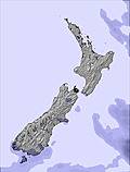 | 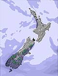 | 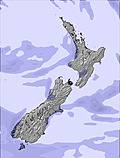 | 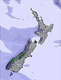 |  |  | |||||||||||
— | — | — | — | — | — | — | — | — | 2 | 1 | — | — | 3 | — | — | — | |
— | — | — | — | — | — | 4 | 7 | — | — | — | — | — | — | — | — | — | |
max °C | 3 | 2 | 3 | 3 | 3 | 3 | 3 | 4 | 1 | -2 | -1 | 1 | 1 | -2 | -4 | -1 | 2 |
min °C | 3 | 2 | 3 | 3 | 3 | 3 | 3 | 2 | 0 | -2 | -2 | 0 | 0 | -4 | -4 | -3 | 0 |
2 | -1 | 0 | 0 | 0 | -2 | -3 | -2 | -4 | -7 | -6 | -3 | -7 | -9 | -9 | -7 | -3 | |
82 | 75 | 44 | 63 | 43 | 68 | 91 | 94 | 90 | 98 | 81 | 38 | 48 | 97 | 69 | 66 | 60 | |
2250 | 2050 | 2300 | 2300 | 2850 | 2800 | 2250 | 2300 | 1900 | 1400 | 1250 | 1750 | 1900 | 1300 | 750 | 1100 | 1950 | |
— | — | 8:18 | — | — | 8:18 | — | — | 8:18 | — | — | 8:19 | — | — | 8:19 | — | — | |
5:07 | — | — | 5:07 | — | — | 5:07 | — | — | 5:07 | — | — | 5:07 | — | — | 5:07 | — | |
Go pro and carve into:
Avalanche information: New Zealand Avalanche Advisory
Latest snow reports near Snow Farm:
Moderate to heavy rain showers reported from QueenstownAeroAws at 357 metres elevation 7 kms WNW of Remarkables but it is forecast cold enough for snow at higher elevations in the ski area from Remarkables
| Top snow depth: | — |
|---|---|
| Bottom snow depth: | — |
| Fresh snowfall depth: | — |
| Last snowfall: | 8 May 2026 |
| Snow Alerts | Create Alert |
0.7 | Bluebird Powder days Fresh snow, mostly sunny, light wind. |
|---|---|
0.4 | Powder days Fresh snow, limited sun, any wind. |
0.7 | Bluebird days Average snow, mostly sunny, light wind. |

The above table gives the weather forecast for Snow Farm at the specific elevation of 1675 m. Our sophisticated weather models allow us to provide snow forecasts for the top, middle and bottom ski stations of Snow Farm. To access the weather forecasts for the other elevations, use the tab navigation above the table. For a wider view of the weather, check out the Weather Map of New Zealand.
Click here to read further information on freezing levels and how we forecast our temperatures.
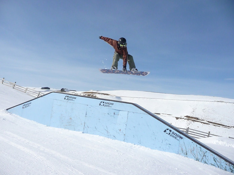
Resort name is also written as Snow Park/Snow Farm.
Overall 4.2 Based on 5 votes and 2 reviews
Snow park: it's excellent. 3 big air, couple of half pipes, lots of rails and box, good music. It was awesome bro
anthony from France writes:
Snow park: it's excellent. 3 big air, couple of half pipes, lots of rails and box, good music. It was awesome bro


 Nearest