

Global Weekly Snow Roundup #314
Weekly Global Snow News, updated 14 May 2026: Fresh snowfall in Argentina, Australia and Lesotho signals winter’s approach, while Japan maintains the world’s deepest snowpack.

Next 3 days weather summary:A dusting of snow on Sun afternoon. Freezing level rising with drizzle on Mon afternoon. Freeze-thaw conditions (max 5°C on Mon night, min 0°C on Sat morning). Wind will be generally light. | Days 4-6 weather summary:Mostly dry. Very mild (max 11°C on Thu afternoon, min 6°C on Tue morning). Wind will be generally light. | |||||||||||||||||
Saturday 16 | Sunday 17 | Monday 18 | Tuesday 19 | Wednesday 20 | Thursday 21 | |||||||||||||
AM | PM | night | AM | PM | night | AM | PM | night | AM | PM | night | AM | PM | night | AM | PM | night | |
some clouds | some clouds | some clouds | cloudy | light snow | light snow | some clouds | light rain | some clouds | some clouds | some clouds | clear | clear | clear | clear | clear | clear | clear | |
km/h | ||||||||||||||||||
Snow map | 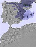 | 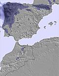 | 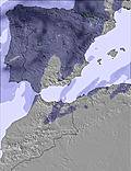 | 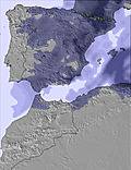 | 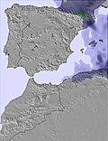 | 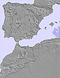 | ||||||||||||
— | — | — | — | 1 | 1 | — | — | — | — | — | — | — | — | — | — | — | — | |
— | — | — | — | — | — | — | 1 | — | — | — | — | — | — | — | — | — | — | |
max °C | 0 | 1 | 1 | 0 | 1 | 1 | 1 | 3 | 5 | 7 | 8 | 9 | 9 | 10 | 10 | 10 | 11 | 11 |
min °C | 0 | 0 | 0 | 0 | 1 | 0 | 1 | 2 | 4 | 6 | 7 | 8 | 8 | 9 | 10 | 10 | 11 | 10 |
0 | -2 | 0 | -2 | 0 | 0 | 1 | 2 | 2 | 4 | 6 | 8 | 8 | 9 | 10 | 10 | 11 | 10 | |
49 | 71 | 83 | 82 | 90 | 87 | 63 | 79 | 35 | 22 | 50 | 32 | 24 | 50 | 28 | 17 | 45 | 34 | |
2700 | 2800 | 2700 | 2700 | 2850 | 2750 | 2900 | 3050 | 3600 | 3750 | 3750 | 4000 | 4100 | 4050 | 4200 | 4250 | 4200 | 4200 | |
7:03 | — | — | 7:03 | — | — | 7:03 | — | — | 7:01 | — | — | 7:01 | — | — | 7:01 | — | — | |
— | — | 9:15 | — | — | 9:15 | — | — | 9:15 | — | — | 9:16 | — | — | 9:17 | — | — | 9:19 | |
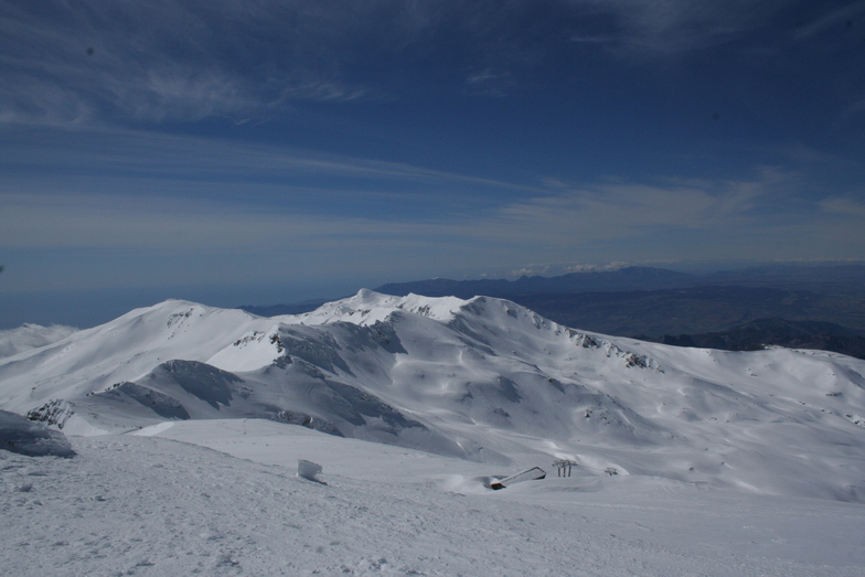
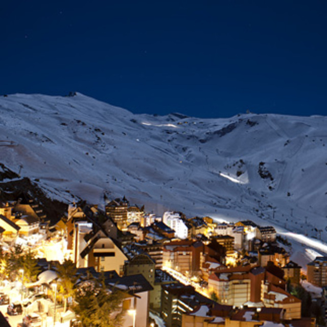
Latest snow reports near Sierra Nevada:
| Top snow depth: | — |
|---|---|
| Bottom snow depth: | — |
| Fresh snowfall depth: | — |
| Last snowfall: | 9 May 2026 |
| Snow Alerts | Create Alert |
0.1 | Bluebird Powder days Fresh snow, mostly sunny, light wind. |
|---|---|
0.4 | Powder days Fresh snow, limited sun, any wind. |
0.3 | Bluebird days Average snow, mostly sunny, light wind. |
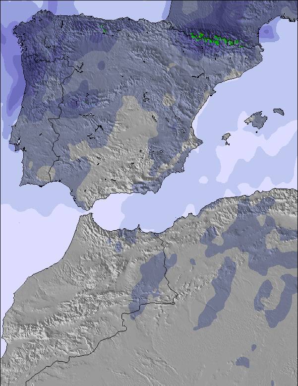
The above table gives the weather forecast for Sierra Nevada at the specific elevation of 2701 m. Our sophisticated weather models allow us to provide snow forecasts for the top, middle and bottom ski stations of Sierra Nevada. To access the weather forecasts for the other elevations, use the tab navigation above the table. For a wider view of the weather, check out the Weather Map of Spain.
Click here to read further information on freezing levels and how we forecast our temperatures.
Overall 4.0 Based on 133 votes and 92 reviews
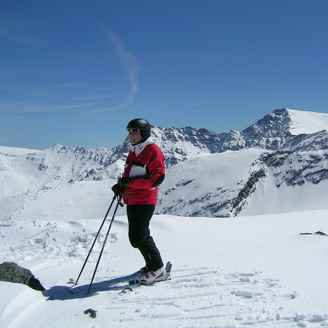
The attraction of this resort is its accessibility to southern Spain and Portugal. It is less of a credible alternative to the Alps or Pyranees to those who are travelling long distances. It is a high mountain with decent cold snow during the season, tending to become a good late winter resort. The resort itself requires lots of uphill walking unless you are staying close to the lifts. It doesn't have the apres-ski vibe experienced in the Alps. Whilst the ski area can be covered in a day by experienced skiers, the runs are fairly decent. The gondola takes you to a mid station from where you progressive climb from green to blue to red runs. The reds are quite steep. Therefore, it is good for families or mixed ability groups. It lacks the charm of other European counterparts, but is a great facility to have so close to to the med. Granada is 45 mins away and a great town to visit. The sea is 90 minutes away. Avoid weekends and holidays.
Rupert from Portugal writes:
The attraction of this resort is its accessibility to southern Spain and Portugal. It is less of a credible alternative to the Alps or Pyranees to those who are travelling long distances. It is a high mountain with decent cold snow during the season, tending to become a good late winter resort. The resort itself requires lots of uphill walking unless you are staying close to the lifts. It doesn't have the apres-ski vibe experienced in the Alps. Whilst the ski area can be covered in a day by experienced skiers, the runs are fairly decent. The gondola takes you to a mid station from where you progressive climb from green to blue to red runs. The reds are quite steep. Therefore, it is good for families or mixed ability groups. It lacks the charm of other European counterparts, but is a great facility to have so close to to the med. Granada is 45 mins away and a great town to visit. The sea is 90 minutes away. Avoid weekends and holidays.


 Nearest