


Global Weekly Snow Roundup #318
Weekly Snow News for the world, updated 11 June 2026: Australia's season begins, Val d’Isère reopens and major snowfall is forecast for the Andes.

Next 3 days weather summary:Moderate rain (total 18.0mm), heaviest on Sun night. Very mild (max 18°C on Fri afternoon, min 10°C on Sun morning). Winds increasing (calm on Sat night, strong winds from the WNW by Sun night). | Days 4-6 weather summary:Mostly dry. Warm (max 20°C on Wed afternoon, min 14°C on Mon afternoon). Mainly near gales. | ||||||||||||||||
Fri 12 | Saturday 13 | Sunday 14 | Monday 15 | Tuesday 16 | Wednesday 17 | ||||||||||||
PM | night | AM | PM | night | AM | PM | night | AM | PM | night | AM | PM | night | AM | PM | night | |
some clouds | rain shwrs | some clouds | clear | rain shwrs | clear | rain shwrs | rain shwrs | some clouds | clear | clear | clear | clear | clear | clear | clear | clear | |
km/h | |||||||||||||||||
Snow map | 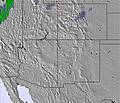 | 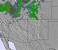 | 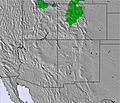 | 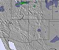 |  |  | |||||||||||
— | — | — | — | — | — | — | — | — | — | — | — | — | — | — | — | — | |
— | 1 | — | — | 2 | — | 1 | 14 | — | — | — | — | — | — | — | — | — | |
max °C | 18 | 16 | 15 | 17 | 15 | 10 | 13 | 12 | 11 | 17 | 16 | 15 | 18 | 18 | 17 | 20 | 20 |
min °C | 17 | 14 | 15 | 17 | 11 | 10 | 12 | 10 | 10 | 14 | 15 | 15 | 17 | 17 | 16 | 19 | 17 |
16 | 12 | 15 | 16 | 11 | 10 | 12 | 9 | 8 | 12 | 13 | 13 | 15 | 15 | 14 | 18 | 15 | |
24 | 33 | 30 | 26 | 40 | 68 | 60 | 54 | 64 | 49 | 20 | 19 | 14 | 13 | 19 | 15 | 16 | |
5300 | 5300 | 5150 | 5300 | 5150 | 4750 | 5050 | 4950 | 4700 | 5000 | 5250 | 5150 | 5350 | 5500 | 5300 | 5500 | 5500 | |
— | — | 5:50 | — | — | 5:50 | — | — | 5:50 | — | — | 5:50 | — | — | 5:50 | — | — | |
8:20 | — | — | 8:20 | — | — | 8:21 | — | — | 8:21 | — | — | 8:22 | — | — | 8:22 | — | |
Go pro and carve into:
Avalanche information: National Avalanche Center
Latest snow reports near Sandia Peak:
| Top snow depth: | — |
|---|---|
| Bottom snow depth: | — |
| Fresh snowfall depth: | — |
| Last snowfall: | 5 May 2026 |
| Snow Alerts | Create Alert |
0.0 | Bluebird Powder days Fresh snow, mostly sunny, light wind. |
|---|---|
0.0 | Powder days Fresh snow, limited sun, any wind. |
0.0 | Bluebird days Average snow, mostly sunny, light wind. |
The above table gives the weather forecast for Sandia Peak at the specific elevation of 3163 m. Our sophisticated weather models allow us to provide snow forecasts for the top, middle and bottom ski stations of Sandia Peak. To access the weather forecasts for the other elevations, use the tab navigation above the table. For a wider view of the weather, check out the Weather Map of United States.
Click here to read further information on freezing levels and how we forecast our temperatures.
Overall 2.1 Based on 2 votes and 2 reviews
Sandia Peak is a great area for the Albuquerque, NM visitor who wants to get in a quick day or half-day of skiing. You can drive around to the other side of the mountain to the base or save some time by riding the Tram on the Albq. side and start from the top. Note that there are no ski rentals available if you do the Tram. The resort is on the eastern slope of the Sandia Mountains that is pitched to average of 15 degrees leading to a family resort of intermediate skiing. However, there is glade skiing and some advanced pitches to keep the day interesting. Sandia does have snow problems in some years but can also have overwelming amounts of snow in wet years. Also look into Ski Santa Fe for a more advanced skiing experience.
Todd from United States writes:
Sandia Peak is a great area for the Albuquerque, NM visitor who wants to get in a quick day or half-day of skiing. You can drive around to the other side of the mountain to the base or save some time by riding the Tram on the Albq. side and start from the top. Note that there are no ski rentals available if you do the Tram.
The resort is on the eastern slope of the Sandia Mountains that is pitched to average of 15 degrees leading to a family resort of intermediate skiing. However, there is glade skiing and some advanced pitches to keep the day interesting. Sandia does have snow problems in some years but can also have overwelming amounts of snow in wet years. Also look into Ski Santa Fe for a more advanced skiing experience.


 Nearest