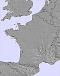
The above table gives the weather forecast for Foel Cwmcerwyn at the specific elevation of 268 m. Our sophisticated weather models allow us to provide snow forecasts for the top, middle and bottom ski stations of Foel Cwmcerwyn. To access the weather forecasts for the other elevations, use the tab navigation above the table. For a wider view of the weather, check out the Weather Map of United Kingdom.
Click here to read further information on freezing levels and how we forecast our temperatures.
My local hill in Pembrokeshire and one I have ski toured a few times over the years. Being on a peninsula, the Preselis can get heavy snowfall from the 'Pembrokeshire Dangler' when other parts of Wales have nothing. The hills are relatively low lying (even by Welsh standards), so the snow rarely lasts long. The best snow conditions are nearly always in the Brecon Beacons or Snowdonia. However, the views over Cardigan Bay and the Pembrokeshire countryside are absolutely stunning!
Like anywhere in Wales..or even Scotland, Foel Cwmcerwyn is clearly not a 'resort', but it's fantastic that these hills have a place on the site!
Free Snow-Forecast.com weather widget for your website
Embed the Foel Cwmcerwyn weather widget on your site for free. It provides a weekly snapshot of snow and rain conditions across all elevations. Follow the two quick steps to grab your custom code and paste it into your site. Choose between metric or imperial units. Click here to get the code.


 Nearest