


Global Weekly Snow Roundup #318
Weekly Snow News for the world, updated 11 June 2026: Australia's season begins, Val d’Isère reopens and major snowfall is forecast for the Andes.

Next 3 days weather summary:Mostly dry. Very mild (max 16°C on Sat afternoon, min 9°C on Fri morning). Winds increasing (calm on Fri night, fresh winds from the WSW by Sun night). | Days 4-6 weather summary:Moderate rain (total 15.0mm), heaviest on Mon night. Very mild (max 18°C on Wed afternoon, min 11°C on Mon night). Wind will be generally light. | |||||||||||||||||
Friday 12 | Saturday 13 | Sunday 14 | Monday 15 | Tuesday 16 | Wednesday 17 | |||||||||||||
AM | PM | night | AM | PM | night | AM | PM | night | AM | PM | night | AM | PM | night | AM | PM | night | |
some clouds | some clouds | some clouds | clear | clear | clear | some clouds | some clouds | some clouds | t-storm risk | rain shwrs | mod. rain | some clouds | t-storm risk | light rain | clear | clear | clear | |
km/h | ||||||||||||||||||
Snow map | 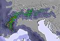 | 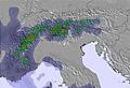 | 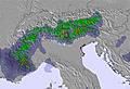 | 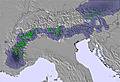 |  |  | ||||||||||||
— | — | — | — | — | — | — | — | — | — | — | — | — | — | — | — | — | — | |
— | — | — | — | — | — | — | — | — | 1 | 2 | 10 | — | 1 | 1 | — | — | — | |
max °C | 10 | 14 | 13 | 15 | 16 | 16 | 15 | 14 | 14 | 14 | 14 | 14 | 13 | 15 | 14 | 15 | 18 | 17 |
min °C | 9 | 13 | 12 | 14 | 16 | 14 | 14 | 14 | 13 | 13 | 14 | 11 | 12 | 15 | 13 | 14 | 17 | 17 |
6 | 13 | 12 | 14 | 16 | 13 | 13 | 12 | 12 | 11 | 13 | 9 | 11 | 15 | 12 | 13 | 17 | 17 | |
58 | 55 | 64 | 58 | 65 | 59 | 68 | 80 | 68 | 79 | 75 | 91 | 83 | 80 | 75 | 55 | 44 | 39 | |
3000 | 3400 | 3650 | 3500 | 3900 | 3900 | 3850 | 3850 | 3700 | 3500 | 3550 | 3200 | 3400 | 3600 | 3550 | 3650 | 3800 | 4000 | |
5:11 | — | — | 5:11 | — | — | 5:11 | — | — | 5:11 | — | — | 5:11 | — | — | 5:11 | — | — | |
— | — | 8:50 | — | — | 8:50 | — | — | 8:51 | — | — | 8:51 | — | — | 8:52 | — | — | 8:52 | |
Go pro and carve into:
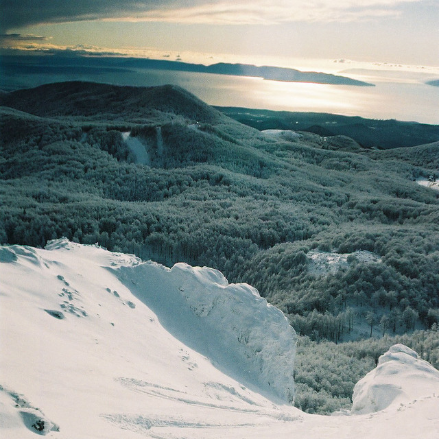
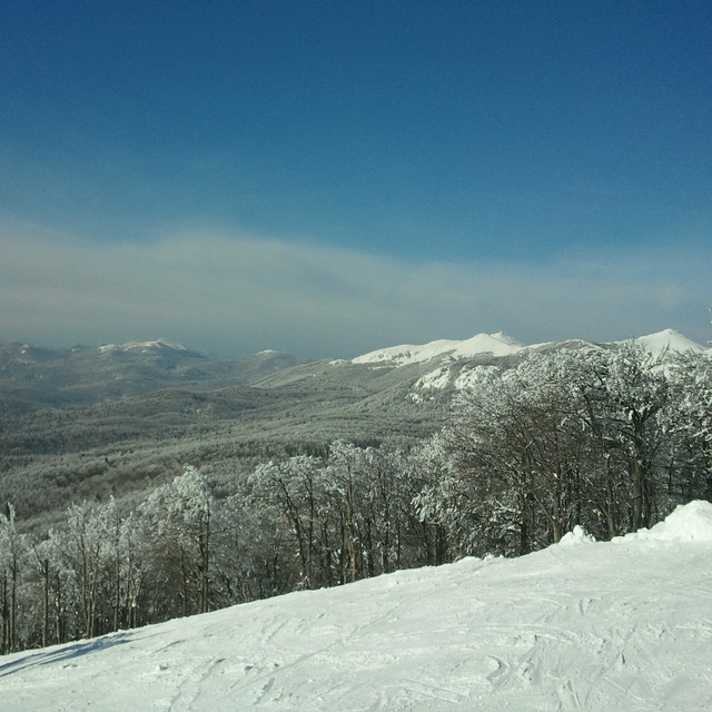
Latest snow reports near Platak:
| Top snow depth: | — |
|---|---|
| Bottom snow depth: | — |
| Fresh snowfall depth: | — |
| Last snowfall: | 12 May 2026 |
| Snow Alerts | Create Alert |
0.0 | Bluebird Powder days Fresh snow, mostly sunny, light wind. |
|---|---|
0.0 | Powder days Fresh snow, limited sun, any wind. |
0.0 | Bluebird days Average snow, mostly sunny, light wind. |

The above table gives the weather forecast for Platak at the specific elevation of 1237 m. Our sophisticated weather models allow us to provide snow forecasts for the top, middle and bottom ski stations of Platak. To access the weather forecasts for the other elevations, use the tab navigation above the table. For a wider view of the weather, check out the Weather Map of Croatia.
Click here to read further information on freezing levels and how we forecast our temperatures.
Overall 2.7 Based on 23 votes and 6 reviews
You have 1 baby slope, 1 red slope and 1 turistic slope. The price for the whole day is about 20 Euro! For this price you can get the whole day in Krvavec or Cerkno or some other ski center. The service is low and the slopes are not serviced. The only lift is old, about 15 years at least, and it doesn't work so well. Very poor!
BoB from Croatia writes:
You have 1 baby slope, 1 red slope and 1 turistic slope. The price for the whole day is about 20 Euro!
For this price you can get the whole day in Krvavec or Cerkno or some other ski center.
The service is low and the slopes are not serviced.
The only lift is old, about 15 years at least, and it doesn't work so well.
Very poor!

 Nearest