

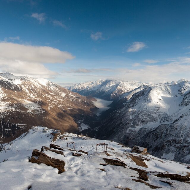
Portillo Re-Opens To Guests Arriving By Helicopter
Chile’s famous Portillo ski resort is reported to have re-opened to guests arriving by helicopter after being cut off by road for more than two weeks by over 6m/20 feet of snowfall.

Next 3 days weather summary:Heavy rain (total 46.0mm), heaviest during Tue afternoon. Very mild (max 14°C on Mon afternoon, min 5°C on Wed night). Wind will be generally light. | Days 4-6 weather summary:Heavy rain (total 22.0mm), heaviest during Sun morning. Very mild (max 12°C on Sat morning, min 6°C on Thu night). Wind will be generally light. | ||||||||||||||||
Mon 3 | Tuesday 4 | Wednesday 5 | Thursday 6 | Friday 7 | Saturday 8 | ||||||||||||
PM | night | AM | PM | night | AM | PM | night | AM | PM | night | AM | PM | night | AM | PM | night | |
rain shwrs | rain shwrs | rain shwrs | t-storm risk | rain shwrs | rain shwrs | t-storm risk | rain shwrs | rain shwrs | rain shwrs | rain shwrs | clear | rain shwrs | rain shwrs | some clouds | rain shwrs | rain shwrs | |
km/h | |||||||||||||||||
Snow map | 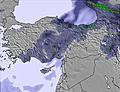 | 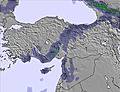 | 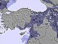 | 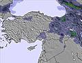 | 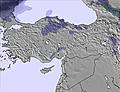 | 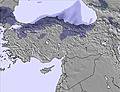 | |||||||||||
— | — | — | — | — | — | — | — | — | — | — | — | — | — | — | — | — | |
mm | 2 | 2 | 5 | 12 | 6 | 6 | 11 | 1 | 1 | 3 | 1 | — | 2 | 1 | — | 4 | 5 |
max °C | 14 | 10 | 11 | 11 | 8 | 8 | 8 | 6 | 9 | 9 | 6 | 10 | 11 | 9 | 12 | 11 | 9 |
min °C | 12 | 8 | 11 | 10 | 6 | 7 | 7 | 5 | 7 | 8 | 6 | 9 | 10 | 8 | 11 | 10 | 6 |
chill °C | 11 | 6 | 10 | 8 | 4 | 6 | 7 | 5 | 7 | 8 | 6 | 9 | 9 | 8 | 11 | 9 | 4 |
Humid % | 37 | 62 | 53 | 57 | 78 | 65 | 69 | 71 | 47 | 52 | 73 | 43 | 40 | 55 | 33 | 48 | 62 |
Freeze m | 5400 | 5000 | 5050 | 5100 | 4650 | 4650 | 4750 | 4500 | 4650 | 4900 | 4550 | 4850 | 5150 | 4950 | 5250 | 5250 | 4900 |
— | — | 5:01 | — | — | 5:03 | — | — | 5:05 | — | — | 5:05 | — | — | 5:07 | — | — | |
7:30 | — | — | 7:29 | — | — | 7:27 | — | — | 7:25 | — | — | 7:24 | — | — | 7:22 | — | |
Go pro and carve into:
Latest snow reports near Mount Cheget:
| Top snow depth: | — |
|---|---|
| Bottom snow depth: | — |
| Fresh snowfall depth: | — |
| Last snowfall: | 27 Jun 2026 |
| Snow Alerts | Create Alert |
0.0 | Bluebird Powder days Fresh snow, mostly sunny, light wind. |
|---|---|
0.1 | Powder days Fresh snow, limited sun, any wind. |
0.0 | Bluebird days Average snow, mostly sunny, light wind. |
The above table gives the weather forecast for Mount Cheget at the specific elevation of 3550 m. Our sophisticated weather models allow us to provide snow forecasts for the top, middle and bottom ski stations of Mount Cheget. To access the weather forecasts for the other elevations, use the tab navigation above the table. For a wider view of the weather, check out the Weather Map of Russia.
Click here to read further information on freezing levels and how we forecast our temperatures.
Overall 3.5 Based on 11 votes and 2 reviews
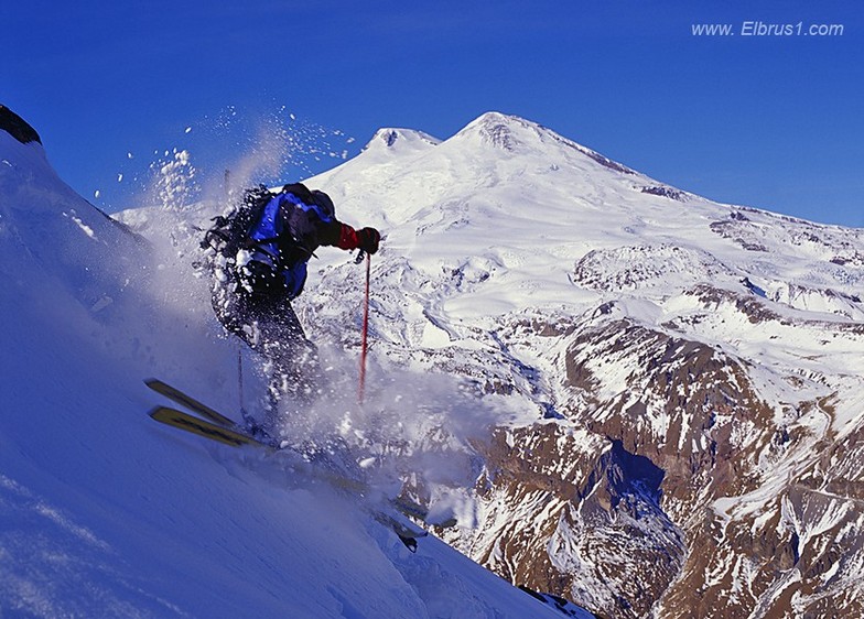
Mt Cheget for Russians is like La Grave but colored Russian. No groomed pistes - only off-piste skiing. Very difficult for the beginners. Season from early December till end of May (especially good end-March till mid April). Low prices for everything. One cable car built in 60-s and never been repaired since. Sometimes problems with locals... But skiing there is amazing and lots of people choose MtCheget!
Alex from Russia writes:
Mt Cheget for Russians is like La Grave but colored Russian. No groomed pistes - only off-piste skiing. Very difficult for the beginners. Season from early December till end of May (especially good end-March till mid April). Low prices for everything. One cable car built in 60-s and never been repaired since. Sometimes problems with locals...
But skiing there is amazing and lots of people choose MtCheget!

 Nearest